
 Dave Rearick: Growing up on the shores of Lake Michigan, the second largest of the five Great Lakes, gave us every chance to learn about glaciers. Glaciers scoured out all five of the Great Lakes about 10,000 years ago. As they melted and retreated, they left distinctive land formations: great carved moraines, bogs, kettle lakes and wetlands, not to mention, the amazing fresh water lakes themselves.
Lake Michigan is over 300 miles long (483 km), 90 miles wide (145 km) and over 900 feet deep (275 meters) at the deepest point. What I learned in school about glaciers at the time just sounded like more ancient history and did little to prepare me for my recent visit to the Fox Glacier on the South Island of New Zealand.
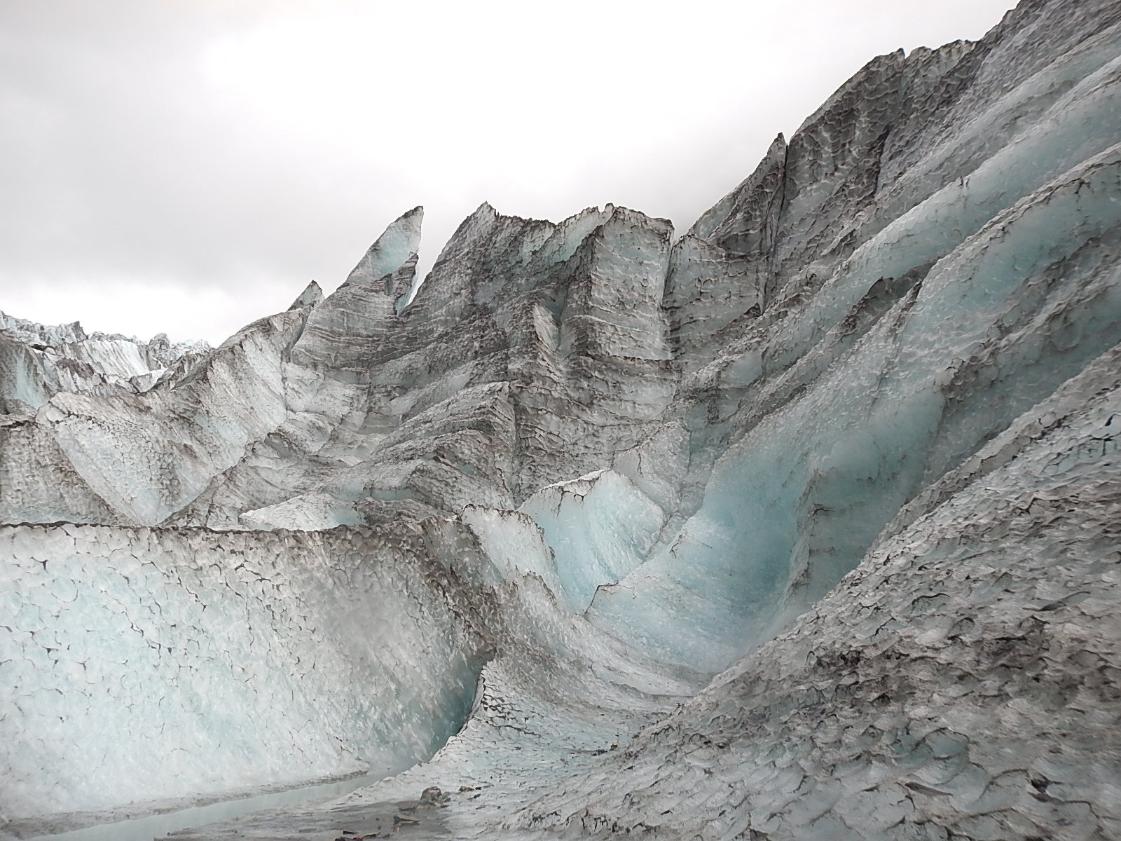
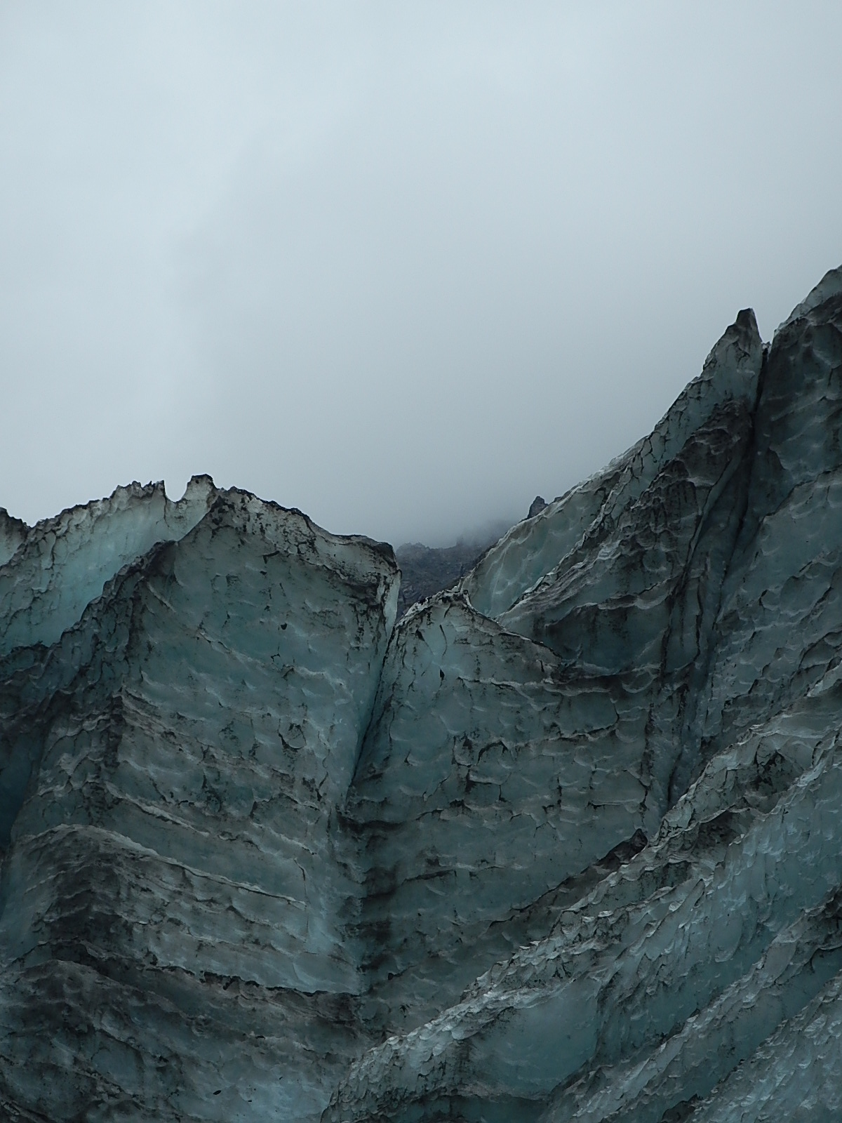
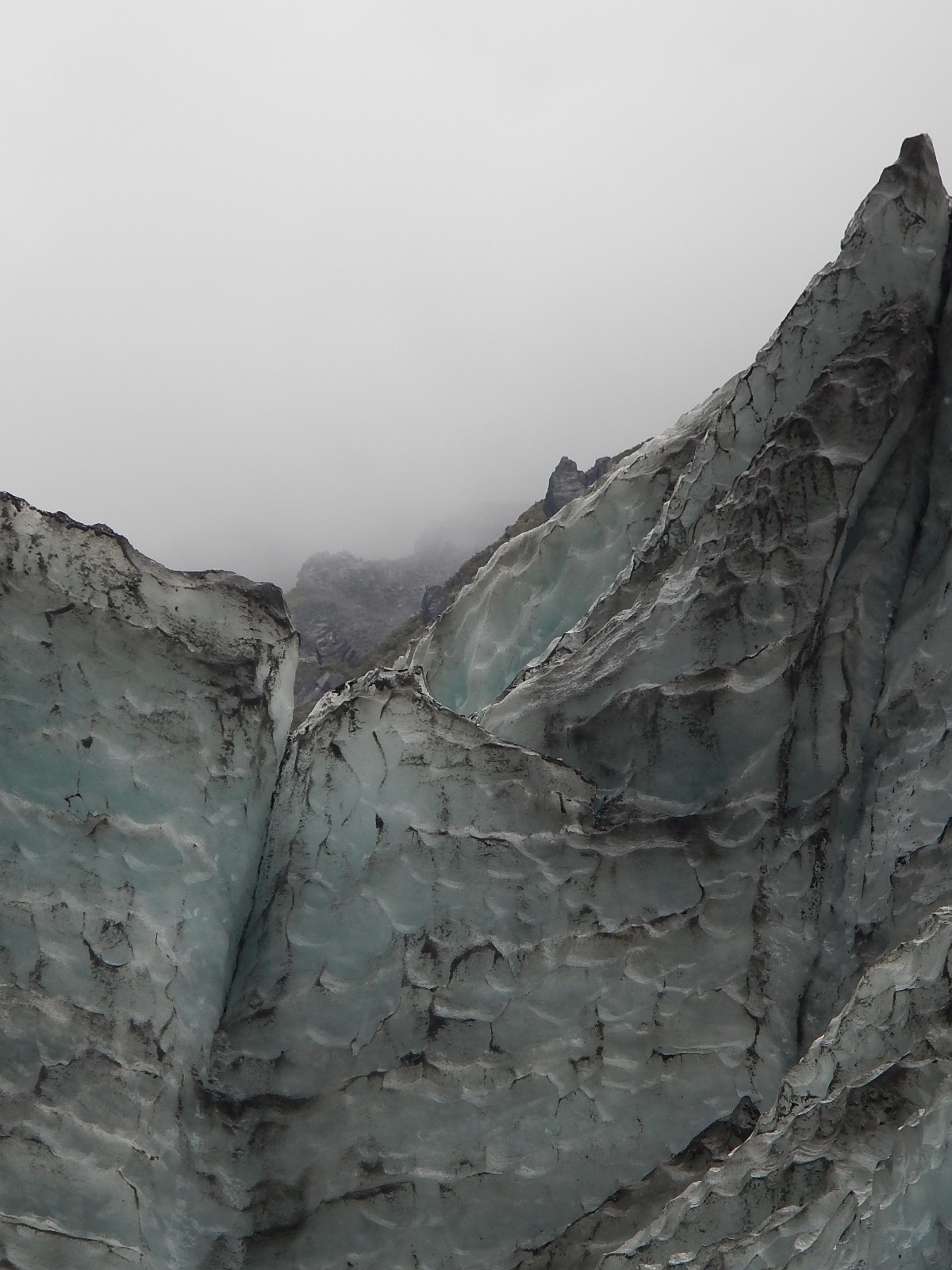
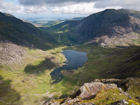
 Fox Glacier in New Zealand’s Westland National Park
For the past several years, we’ve all heard story after story about how human activity and global warming have affected glaciers around the world. Experiencing firsthand the amazing forces at Fox Glacier and the incredible speed with which that change is happening, brought those many stories to a very different level of reality for me. It also reinforced for me the amazing power and need for hands-on learning in and around nature, much like what we are trying to do through our Bodacious Dream Expedition updates tracking my circumnavigation as well as our many topic-specific Explorer Guides.
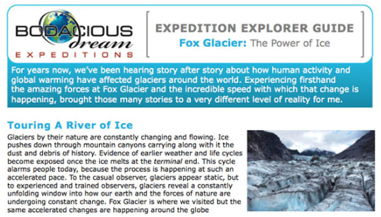
See our new Explorer Guide on “Glaciers – The Power of Ice”
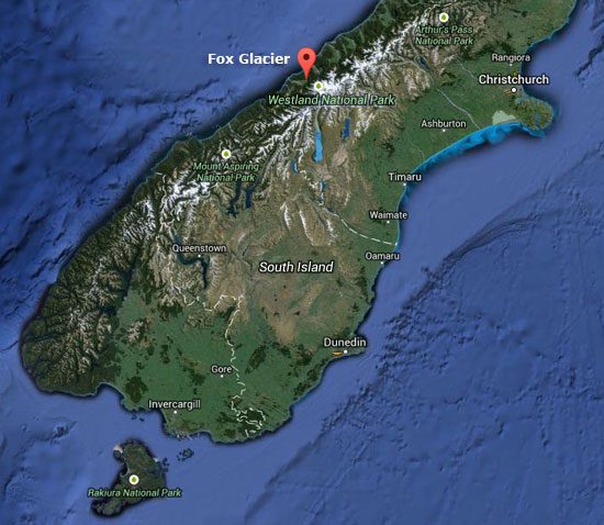
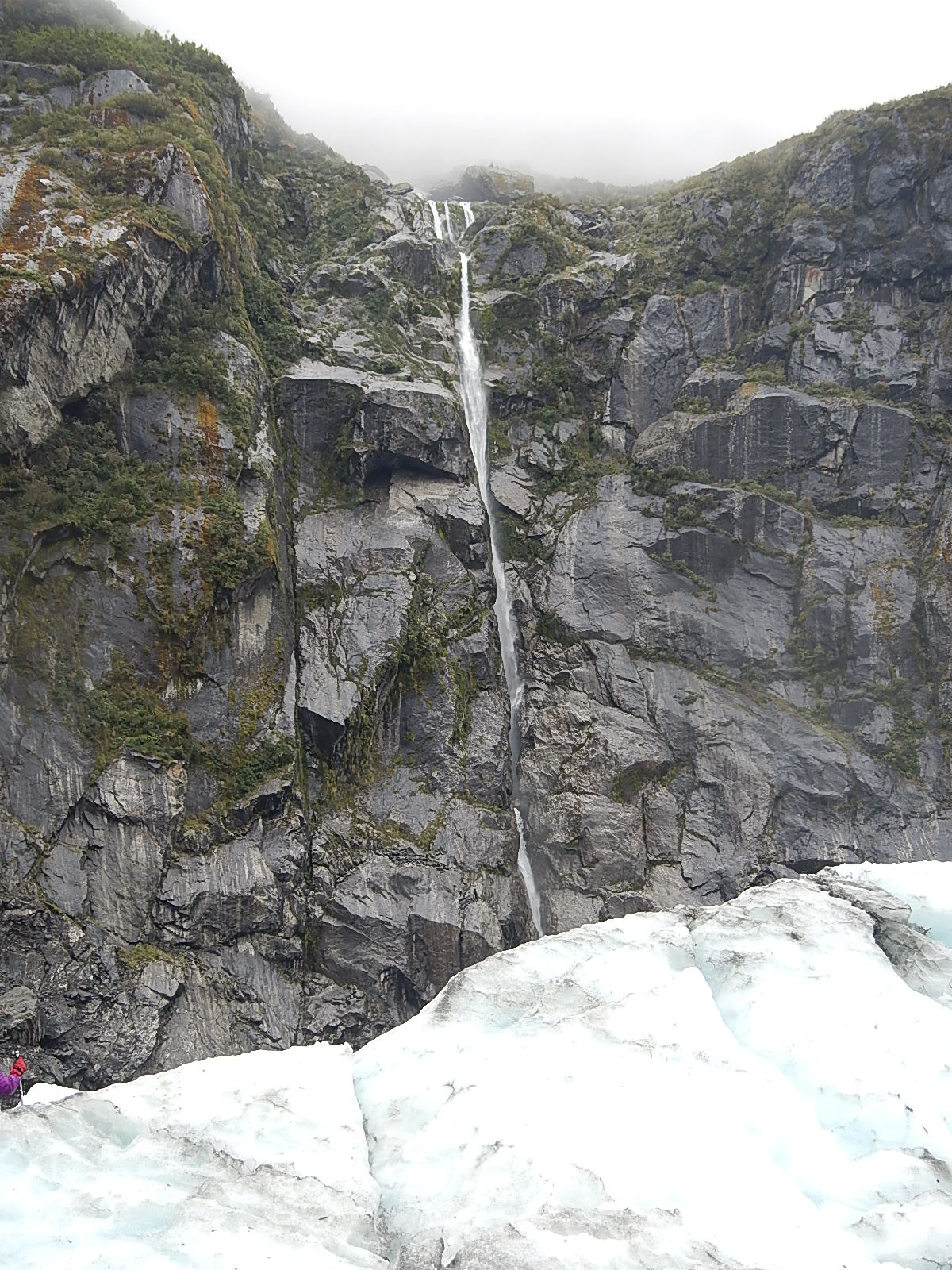
It’s a beautiful drive to the town of Fox Glacier, on the South Island of New Zealand. What you see and feel is so majestic that it cannot help but raise your spirit. Just a few weeks earlier, after crossing the Tasman Sea, I had sailed up the coast of the same South Island and witnessed for the first time the snow-capped mountains of the Southern Alps. Now that I was traveling through them, the scale, the perspective and the sheer beauty of this unspoiled area was even more inspiring. Still, driving past the nondescript entrance to the Fox Glacier area of the Westland Tai Poutini National Park and into the small town of Fox Glacier left me entirely unprepared for what was to unfold the following morning.
Fox Glacier Guiding is located in a prominent spot in the center of the two-block long town. From this location, on a busy day, over 500 people might visit the glacier on various guided tours that include helicopter tours to the upper glacier, advanced ice and mountaineering trips, as well as half-day and full-day hikes. We choose the full-day hike and met up with the rest of our group and two guides for our 9AM slot.
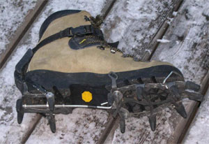 We were fitted with boots, crampons (spikey boot attachments for walking on ice), special waterproof coats and pants, gloves and hats, after which we got special instructions and training from our guides. Once ready, the 20 of us boarded a bus for the three-mile drive to the parking area at the base of the glacier.
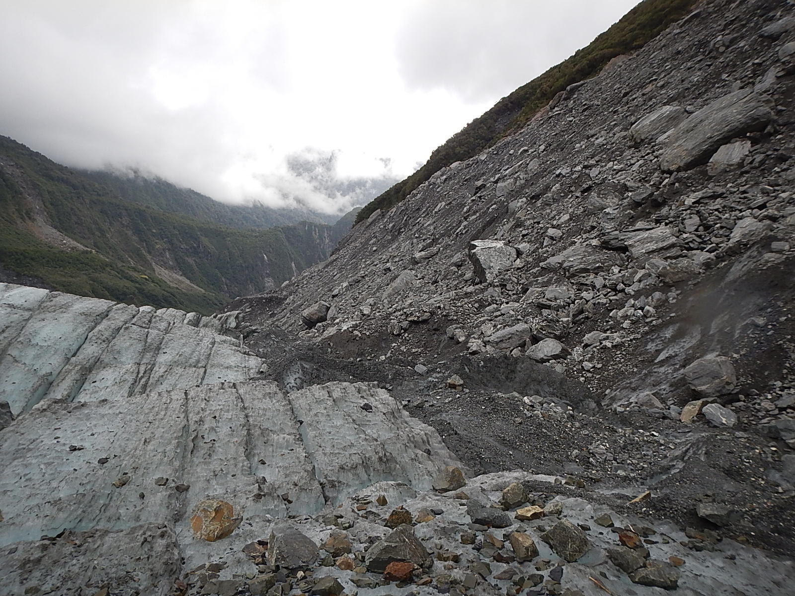
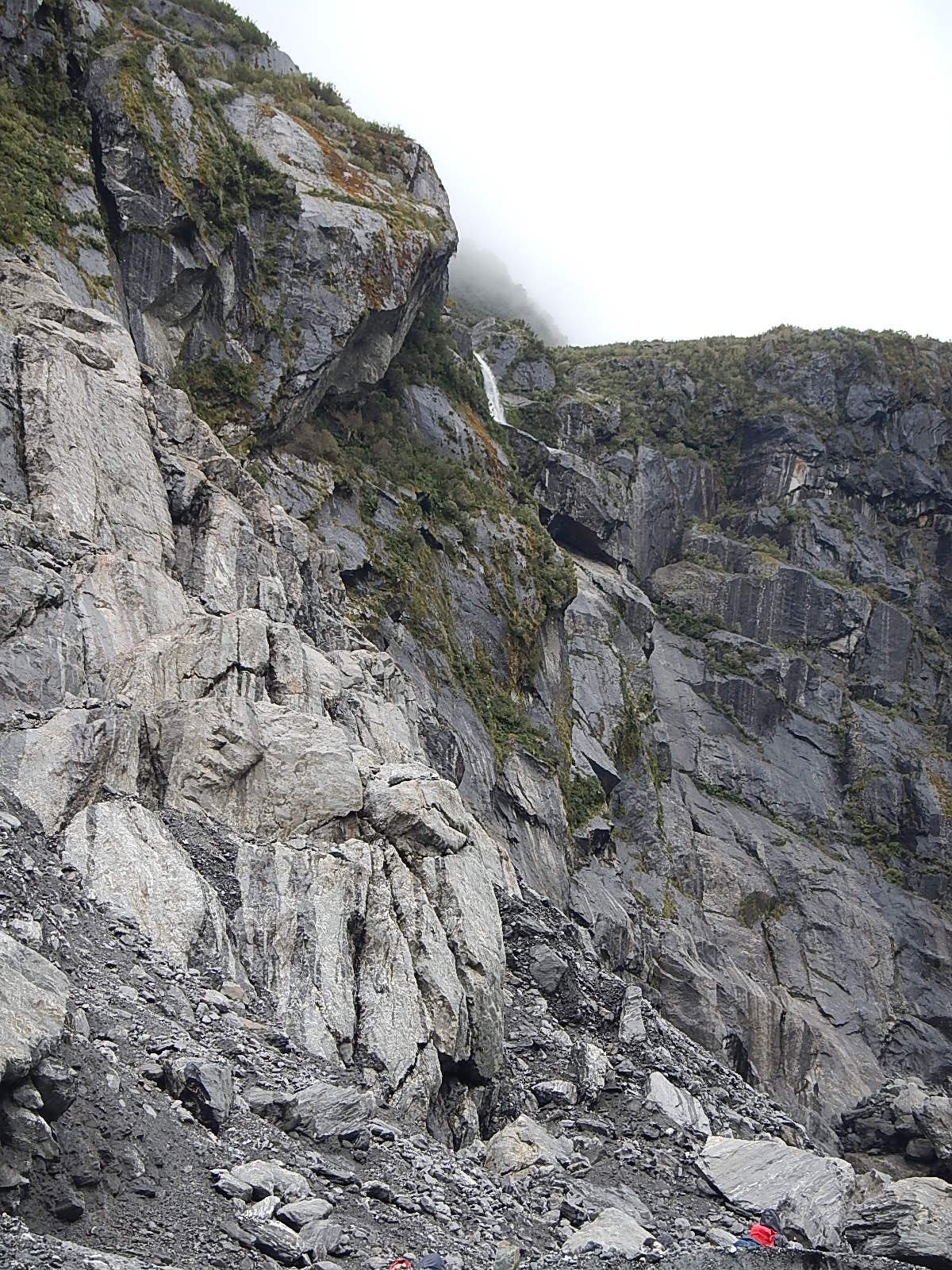
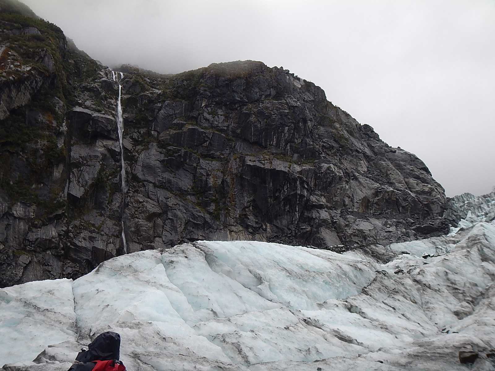
As we stood outside the bus, the first words our guides spoke brought me to attention. Just fifty years earlier, they said, the glacier had entirely covered the parking area where we were standing, and that directly below us, below the gravel road and parking area was what they called “dead ice” – ice that was still melting and flowing its way down into the Fox River and from there into the ocean.
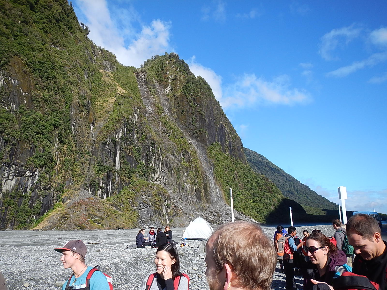
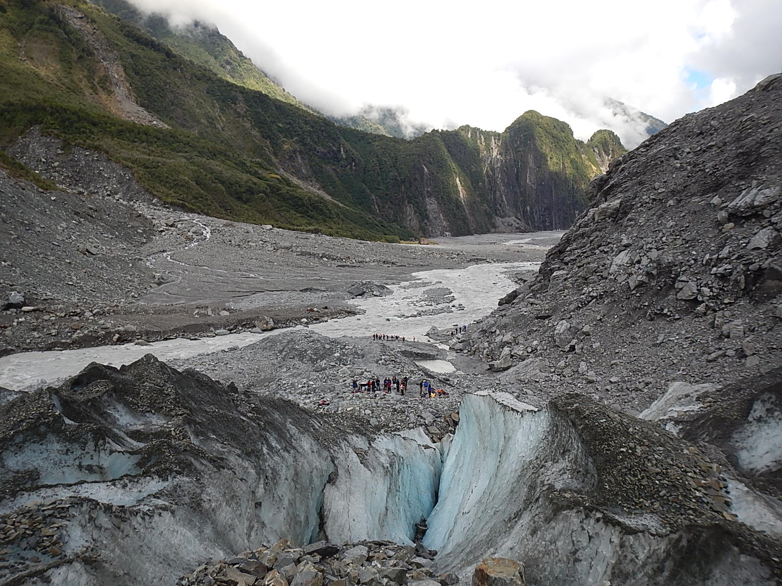
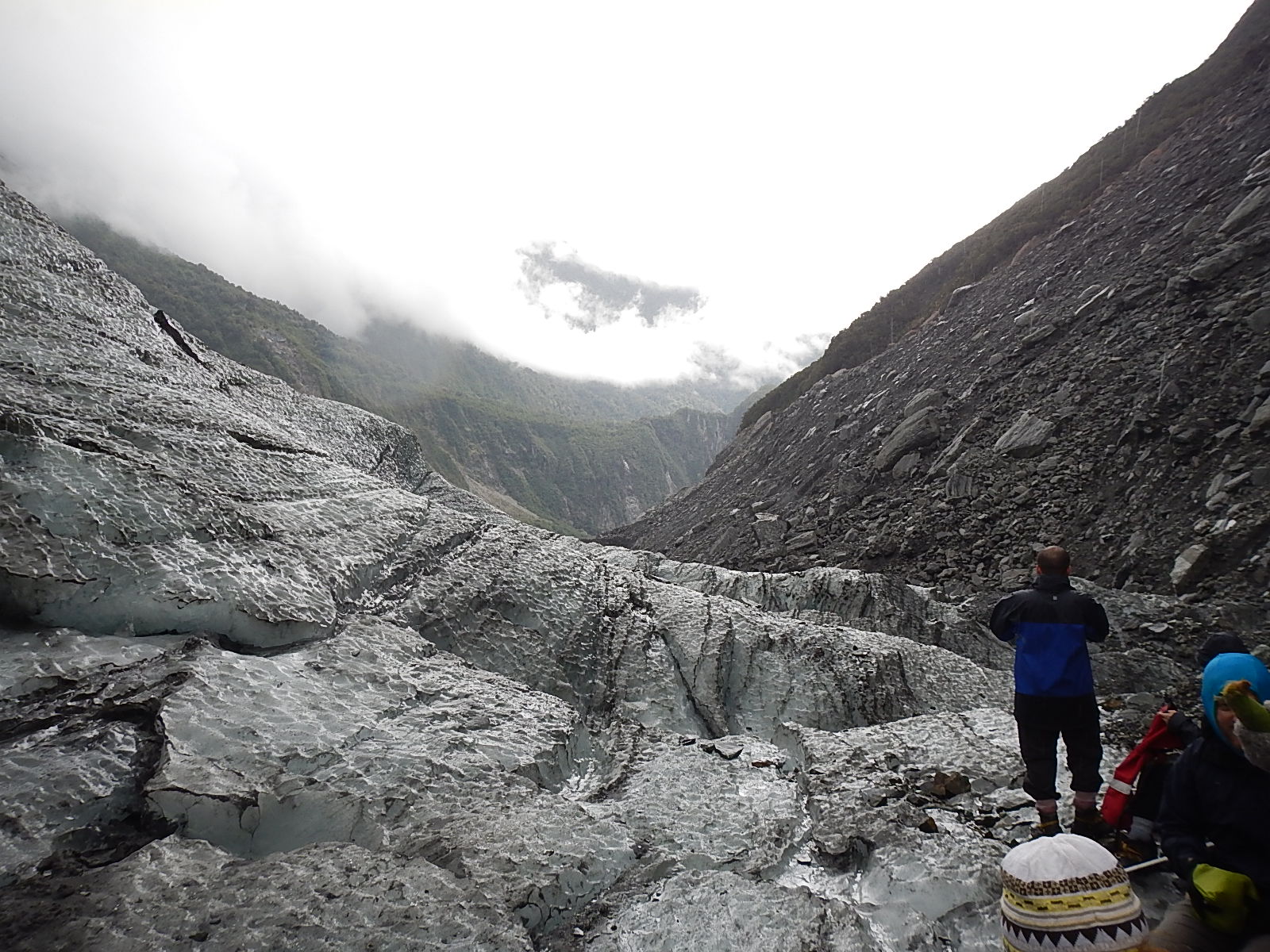
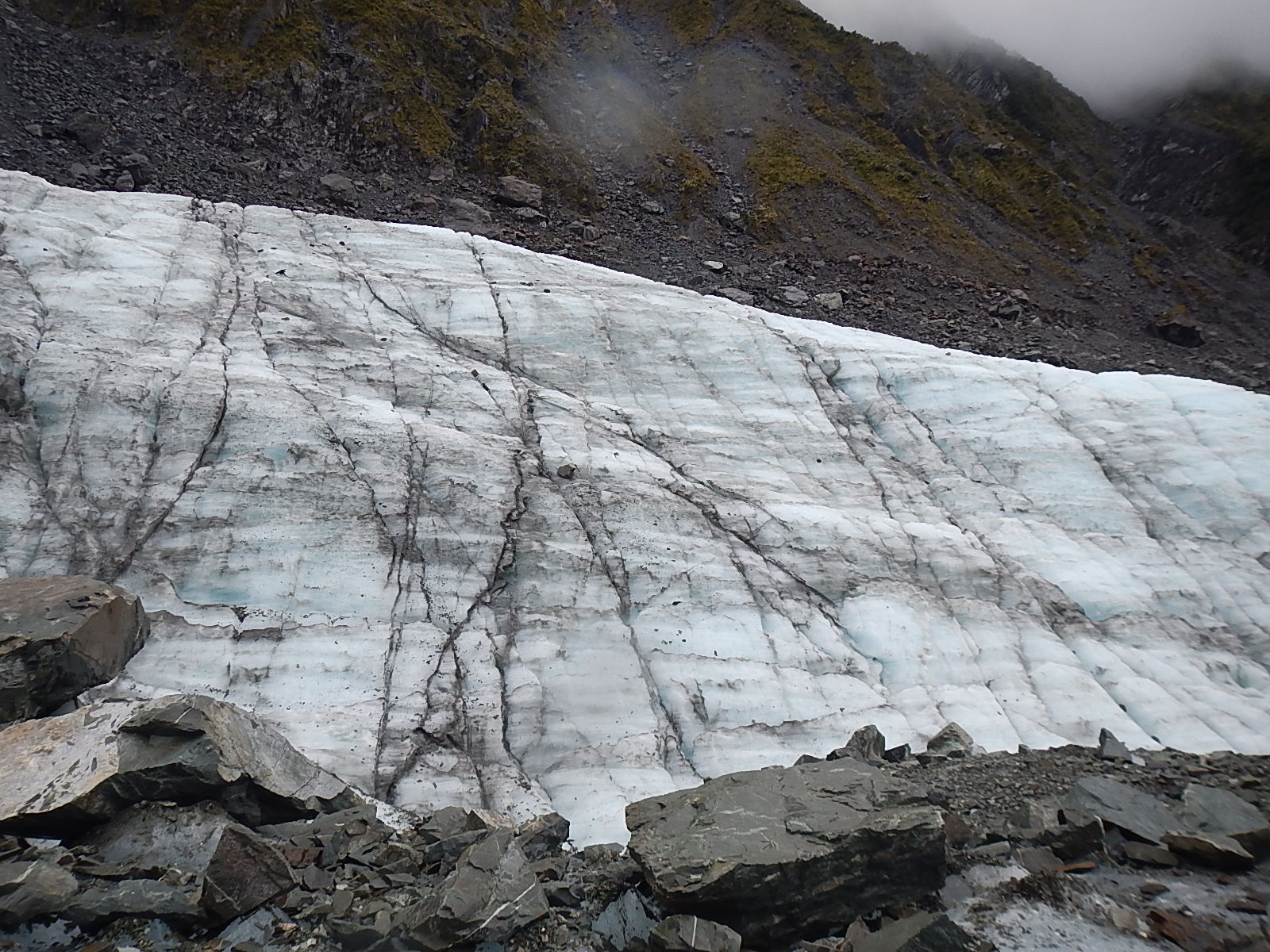
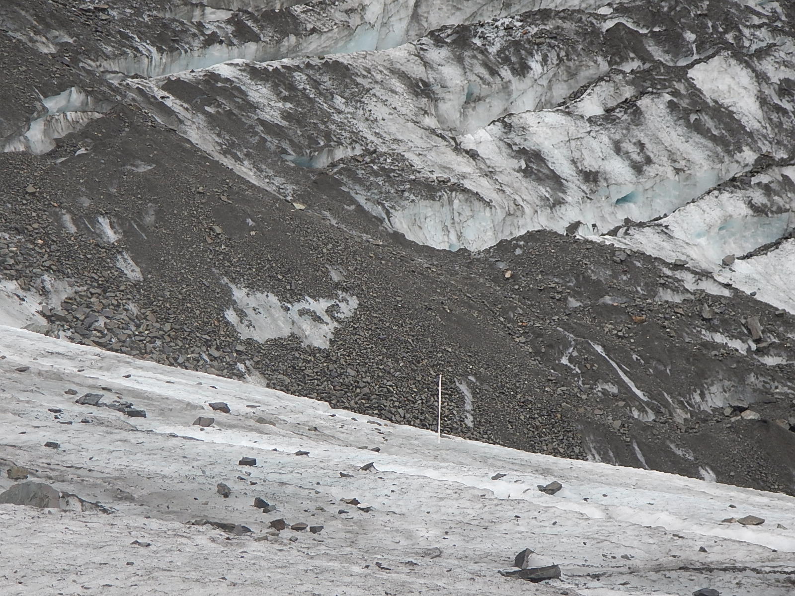
All around us, you could see that the nearly vertical walls of the river canyon had been scraped clean by the glacier as it receded from this area over the past 50 years. Standing in the parking area, I guessed that we were still a mile from the glacier itself. As we hiked further towards the glacier, our guide pointed out the various markings that the receding glacier had left. Most amazing to learn was that just five years earlier, in 2008, the glacier had scoured the hillsides to a height that was now clearly marked by the vegetation line, below which was barren rock, maybe one or two hundred feet above us.
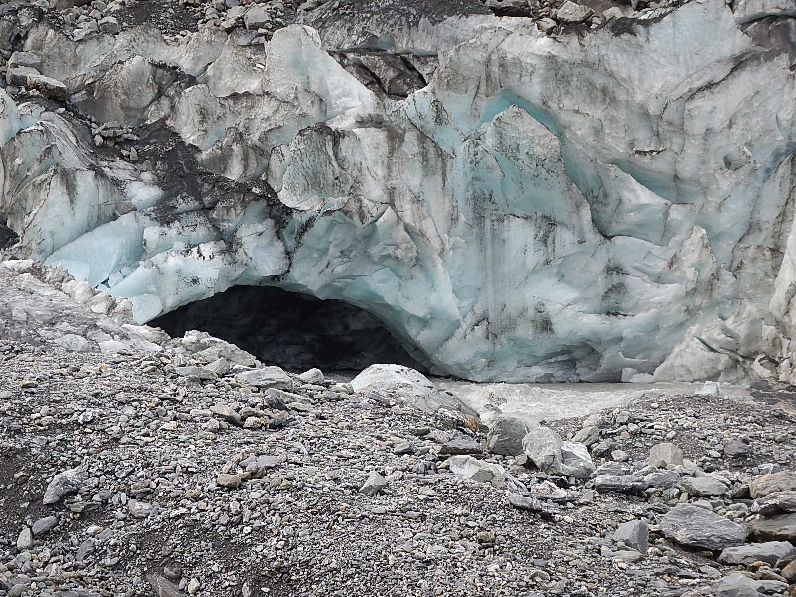
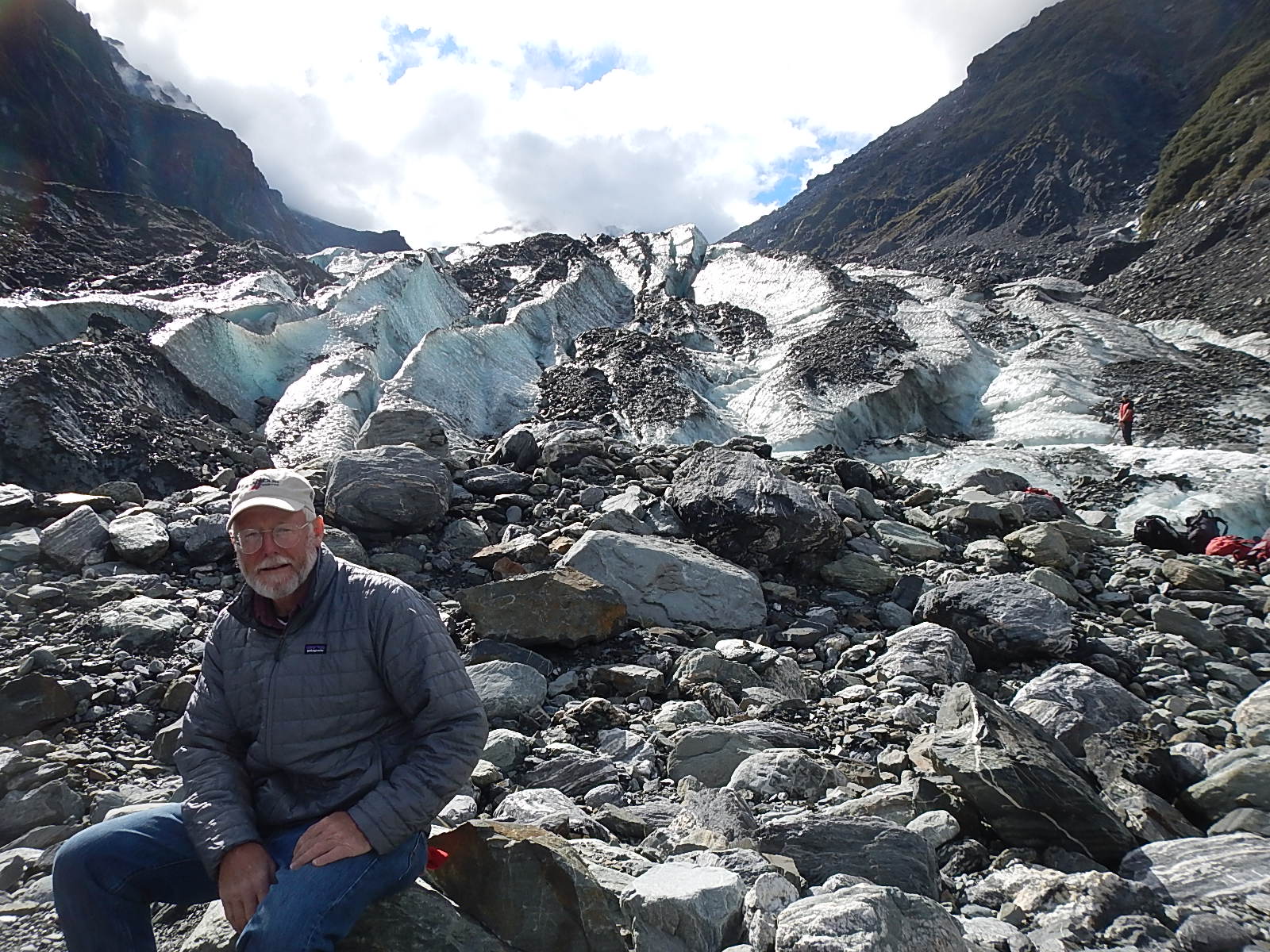
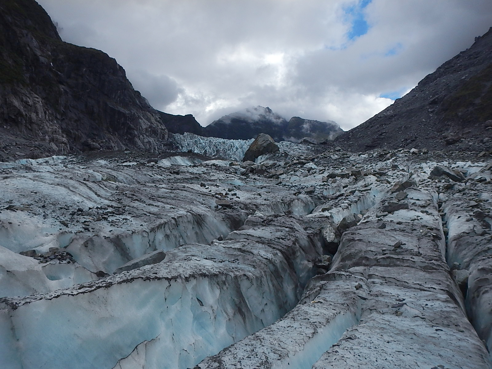
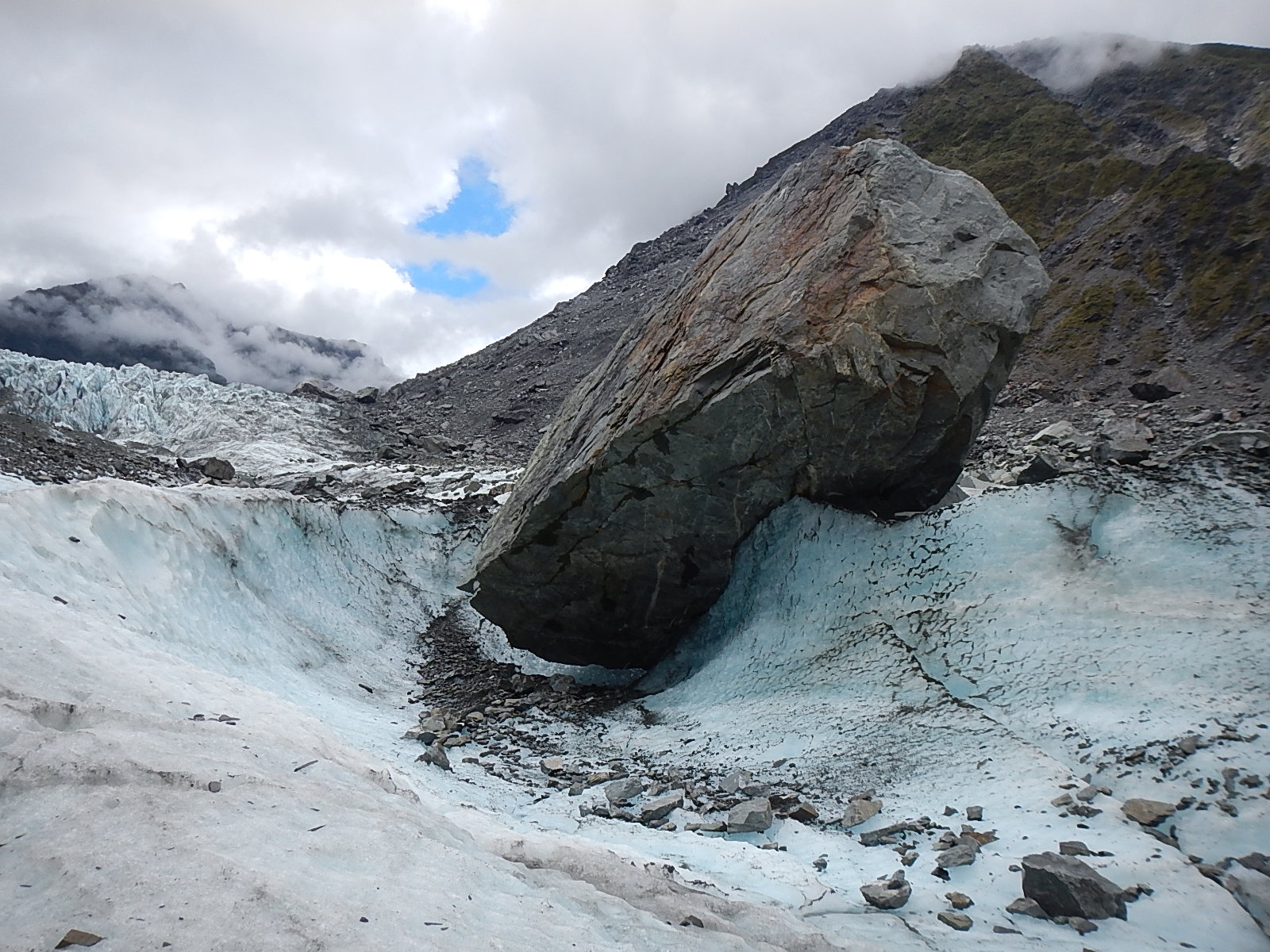
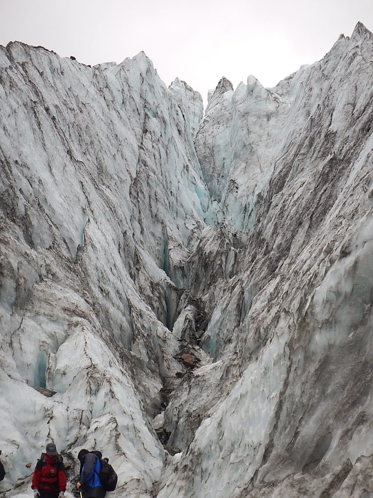
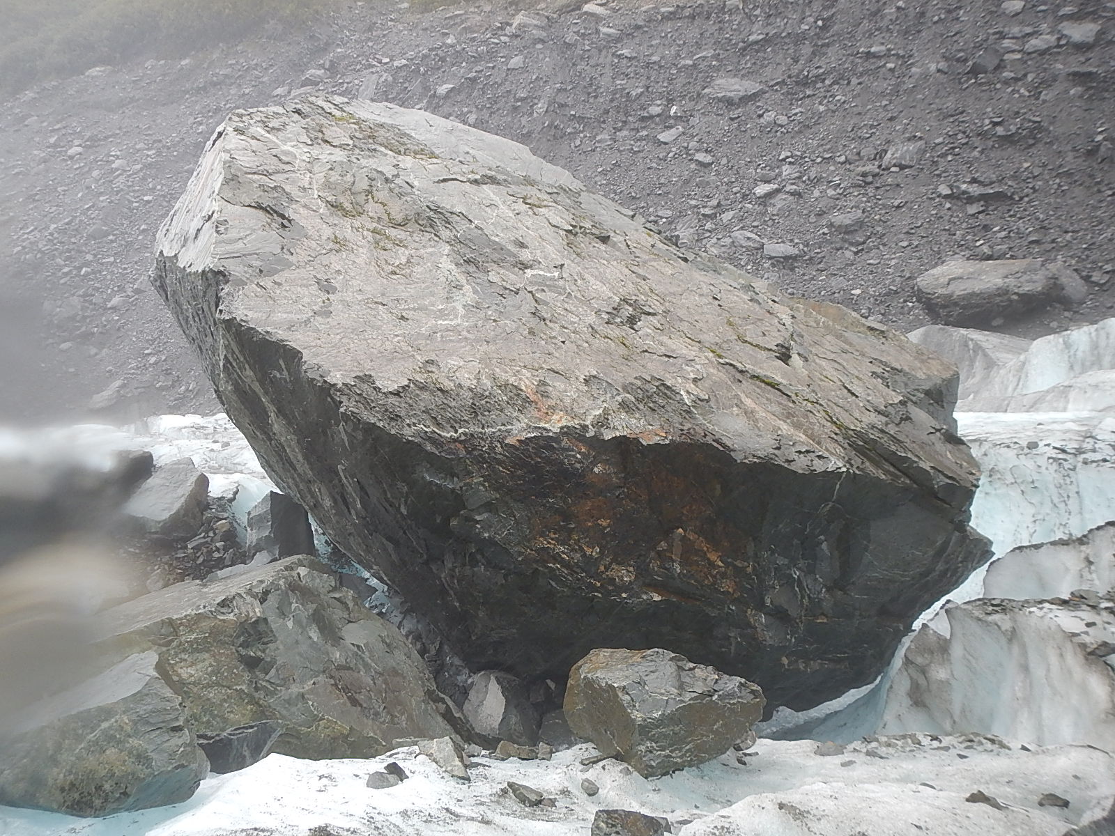
As we hiked closer to the glacier, we put on our crampons and picked up our hiking poles. Our guide Jess explained to us that just a year earlier, they had to rework the paths to the glacier. Prior to that, they had walked onto the ice of the glacier from a path probably about 50 feet higher up the side of the canyon wall. Jess told us that the glacier was melting at the rate of 6 inches (15 cm) a day! That’s 3.5 feet a week, 15 feet a month, 180 feet a year! Glaciers don’t do anything quickly, but they sure do it steadily. They gather snowfall up in the mountains, compress it so that it can’t help but move, ever so slowly, changing and sculpting the earth on its way. This process was clearly evidenced by a large boulder, the size of a small truck that rather suddenly appeared five years ago. Natural history unfolds, and the story of the Earth is told by these slow moving rivers of ice.
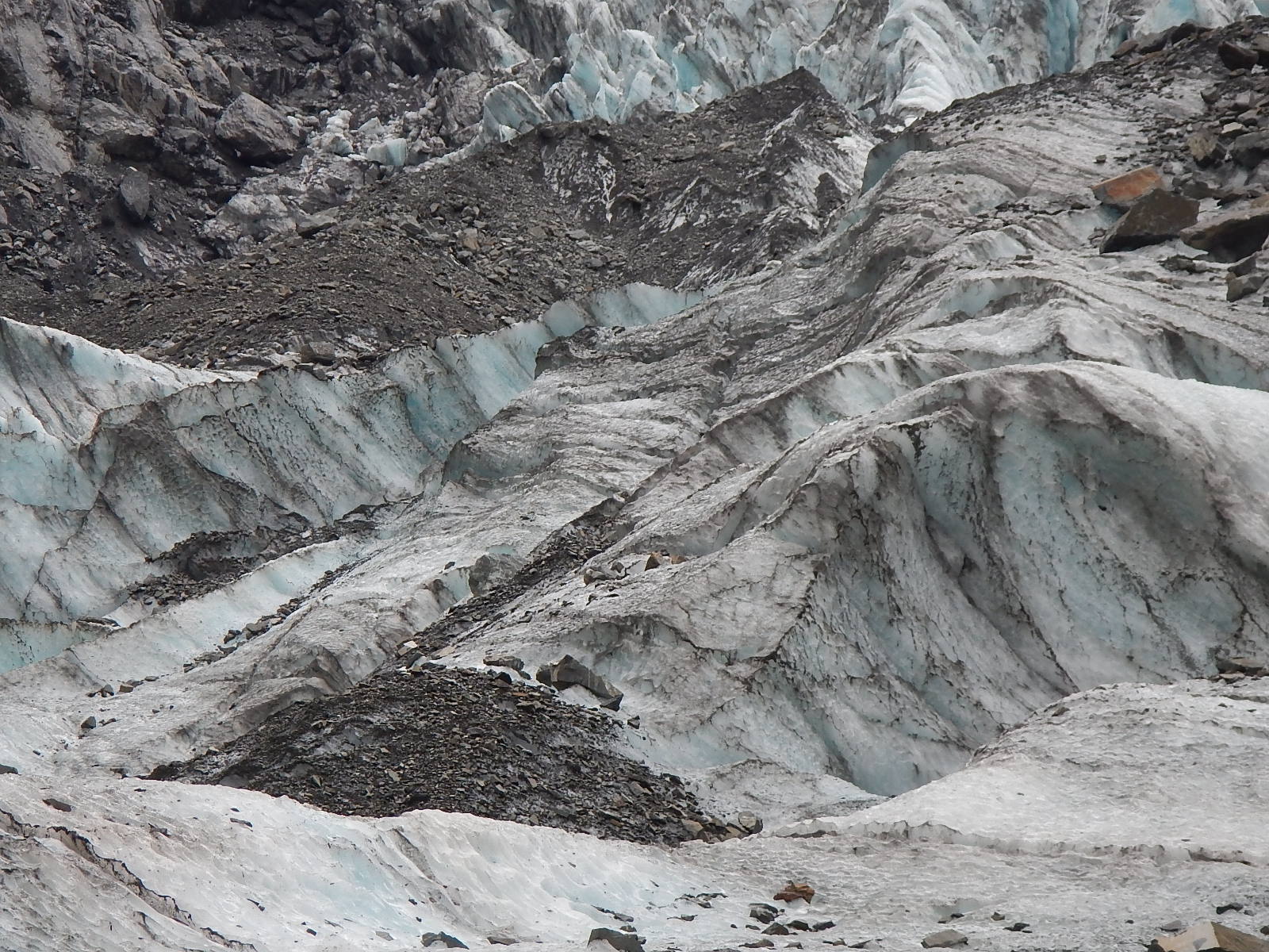
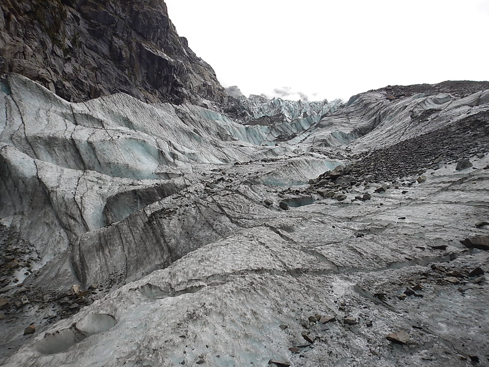
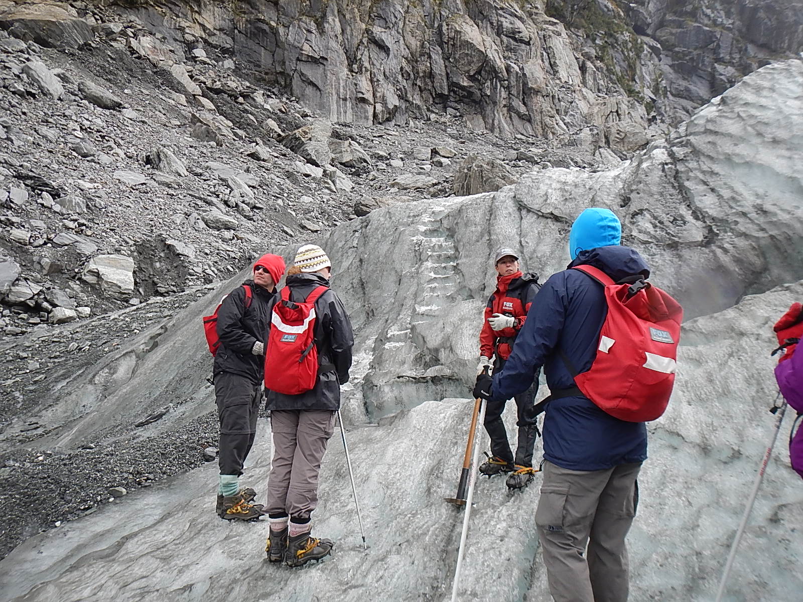
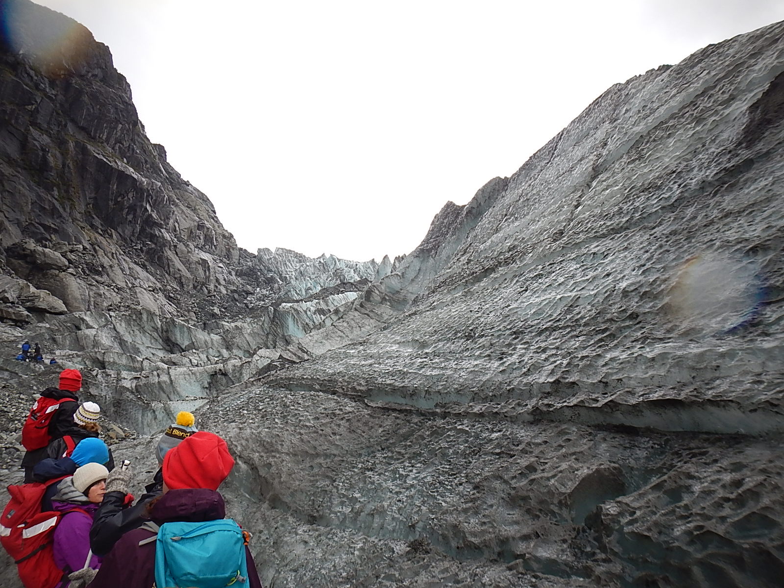
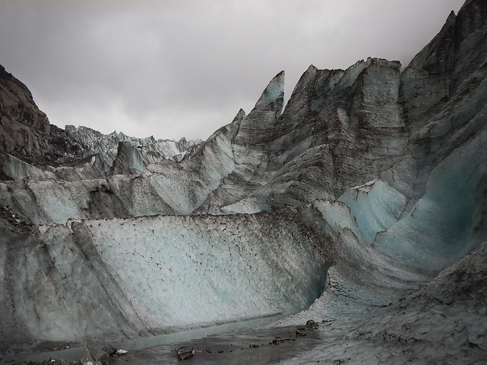
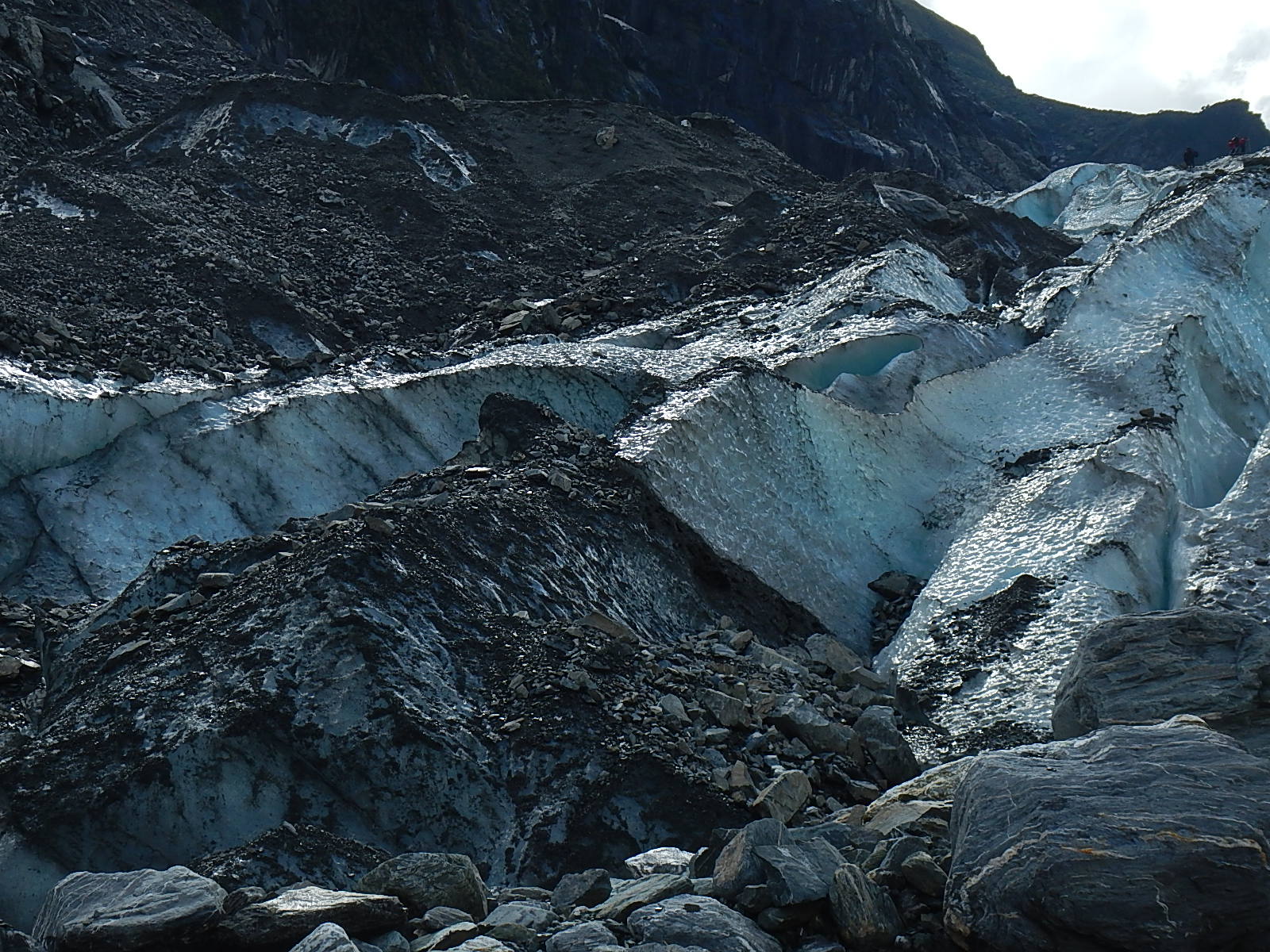
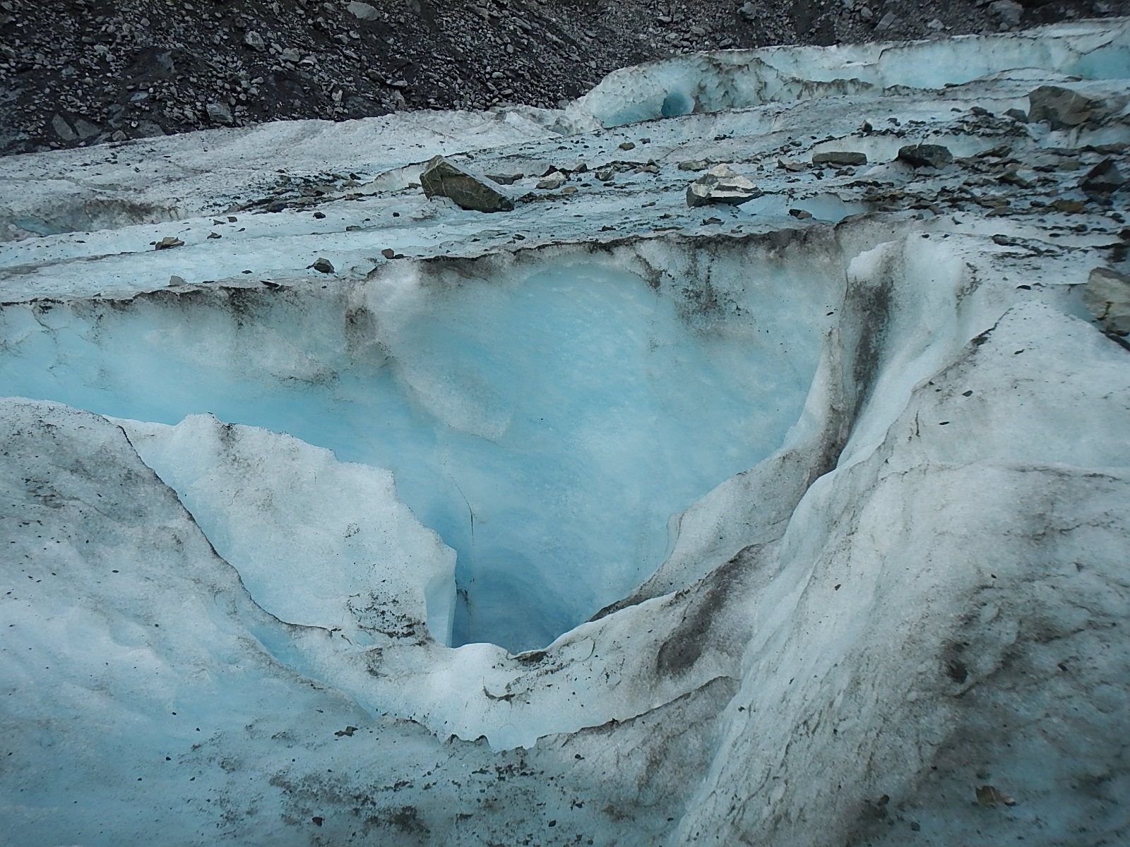
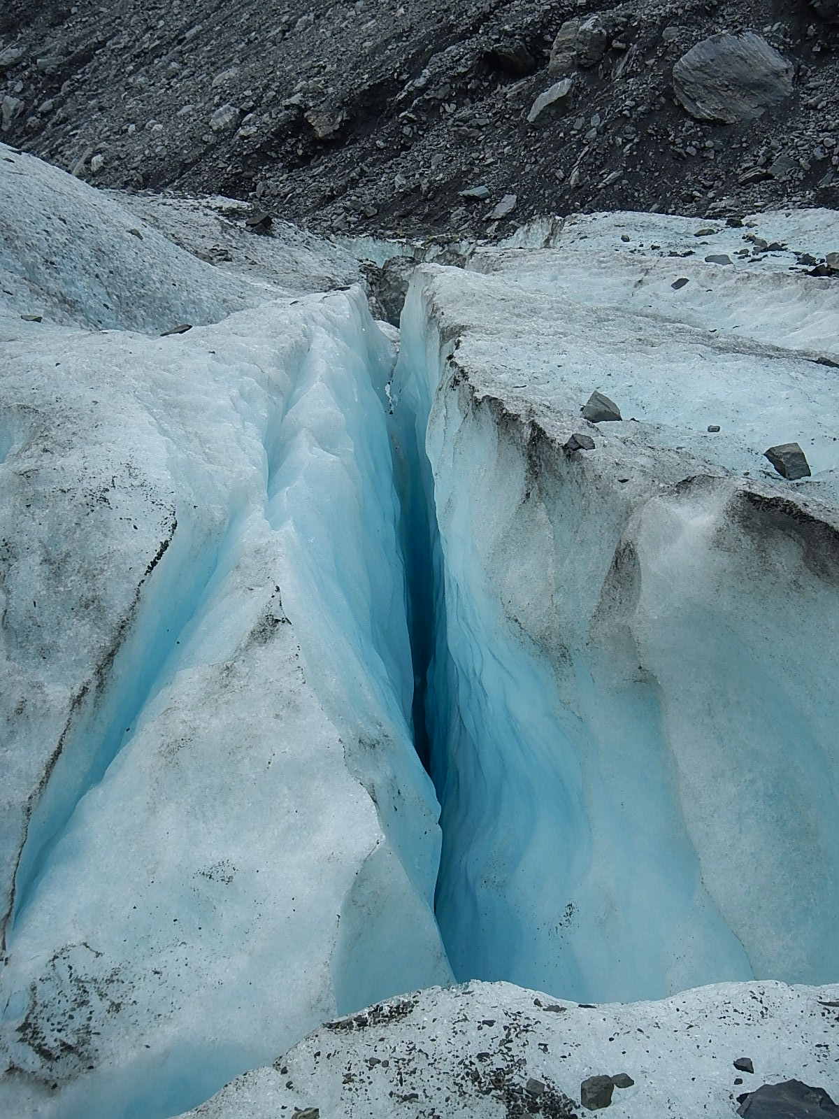
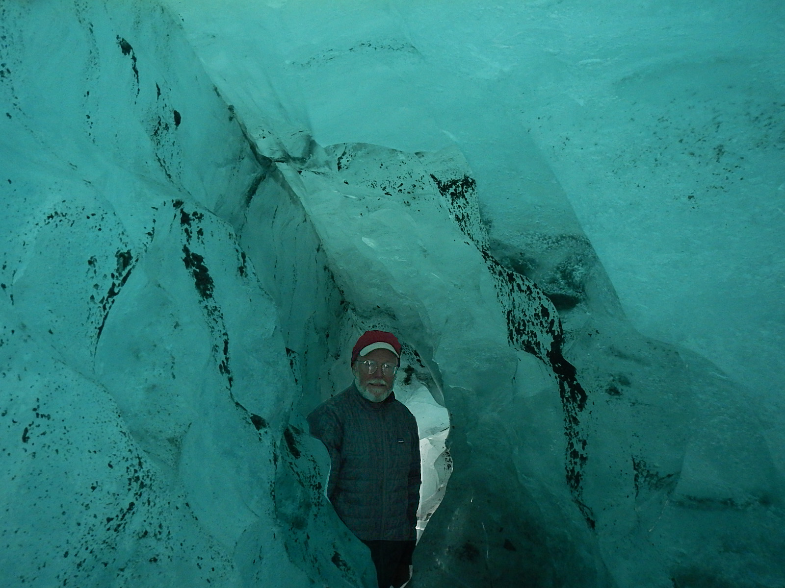
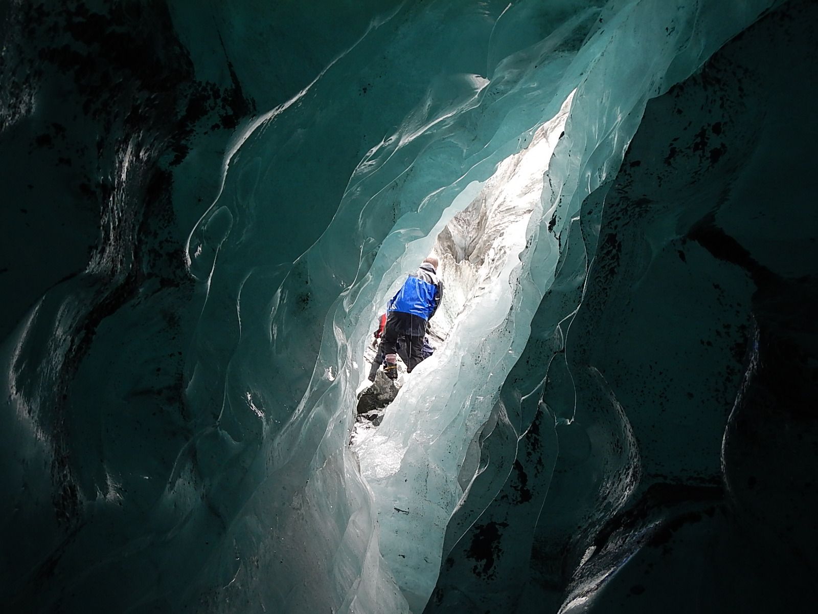
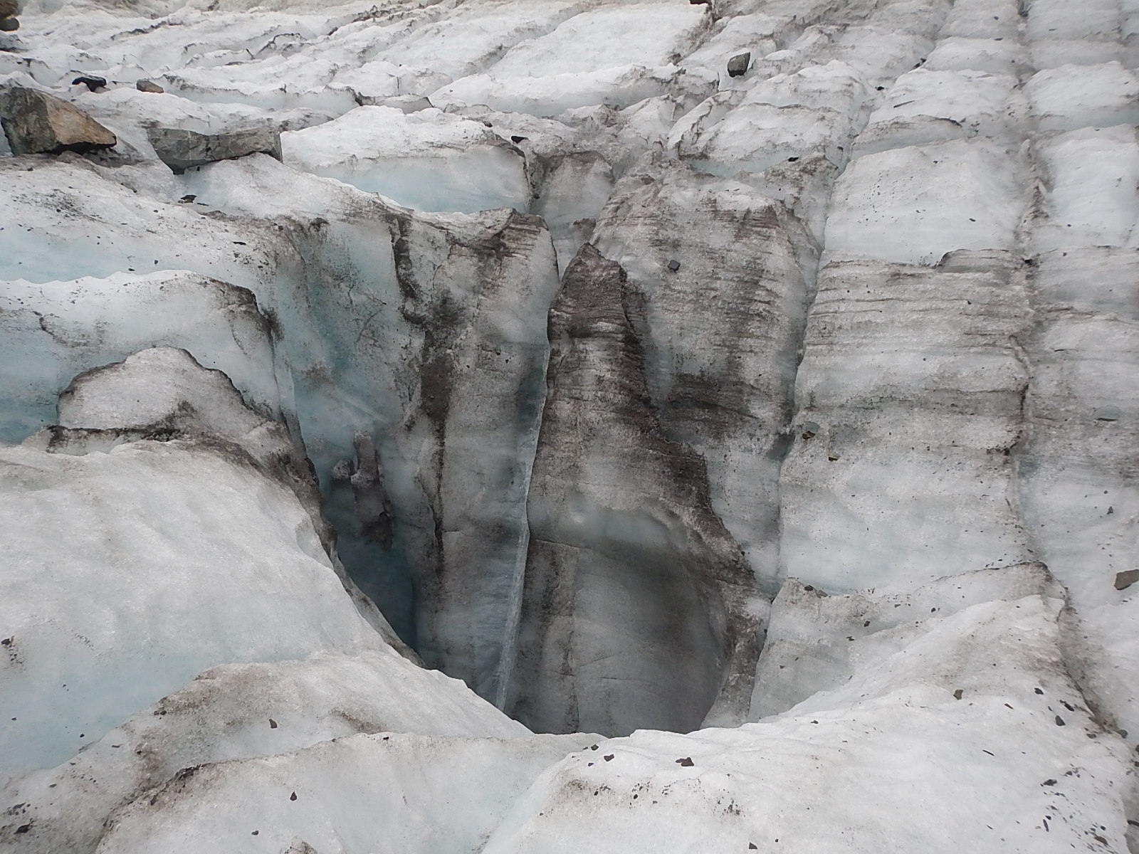
The rest of the day was spent hiking up onto and into the glacier. Each step exposed us to more wonder and amazement. There is so much beauty in the color and shape of the ice, and in tracking the constant changes brought on by the ever-flowing ice and water.
Here are some amazing facts I learned about the Fox Glacier:
· There are over 3000 glaciers in New Zealand!
· The Fox Glacier is one of the few in the world that ends in a rainforest before emptying into the ocean.
· The glacier is over 1000 feet thick (300 m) at its deepest point
· The glacier flows at the rate of 600 feet (183 m) per year
· The thickness of the ice near the terminal face is up to 100 feet (30 m) thick
· The river is about 80% melt off from the glacier.
· Measurement of the amount of change in ice thickness is done by placing long pieces of pipe called ablation poles, vertically into the glacier. They start level with the ice surface and gradually become exposed as the glacier melts. At the time we were there, one meter of pipe was showing, indicating about two weeks’ worth of change (melt).
· Estimates are that in about two years’ time, the glacier’s terminal face will no longer be accessible by foot.
· Half the glacier is contained in the upper “bowl” area where the snow collects and compresses into ice.
· The other half is called the “tongue,” which is the mass that flows down to the river area.
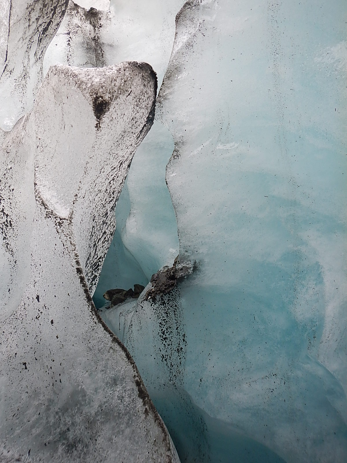
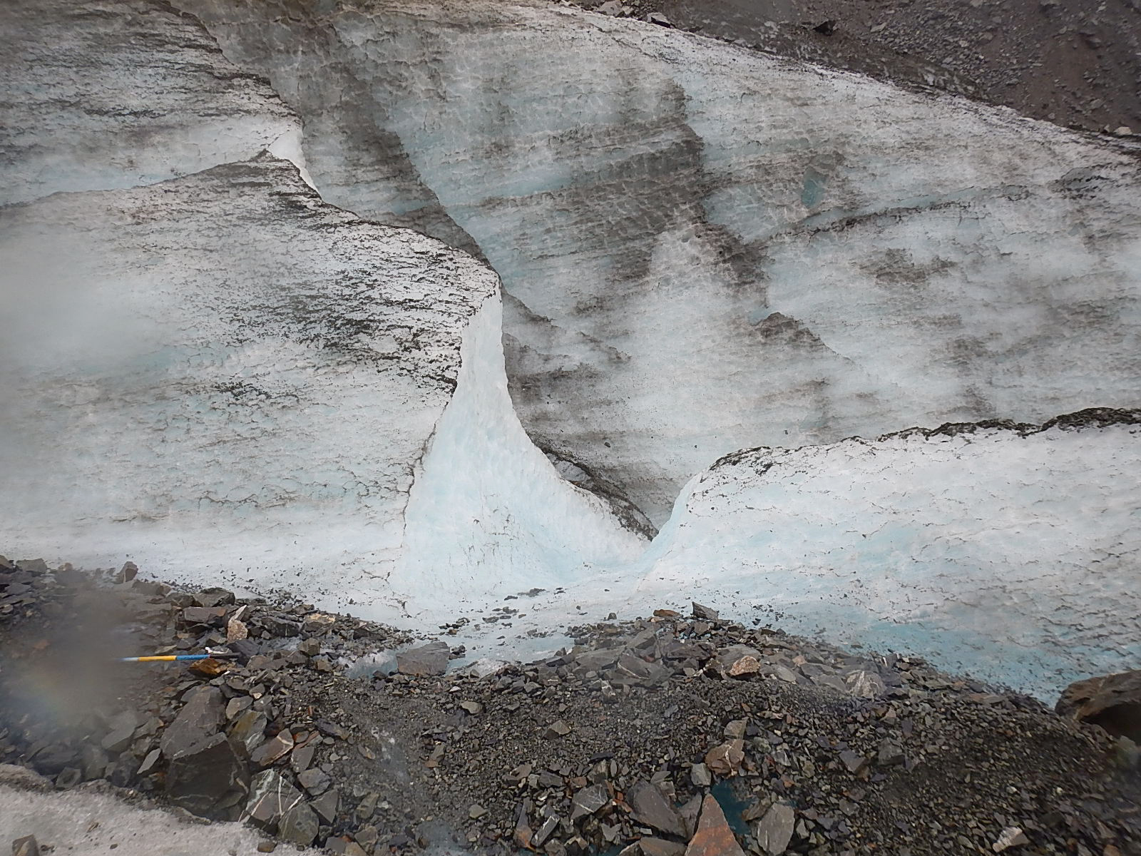
· The fissures and crevasses happen perpendicular to the compression stress of the glacier; closing and opening as the great masses of ice move and shift daily.
Glaciers by their nature are constantly changing and flowing as the pressure of the ice pushes down through the contours of the mountain canyons carrying along with them the dust and debris of history, as well as evidence of various weather and life cycles which then become exposed once the ice melts off at the terminal end. This amazing cycle alarms people in the world today, because the whole process is happening at such an accelerated pace. What looks to the casual eye to be a static natural wonder, to an experienced guide who has been there a number of seasons, reveals a constantly unfolding window into how our earth and the forces of nature are undergoing constant change.
I hope you enjoy the videos I’ve included here that I took while at the glacier. I know they aren’t of a professional travel brochure quality, but I think they offer a true and authentic entry into the story and into what you might actually experience on the glacier if you were to go there. The rains and fogs of the day certainly added their effects as well, but to me, they all combine to show the stark beauty and harsh contrasts of this hard yet fluid environment – much like my videos of the stormy tempest at sea revealed the powerful nature of the ocean.
I hope that if one day you have the chance, you will choose to experience a glacier firsthand. If you do, I would recommend you hike rather than take the helicopter ride. I am sure the helicopter ride is beautiful, but you will land on a very static snow field up on the higher slopes of the glacier, and you might miss the story of these fascinating indicators of our environment, that are unfolding farther down towards the terminal face.
Of all the sights I witnessed that day, the one that stood out for me was that enormous boulder, about the size of a small truck, tilted up on its edge as if might at any moment fall over. The Fox Glacier Guides have been keeping an eye on this boulder for five years, ever since it first appeared, after having been carried down by the glacier. In those five years, they have seen the boulder reposition itself in many different angles and positions, but no one has ever actually seen it move! That is the power of the earth and nature – the capability, one drop at a time, or one wave at a time to move a boulder or wash away a shoreline. If you’ve ever wondered just how your single life could have an impact on the larger world, I think somewhere in there might be your answer.
– Dave
=========================================================
B) TEGAN MORTIMER: GENERAL EXPLORER GUIDE BACKGROUND ON GLACIERS
The Power of Ice: Discovering the Glacial Landscape
 Tegan Mortimer: Did you know that Charles Darwin was a geologist? His thoughts in the Origin of Species were influenced by early discoveries in geomorphology, a field of science which tries to explain how landscapes change based on the pressures placed upon them. Ice is one of the greatest creators of landscapes. Just like Dave described the Great Lakes being carved out by glaciers, in that same way was Cape Cod along with many other features of my native Massachusetts coastline also created by glaciers. When you really look closer, it’s possible to see much of the history of a landscape in the way it looks today.
The photo below is of a place in north Wales called Cwm Idwal (in Welsh a “w” is a vowel and is pronounced like “oo”) in the Glyderau Mountains.
 Cwm Idal in the Glyderai Mountains of North Wales
Charles Darwin visited Cwm Idwal in 1831 to study the many fossils of ancient marine life that were found in its rocks. What they showed was that this land was once the bottom of the sea! For Darwin and his fellow geologists who were trying to show that landscapes could be shaped and changed in this way, these finds were so exciting that they somehow missed something even bigger! It was another 10 years before Darwin returned to Cwm Idwal and this time he noticed the very obvious evidence of glaciation on the landscape. Cwm Idwal is what geologists call a “hanging valley” (otherwise called a cirque, or a corrie, or a cwm), which is the area from which a mountain glacier originates. Below Cwm Idwal stretches a wide glacial U-shaped valley, which reaches all the way to current sea level. Cwm Idwal and the surrounding area are a wonderful example of “typical” glacial features.
How glaciers change the landscape
Glaciers and ice sheets form landscapes through two methods. The first happens when glaciers erode the landscape by scraping up the soil and bedrock after which they then deposit this material in other places.
Depending on the type of rock that a glacier is moving over, different glacial features will be left behind. Soft rocks like sandstone or limestone are easily ground up by the pressure of the ice, while harder rocks like granite are usually eroded through a process called “plucking.” Water from the glacier melts into cracks in the rocks which than refreezes. As the ice in the glacier moves it plucks away pieces of rock which are caught in the ice. Water also expands when it freezes and is capable of breaking apart rocks in what is called “freeze-thaw weathering.” I’ve already talked about U-shaped valleys and cirques, which are formed by glaciers moving through mountain landscapes.
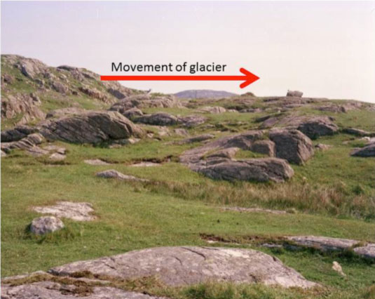
The second method of erosion is called a roche moutonnée or a whaleback, which is an area of exposed bedrock, which has a smooth gently sloped side and a steep vertical side. The photo below shows a few roche moutonnée which are only a few feet tall though it is possible to see very large ones as well. Based on the direction of the sloping and vertical sides you can tell which direction the glacier was moving. Remember that fact, as it will come up later. The sloping side is the direction the glacier was coming from and the ice grinds down that side of the rock. The steep side is the direction the glacier was going and here is where that process called plucking happens. The tops of roche moutonnées often have scratches called striations which are horizontal scape marks from the rocks and debris in the ice.
Another erosional feature is called a crag and tail which is a tall hill usually with exposed rock and a gently sloping tail of softer rock behind it. In this case, the steep side of the hill is the direction that the glacier came from. The most famous crag and tail is Edinburgh Castle and the Royal Mile in Edinburgh, Scotland. The crag in a crag and tail is an area of very hard rock, usually a volcanic plug which forms when magma cools inside the vent of a volcano creating a column of very hard rock. When the glacier hits this rock it can’t erode it, so it will be forced to flow around the plug like water flowing around rocks in a stream. The plug protects the softer rock behind it leading to the formation of the tail.
All that eroded material has to go somewhere and glaciers leave behind particular landforms made up of all that “stuff.” Sediment left behind by glaciers is usually called till, which is made up of sand and gravel and rocks of every size. Erratics are large rocks like the photo below are left behind by a retreating glacier. Geologists can study the mineral structure of erratics to learn where they come from and learn more about the behavior of glaciers and ice sheets.
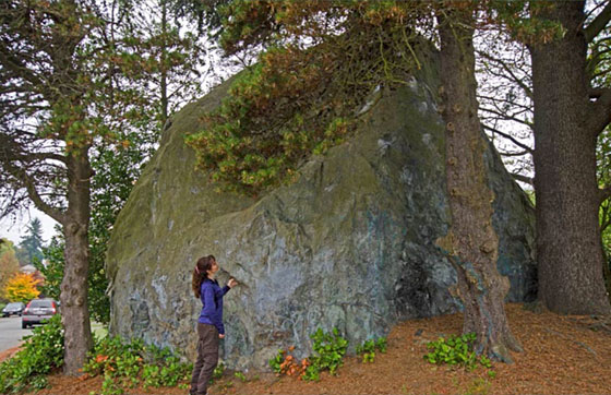 An Erratic
Glaciers push up ridges of material which are called moraines. These ridges can be formed at the base of the glacier which are called terminal moraines or at the edges of the glacier which are called lateral moraines. Cape Cod and Long Island on the US east coast are areas which have a series of terminal moraines formed by the Laurentide ice sheet thousands of years ago. As a glacier retreats, it can leave behind a series of terminal moraines which reflect the extent of the ice at different periods. Sometimes meltwater from a glacier will be kept from exiting a valley by a terminal moraine and will form a lake.
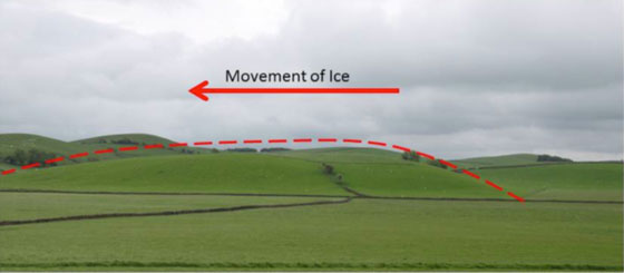
Lastly I want to talk about a depositional feature called a drumlin. When you look at a drumlin, like in the photo below, you might be reminded of the shape of a crag and tail or a roche moutonnée. A drumlin is a type of hill which looks roughly like the bowl of a spoon held upside down. It is shaped a bit like an egg and here too you can tell which way the glacier was moving. The wide side is the direction the glacier was coming from and the narrower end is the way the glacier was going. It’s a bit hard to see in the photo below, so I’ve added the dotted red line so you can see the rough shape. Drumlins are formed underneath the ice as the internal movement adds till to the core of the drumlin. Drumlins often occur in large groups which are called drumlin fields or swarms of drumlins. Many drumlins are found in areas with agricultural activity because glacial sediments can be very good for growing crops.
Glaciers Today
So what is a glacier? Dave explained it pretty well; a glacier is essentially a river of ice. A river of ice? How can that be? Glaciers are always on the move. The immense weight of the ice in a glacier causes it to deform internally, which results in unstoppable movement. Gravity and meltwater underneath the glacier can also help it to move downslope. The areas at the edges of the glacier are under less pressure so this is where great cracks in the ice called crevasses form. When pieces of a glacier fall off the base of the glacier it is call calving.
But the Fox Glacier is retreating, so how then is it moving downhill? The growth of a glacier is based on something called mass balance. Snow falls on the top of the glacier and freezes while ice from the bottom of the glacier melts or breaks off, a process that is called ablation. As long as the accumulation at the top outweighs the ablation at the bottom, the glacier will grow. However, if the ablation outweighs the accumulation, then the glacier will retreat. This is the case of the Fox Glacier and unfortunately the case for many glaciers around the world.
Does it really matter if the glaciers disappear?
It would most certainly be a shame for alpine glaciers to disappear due to the effects of human climate change. They are beautiful places to visit and so provide revenue from tourism to areas in these regions. However, and more importantly, glaciers also provide huge stores of fresh water, which is released throughout the year. For example, about 1.3 billion people depend on Himalayan glaciers for drinking water and other water needs. If these resources were to disappear, it would have devastating effects on human populations.
Glaciers of the Past
At times throughout Earth’s history, huge swathes of the planet have been covered by ice. We know that some of these ice sheets covered thousands of miles and could be several miles thick. Such ice ages can last for millions of years and go through a series of glacial and interglacial periods where ice cover increases and decreases. The last ice age started 2.6 million years ago and is still ongoing today. We are currently in an interglacial period called the Holocene, which started 12,000 years ago. When people talk about the “Ice Age” they are usually talking about the previous glacial period, which occurred from 110,000 to 12,000 years ago. The ice was at its greatest expanse just 22,000 years ago when most of the northern half of North America and northern Europe and Asia were covered in ice. In the southern hemisphere, the Andes in South America and Southern Alps in New Zealand had large ice caps as well.
The glaciated landscapes of North America, Europe, South America, and New Zealand were formed during this Ice Age.
What happens when massive ice sheets disappear?
The most important thing to remember is that ice sheets (and glaciers) hold a huge amount of water. The sea level was about 120 meters lower during the last glacial period than it is today. We still have two major ice sheets on earth, the Antarctic Ice Sheet and the Greenland Ice Sheet. If these were to melt – which they give every indication of doing, and quite rapidly, we would see increases to sea level, which would threaten many coastal cities and sea-dependent communities across the globe.
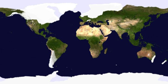
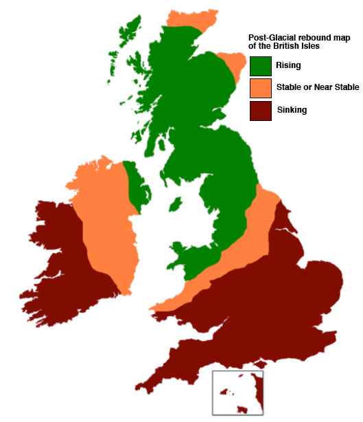
Another process called “glacial isostatic adjustment” is responsible for changes in sea level in areas, which were covered by ice sheets. The heavy weight of the ice presses down on the earth’s crust down. This displaces the fluid mantle under the crust and causes a bulge to form at the edge of the glacier. When the ice is removed, the crust will slowly return to its original state. This means that the pressed down areas will rise and the bulge will sink. This movement of the crust is reflected in the sea level. This effect is especially present in Northern Europe where areas in Scandinavia and the UK are rising in relation to sea level. The UK is an interesting example because the British Ice Sheet didn’t reach the southern part of England, so while Scotland and northern England are rising, the southern coast of England is experiencing accelerated sea level increases.
– Tegan
:: Tegan Mortimer is a scientist with Earthwatch Institute. For more exciting science insights, check out our BDX Explorer Guides or stop by our Citizen Science Resources page, where you can also find all of Tegan’s previous “Science Notes.”
We welcome your input or participation on our BDX Learning & Discovery efforts. You can always reach us here or @ <oceanexplorer@bodaciousdreamexpeditions.com>
=========================================================
C) NEW ZEALAND GLACIER SCAVENGER HUNT
Tegan has offered up a New Zealand Scavenger Hunt …
Explore Fox Glacier and Tasman Glacier vie Google Earth.
Just click on the image here to begin …
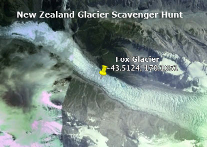
http://bodaciousdreamexpeditions.com/new-zealand-glacier-scavenger-hunt/
=========================================================
D) FOX GLACIER QUESTIONS FOR EXPLORER GUIDE
- If you placed a rock in the glacier at the top of the mountain, how long would it be until the rock was seen at the terminal face of the glacier?
- What is unique about the climate where the Fox Glacier ends and melts into the Fox River?
- How much of the volume of the Fox River comes from the melt of the Fox Glacier?
- You see lots of cracks and breaks in the glacier. When these open up wide enough to fall into, what are they called?
- What is the scientific name for the big boulder that has moved down the glacier in the videos?
- What is the technical term for the process that is the melting away of the glacier?
- What causes the snow that falls in the mountains to turn into the ice that is the glacier?
- How many glaciers are there in New Zealand?
- Where would you see another glacier with the same climate at the end point?
- What is the name of the special equipment you put on your boots so you can walk on the ice?
- What do they call it when a big chunk of ice breaks off the front edge of the glacier?
- How thick is the glacier in the thickest part?
- What is the name given to the hilly land left from the debris of a glacier as it melts away?