
:: LEG 2 : Cape Town, South Africa to Wellington, New Zealand
December 21, 2013 – February, 8, 2014 (49 Days)
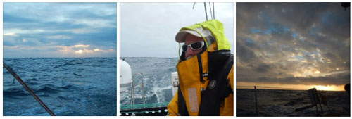
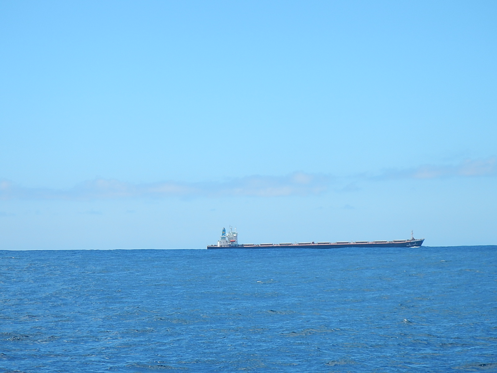
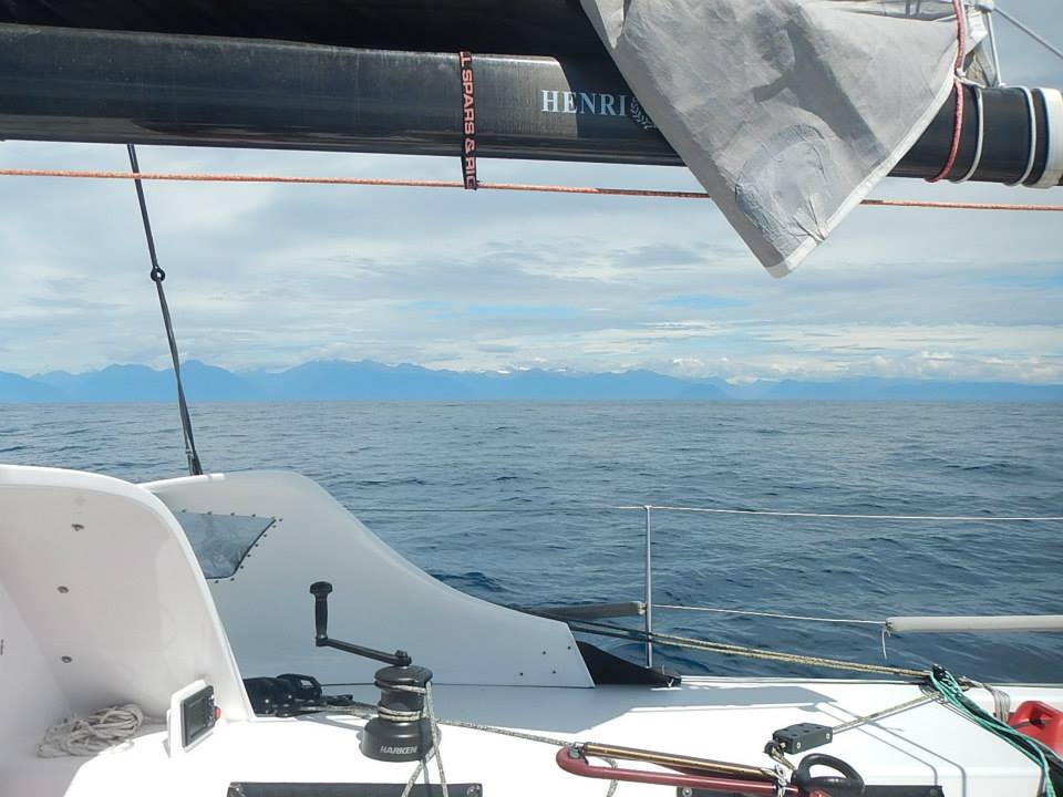
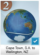 Bodacious Dream and I left Cape Town, S.A. on December 21, 2013 taking advantage of a small weather window in hopes of minimizing the effect of the typically strong southeast winds around the Cape of Good Hope. We had to work our way south before we could straighten our course along the 40-degree latitude towards Western Australia, Tasmania and New Zealand. Close to the coast, we encountered quite a few commercial container ships as well as fishing ships. Little did we know just how few ships we would see the whole rest of the leg.
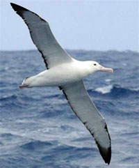
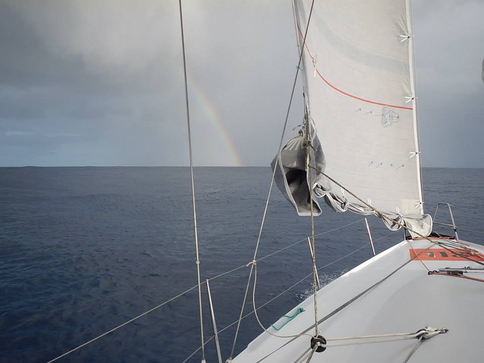
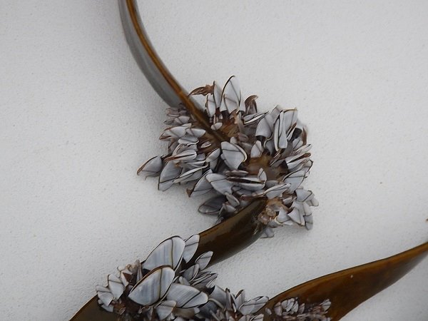
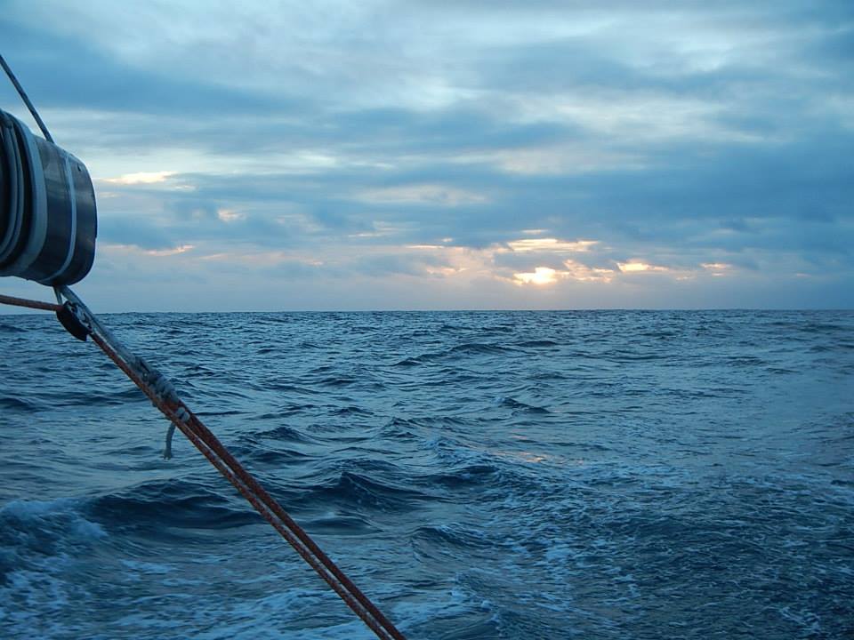
The Southern Ocean in addition to being fairly desolate is also famous for its cold northward flowing waters and its extreme weather, but also for its large population of Albatross birds, who have the uncanny ability of seeming to fly forever without ever flapping their wings!
This mix of cold fronts which are low-pressure systems, rotate clockwise here in the southern hemisphere while the high-pressure systems rotate counter-clockwise – and together they generate a mostly steady stream of westerly winds, which is what we needed to ride to get us to our destination. Our “Wind and Weather” Explorer Guide has a good explanation of these phenomena.
A few days out of Cape Town, I ran into a fisherman who besides wishing me good luck, also told me I would be seeing some spectacular bioluminescence along the way. He was certainly right about that, as this later update on bioluminescence explains.
Just as I did in 2012, when I was making a Trans-Atlantic crossing back from France, I spent both Christmas and New Year’s at sea. I celebrated both holidays this year with my usual simple freeze-dried fare, but added several courses of gratitude for the many family and friends who were following our journey over the web.
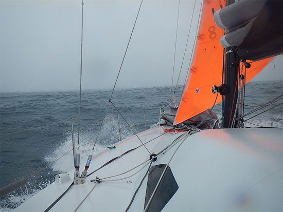
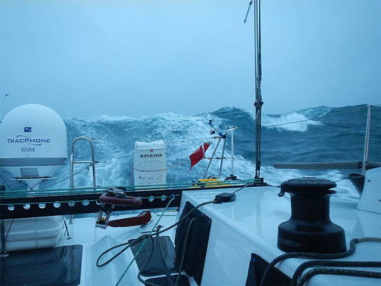
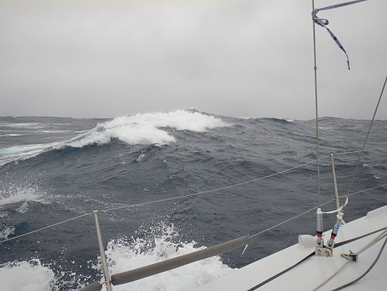
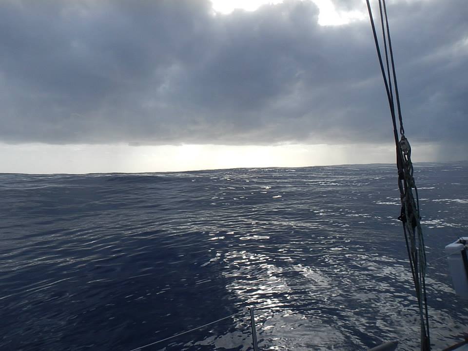
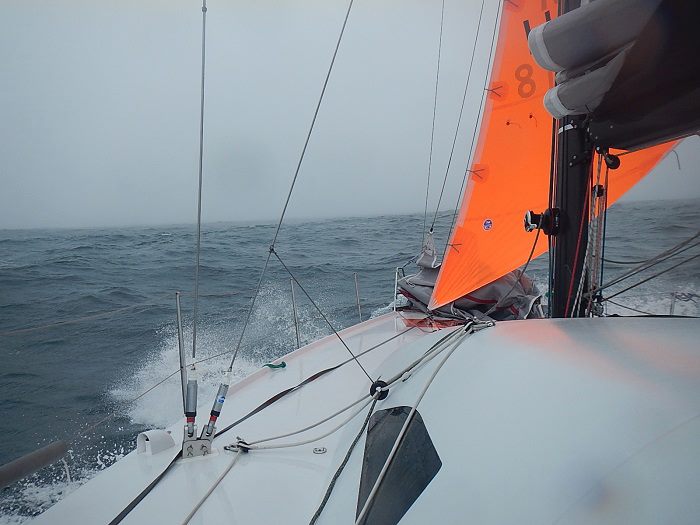
A few days into the new year, I began encountering an extended sequence of consecutive low-pressure cold fronts that significantly kicked up wave and wind conditions. While other world-crossing sailors often have larger, heavier boats and can make use of all the wind 30 knots can provide, Bodacious Dream only needs 15 to 20 knots for a really quick ride. So, when the winds get much higher, it becomes a lot more work for me to single-handedly keep this racehorse under control and not have her gallop off too fast.
 41.309362S, 39.09651E
The simpler rules apply in the middle of the ocean… whatever the sea gives you, that’s what you work with… and you do your best. The following few weeks kept me jumping and working extra hard to navigate our way through some bumper-to-bumper bad weather.
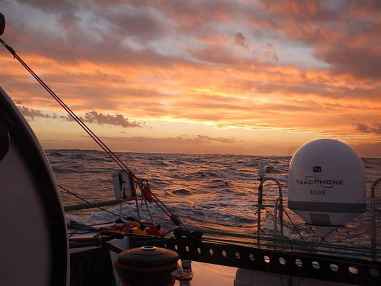
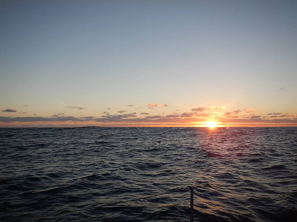
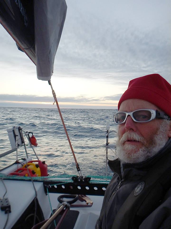
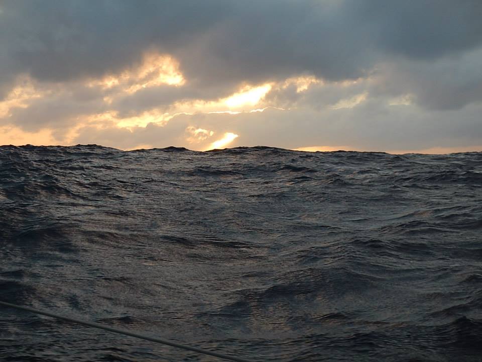
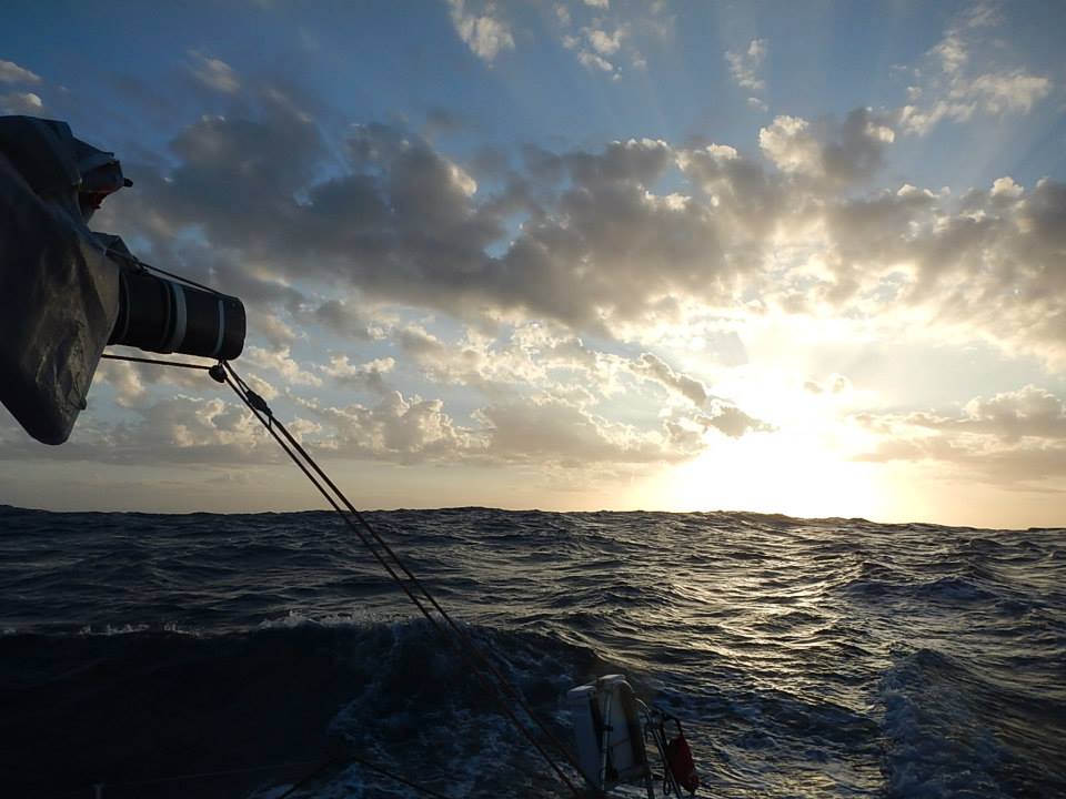
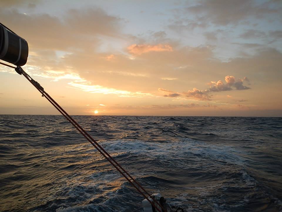
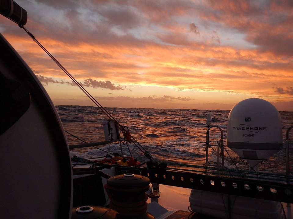
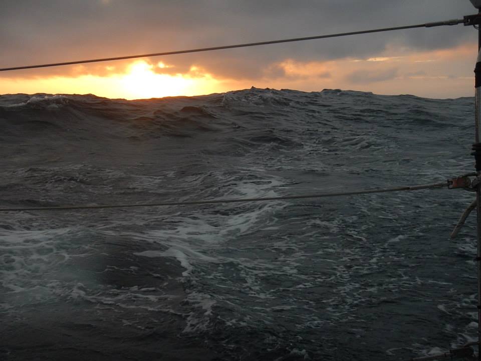
Getting to experience storms up close, allows you to appreciate them not only for their great strength, but also for their great beauty; the size and shape of the waves, the rhythmic intensity of the winds, the swirling curtains of rain and the constantly shifting watercolor shades of grey. I try to capture some of these elements in my photographs, but they rarely show the bracing brilliance that you feel moving through the storm-charged air. As I’ve only a few times before been in such extreme conditions for such an extended period of time, I found it all a bit edgy, but (always) mesmerizing.
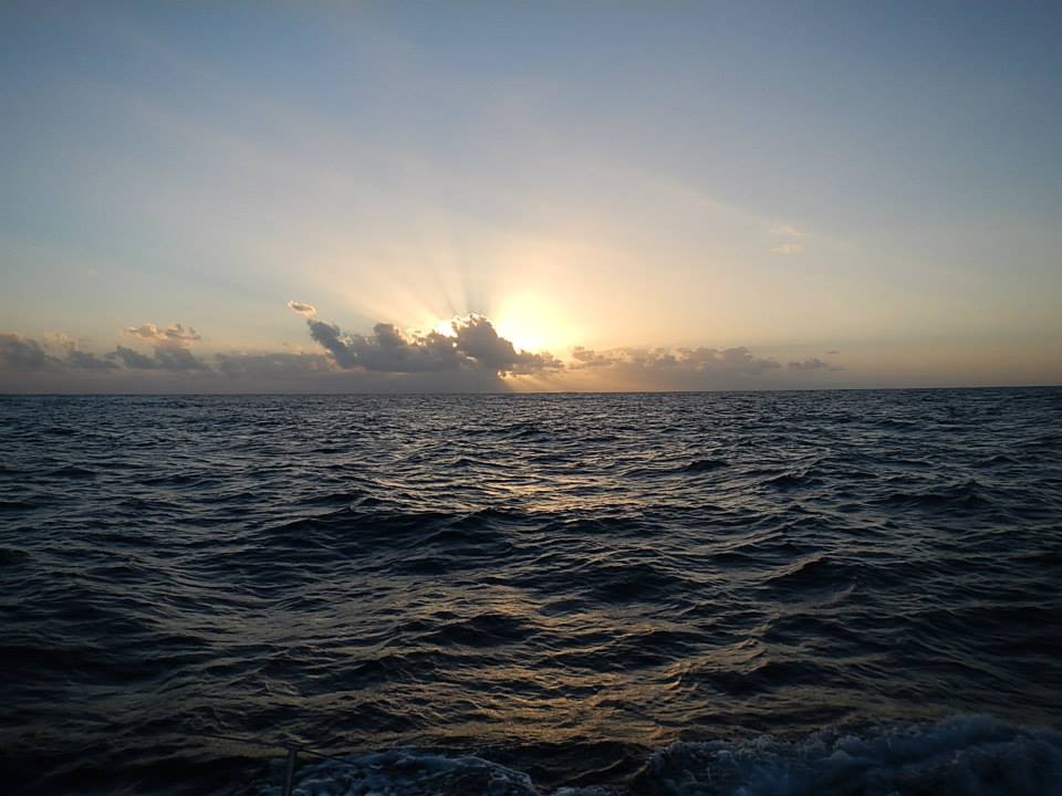
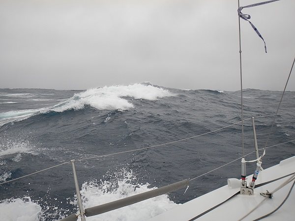
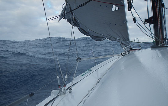 We’re talking considerably bigger waves than this …
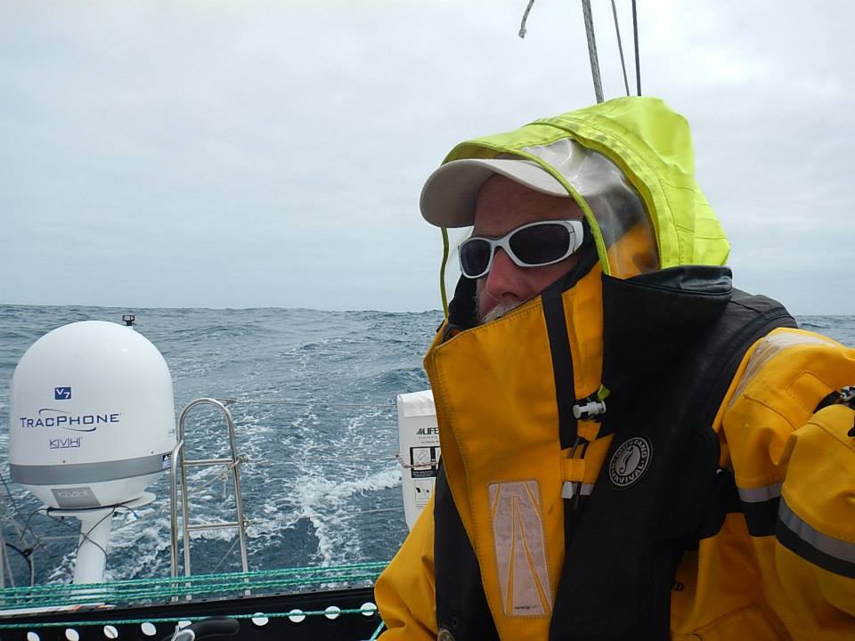
So, what do you do when it’s storming out? Basically, you hunker down! You keep yourself wrapped in your foul weather gear, and at the ready to kick into action to address any situation that arises. In between times, I often sit below in the companionway and watch the storm (and time) go by. Occasionally, I read a bit from one of my books, but it’s a challenge to let your mind relaxed when all that’s going on around you is of such pressing importance and so incessant in its demands on your attention.
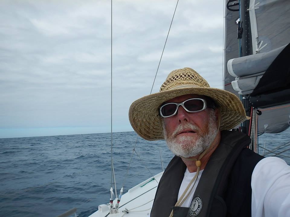
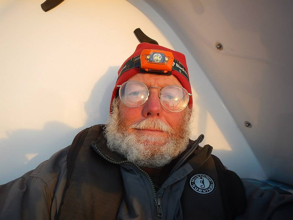
I regularly get asked about my daily routines. I don’t generally take a lunch, but rather snack on foods through the day. Beef jerky, crackers, cheeses, fruits and chocolate make up my most important food groups. At least a couple of times during the day, I’ll take over driving and allow Otto, the auto-pilot, a chance to relax. All through the day, depending on the wind direction and speeds, I make adjustments to the sails, plot navigation and make notes in the ship’s log. As I said, higher winds mean more sail adjustments … from reefing the mainsail and jib to taking the jib down and resetting it again.
Once sunset happens, and my visibility diminishes, I let Otto drive through the night. How I sleep is in 20-minute increments – irrespective of whether it is day or night. In a way, you have to always be trying to sleep. Why 20 minutes? Well, that is generally the time it takes a ship to reach you from the horizon. So I use my little egg timer to poke me awake, so I can see what’s happening. I don’t know, but somehow or other this seems to provide me enough sleep to keep going.
 39.5612499S, 70.330989E
 It was at the top of Leg 2, we also launched our circumnavigation-specific Explorer Guides. As the scope of this set was global and thus more ambitious than our earlier Guides, it took some extra time to get them ready. In case you missed the Explorer Guide story, let’s just say we’re big on breaking down the distance between experience to learning. During this leg, we were also excited to learn that the great Atlantic Cup Regatta would be including a Kid’s Page for which they would be using our BDX materials and my own “cartoon” likeness.
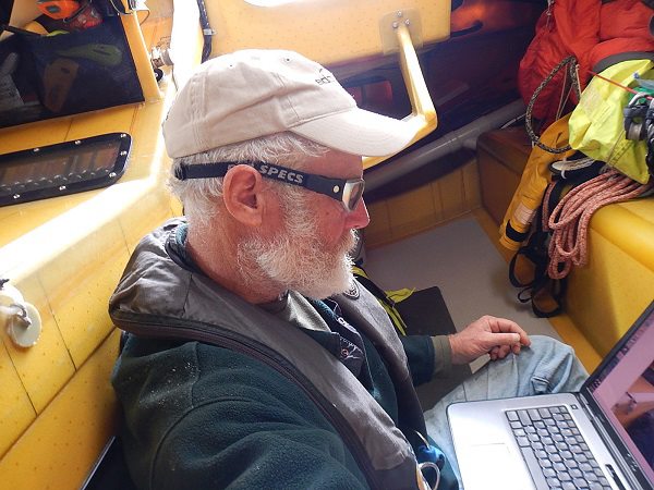
With so much intense weather, you end up spending a good deal of time in the belly of the boat. I have instruments that monitor course, wind, and speed. I also monitor how Otto (the auto-pilot) is doing, and can override him as is necessary. Otto makes all the corrections necessary via the computers and electro-magnetic compasses … sometimes sailing to a wind angle and at other times to a compass course. When he sails to a compass course, I must keep a constant watch to make sure the wind isn’t shifting to the wrong corner and forcing us into a gybe … which at these wind speeds is a huge mess, not to mention dangerous as well.
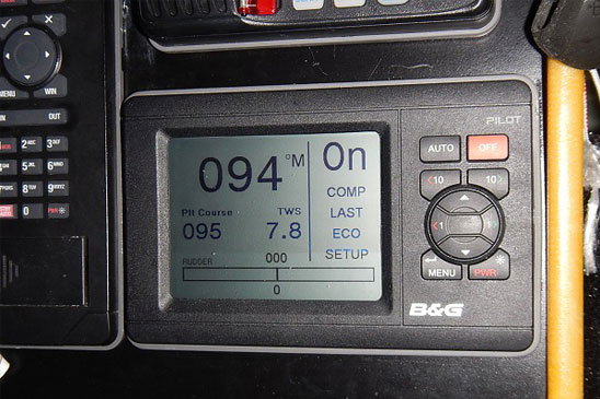 Controls for the Auto-Pilot …
I adjust the course as necessary via button commands, but sometimes, a huge wave will push us far enough off course that Otto’s auto-correction goes too far the other way, which leaves me to straighten out the mess. Actually, at times the winds are strong enough, that they pulsate with the pressure. You can tell just by the rhythm of the wind gusts, when the pressure is building, when the storm passes and when it begins to abate.
Stormy Seas …
I mentioned in the recap to Leg 1 Recap, how tuned in you get to the sounds that the boat makes. Similarly, you get tuned into the MUSIC it makes too. Depending on the wind and the weather, the sounds that reach your ears are a shifting and complex symphony. There is the constant push of water against the hull where the bow enters the water and sets up a strong forward rhythm – the surge UP and then the drop back DOWN as the boat powers over a wave. If you are interested, here is a post where I go into describing Nature’s Music in more detail.
Sounds of the Sea
All these sounds taken together also serve as a reassuring acoustic reminder that everything is working and that the boat is moving right along.
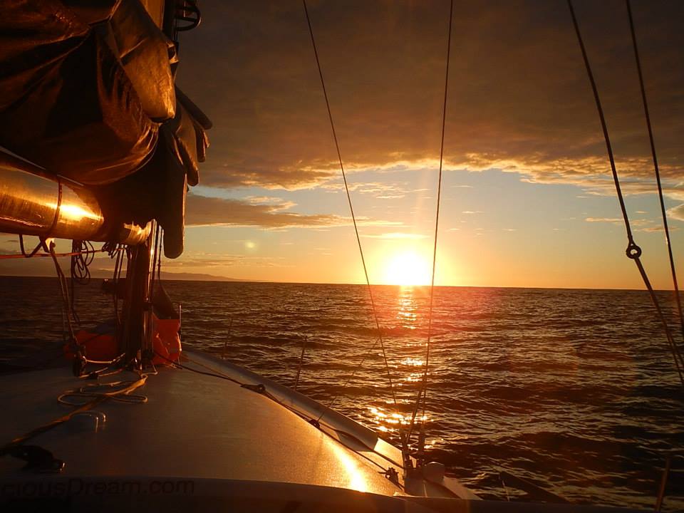
Interspersed throughout the leg, were some sunny days too with calmer winds. The good thing about days of calmer weather is that it makes it easier to accomplish ordinary tasks like sleeping, eating, reading and writing. I was able to finish a number of books along the way. Those would be… Long Walk to Freedom (about Nelson Mandela), Losing my Virginity (about Richard Branson,) Incognito (David Eagleman on the brain,) Dreamland (David K. Randall on the science of sleep) and What the Dog Saw (Malcolm Gladwell essays.)
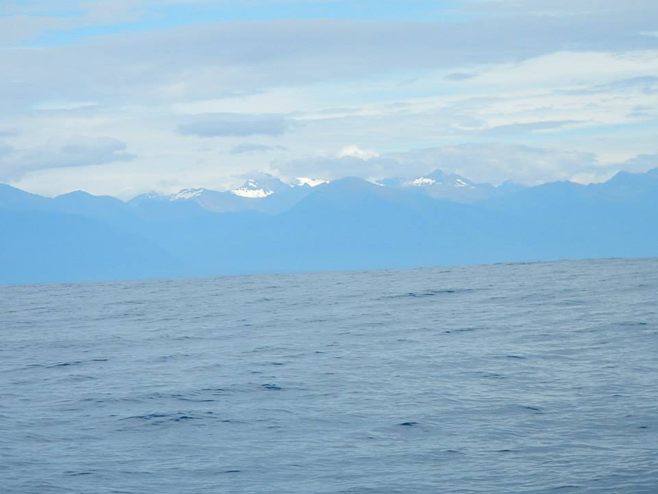
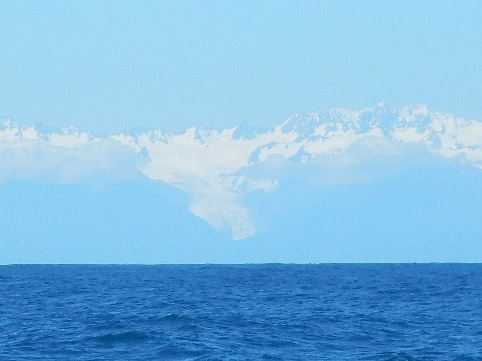
Across the Tasman Sea and eastward we sailed, and after 45 days at sea, we caught our first sight of land of the South Island of New Zealand on February 4th.
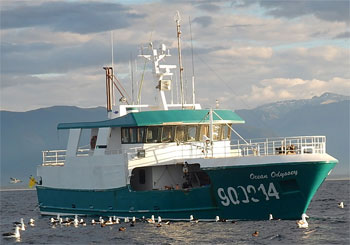
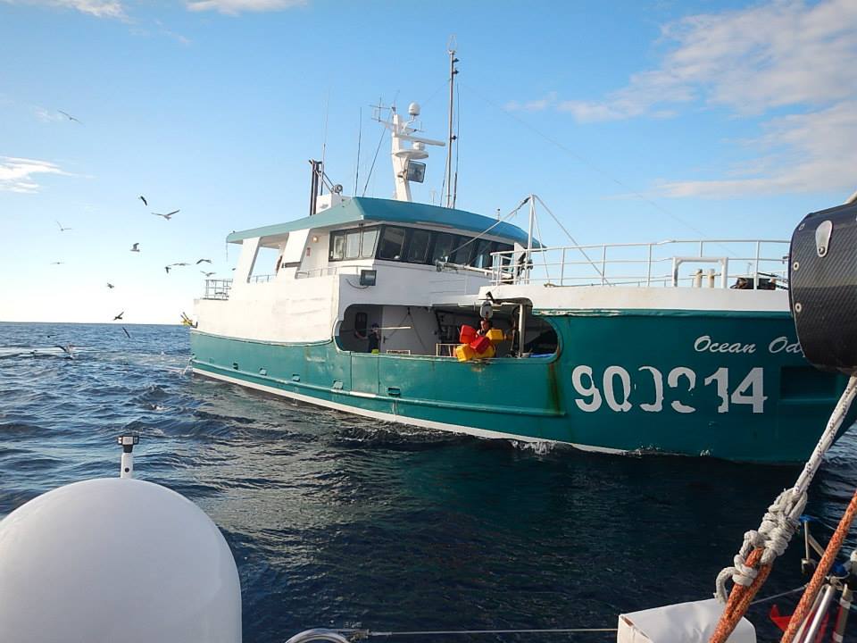
Soon after that, very short on fuel and even shorter on forecasted wind, we met up with a generous fisherman, aboard a boat called Ocean Odyssey who supplied us with much-needed fuel, though we did have to politely decline his other generous offers of a shower and fresh food.
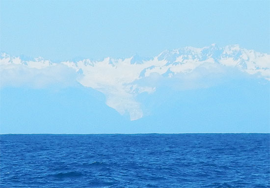
With a resupply of fuel, we made our way up the beautiful West Coast of the South Island and past the majestic Southern Alps to the northern tip and Farewell Spit, a locale sadly known for its too frequent whale strandings, which Tegan covered in one of her Science Notes.
A strong headwind made the last 120 miles down the passage between North and South Island and through the Cook Strait a tough challenge.

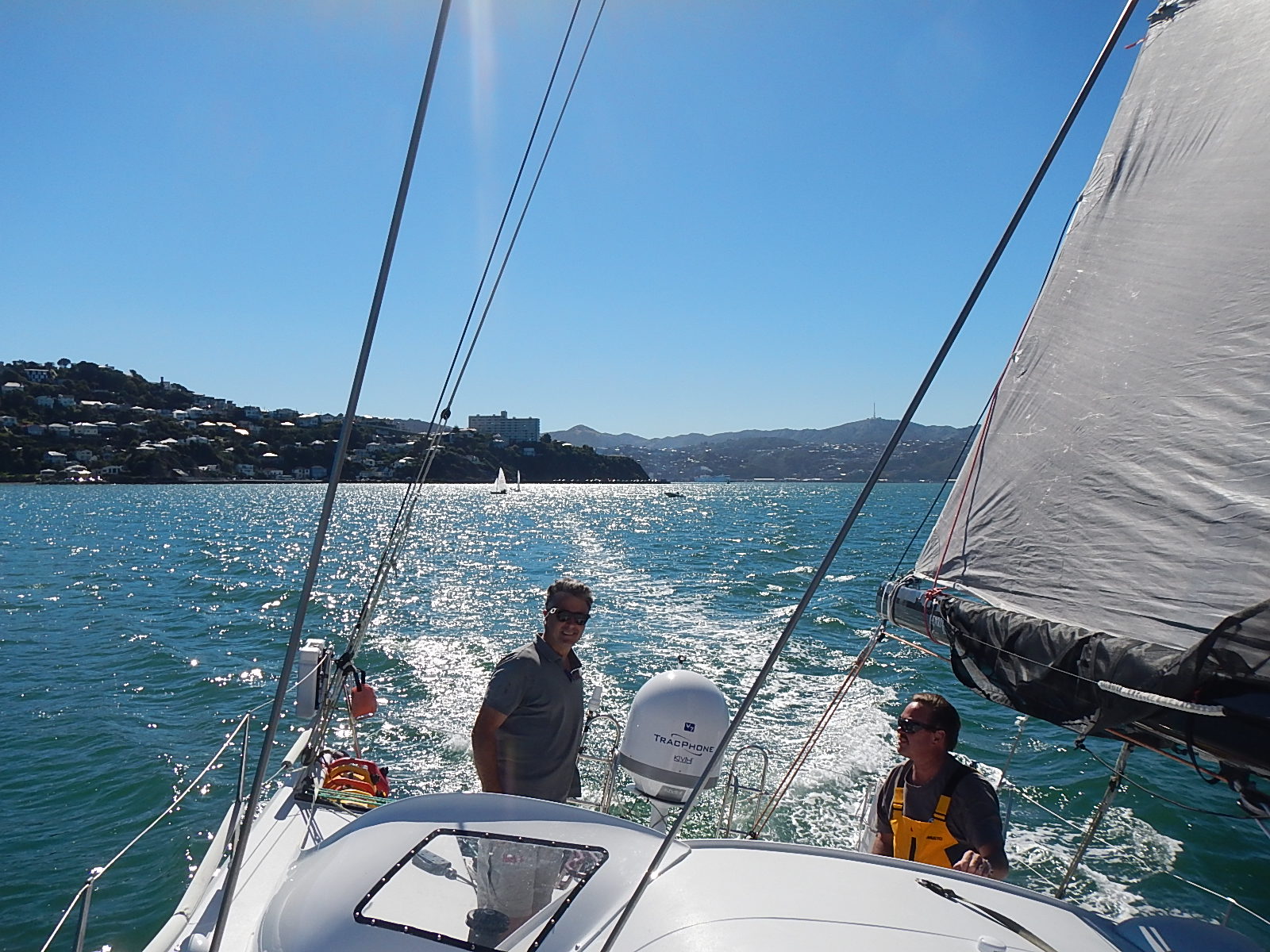
Finally though, we entered the harbor in Wellington and quickly met up with the friends who two years earlier had built and launched Bodacious Dream. It was a wonderful homecoming to be sure! While in Wellington, I spent some time with the man who led the build of Bodacious Dream, Lapo Ancillotti – which resulted in a wonderful interview with Lapo that reveals his extensive knowledge of composite materials used in modern-day boat (and airplane) construction
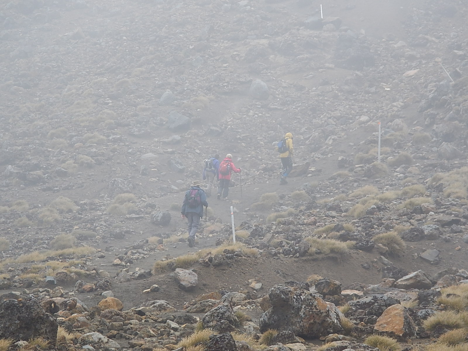
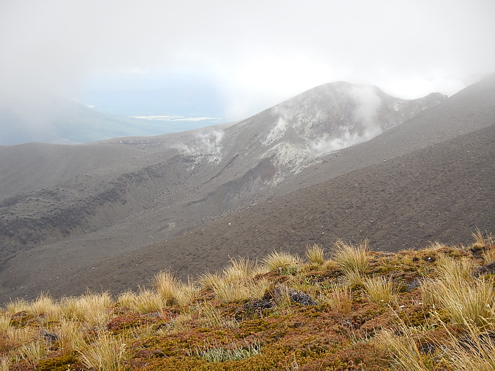
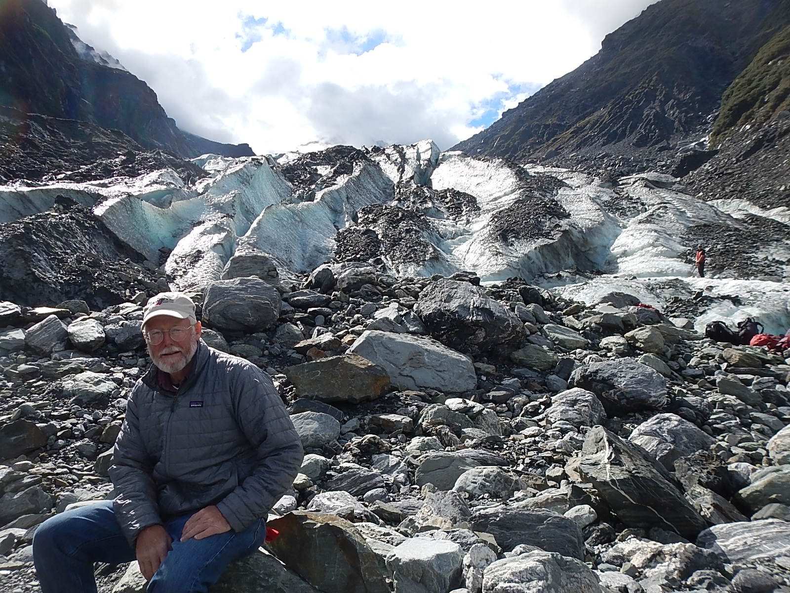
With Bodacious Dream in the competent hands of her original builders for maintenance, I took time to explore some of the North and South Islands of New Zealand. A hike into the incredible Tongariro Volcano Park was most memorable. Even more memorable was a trip I took through the South Island ending with an incredible tour of the Fox Glacier, which provided me SO many wonderful insights into the nature of our role as caretakers of the Earth.
After the Fox Glacier visit where I captured both photos and videos, I couldn’t help but translate the experience into a full Fox Glacier story update. Tegan Mortimer, who we quickly learned was an expert on glaciers, helped us too with a most excellent Science Note on Glaciers. We also created a brand new Explorer Guide just for Glaciers. Thank you New Zealand – an amazing country to which I hope to return.
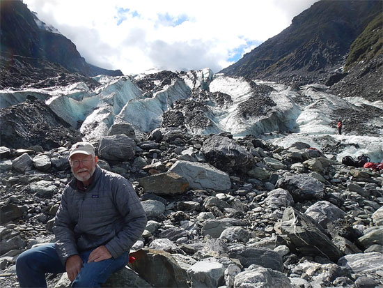 Dave at Fox Glacier
With our preparations complete, and after an unplanned trip back the U.S. to attend to family circumstances, I found myself forced to reconsider the original plan for the route of the final legs of the voyage. After much deliberation, and looking closely at our calendar and the approach of chilly autumn in the far Southern Hemisphere, I made the decision to forego passing through Tierra del Fuego and rounding Cape Horn and instead to head toward the Galapagos Islands and then from there through the Panama Canal and back into the Atlantic Ocean. Once into the Caribbean, we headed north to complete what we began last October in Jamestown, Rhode Island, USA.
:: Our many updates from the water can be found on the Expedition Blog … where they are filtered by subject and date.
:: And all our Leg 2 photo albums can be found on our BDX Facebook Photo Album Page.
:: Leg 1 = Newport, RI to Cape Town, S.A.
:: Leg 2 = Cape Town to Wellington, New Zealand
:: Leg 3 = Wellington, NZ to the Galapagos Islands
– Dave, Bodacious Dream (and the ballacious) Franklin
:: BDX Website :: Email List Sign-Up :: Explorer Guides :: BDX Facebook