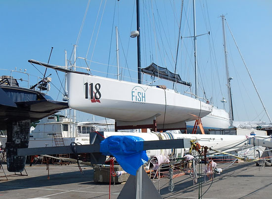
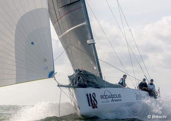
I arrived back in Rhode Island this past Monday from my home on the shores of Lake Michigan. At the Hinckley Boatyard in Portsmouth, RI, I’m reunited now with Bodacious Dream, which has been waiting patiently for me to return.
 Bodacious … just hanging out … getting ready …
Leaving there and arriving here marked a big transition in the life of Bodacious Dream
and myself. It means I’ve done the majority of the organizational work necessary for me to be away from home for some ten months! Imagine if you had to do the same … a whole lotta lists … that’s all I can say.
We’ve kept you updated the past two years as best we could with our travels and our races onboard Bodacious Dream … but that has all been something of a dress rehearsal for what is about to happen now … in that all that has allowed me the opportunity to really get to know this marvelous sailing ship and to see just how I might best configure her for the main event … that of a SOLO GLOBAL CIRCUMNAVIGATION.
We’ve done well in some of our races and learned a lot in the rest, but I’ve learned the most I would say from sailing her back from Europe alone, and from talking with other sailors with more open-ocean experience than I. So, now the time is upon us and for the next six weeks, I’ll be here in Rhode Island implementing those lessons and refinements so that I can sail her around the world in as safe and natural way as possible.
Here’s a video I shot Wednesday at the boatyard … a little introduction as to what lies ahead … and some of the work that needs to be done before we set sail.
Dave’s Intro #1 to the Circumnavigation …
We’ve got new mounts for the KVH Satellite Dome, where our Internet connection resides. We’ve also got new hatches, new hardware, new spray shields for the cockpit, new lines and halyards as well as expanded storage units for lots of food (and cookies) to keep us fit and happy. We’re also working on enhancing the quality of our information uploads with GPS-tagged photographs and Google Earth/Ocean mapping tours. These amazing technologies are going to allow you to see much more of what’s happening in real-time, than we can show you here in e-mails or blog posts. We are determined to get ourselves on the leading edge here in so far as how we use these great new tracking and recording technologies!
To give you a feel for the scope and distance of the adventure, here is our ITINERARY for the circumnavigation, along with a few details and comments.
We’re looking for good weather October 1st to leave Newport, RI and to return there around June 1st, 2014!
If you are reading this and you have any thoughts, learning advice, questions or such, please feel free to email them to us at info@bodacousdreamexpeditions.com!
So, let’s take a look!
•=•=•=•=•=•=•=•=•=•=•=•=•=•=•=•=•=•=•=•=•=•=•=•=•=•=•=•=•=•=•=•
:: GLOBAL BODACIOUS DREAM EXPEDITION
Circumnavigation of the Globe (Planned Itinerary – updated 8.20.13)
#1) DEPART NEWPORT RI (OCTOBER 1, 2013)
Coordinates: 41 29’ 13.20”N, 71 20’ 34.25”W
•=•=•=•=•=•=•=•=•=•=•=•=•=•=•=•=•=•=•=•=•=•=•=•=•=•=•=•=•=•=•=•
#2) Proceed Southerly towards South America to the MOUTH OF THE AMAZON RIVER (off the coast of BRAZIL)
Coordinates: 0 34’ 15.04”N, 49 23’ 33.97”W
Length of sail: Approximately: 14 Days
Expected duration of sail: 2700 miles
Goal: Explore the mouth of the largest river in the World and its effect on the ocean and species of animals that adapt to the mix of salt and fresh waters.
•=•=•=•=•=•=•=•=•=•=•=•=•=•=•=•=•=•=•=•=•=•=•=•=•=•=•=•=•=•=•=•
#3) Commence onward to one of the ST. HELENA ISLANDS (in the middle of the Atlantic)
Coordinates: 15 57’ 48.985”S, 5 42’ 12.05”W
Length of sail: 2800 miles
Expected duration of sail: Approximately 15 Days
Goal: This remote and desolate island in the middle of the south Atlantic provides a unique opportunity to stop and explore.
•=•=•=•=•=•=•=•=•=•=•=•=•=•=•=•=•=•=•=•=•=•=•=•=•=•=•=•=•=•=•=•
#4) Commence onward to CAPE TOWN, SOUTH AFRICA
Coordinates: 34 15’ 11.115”S, 18 37’ 33.29”E
Length of sail: 1700 miles
Expected duration of sail: Approximately 10 Days
Goal: Visit whale habitat, various cultural areas and this historical maritime waypoint for world circumnavigators both modern day and historical. Cape Town is known as the “Tavern of the Seas.”
•=•=•=•=•=•=•=•=•=•=•=•=•=•=•=•=•=•=•=•=•=•=•=•=•=•=•=•=•=•=•=•
#5) Commence onward to the KERGUELEN ISLANDS
Coordinates: 49 19’ 24.375”S, 69 21’ 06.56”E
Length of sail: 2400 miles
Expected duration of sail: Approximately 12 Days
Goal: Enter the desolate South Indian and Southern Oceans. These stretches of open ocean provide the routing around the globe. Often this is referred to as a circumnavigation of the Antarctic Continent because by any course of travel, Antarctica must be sailed around. The Kerguelen Islands are a very remote and desolate island group in the Southern Ocean.
•=•=•=•=•=•=•=•=•=•=•=•=•=•=•=•=•=•=•=•=•=•=•=•=•=•=•=•=•=•=•=•
#6) Commence onward to WELLINGTON, NZ
Coordinates: 41 20’ 15.265”S, 174 50’ 49.61”E
Length of sail: 4100 miles
Expected duration of sail: Approximately 20 Days
Goal: Wellington, NZ is on the southern tip of the North Island of New Zealand. It is also the birthplace of Bodacious Dream as she was launched there in December 2011. The plan is to visit many interesting natural sites around New Zealand.
•=•=•=•=•=•=•=•=•=•=•=•=•=•=•=•=•=•=•=•=•=•=•=•=•=•=•=•=•=•=•=•
#7) Commence onward to CAPE HORN AND STRAIGHTS OF MAGELLAN
Coordinates: 55°43’2.15″S, 66° 6’59.07″W – Google Maps
Length of sail: 4200 miles
Expected duration of sail: Approximately 21 Days
Goal: Visit and cruise historic Cape Horn and Straights of Magellan. Cape Horn is the Everest of Sailing.
•=•=•=•=•=•=•=•=•=•=•=•=•=•=•=•=•=•=•=•=•=•=•=•=•=•=•=•=•=•=•=•
#8) Commence onward to the FALKLAND ISLANDS
Coordinates: 51 49’ 19.01”S, 59 35’ 22.24”W – Google Maps
Length of sail: 400 miles
Expected duration of sail: Approximately 2 Days
Goal: These interesting islands are just east of the southern tip of South America.
•=•=•=•=•=•=•=•=•=•=•=•=•=•=•=•=•=•=•=•=•=•=•=•=•=•=•=•=•=•=•=•
#9) Commence onward to SOUTH GEORGIA ISLAND
Coordinates: 54 28’ 46.78”S, 36 26’ 26.66”W
Length of sail: 800 miles
Expected duration of sail: Approximately 4 Days
Goal: This historic location was the final rescue place of the Shackleton Expedition when they were trapped on Antarctica through the winter and traveled overland, built a small boat and sailed to South Georgia Island for rescue. This was an amazing story of human endurance. Shackleton is buried on South Georgia Island.
•=•=•=•=•=•=•=•=•=•=•=•=•=•=•=•=•=•=•=•=•=•=•=•=•=•=•=•=•=•=•=•
#10) Commence onward to ANTIGUA, WEST INDIES
Coordinates: 17 0’ 46.41”N, 61 46’ 17.63”W
Length of sail: 5000 miles
Expected duration of sail: Approximately 30 Days
Goal: A short visit to this great Caribbean Islands on the way back to the East Coast of the United States.
•=•=•=•=•=•=•=•=•=•=•=•=•=•=•=•=•=•=•=•=•=•=•=•=•=•=•=•=•=•=•=•
#11) Commence onward to CHARLESTON, SC
Coordinates: 32 44’ 27.10”N, 79 51’ 11.99”W
Length of sail: 1400 miles
Expected duration of sail: Approximately 6 Days
Goal: A quick stop in Charleston, which has become a second home for Bodacious Dream as she has competed the past two years in the Atlantic Cup Race that starts in Charleston.
•=•=•=•=•=•=•=•=•=•=•=•=•=•=•=•=•=•=•=•=•=•=•=•=•=•=•=•=•=•=•=•
#12) Commence onward to completion of circumnavigation in NEWPORT, RI
Coordinates: 41 29’ 13.20”N, 71 20’ 34.25”W
Length of sail: 700 miles
Expected duration of sail: Approximately 4 Days
•=•=•=•=•=•=•=•=•=•=•=•=•=•=•=•=•=•=•=•=•=•=•=•=•=•=•=•=•=•=•=•


