
Late Thursday night, we passed our 3000-mile halfway point on Leg 3 … always a big milestone! At present, Bodacious Dream and I are sailing in a northeasterly direction trying to position ourselves for some interesting weather that’s between us and the trade winds, which will move us towards the Galapagos Islands.
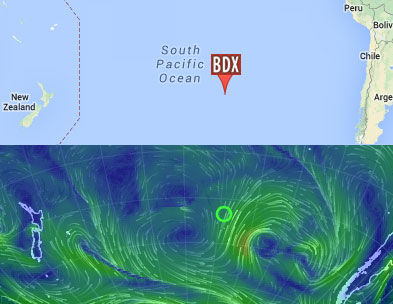
Saturday, April 12, 2014 – 38.1276S,121.1474W
We’re in a part of the Southern Pacific Ocean that doesn’t get much traffic or attention from weather gurus, so most of the forecast data we use comes from the folks at Commanders Weather – the accuracy of which can vary widely. For example, yesterday’s winds were forecast to be between 12-20 knots, yet most of the day they were from 24-28 knots … a pretty noticeable difference. While they do their best, you can never be certain with weather. So keeping all options in mind, I’ve set up BoDream with the smaller storm sail on the bow for the next few days. As weather’s been a lot on my mind here, I thought I’d talk a bit more about that in this update.
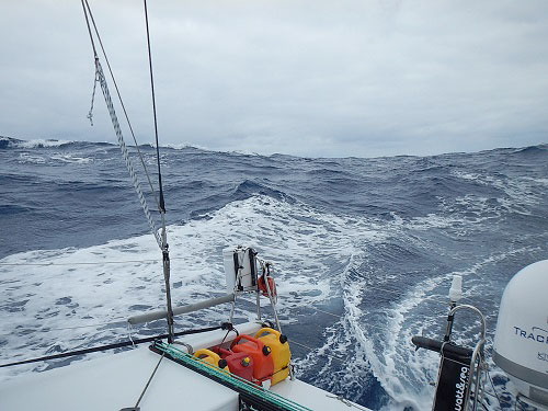
Cold front waves – 38.520408S,124.282397W
As best I can piece it together, the first upcoming event is a cold front that’s supposed to move up from the south and bring with it winds of 20 knots – but they could be higher of course, and should the front carry with it squalls and rain storms, you need to prepare for winds up to 30-35 knots. This system is supposed to pass through so that by mid-weekend, the wind speeds should ease down for a day or so … at which point, we will likely encounter another low-pressure system.
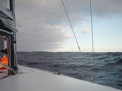
Starboard Views – 38.521624S,124.301575W
For this second low system, we’ll go with a different strategy – one that has us trying to race east of it. This is not a typical strategy, because the eastern side of the front is the windier side, BUT if we can get there ahead of it, it may be possible after it passes, for us to capitalize on the prevailing southerly and southeasterly winds that flow up the South American Coast and use them to push us towards the Galapagos Islands. That’s the plan anyway!
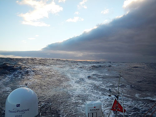
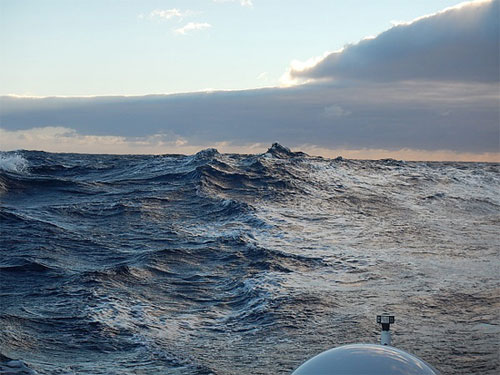
Low-Pressure Waves – 38.520591S,124.284739W
At the moment, I’m sailing east and northeast as fast as I can. I’m being cautious of course, given the variables, but the hope is to get as far in front and east of this new low as possible. Now, add to that, the fact that this low system is only FORECAST to develop; at this point, it’s not actually there yet! Credit these kind of projective weather forecasting tactics to the amazing power of today’s computer weather models and satellite imagery capacities.
Rolling Big Ones – 38.520408S,124.282397W
In “predicting arrival date” news … with just under 3000 miles left to the Galapagos Islands, I think back to that same point in the previous two legs and how fun it was to try and predict the arrival date from this far out. My best guess at this point is that I still have two and a half weeks left. The troublesome part is that the last bit of distance, the 200 miles or more south of the Galapagos, is in an area of little or no wind, which I expect will be a bit frustrating for the old salt who smells land nearby. In any case, right now, I’m guessing we’ll make land on April 28th.
In “food” news, at a few days beyond two weeks from New Zealand, I ate the last fresh orange yesterday. I have a few fresh apples left, but whatever else remaining is either canned or freeze-dried. I do have some cheese in wax, which will keep a little while longer; long enough I hope to re-enact a few of my appetizer happy hours from the Trans-Atlantic crossing of a year and half ago when at sunset, I’d slice part of an apple, some cheese and some crackers … and live the good life!
I hope life is good for you all, as well …
More soon …
– Dave, Bodacious Dream and Franklin
:: BDX Website :: Email List Sign-Up :: Explorer Guides :: BDX Facebook