Harmonics of the Great Gyres

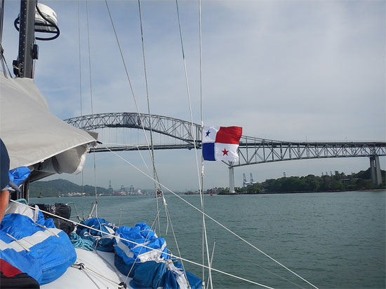
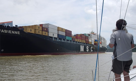
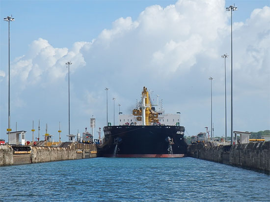
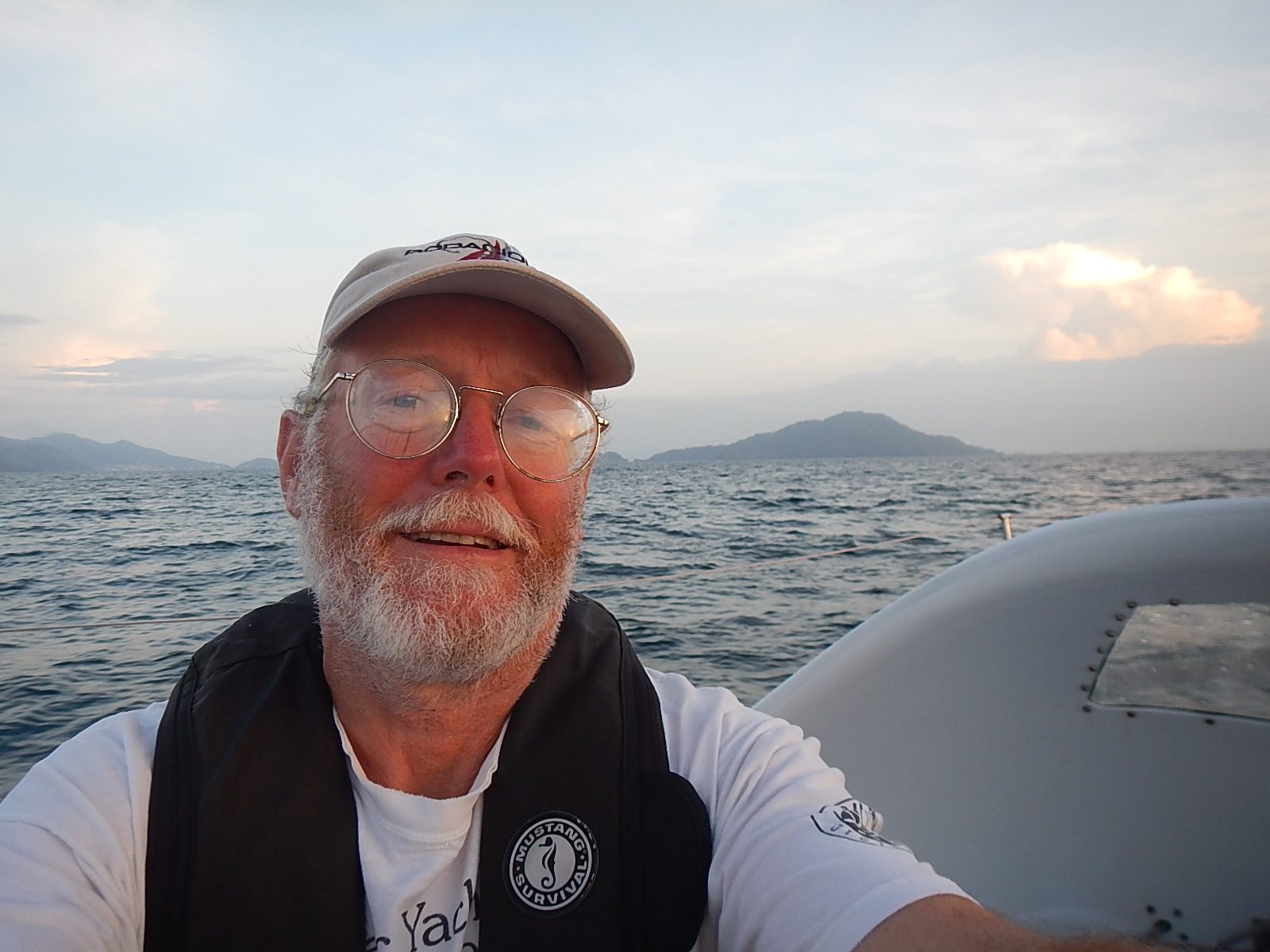
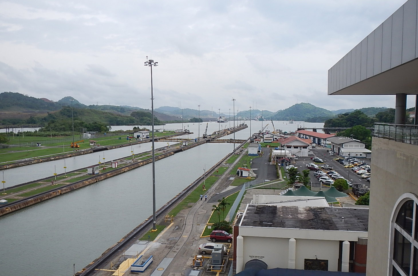
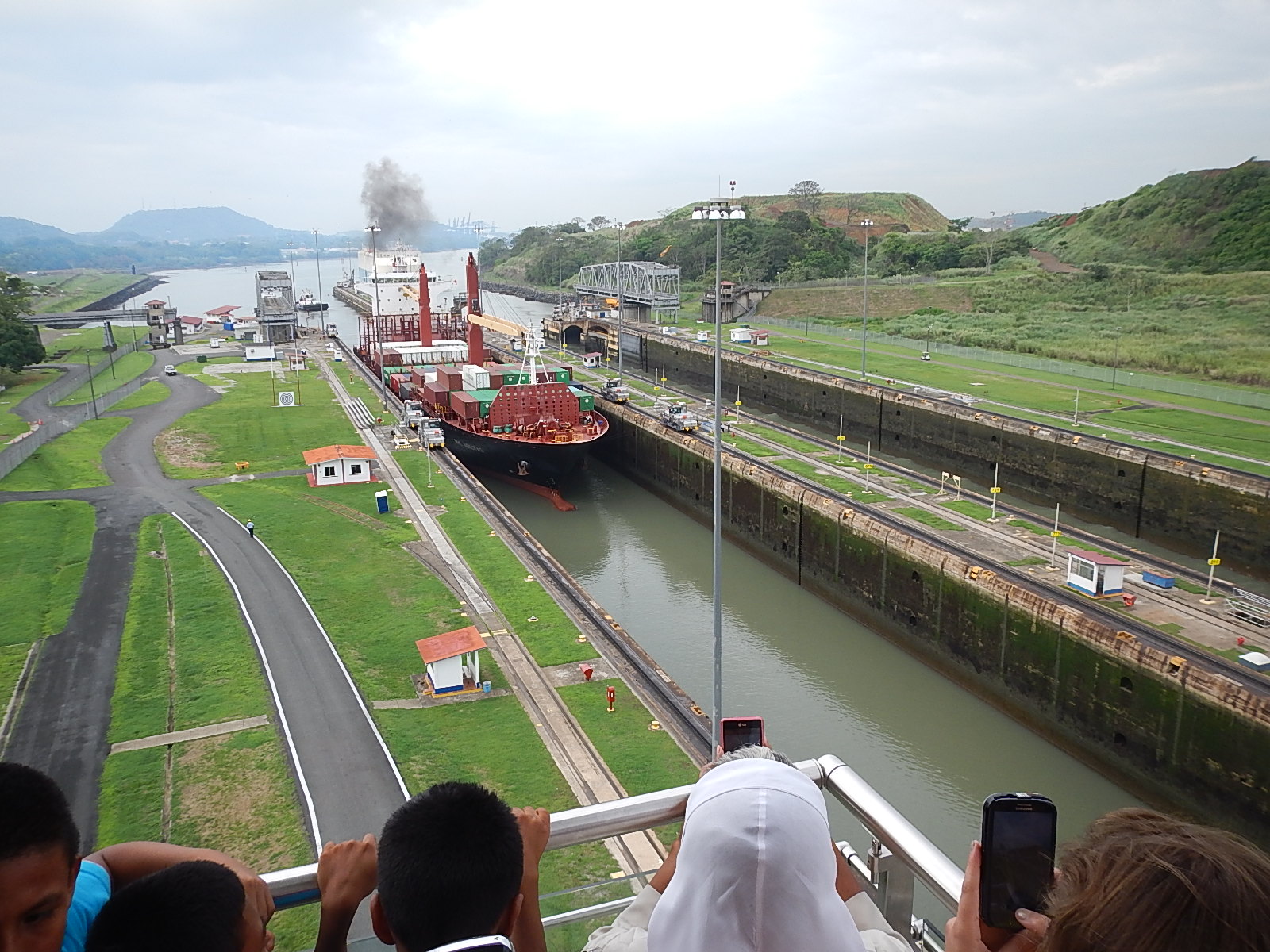
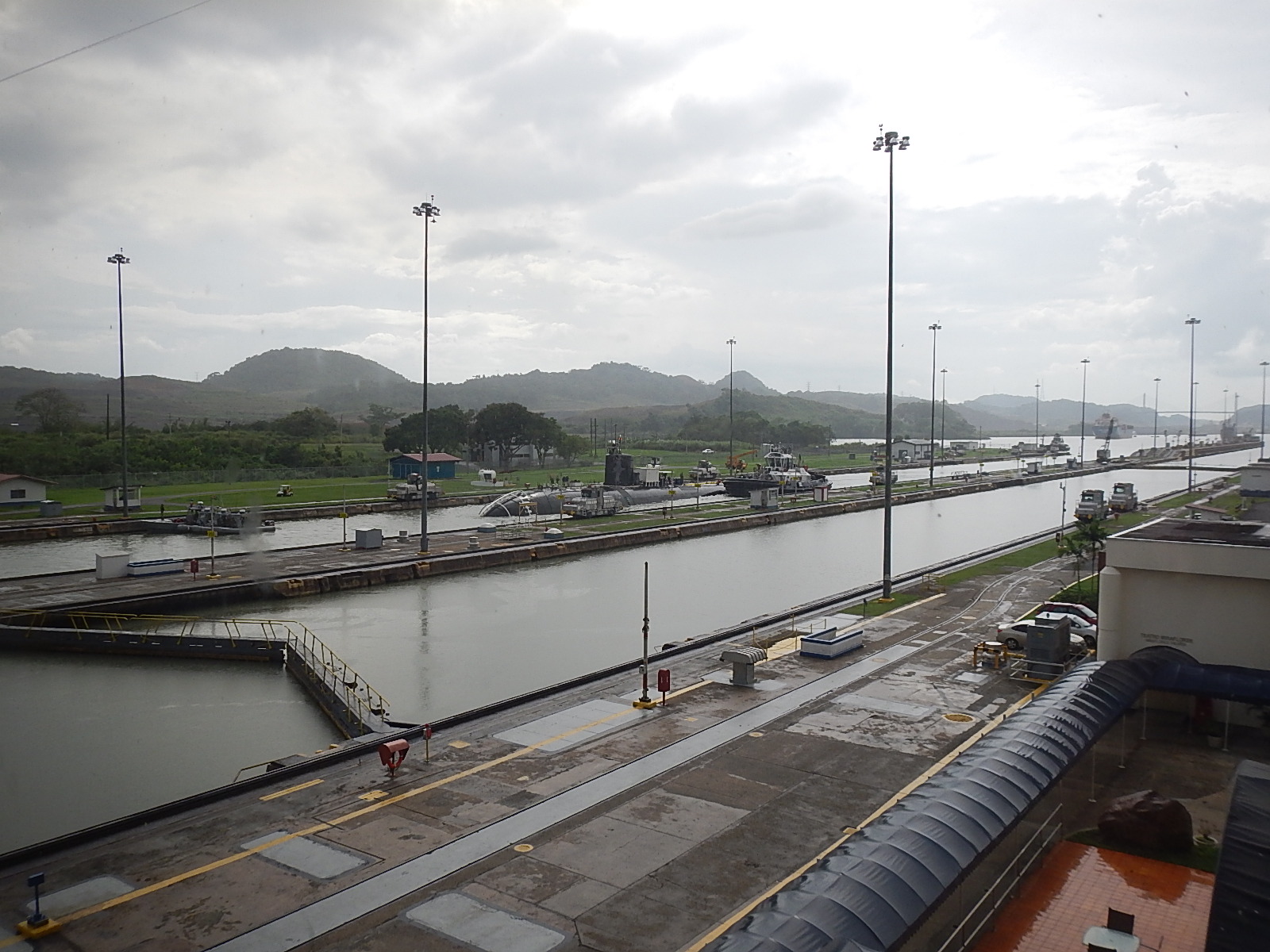
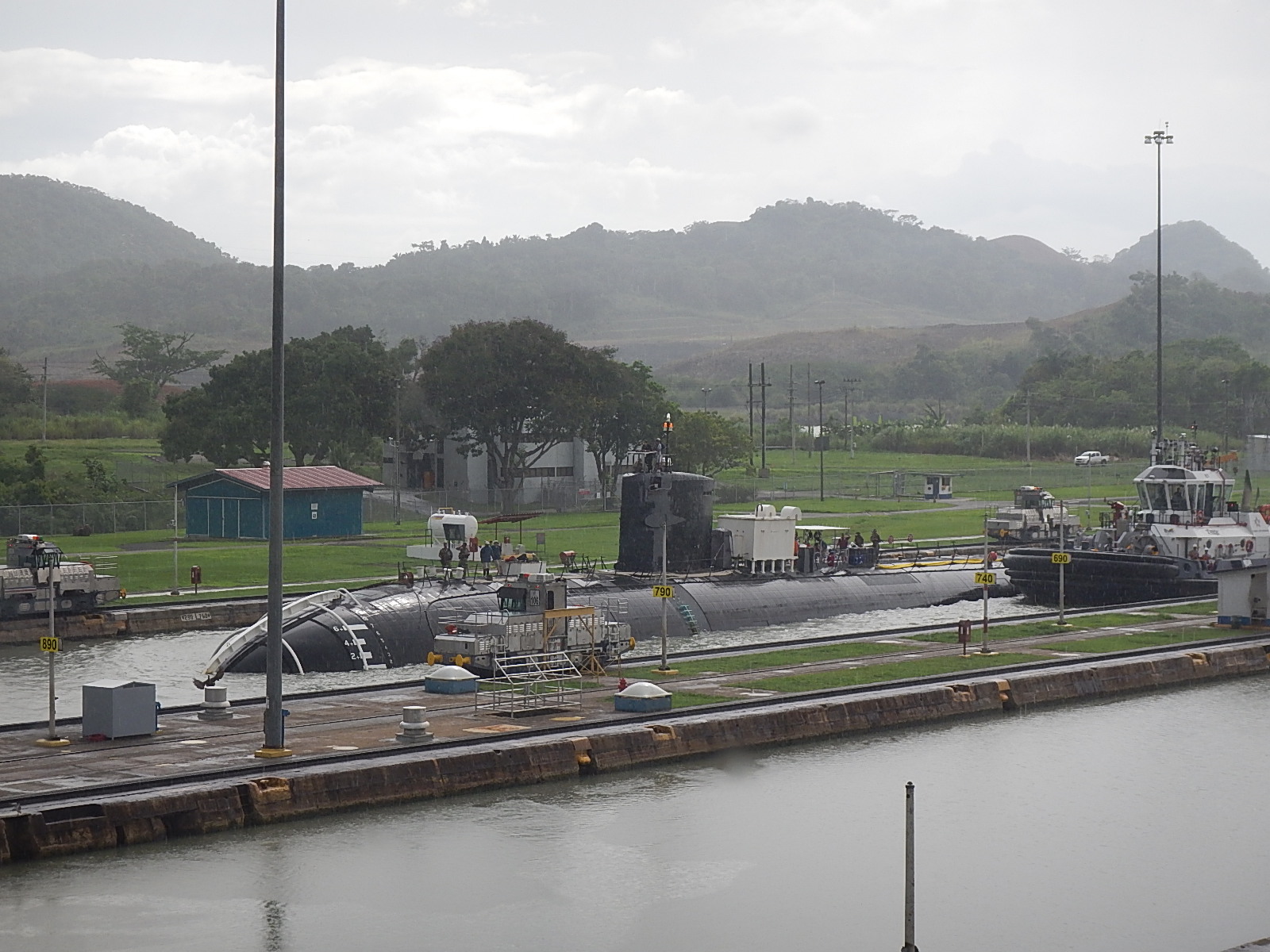
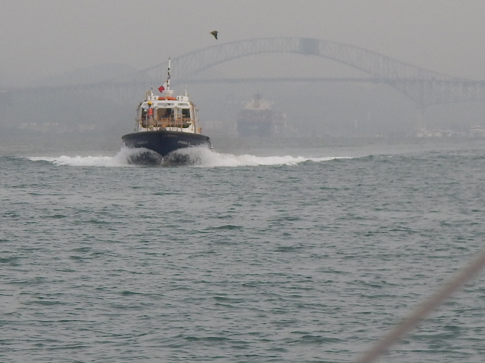
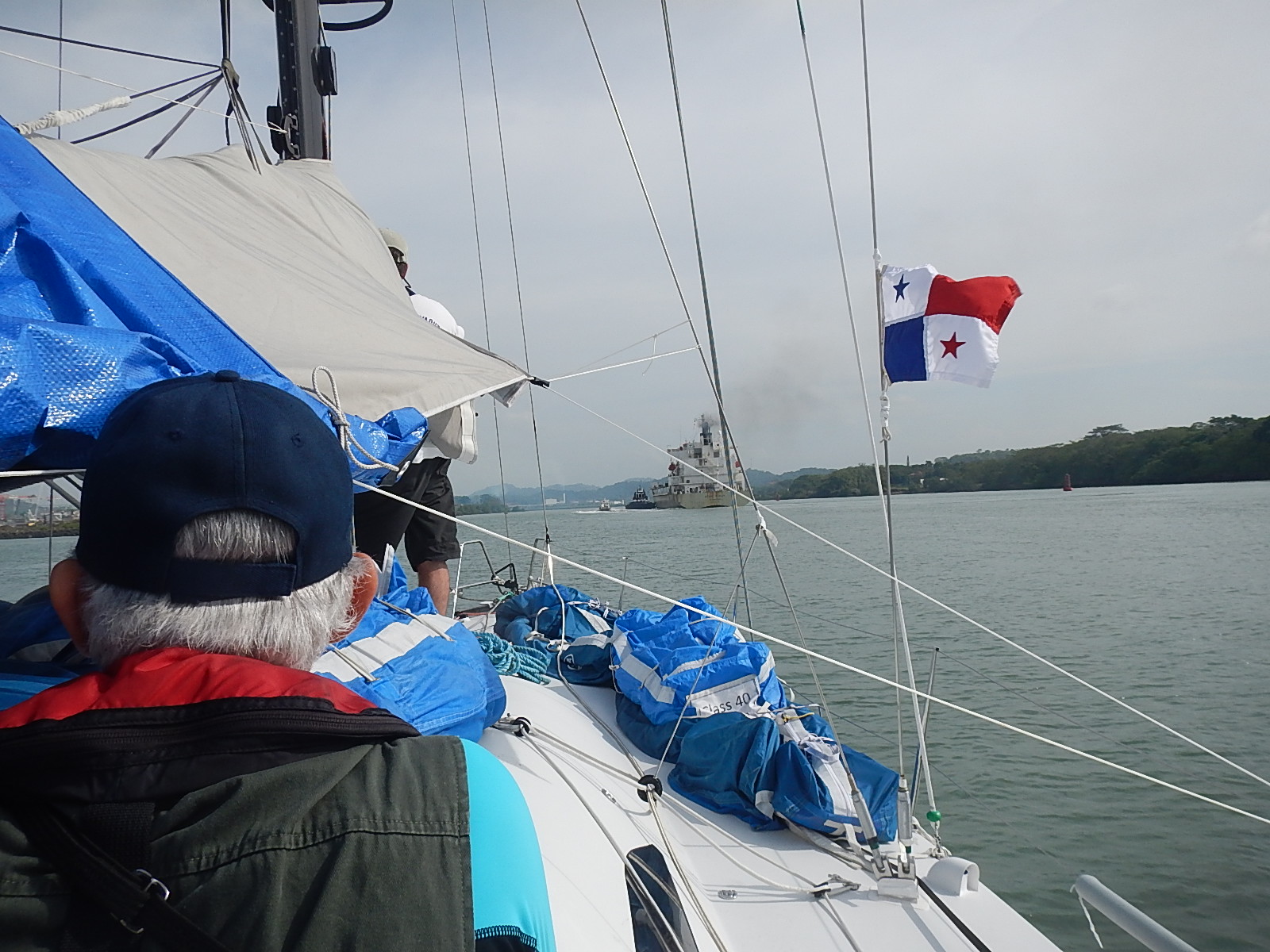
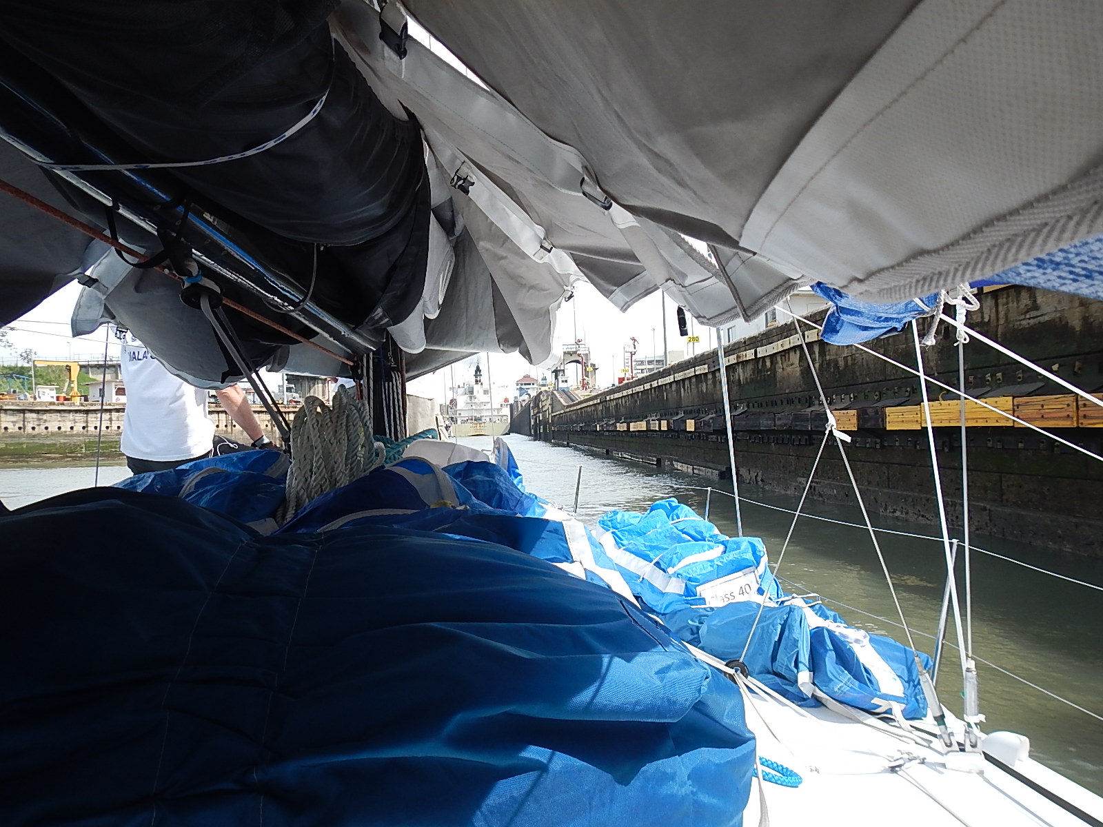
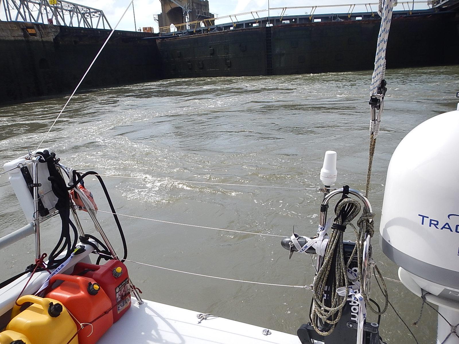
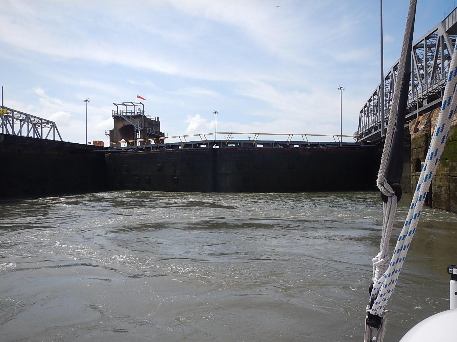
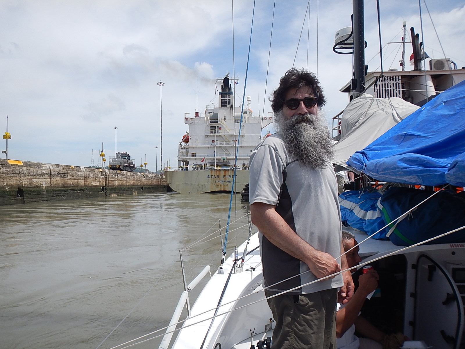
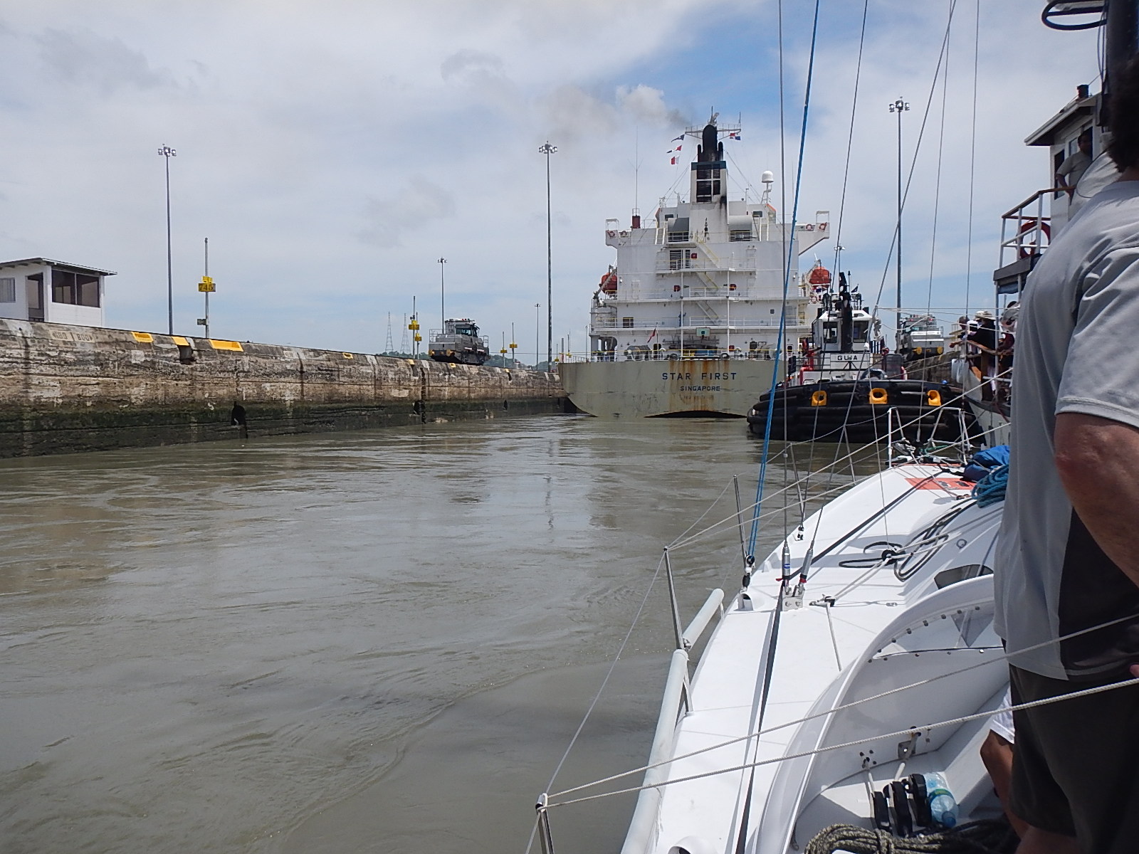
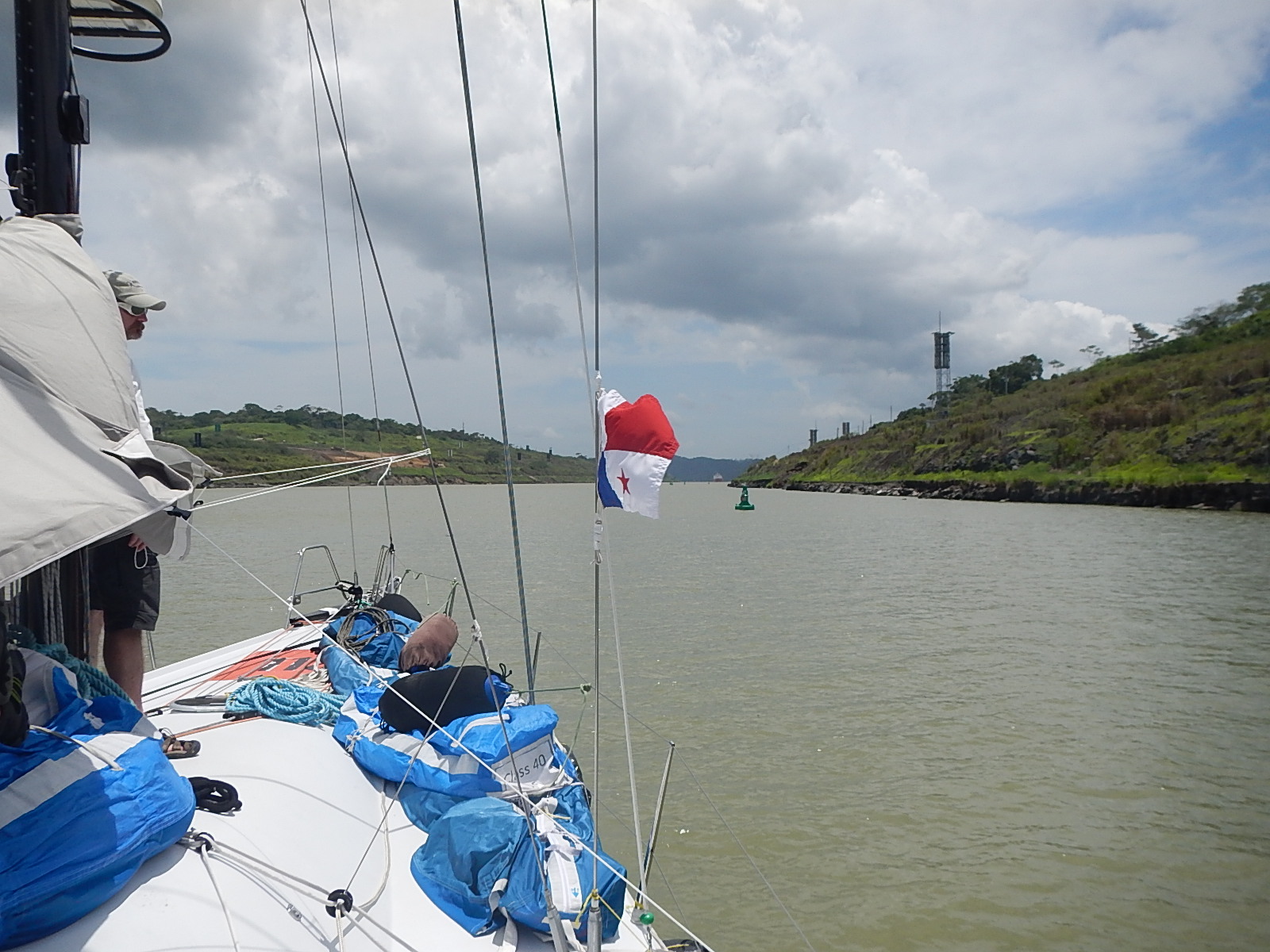
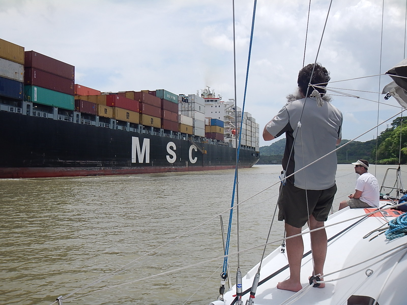
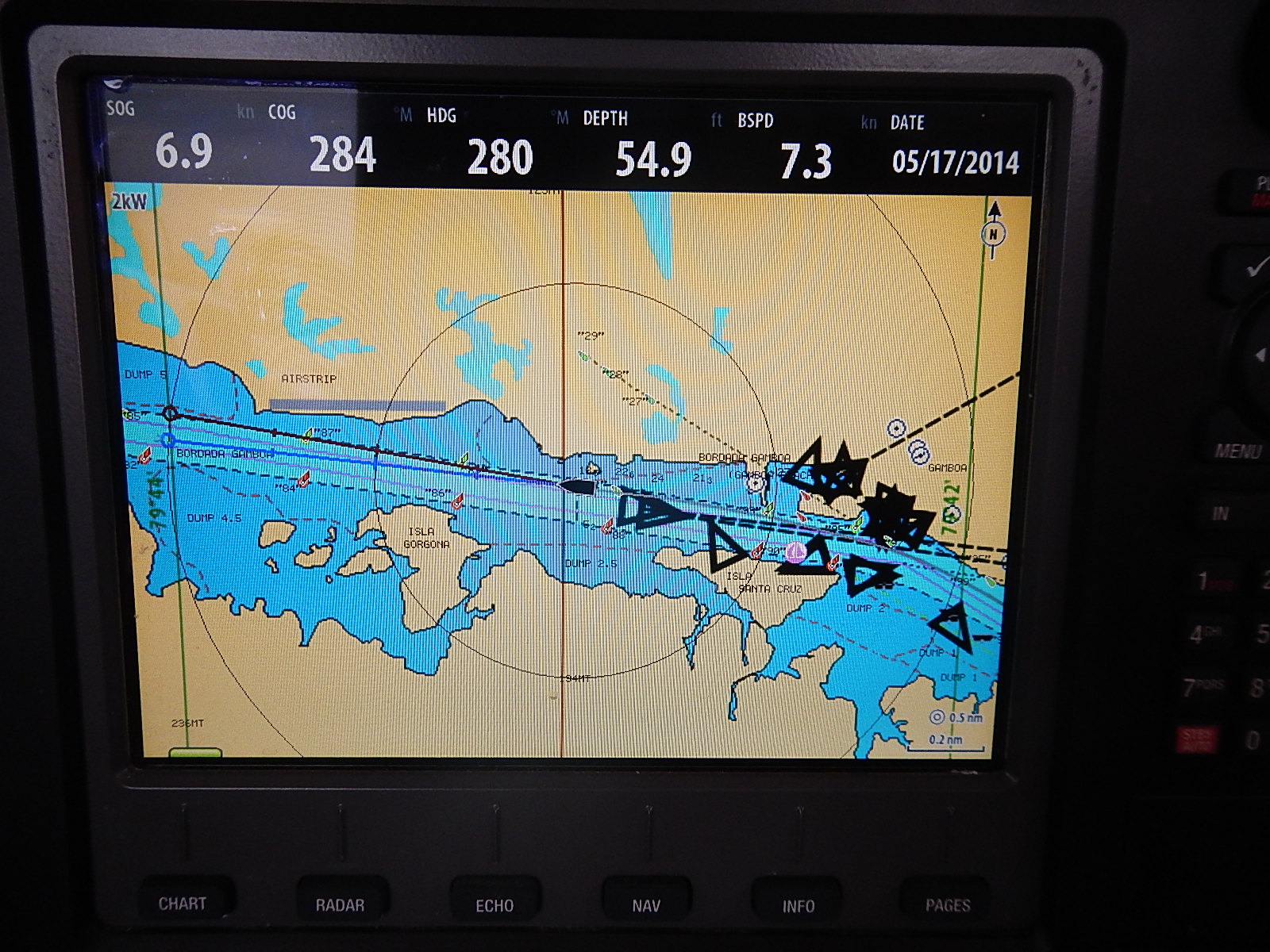
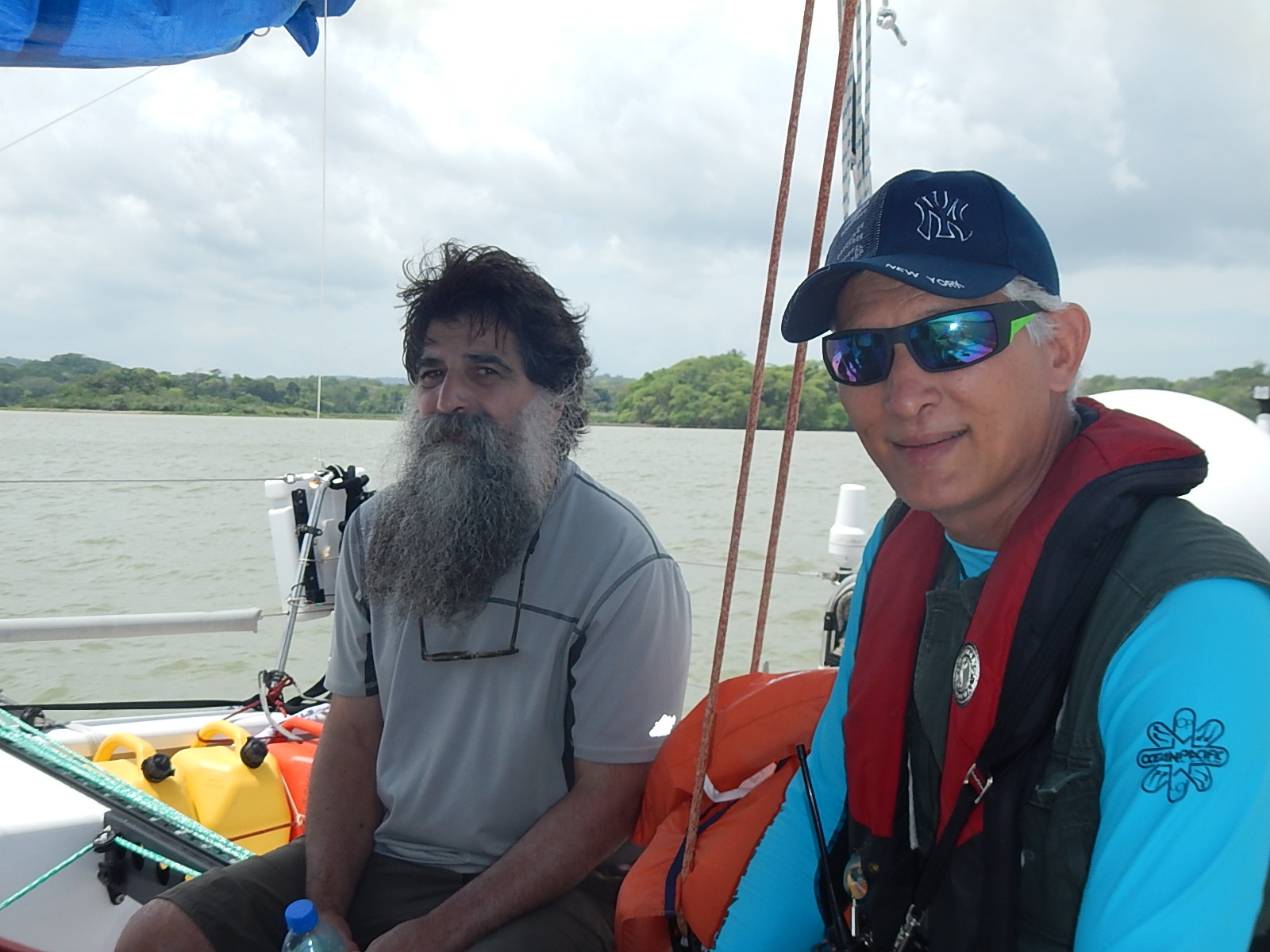
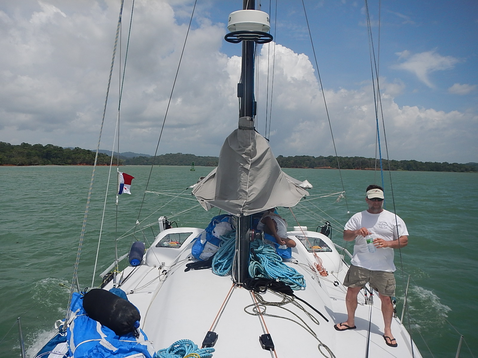
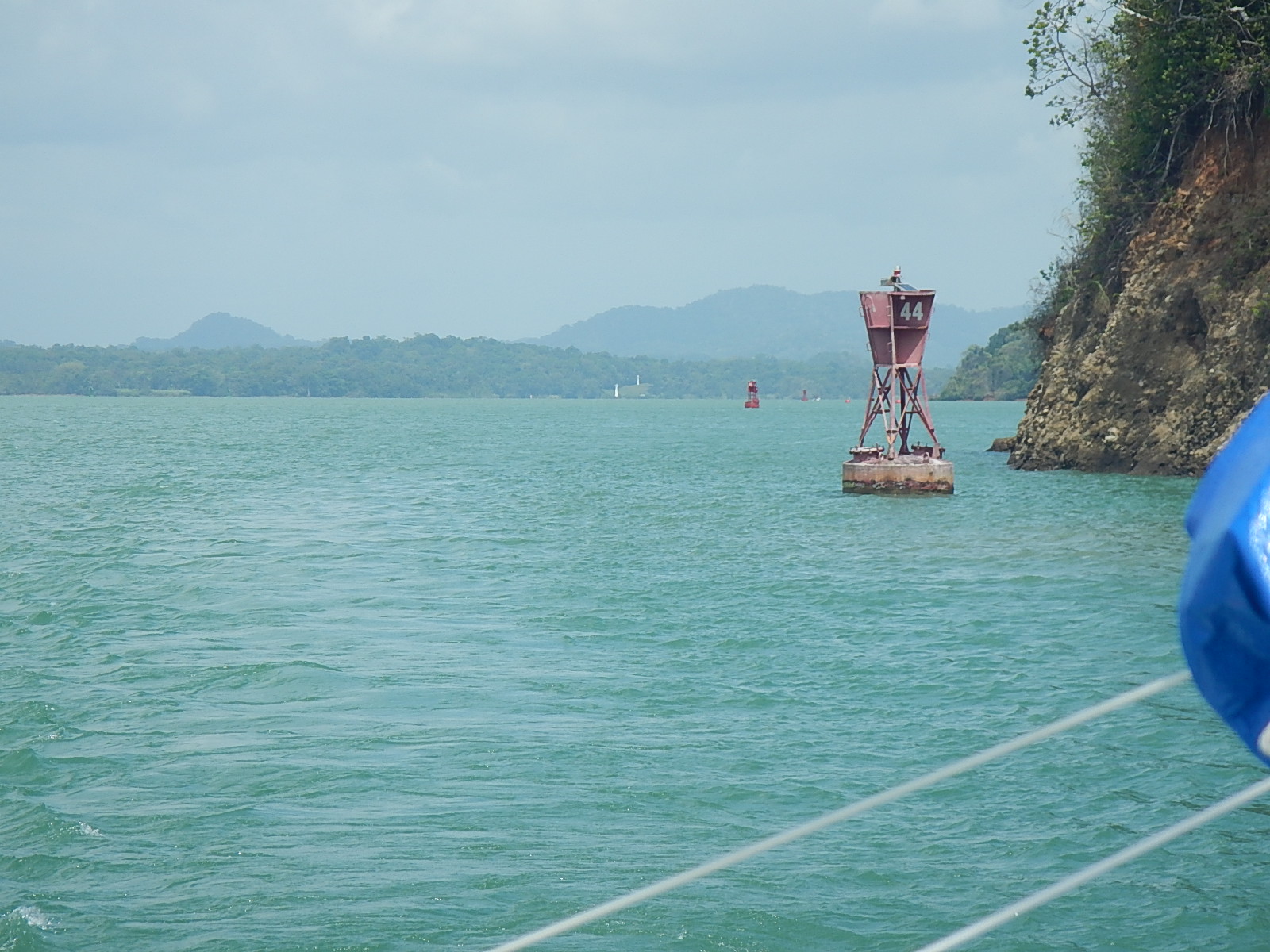
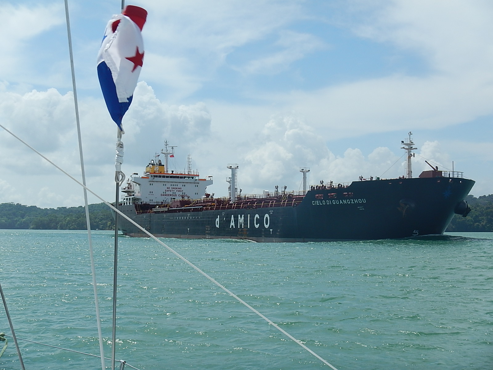
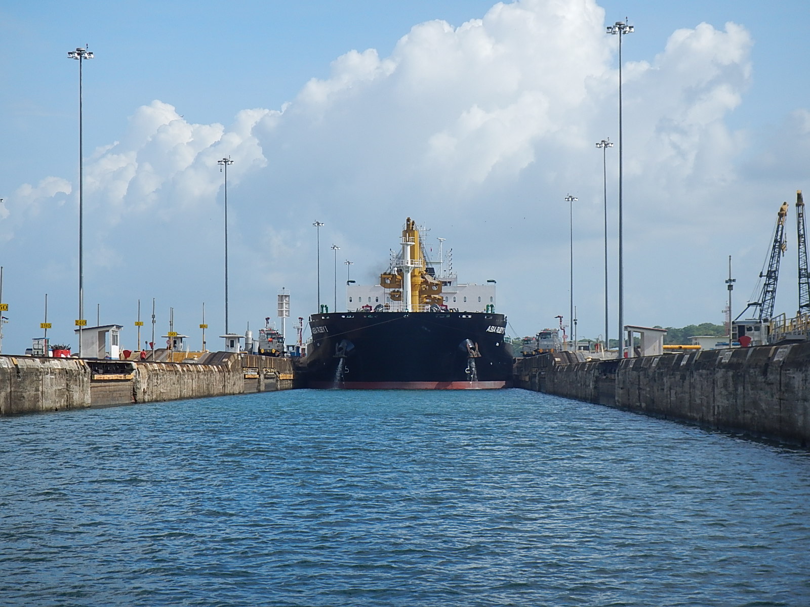
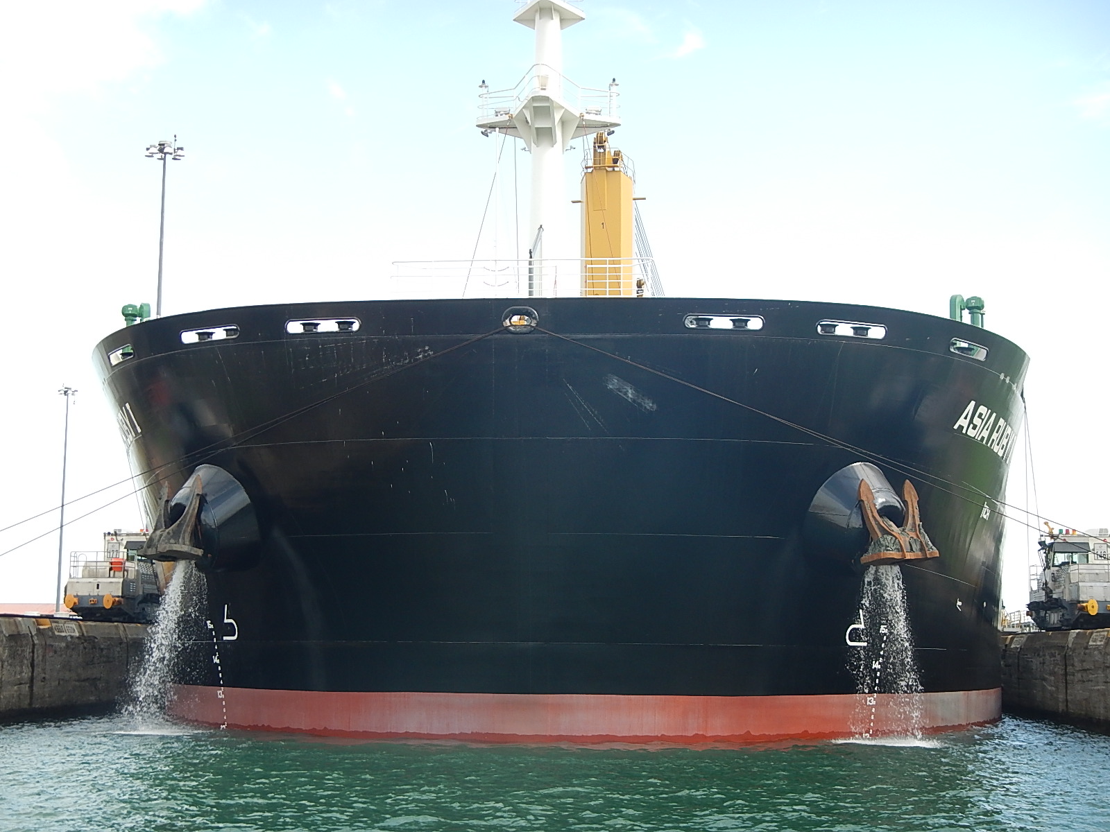
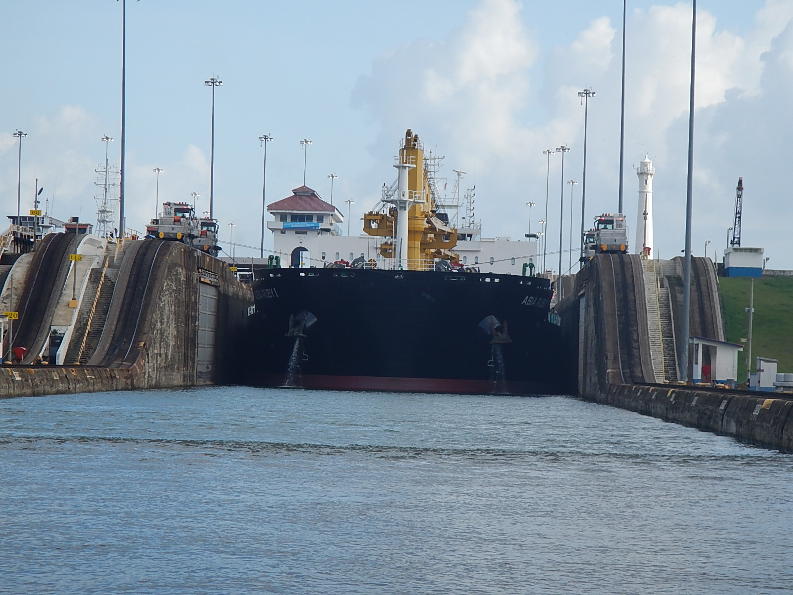
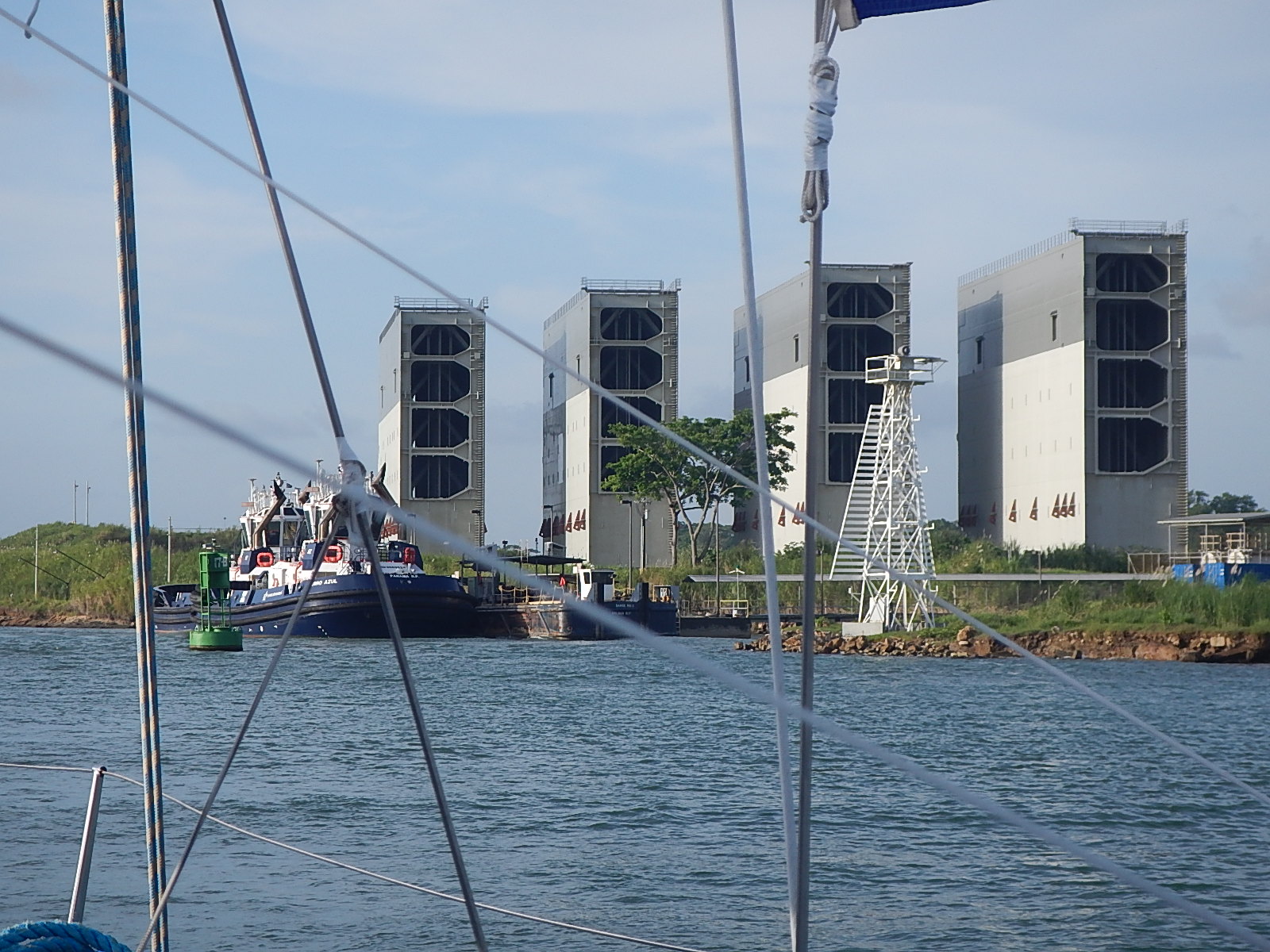
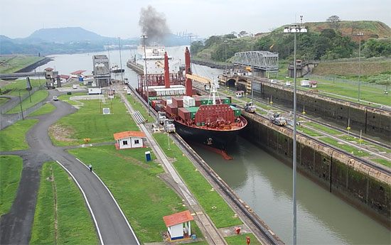
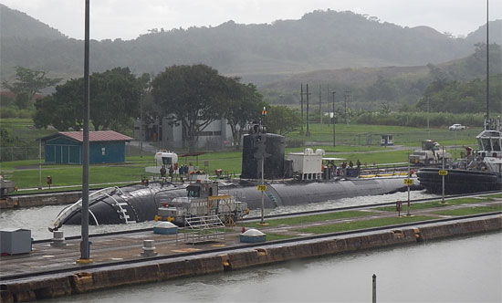
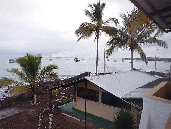
Approaching the end of a week in Panama that saw Bodacious Dream transiting the Panama Canal… from the Pacific to the Atlantic Ocean in just 12 hours!

6013_panama_300
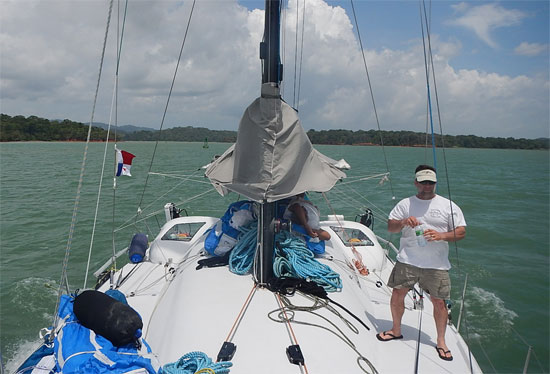
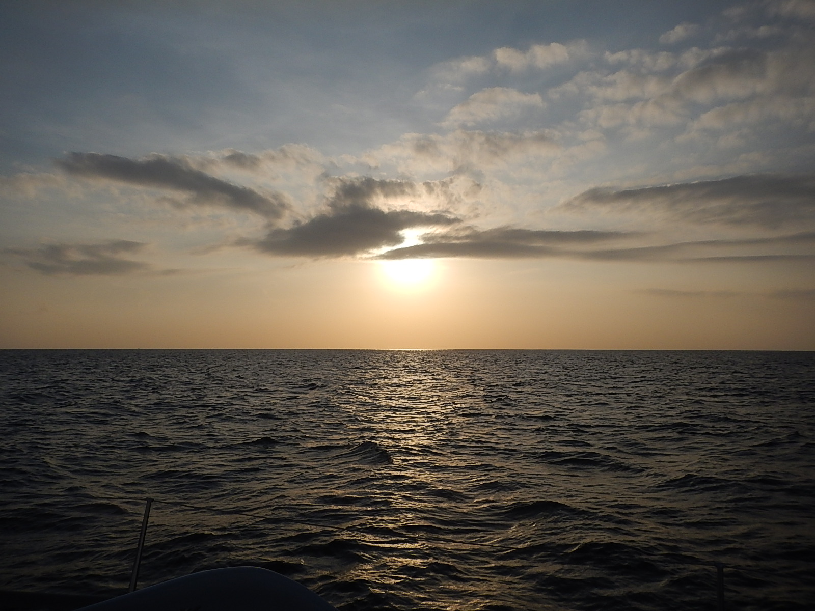
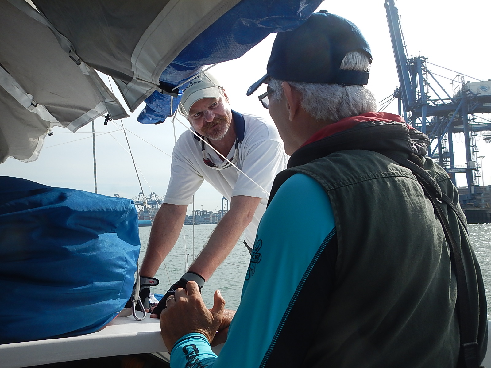
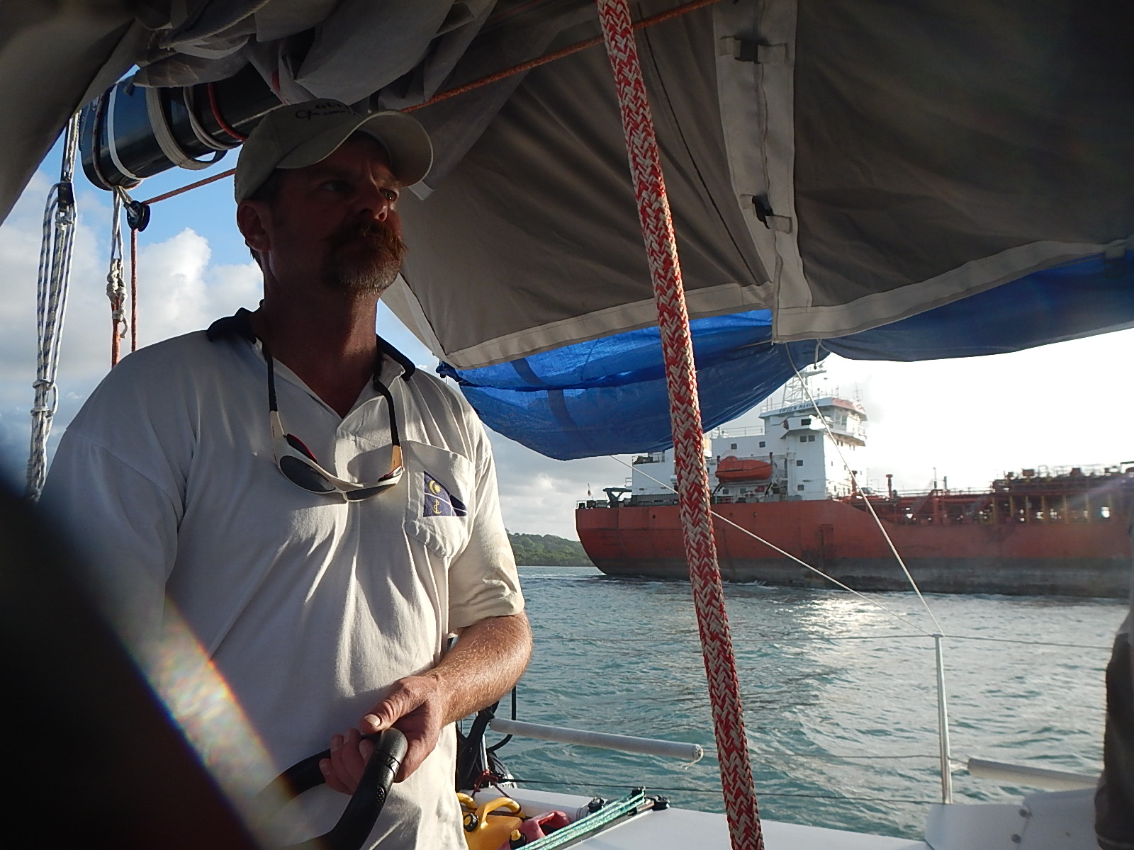
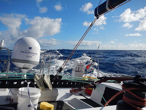
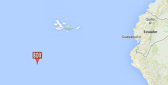
It’s early morning on Thursday and I’m heading down to the marina to put final provisions and water onto the boat and hopefully, by the time you read this, I will have departed. Our course will take us north towards the Yucatan passage that runs between Mexico’s Yucatan Peninsula and western tip of Cuba. From there, I’ll cross the Gulf Stream and skirt the Florida coast as I head to a stop-over in West Palm Beach.

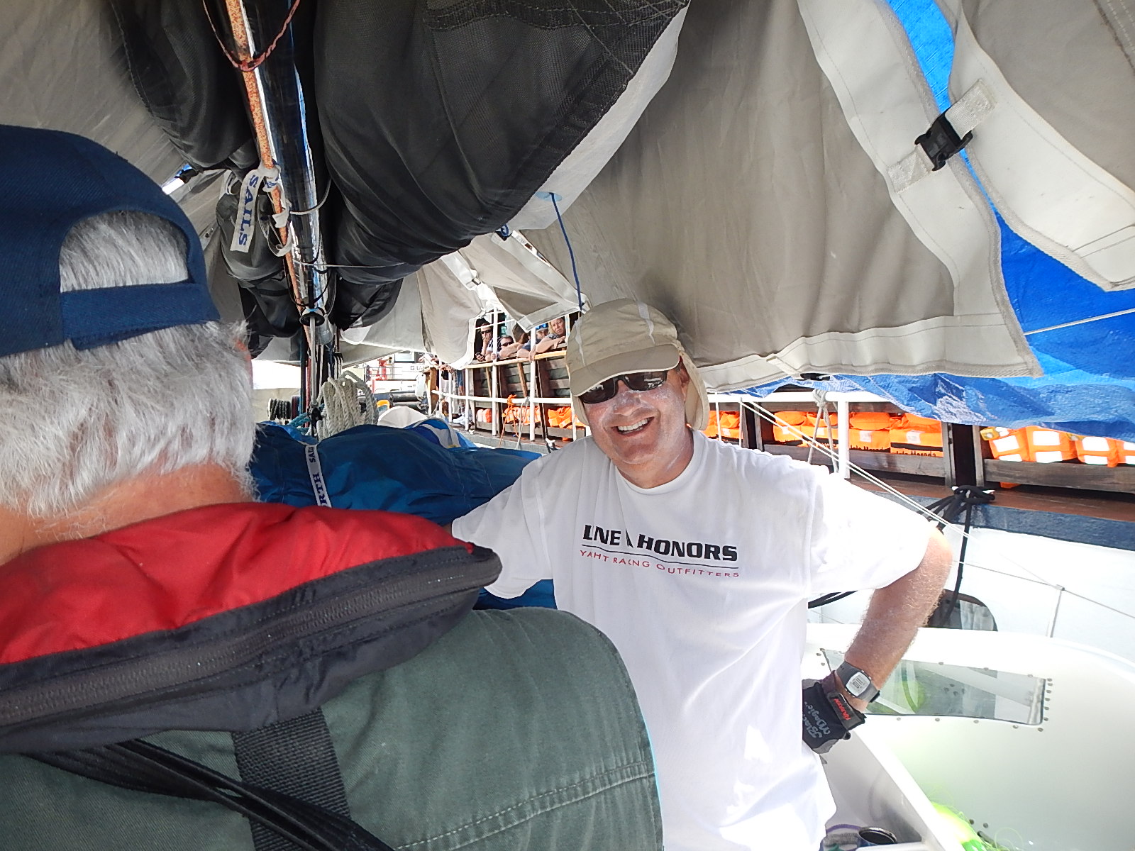
The time here in Panama City has been fascinating. The city is lively and full of folks from all over the world. There is a great rejuvenation going on in the old part of the city where fine old buildings are being restored and renovated to accommodate stylish shops and fancy restaurants. The feel around here is vibrant. However, as all good journeys must continue, so must this one as well.

I expect the next few thousand miles will unleash a rush of memories that have stored up inside me since I departed Jamestown, RI on October 2nd of last year. I have no doubt that among those thoughts will be some more philosophical in nature … reflections on our amazing oceans and planet Earth. The time left on the voyage will pass quickly, but the memories I am sure will remain with me for many years to come – so I will try to share them with you here as they arise.

:: Marine Debris

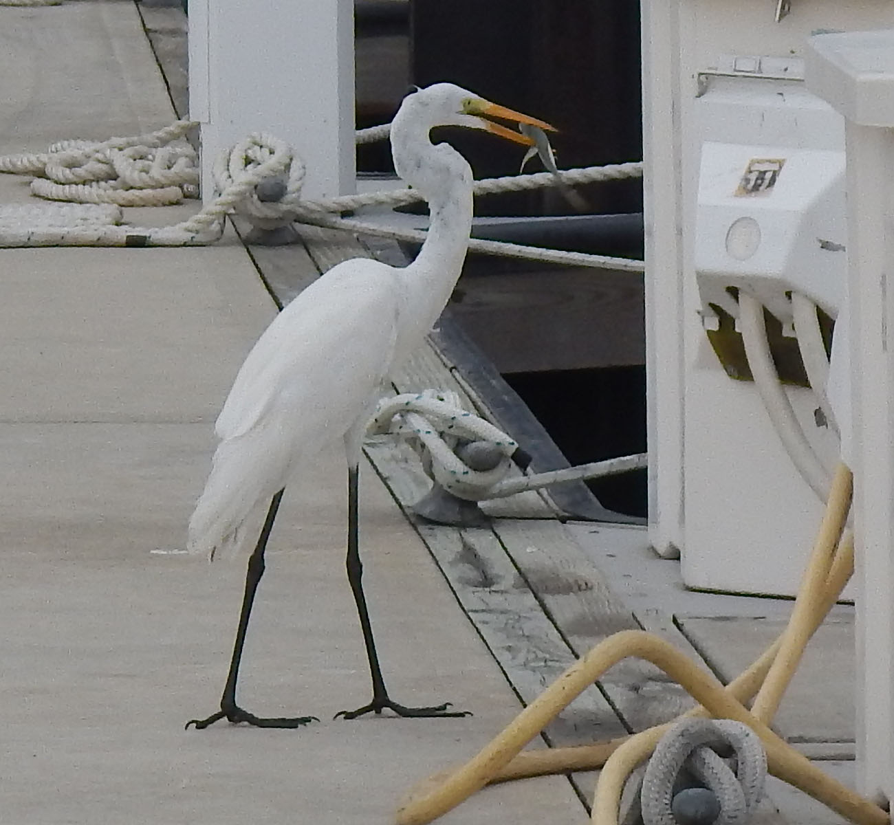
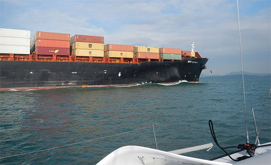
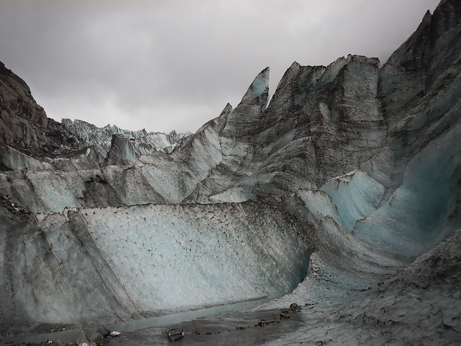
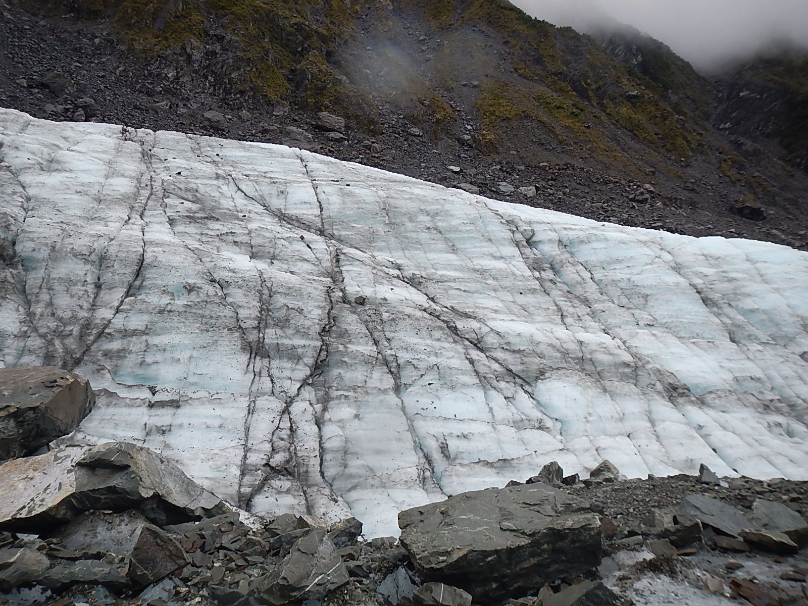
One of the questions I get asked often is how much debris I see out on the water. I have to say that for most of the voyage and especially in my crossing of the desolate Southern Ocean, I didn’t see that much debris. Remember though, my course has taken me very far from land … except when arriving or departing from my scheduled stops.

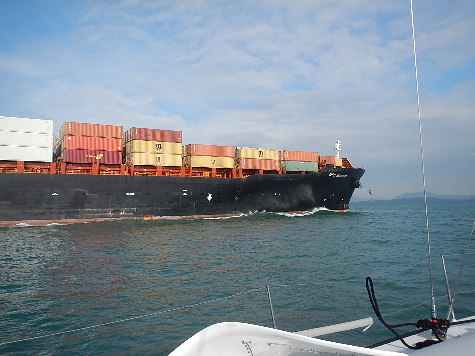
Recently however, as I got to about 150 miles from Panama, I began to see floating debris everywhere. I would no sooner spot a floating piece of plastic and watch it trail off behind me, then I’d see another in front of me. One night on the approach to Panama, I heard the sound of something hard hitting the deck. I was below and suspected a piece of mast hardware had come loose and fallen. With flashlight in hand, I scanned around and found an old plastic cigarette lighter that had somehow been tossed up across the bow. I picked it up, and thought to myself …”This is not supposed to be here.”

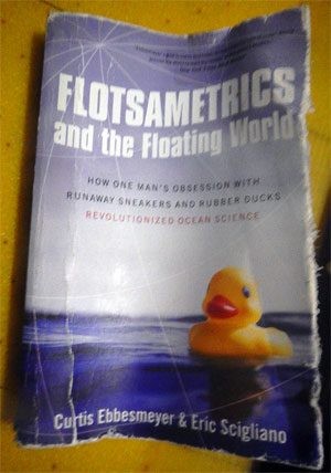
As I learned on this trip, there is quite a field of scientific study that has built up around how man-made debris moves around in the ocean. Some special learnings for me came from a book I read called, Flotsometrics, written by Curtis Ebbesmeyers and Eric Scigliano.

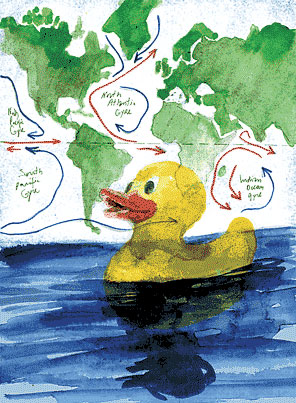
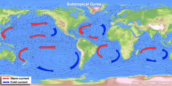
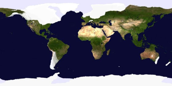
Curtis spent his life as an engineer and oceanographer, first working on important issues with oil platforms: wave heights, sewage disposal and things of that nature. But along the way, as he studied the waters of Puget Sound in the northwest corner of the U.S., he became more and more fascinated with the general drift of ocean waters and what are known these days as the great “Gyres.” At present, oceanographers have identified five of these great gyres and 5 more minor ones.

World's GyresClick here to get a larger version.

The book was one of a selection given to me, just before I departed by Tegan Mortimer, our scientist colleague from Earthwatch, who thought I might find it intriguing. The book explains how through the centuries “drifters(items tossed into the sea to see where they would end up, like notes in a bottle, etc.) have been used to satisfy people’s wide-ranging curiosities about the world. From Columbus, who in observing various items floating in the sea and washing up on the shore, took it as evidence that there were other continents not that far away, to ancient peoples who commonly gravitated to specific beaches that collected the flotsam of the ocean. In many cases, these items helped provide these people with some of the necessities to help grow their civilizations. I found this book just fascinating, and especially how it was told in such a wondrous and whimsical way.

rubber duckyAs Curtis’ lifetime unfolded, he became more and more focused on these floating objects, and with the help of another software engineer friend, he began to use computers to model and predict the travels of the “drifters.”

Imagine the fun he had following and logging data on the 80,00 pairs of Nike shoes lost when a container ripped open off the coast of California, or that other famous lost container full of 28,800 actual yellow rubber ducky bath toys! Along the way, he also tries to solving the mystery of those duckies that floated upright, guided more by the wind, as opposed to those that floated upside down, more directed by the water.

This is truly a book that I can see reading and sharing with kids, as it inspires one to think and imagine more grandly the many interesting and serendipitous ways the oceans of the world interact with each other.

Floatsametrics
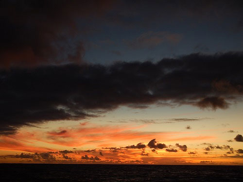
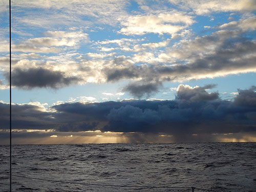
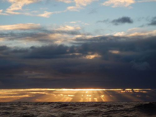
The part that especially captured my imagination and provoked me to write this came in the final chapter, Harmonics of the Gyres. With the sun setting into the western sea, I squinted to keep reading about how after years of study, he came to see that these gyres spin in predictable revolving patterns – revolutions that could be measured in years, and he saw how each gyre when compared to one another were separated by factors of two.

As he thought about it, it occurred to him that this was also the basis for our typical musical octave – our common scale – do, re, me, fa, so, la, te, do. So he saw that potentially, though far below the audible range of human beings, the earth’s oceans may have a similarly harmonic scale to them; a rhythm by which the watery worlds vibrate and sing to us, even if it is only our subconscious that hears it.

subtropical_gyres_550

It caused me to wonder in new ways about why it is I’ve always been so pulled to the waters of the world. How can I sit on the shore and stare off to the horizon for such long lengths of time? Why am I drawn to do what I’m doing, sailing across the oceans totally immersed in the environment, the boat, the sea and the weather? Perhaps this theory helps explain why some very basic part of me has always been so entranced by the music of the sea.

If you can find the time, grab this book and a map of the world and sit down with your children and explore the world with this whimsical oceanographer as your guide. In fact, I think when I grow up; I want to be an oceanographer too!

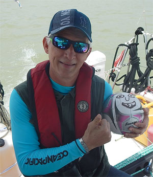
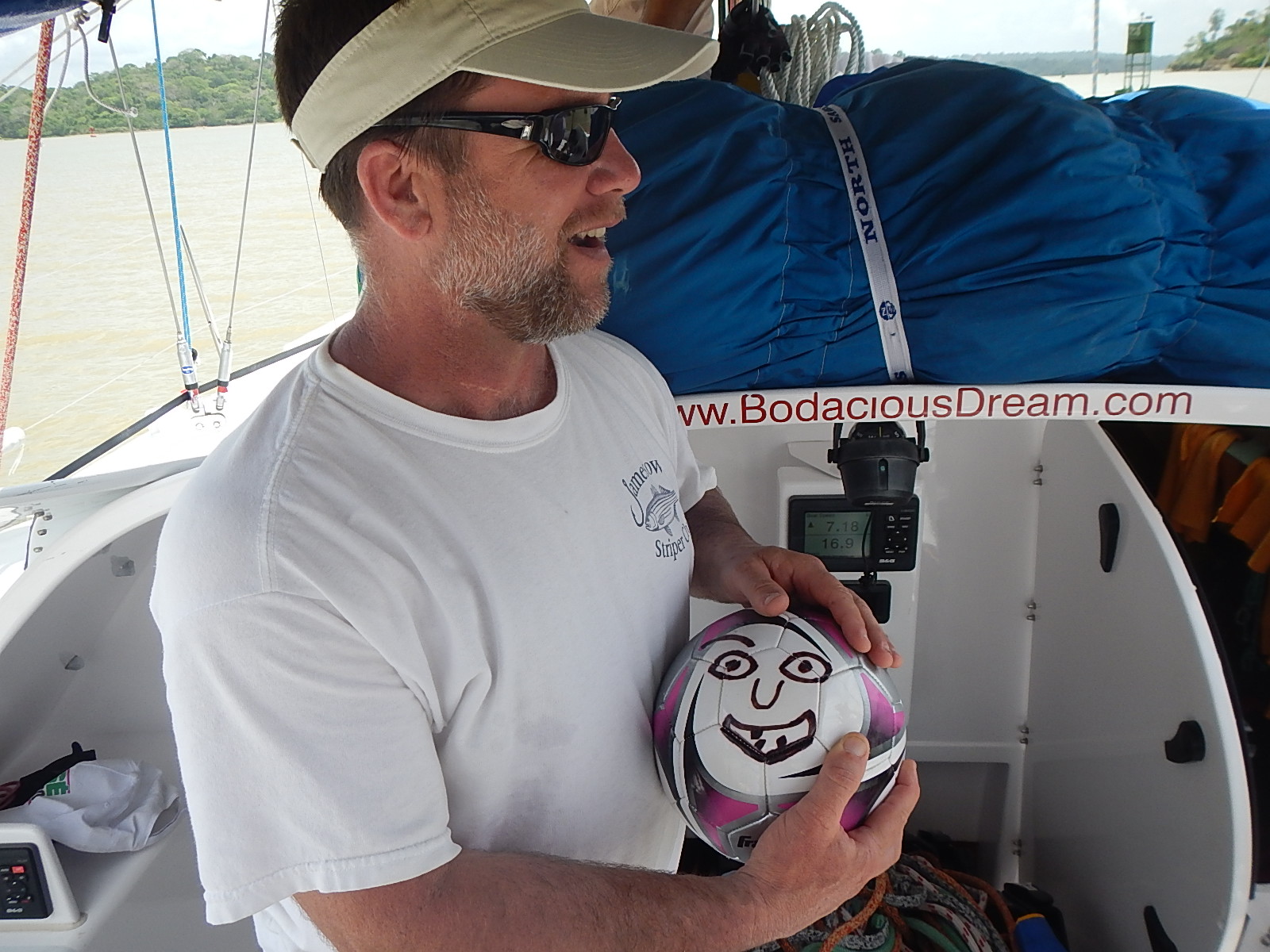
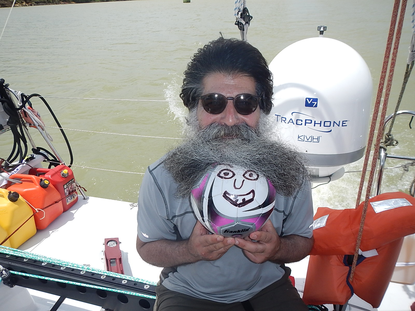
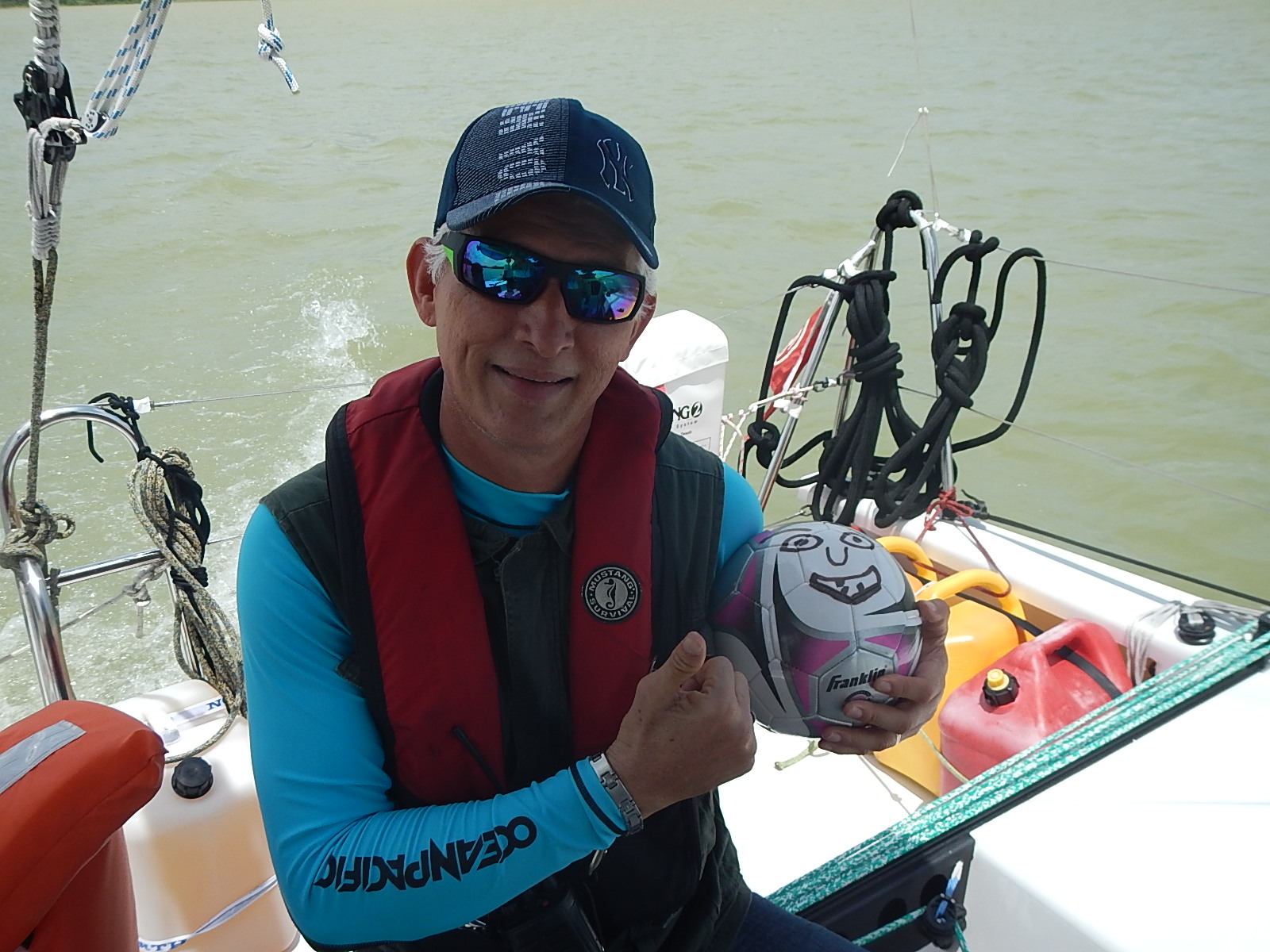
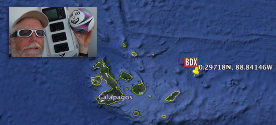
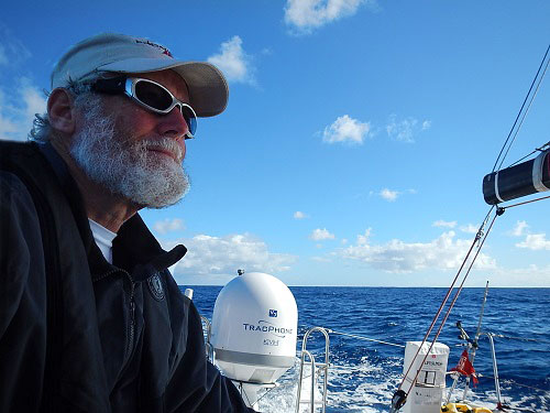
– Dave, Bodacious Dream and Franklin (who really liked the rubber ducky part)

:: BDX Website :: Email List Sign-Up :: Explorer Guides :: BDX Facebook

Our Panama Canal Adventure!

Wow… what a day!! Saturday we watched the sun rise in the Pacific and set in the Atlantic! Across Central America we traveled, from the sea to shining sea all in about 12 hours… via the 48-mile Panama Canal of course!

Rob, Pierce, Joe, Bruce – my crew of trusted old friends who had traveled here to be my required crewmates for the crossing joined me Saturday morning at 5 AM CDT, so that we could pick up our pilot at 6:30 close to the Canal’s Pacific entrance. Tito, a local line handler recommended by our agent, Francis from the Panama Agency, also joined us. Tito had taken a night bus from the Atlantic side of the isthmus and was waiting for us at the boat when we arrived.

pan_am_bridge_550Under the Pan-American bridge on the way to meet our convoy mates …

We were soon loaded and ready-to-go, when we got a delay notice. We’d pick up the pilot at 7:30 instead of 6:30. But then, right at 7:30, the pilot boat approached and Raphael, our pilot, hopped onboard and began giving us our orientation on how we would proceed through the canal.

5954_rafael_300Rafael (pictured to the right getting acquainted with Franklin) informed us we would be traveling through the first two sets of locks as a convoy with two other ships; one was a large (over 500 feet long) cargo ship from Singapore and the second, a smaller 95-foot passenger tour vessel named Islamorada, which by the way, originally belonged to the Chicago gangster Al Capone!

With much anticipation, we proceeded slowly up the channel, en route to meet the “big” ship and Islamorada.

5983_big_ship_550
No question which of us was going to get the big bunk …

The term “lock” refers to these various sub-divisions of the canal through which you must pass. Each lock has chambers, which are like steps. So, the first lock (Miraflores) has two chambers. The big ship entered the chamber first, then Islamorada and then Bodacious Dream came in and tied alongside the Islamorada.

5926_turbulence_550
A bit of turbulence as the water floods in … 

At that point, the gates closed and the chamber filled with 100 million liters (26.4 million gallons) of water, which had the effect of lifting all our vessels up to the level of the next chamber.

pc_map_400

This process was repeated with the second chamber. There are two locks on the Pacific side; each with two chambers, which take you up to at 85 feet above sea level and release you into Lake Gatun – an artificial body of water in the middle of the isthmus. We then motored 21 miles across it. Once across it, we entered the single Pacific-side lock (which has three chambers) – which resulted in our descent to the Atlantic coast.

long_ship_550
Joe keeping an eye on a long ship …

The canal is active 24 hours a day, during which time from 33 to 42 ships pass in both directions… every single day of the year! An astonishing volume of commerce and traffic from all around the world goes through these narrow 110-foot wide canals!

Every moment of the trip had us wide-eyed and excited as kids, as we watched the passing of huge freighters and listened to Raphael and Tito tell stories from some of their past trips. We also saw and heard about the construction for the new expansion of the canal which, when open in 2015, will allow much larger ships to make the passage.

5965_Bruce_550Bruce balancing as we motor across Lake Gatun …

Our crossing of Lake Gatun in the middle of the trip also gave us a beautiful view of the interior of the country of Panama. We even saw a crocodile, though it took me too long to locate it in the camouflage to get a decent photograph of it!

Pushing as hard as we could to keep on schedule against an often strong wind, we were running 30 minutes behind in reaching our appointed time at the Atlantic side locks, but somehow Raphael and our agent Francis worked it out so that the authorities waited for us to arrive. At that point, we passed through and gently down the three chamber steps to where the final gates opened up at the level of the Atlantic Ocean, thus delivering Bodacious Dream back into her home waters, after six months of circumnavigating adventure.

5977_big_ship_550Tonnage before beauty …

There is SO much history in the 100 years of the operation of the canal that it’s hard to know just where you might start to tell the story. The displays at the Visitor’s Center Museum do a fine job of depicting the enormous task of cutting a channel through the country from one ocean to another, all the while being forced to invent new construction machinery and new engineering techniques to make that possible.

Panama_Canal_Construction_550One of the Wonders of the World … I believe it …  

The task at that time was so enormous and so full of unforeseeable challenges, that the greatest obstacle was lack of imagination, which could only be overcome by extending the reach of the builders’ imaginations into new and uncharted territory.

The US took over construction of the canal from France in 1904, and it would be a decade before it opened. From that time on, the U.S. was the administrator of the Canal Zone. In the late 1970’s, during President Jimmy Carter’s administration, a treaty was signed which turned operations of the canal over to the Panamanian government by the end of the century.

Since that time, Panama has operated the canal, maintaining it and making improvements to increase it capacities… including the new larger canal I mentioned, which will make it possible for more and larger ships to traverse the Isthmus. This has also spurred much new development and economic rejuvenation in Panama City and the surrounding areas, making Panama an increasingly attractive and popular travel destination. I was also surprised to learn that the Chinese were planning to construct a new competing canal passage through Nicaragua!

Well, as there’s quite a few more photos, we put together a few slideshows on the page here with photos of our day travelling through the Canal. You can also view it in a bigger format as a photo album on our BDX FACEBOOK page … http://on.fb.me/1lBIbz3

SLIDESHOW #1

#1 – Click arrows to advance! Scroll over to read descriptions.

SLIDESHOW #2

#2 – Click arrows to advance! Scroll over to read descriptions.

Now that we’re through, I’m collecting my thoughts and catching my breath, before I resume the final leg of this amazing circumnavigation later this week.

From all of us on Bodacious DreamJoe, Rob, Pierce, Bruce, Tito, Raphael, and Franklin, who had some great fun rolling with all those new people… thanks for following along.  Back soon with more!

– Dave

:: BDX Website :: Email List Sign-Up :: Explorer Guides :: BDX Facebook

Crossing the Panama Canal Today!

The few days since I arrived in Panama on Wednesday have been pretty non-stop. First, I had to go through the procedures and inspections that are required before you can get clearance to transit the canal. Then I spent all day yesterday and today getting the boat ready, buying provisions and making on-the-fly adjustments to the plan as they came up.

:: We will start our transit of the canal today SATURDAY morning at 6:00 AM CDT!

We’ll have to leave the harbor and motor out to Buoy #6, where we’ll pick up our pilot and then continue northward into the canal and the first set of locks at Miraflores. If all goes according to schedule, we’ll be passing through that lock about 8:30 AM – so if you are up and so inclined, there will be live cameras along the way and you can hopefully spot us as we go through the locks and make our way through the 40-mile passage to the Atlantic Ocean.

:: Here is the Link for the LIVE WEBCAMS… pancanal.com/eng/photo/camera-java.html

5838_big_ship_550
Up close and personal  with some of the big boys around here!

I’m lucky to have a great crew of four guys joining me for the passage – old friends who came down just for the passage – Pierce Johnson, Rob Plotke, Joe Yoffa and Bruce Dickinson. So far, we’ve had a great time getting Bodacious Dream ready to make the transit and learning about all the things we’ll need to do to make the transit properly.

5893_canal_ship_550
From the viewing deck at the Miraflores Locks

One of the things we’ve done is to visit the Visitor’s Center at the Miraflores Locks and watch a few of the big ships go through the canal. Today, we watched one ship enter and pass through at which point we opted to head to the nearby restaurant for some lunch. During the middle of lunch, we saw an amazing sight – a submarine coming into the locks for transit through the canal! That can’t be something they see everyday!

5909_canal_sub
A submarine passing through at lunchtime today … 

It’s pretty thrilling really being surrounded by all these gargantuan structures. What a monument to human industry and ingenuity – and uncanny when you realize it’s 100 years old this year! Imagine what it must have taken to conceive, design and construct such a thing. If what I’ve experienced so far is any indication of the things to come, then there should be some great stories coming your way in a day or two.

It’s after midnight now and I have to be up early to start what is sure to be a long day, so off to bed I go. I’ll try to send a few photos and updates while we’re underway. Hopefully, by this time tomorrow, Bodacious Dream will be back in the Atlantic Ocean! It’s been about 6 months now since she left her home waters.

Stay tuned for more!

– Dave, Bodacious Dream, “Panama” Franklin & the great crew of Joe, Pierce, Rob and Bruce!

The Roaring World – Galapagos #4

5815_DR_275By the time you read this,  I will have landed in Panama and commenced the next phase of the journey… traversing through the Panama Canal.

From the amount of large shipping traffic I have been seeing the last few days, I fully expect the experience to be very different from that of the Galapagos Islands, where so much work is being done to better understand, research and protect the islands.

Here in Panama, over 100 years ago, it was of the highest importance for the governments of the world to find a quicker and safer passage between the Pacific and Atlantic Oceans. The amazing canal that was created up and over the wild Isthmus of Panama profoundly changed the course of world commerce, travel and development. Both of these desires – the one to preserve nature as it is, and the other to remake nature to human purposes, are important – though oftentimes, they stand at opposite ends of a lively and ongoing debate.

So by now, you have hopefully had a chance to check out Tegan’s excellent Science Notes on the Galapagos. Before I begin to explore Panama, I have a few more observations to share on the Galapagos.

While I have sent along updates on my initial visit to the Charles Darwin Research Station, and my subsequent visit to North Seymour Island… not to mention my close encounter of the near disastrous kind… my time on the Galapagos Islands also provided me the opportunity to meet quite a few interesting people and to learn something about their particularly unique and passionate pursuits.

While visiting the cafés of Santa Cruz in the evenings, I met turtle experts, tour guides, and other global citizens, not so different from myself… as well as several scientist/sailors who were researching local sea life.

One interesting encounter was with a crew member with the Sea Shepherd organization, widely known for their activist opposition to commercial whaling, who educated me as to some of the organization’s less publicized efforts. As regards the Galapagos specifically, Sea Shepherd has given assistance to local authorities in two different areas; the first was in providing trained sniffing dogs to detect the illegal smuggling of exotic pets like iguanas and sea cucumbers, and secondly, by providing local commercial fishermen with AIS (Automatic Identification System) transmitters so that the authorities, as well as other local fishermen operating legally, can better enforce fishing regulations in their territorial waters and thus better promote the health and vitality of the regional fishing stock.

sea_cucumber_550

As Tegan explains in her report, there have for long been a variety of research projects going on in the Galapagos. She points us to one that our colleagues at Earthwatch are undertaking with the island’s famous Darwin finches.

bottlenose_275Once in Panama, we will be close to another great Earthwatch Research project – this one involved in safeguarding whales and dolphins in a still remote southern bay of Western Costa Rica, with the intent of protecting them when tourism starts to expand in that area. The project monitors three species of cetaceans in the gulf: the pantropical spotted dolphin, the bottlenose dolphin, and the humpback whale. By focusing on these cetacean species, they hope to gain knowledge on how to more effectively preserve this beautiful marine ecosystem.

While the Galapagos are a special place that has in recent times become a “hot” destination for the eco-tourism industry, the fact is that places just like the Galapagos exist in one form or another just about everywhere in the world. Most, if not all of these under-developed areas are under similar pressures to withstand the immense pressures put upon the local environment and their populations.

Think about the Galapagos going from 600 residents to 20,000 in less than four decades all the while working to accommodate the growing stream of tourists that come – all of whom need food, lodging and services. Imagine the effect this has on indigenous populations and their traditions, which can easily be overwhelmed by such demands.

One last memory of my time on the Galapagos I would like to share. Last week at the end of a long day working on the boat (and in the rain…) I found myself growing increasingly frustrated with how long it was taking me to get things done. At the end of the workday, as I stepped off the water taxi, I suddenly knew I had to take a walk to Turtle Bay – some 40 minutes away. I had only an hour before public access to the beach was to close, so I hurried off.

4786_catcus_550

The hike took me through a broad patch of cactus and trees, then through low brush and across lava fields at which point, l cleared a rise where ahead of me opened up one of the cleanest and longest stretches of white sand beach I have ever seen.

4838_beach_550Turtle Beach

With only a few moments until I had to turn around and walk back, I dug my feet in the sand and watched as surfers rode the waves, hikers walked along the beach, photographers with extra long lenses looked for epic photographs and ghost crabs played tag with the waves and with each other. In just a few minutes’ time, all the frustrations of the day evaporated, and I found myself tucked under nature’s wing … preserved there at the shifting border between sea and shore.

Turtle Beach – Santa Cruz Island – Galapagos

It struck me in that moment how very important it is that places such as Turtle Beach be allowed to exist – specifically such places that still ROAR with a natural beauty that has not yet been compromised and transformed by commercial development, excessive tourism or resource extraction.

How can we keep these places as natural and undisturbed as possible yet still allow them to be publicly available to all? How can we maintain their raw and yet fragile beauty so that they might remain pristine for generations to come?

It’s places like Turtle Bay that help to keep us in touch with our natural world – and with our natural selves! We are not separate from the natural world. Rather we are an absolutely integral part of it – the world’s fate is our fate. As the great Henry David Thoreau famously wrote… ”In wildness is the preservation of the world.”

As the miles click off behind me and I near my transit of the Panama Canal, I come to the close of my time traversing the Pacific Ocean. I know that the crossing of the Canal will be another amazing experience and of an entirely different nature than any that has come before it… but an experience entirely new and unexpected I know it will be… which I suppose is what people like myself awaken each morning intent upon experiencing.

– Dave, Bodacious Dream and (the ready-for-anything) Franklin

:: BDX Website :: Email List Sign-Up :: Explorer Guides :: BDX Facebook

A Close Call in the Galapagos #2

It’s been quite the eventful 24 hours since I began my final preparations for leaving the amazing Galapagos IslandsBodacious Dream and I departed yesterday, Wednesday the 7th about 14:15 hours from Puerto Auyro on Santa Cruz Island, and headed west and then north around the western side of the island through the late afternoon and evening. No particular reason to go that way instead of the shorter, eastern way other than after so many weeks of sailing through vast oceans with vistas of only ocean and sky, I thought I’d like to sail along the shoreline for a while. That and the fact that Panama, my next destination, is only 935 miles away and I’m not feeling super rushed to get there! A short hop to be sure, compared to all the others!

Crossing the EquatorThe “Ballboy” and I cross the Equator … 0.29718S , 88.84146W

While my list of typical pre-departure “things to do” like closing out my bills, shopping for fresh food, clearing out of customs and immigration, packing and stowing things on the boat, checking the gear and the engine usually go on without too much fanfare, yesterday wasn’t to be such a day.

Santa Cruz, Galapagos
An overcast morning looking out on the harbor of
Puerto Auyro 

:: Early Wednesday morning, I met up with Peter and Diego who run Galapagos Ocean Yacht Services, who have not only been great hosts but a tremendous help in guiding me through the local bureaucratic requirements. Diego and I were headed out to Bodacious Dream to put the fuel onboard, which meant we had to have a water taxi come over and pick us and the fuel up and then take us out to the boat. That part went smoothly. After securing the fuel on board, we called for another water taxi to come take us back to shore.

While waiting for the taxi, we noticed something strange. It’s that kind of slow to dawn on you change in your visual field that suddenly causes you to wonder… “Hold on, wasn’t that boat over there before?”

Sure enough, we were moving… and Bodacious Dream had come adrift from it’s mooring! Yes, we were still tied to it – but we were both adrift! The mooring had broken its anchor which meant we were loose and drifting backwards towards the surf and shore that was less than 75 yards away – maybe less than five minutes away from the rocks!

Mooring Broken
Just before this, we were moored right between these two steely dudes! 

5026_sc_moorings2Thankfully, Diego with his command of the native language was able to raise help from the water taxis as well as from the crew of one of the large steel research vessels next to us.
In short order, we were unhooked from the floating mooring and secured to another mooring, while others stood by scratching their heads and wondering how that happened! Had we been just a few minutes later to arrive, who knows WHAT might have happened.

As I counted my blessings and made my final preparations, I noticed the two 100-foot steel research vessels disconnect from the moorings they were attached to and instead set their own anchors! I guess if you’re that big a boat and you see a little 40 foot boat that weighs less than a 10th of what you do, break a mooring, you wouldn’t trust it either!

Once secured, Diego and I headed back to shore to finish up my to-do list, so that I could get underway as soon as possible. It was obvious to me by then that Bodacious Dream and I were both ready to leave the Galapagos!

:: So, now after having run steadily through the night, we are on our course toward Panama and the Panama Canal, which I expect will be quite an experience on its own.

3278_200_32.333568S_103Checking the log and distances, here are the interesting numbers for today! Panama is less than 900 miles away. Bodacious Dream has sailed over 40,000 miles since she was launched in Wellington, NZ in November 2011. I’ll have to do the math on the circumnavigation totals, but off the top of my head, I’d say it’s around 25,000 miles since Newport. As I write this, I am just north of the Equator. If my mental maps are correct, you can ONLY cross the equator in two oceans. This trip, I crossed going southbound in the Atlantic, and have just crossed going northbound in the Pacific!

:: I learned a lot in the Galapagos Islands. There was so much more to see that I just didn’t have time to do. In my next update, I will share with you some observations on the incredible wildlife I saw, but for now let me share with you here a bit of what life is like in the in the Galapagos Islands, and specifically in the town of Santa Cruz where I stayed.

I learned from locals that in the 1960’s there were only 600 people in the Galapagos. Since then, the population has risen to over 20,000. As Peter told me, it is famous now as an eco-tourist destination. You can see that the locals must struggle to both capture the tourism economy and to manage the growth that has come so quickly to the islands.

Santa Cruz, Galapagos
The Tourist’s Main Street

While walking along the newly built promenades, you see restaurants, jewelry shops, art galleries and the inevitable t-shirt shops. Just a few blocks away though are the older buildings with apartments and storefronts of a more local nature. All these buildings are built with concrete! Wood is scarce here and has to be imported from the mainland, while concrete can be made from the volcanic ash of the islands.

4852_sc_volleyball_550Volleyball and Socializing … 

The weather while I was there was hot and muggy, so many businesses observed siesta time by closing up for a couple of hours in the middle of the day and then reopening in the afternoon and evening. As they have for years long before the tourists showed up, it is a tradition for the locals to come down to the waterfront in the evening and to enjoy each other’s company in the town square. Every evening about 6 o’clock, the men began to gather at the volleyball court in the center of town for a pick-up game, while many of the families sat around the perimeter and watched, and the children played. It seemed to be quite the town event.

4770_sc_cafe_550Music and Talk in the Cafés …

:: By this point many of us touristas were wandering back to town from either a tour or a local hike, stopping by the small sidewalk café and enjoying a cold drink before heading our respective ways. In these impromptu gatherings, I heard a full range of languages… from German and French to Swedish, English (in several varieties) to Polish and Russian. I experienced so many great conversations through the few days I was there, but the one that I will share with you here sheds some light on one of the more memorable events in my circumnavigation.

If you remember, back in the Southern Ocean east of the southern tip of the African continent, I encountered a night with floating bioluminescent globes in the water – hundreds of them as I sailed through this area. Well, one of the folks I met at the sidewalk café was a scientist and captain of one of the sailing boats in the harbor, and they were conducting research for a magazine story. Somehow, we got onto the subject of the bioluminescence and he thought that what I had seen might have been bioluminescent squid that sometime float with surface currents.

Screen Shot 2014-05-08 at 2.17.47 PM

He told me of an experience they had one night while sailing. Apparently, there is only one type of seagull that feeds nocturnally and there are many of them around the Galapagos. (In fact, just last night, I had two of them flying around the boat and playing in the slipstream of the airflow off the sails.) Anyway, he described a night when they saw one of these bioluminescent squid flying through the air… obviously in the clutches of one of these nocturnal feeding gulls. Now wouldn’t THAT have been a sight to experience?

Sitting in the cafés at night, I was enthralled listening to scientists, researchers, and regular folks like you and me sharing with each other their own unique experiences and stories of the oceans and the earth.

Blue Footed Boobie:: Over the next couple of days as I make my way towards Panama, I’m setting myself the task of writing down some of the amazing things I witnessed and learned while exploring the Galapagos Islands. I’ve got some great photos of the wild life too … and believe it or not, if you haven’t seen a blue-footed boobie, they actually do have blue feet! I can confirm that as fact!

So, as I make my way north, I’m hoping for gentle days of sailing and some better weather. It rained every morning in the Galapagos, and I can still see showers around me on the horizon here. The locals kept saying that the rains were unusual this time of year. Normally, it’s dry and getting a bit cooler by now as the sun makes its way towards the Tropic of Cancer. Actually, I suppose it’s not so curious but one of the consistently reoccurring stories from each place I’ve stopped on the voyage is that the weather systems are different this year. It’s a great and mysterious world we inhabit … full of telling signs and full of deep wisdom, if only we take the time to listen.

– Dave, Bodacious Dream (and galloping) Franklin!

P.S. While I was in the Galapagos, While he was there, the Jamestown Press back in Rhode Island caught up with me and got the updated story on the circumnavigation.
4756_dr_jamesp_550

In the Galapagos Islands #1

Time sure does fly. I arrived here in in the Galapagos Islands and moored Bodacious Dream in Santa Cruz Harbor on Thursday morning. It took a bit of time to get settled before I could grab a much-needed shower and a great local breakfast complete with passion fruit juice and delicious fried plantains. The rest of Thursday and Friday were taken up with governmental errands, working around their annual May Day Holiday, catching up with emails and tracking down the best Wi-Fi hot spots!

crab2_550Red Rock Crab – Lives along the shore … used mostly for bait …

Each day I must take a trip out to Bodacious Dream‘s mooring. To do this, I need to take a water taxi; these boats run by locals hold about 12 people. There are probably a dozen working at any one time, wandering around the harbor moving people and supplies to and from boats, as well as to one of the farther corners of the harbor where people can land on a beach and hike inland. There are no roads to these beaches, so your only option is the water taxi.

water_taxi_550
A fancier Santa Cruz Water Taxi

I have to visit Bodacious Dream each day to check the lines and gear and to make sure that nothing is rubbing or wearing out that could cause big problems if undetected! This slow rubbing action is called “chafing,” and it’s one of those nagging and ongoing problems sailors face. A line rubbing back and forth across a hard surface doesn’t take long to wear through!

In the few days I’ve been here, I’ve had the pleasure of meeting a number of other sailors from around the world. Most are headed where I’ve come from – deeper into the South Pacific or to New Zealand or Australia – so we’ve have had fun exchanging stories and information. As you might imagine, they come from all walks of life. Some are life-long sailors, some are new and have dropped out and are cruising around the world. Some are doing research on various projects, but each one had an interesting tale to tell, which has made evenings hanging out the local sidewalk cafés very lively and rich with conversation!

station_darwin_550Entrance to the Estacion Charles Darwin

Saturday afternoon, I took a walk up the road about a kilometer to the headquarters of the Park Nationale and the Charles Darwin Research Station. This is where they do much of the research on the giant tortoises and land iguanas, and where they have been able to hatch, incubate and raise tortoises in captivity and so help to keep the range of the various species strong on the islands.

land_iguana_550
A Land Iguana… 3-5 feet long – weighs up to 25 Pounds – can live 50-60 years!

Being more than a bit nosy, I tagged along with a tour group, eavesdropping in on the guide’s talk to pick up a few facts.

tortoise1_550Galápago is the Spanish name for Turtle … some of these near 500 pounds

Years ago, the tortoises were hunted by sailors who killed them for the meat and took them with them on the boats, keeping them alive until they were needed later for food. As a result, the tortoise population was nearly wiped out; hence, the need for a protected preserve and research area. One of the most famous turtles from around here was named Lonesome George. He was over 100 years old and the only surviving giant “pinta” tortoise. He died in 2012 and sadly, with him went extinct that entire species of tortoise.

tortoise4_550The number of tortoises on the islands today is around 15,000.

Most of the tortoises look the same until someone explains how they have each adapted to their various habitats. The most obvious differences in the tortoises I see are in the size and patterns of their shells and the lengths of their necks. Their necks range from short to medium and to long. They think this is because of the height of vegetation in the various islands and habitats from which they come. Low vegetation favors short necks; higher vegetation requires longer necks. Much of this is what Darwin discovered and documented during 1835 when aboard the HMS Beagle; he landed here for five weeks and studied various species of birds (finches in particular) and other wildlife.

There is so much to see here. Unfortunately, time is passing quickly so I won’t get the chance to do too much exploring on this trip. I am taking a tour on Tuesday to the island of North Seymour where I should get a chance to see all sorts of interesting and infamous species of birds and wild life. I’m especially looking forward to encountering the Blue-footed Boobie … that, believe it or not, actually does have blue feet! I’ve seen pictures before; now I can’t wait to see them in real life!

giant_prickly_pear_550
Giant Prickly Pear Cactus – Iguanas love their fruit

For now, I’ve got more chores to do with the boat today. As you can imagine, using the water taxi to get fuel and provisions to the boat takes up a lot of time. Then I hope this afternoon to get the chance to explore one of the other beaches that is close to the downtown area of Santa Cruz. I know I’ll enjoy the hike, since my legs don’t get all that much exercise when I’m on the boat.

By later afternoon on Wednesday, I hope to be back at sea, headed to the Panama Canal. So, we’ll update you before I leave and along the way.

Thanks for following along!

– Dave (on land with no Bodacious Dream and no Franklin with some people!)

The 2014 Atlantic cUpdate

The Galapagos Islands are almost in sight and though I’ll be there in less than a day, I’m going to take my time, so that I arrive in the morning hours of Thursday and thus have the day to make my way safely into the anchorage and secure Bodacious Dream for my stay.

Screen-Shot-2014-04-30-at-12.12
Pretty close to land … 1.34389S , 90.88464W

Once I tie off, as always, I’ll have to take care of the customs and immigration paperwork and then … (hallelujah!) … head to the showers! Phew! Overall, it hasn’t been too bad, but the last few days have been quite warm and a cleansing shower will make a lot of things better. So, give me a couple of days to sleep and sort things out in the Galapagos and I’ll return with a game plan to share as to what interesting things I might get to explore.

Atlantic CupIn the meantime … it’s May 1st tomorrow, which means just 10 days until this year’s running of The Atlantic Cup Race. Read on below for my preview on this year’s race. If I wasn’t here, you can be sure I would be there! So, read on and then follow the action.

May of 2012, Matt Scharl and I co-skippering Bodacious Dream were jib reaching up the Eastern seaboard of the US from New York City past Long Island towards Newport, Rhode Island in the second running of the Atlantic Cup Race. We had just spotted Block Island and Matt went down below to check in and see where we stood on the leader board. Moments later, he came up with an exuberant smile exclaiming we were in the lead by several miles. It was an exciting night as we worked our way into Narragansett Bay and ultimately to first across the finish line at Ft. Adams, winning the second leg of the event. We placed second overall in 2012 after the three event legs were totaled. 2013 proved even better for us as Bodacious Dream, after winning both offshore legs and placing second in the inshore regatta, placed first overall in what many have claimed to be one of the best Class 40 events in the world!

AC13_1_finish4
Bodacious Dream/ 2013 Atlantic Cup – first across the finish line in NYC! (See Video Here!)

Those were exciting times, not only for us, but for many of you as well who followed the event with the great coverage provided by the event’s website @ www.AtlanticCup.org. The fun of all 7 boats arriving at the finish line in Newport Harbor within 45 minutes of each other, after 250 miles of ocean sailing … was hard to believe. I guess heart stopping awesome might say it best! Any one of those boats could have won that leg with just a wind shift of a few degrees.

As you know, I’m presently sailing Bodacious Dream back into the Northern Hemisphere and will miss the Atlantic Cup this year, but I know that Manuka Sports Event Management, energized by Julianna Barbieri and Hugh Piggin will once again be putting on a great event.

If I may, I’d like to take a few minutes to offer my own personal preview of the race and this year’s entrants, but before I do that, let me tell you a bit more about the event.

ac_map_2014Three Legs of the Race – Two offshore and One inshore …

The Atlantic Cup, presented by 11th Hour Racing, is a multi-discipline event. As you can see in the map above, there are two offshore legs – the first from Charleston, SC to New York City and then from NYC to Newport, RI —both of these double handed. Once in Newport, a third event—a two-day course-racing regatta with a crew of six completes the entire race schedule.

Unlike the long distance and trans-oceanic races in and around Europe, where one bad tactical decision early in the race or one equipment problem can make for thousands of miles of disappointing sailing, The Atlantic Cup competitors get a fresh start with each new leg and the event is generally won by the most consistent competitors!

seas-regAnother great attribute of the Atlantic Cup is its commitment to running a clean and carbon neutral event, which has earned the Atlantic Cup a Platinum Level Clean Regattas certification by Sailors for the Seas.

They have also worked hard at providing an educational platform for inner city kids and using their resources and website to promote direct experience learning initiatives. If you go to their Kids Page, you will see how they have taken a page from the Bodacious Dream playbook, and posted “educational guides.” You might even recognize that cartoon captain host … people tell me it’s a great likeness. Their work the past few years have allowed hundreds of kids to visit with skippers and tour the boats when they are docked in Charleston, New York City and Newport.

capt_dave_ac_550
And although Bodacious Dream, sporting our FiSH-emblazoned spinnaker won’t be on the water this year, our sponsor of the past two years, Jamestown FiSH, the award-winning restaurant across the bay from Newport, will once again be sponsoring parts of the racecourse with a mark off Jamestown Harbor, the finish line for Leg 2 and the inshore course races as well as a skipper’s reception at their excellent restaurant! Jamestown Fish is co-owned and managed by John Recca and Cathy Squires, along with the sponsors and owners of Bodacious Dream. A must mention, head chef Matthew MacCartney was just named the “People’s Choice, Best Chef in New England” by Food and Wine Magazine! Put it on your list of places to visit this summer and come join in the festivities during the skipper’s reception on May 23rd!

AC14_teams
The Competitors in this year’s Atlantic Cup …

Now, let me get back to my preview of this year’s competitors. This year’s lineup, in no particular order, so far is Gryphon Solo II, the former Icarus now being raced as JeffreyMacFarlane.com, Pleiad Racing, Dragon, and a new entry named Flatline.

Each one of these boats has proven worthy of winning major regattas. Gryphon Solo II placed 3rd in 2012’s Atlantic Cup, Icarus placed 2nd in 2013’s Atlantic Cup winning the inshore series, Dragon has a fresh new refit and new articulating bow sprit this year, Flatline has been resurrected after a major accident and is showing up in fine shape and the guys on Pleiad Racing have been refining their rocket ship all year!

But good boats alone don’t do it and the depth of talent this year is as deep as ever. Gryphon Solo II skippered by Joe Harris with Pat O’Connor, have been around and up and down the East Coast for many years; Joe has victories in Trans-Atlantic races and Newport-Bermuda Races. Jeffery MacFarlane.com (old Icarus), skippered by Jeffery MacFarlane, has spent the last couple of years racing around Europe in the Mini Class and was ranked no. 1 internationally last year! Pleiad Racing is skippered by Ed Cesare with Chad Corning … need more be said? Both these guys come from very extensive racing backgrounds; too many events to list here and they are back for the second year ready to take it on. Dragon will be skippered by Mike Hennessey and Rob Windsor. Mike is the North American Class 40 representative and has all the cards. Rob has sailed everywhere. He’s just now back from the latest Transat Jacques Vabre – a double handed Trans-Atlantic Race from France to Brazil. Flatline, skippered by Kyle Hubley with Frederic de Mesel are definitely the unknowns, but they have thousands of offshore miles between them, so experience is definitely not lacking.

ac13_bigsails1Bodacious Dream w/ FiSH sail … Atlantic Cup 2013 – photo by Billy Black

So, pairing up these sailors with these boats, all the signs are that this is going to be one of the closest Atlantic Cup Events ever. If last year’s finishes were nail biters, this year could chew those fingers to the bone. I can only say I wish I could be there, as the competition and camaraderie are going to be something else. And just as an indicator of how American boats stack up against the French and European boats that tend to dominate European races – only one European boat has made it to the podium, the German boat Mare in 2012. None of the top French competitors who visited in 2012 and 2013 made it to the podium. Suppose we scared them off? Could be! Now there’s a challenge to my European friends and competitors!

So, it’s time to point your browsers to www.theatlanticcup.org and check out the stuff happening on the website, vote for your favorite team and introduce your kids to the great information and educational fun on the kid’s pages. After you check them out then mark your calendar to follow the event when it begins on May 10th … or even better, get on down to the docks, visit with the sailors and join in the fun. This is going to be a great year!

From the middle of the Southern Pacific Ocean …

– Dave, Bodacious Dream (and native east-coaster) Franklin
1.34389S , 90.88464W

The Fellowship of the Sea

At the end of last week and with a huge sigh of relief, Bodacious Dream and I finally broke into the solid trade winds that blow up the western coast of South America! It was after another beautiful sunrise, that the winds began to stabilize and since then, we’ve been sailing a fairly steady and pleasant course at speeds right around 10 knots.

Bo loves this point of sail … an open beam reach where the wind is from the side of the boat and the waves are from behind! In the previous days though, while the wind had been from the side of the boat, the leftover waves from the earlier weather patterns had been hitting us on the bow making it bumpy and uncomfortable for days at a stretch. But right now, this is what “champagne sailing” is all about … it’s that Jimmy Buffet style of sailing!

4042_18.58804S_96.423916W
A song in the making … 18.58804S, 96.423916W

And speaking of Jimmy Buffet – while doing my regular rounds of the boat today, I captured this “still life” picture above titled … “a bucket, a sponge and my wool socks drying in the trade wind’s sun … and I thought, that’s GOT to be a Jimmy Buffet song in the making!” Go for it Jimmy … just remember me when the royalty checks start coming in!

Back home in the Midwest, it’s springtime and everyone’s working on their boats getting ready to put them in the water. One of the great traditions at my home yacht club,The Michigan City Yacht Club, is Cooper’s annual spring sock burning party – a time when you burn your winter socks and make the transition over to flip-flops. I’m not sure if the snow has melted enough this year for anyone to be burning their socks just yet, but in honor of my friends back home, I’m doing my part here – without the flames!

21.332942S, 97.16551W
The Waves of Night – 21.332942S_97.16551W

Right now, it’s the middle of the night; Bo is sailing smoothly and quickly and I just checked the log. We’ve sailed a over 5000 miles now since leaving New Zealand four weeks ago and have 500 miles left to go to the Galapagos Islands. I’m getting pretty excited to visit these famed islands and to see the many interesting animals and plants that exist there. At the same time, as you know, what we’re executing here is Plan B – as Plan A was to sail around Cape Horn. Naturally, I can’t help but wonder if that course might have worked out all right … but checking today’s weather down there shows 35-50 knot winds at the Horn and up the Eastern Seaboard of South America … so it seems like the course adjustment was a pretty wise decision.

19.02225S, 96.429072W
Eyes Forward Sailor – 19.02225S, 96.429072W

As each day goes by here, I move further and further north towards the Equator, which is just above the Galapagos Islands and each day, the temperature grows warmer. If you’re out of the wind, short sleeves and no socks is just fine. If you’re in the wind, a jacket works best. Earlier, I had to dig around to find the sunscreen. It had gotten buried since the last time I needed it. The air temperature was about 80 today. Even with 20 knots of wind, the wind chill temperature only takes it down into the middle 70’s! I haven’t been this warm sailing in quite a while!

I had a very special time on the water last night that I wanted to tell you about. After sunset, the wind and waves started going at it pretty good … and I decided to take a turn at the helm to test the balance of the boat. I wanted to see if the sails and the course were all working together and how much pressure I had to apply to the helm to keep the boat straight and on course. The point of that is to make sure that Otto (our auto-pilot) doesn’t have to work any harder than necessary. Happily, the helm felt JUST right … and the touch was feather-light – so, I relaxed and let my eyes and mind wander. The night was dark and moonless, and the soft, warm wind was tossing the clouds all about the sky. Then suddenly, a new round of bioluminescence erupted, sending sparks shooting out from the wake of the boat.

22.536945S, 97.197512W
Squalls a Coming – 22.536945S, 97.197512W

As I described in an earlier post on bioluminescence, these moments with the sea alight with glowing phosphorescent are extraordinary and unforgettable. As I watched the luminous trails spin and drift, I looked over the horizon and found a bright shining star … and I set my course to it. Soon enough that star moved away, and I found another star to follow … and before too long my everyday perception of time … just slipped away.

There I was steering my ship through warm trade winds and focusing my course on a single star. Minutes passed; I don’t know how many. But in the course of those few brief moments, I gradually felt myself drawn into some larger world. I felt as if I were a part of some weather-worn fraternity of sailors going back thousands and thousands of years, who had all done just what I was doing now … and in this moment, I was one of them!

As I gazed into the heavens, my thoughts drifted farther off, as I imagined myself steering Bodacious Dream straight across the universe! And then I thought … I AM doing that … in fact, that’s ALL I’m doing … and I wondered if perhaps somewhere out there beyond the stars, there was another world and another sailor who at that very moment was focusing his or her course on our star and on the soft glow of Earth that is home to all the dreams that we have ever dreamed.

20.26899S, 96.582191W
The Universe … straight ahead … 20.26899S, 96.582191W

I’ll leave it at that … before I lose the roll of the waves and the fellowship of the sea.

Stay tuned for more coming soon! Ok?

Here we go … sailing the trades—without any darn socks!

– Dave, Bodacious Dream (and the suddenly mystical) Franklin

6.11366S, 94.40054W
6.11366S, 94.40054W 

Tegan’s Science Notes #8: Glaciers

capt_dave_ac_125Dave Rearick: As promised, here’s the second half of our Glacier Report, the first part of which with my notes, photos and videos of my trip to Fox Glacier is viewable HERE!

Today’s follow-up post, from our Earthwatch Scientist, Tegan Mortimer summarizes much of what science has learned about glaciers. Tegan knows a lot about glaciers, so I encourage you to read on and learn more about this important subject.

And if you would like to share these learnings with those younger than yourself, be sure to check out our new (and easily printable) Explorer Guide on Glaciers – or engage Tegan or I with questions via email.

So, take it away, Tegan! 

_______________________________________________________________
1. The Power of Ice: Discovering the Glacial Landscape

Tegan MortimerTegan Mortimer: Did you know that Charles Darwin was a geologist? Many of the thoughts in his most famous work, The Origin of Species were influenced by early discoveries in geomorphology – a field of science which tries to explain how landscapes change based on the pressures placed upon them. Ice is one of the greatest creators of landscapes. Just as Dave described the Great Lakes being carved out by glaciers in his previous post, in that same way was Cape Cod along with many other features of my native Massachusetts coastline also carved out by glaciers. When you really look closer, it’s possible to discover much of the history of a landscape by the way it looks today.

The photo below is of a place in North Wales called Cwm Idwal (in Welsh a “w” is a vowel and is pronounced like “oo”) in the Glyderau Mountains.

cwm_idwal_560Cwm Idal in the Glyderai Mountains of North Wales

Charles Darwin visited Cwm Idwal in 1831 to study the many fossils of ancient marine life that were found in its rocks. What they showed was that this land was once the bottom of the sea! For Darwin and his fellow geologists who were trying to show that landscapes could be shaped and changed in this way, these findings were so exciting that they somehow missed something even bigger!

It was another 10 years before Darwin returned to Cwm Idwal and this time he noticed the very obvious evidence of glaciation on the landscape. Cwm Idwal is what geologists call a “hanging valley” (alternately called a cirque, or a corrie or a cwm), which is the area from which a mountain glacier originates. Below Cwm Idwal, stretches a wide glacial U-shaped valley, which reaches all the way to current sea level. Cwm Idwal and the surrounding area are a wonderful example of “typical” glacial features.

2. How glaciers change the landscape

Glaciers and ice sheets form landscapes through two methods. The first happens when glaciers erode the landscape by scraping up the soil and bedrock after which they then deposit this material in other places.

NZ_scavenger_hunt_sidebarDepending on the type of rock that a glacier is moving over, different glacial features will be left behind. Soft rocks like sandstone or limestone are easily ground up by the pressure of the ice, while harder rocks like granite are usually eroded through a process called “plucking.” What happens here is that water from the glacier melts into cracks in the rocks which than refreezes. As the ice in the glacier moves, it plucks away pieces of rock which are then trapped in the ice. Water expands when it freezes and is capable of further breaking apart rocks in what is called “freeze-thaw weathering.

(:: For a fun sidetrip, explore Fox Glacier via Google Earth by clicking on this link or the image above!)

The second method of erosion results in a roche moutonnée or a whaleback, which is an area of exposed bedrock, which has a smooth gently-sloped side and a steep vertical side. The photo below shows a few roche moutonnées which are only a few feet tall, though it is possible to see very large ones as well. Based on the direction of the sloping and angle of the sides you can tell which direction the glacier was moving. Remember that fact, as it will come up again later. The sloping side is the direction the glacier was coming from and the ice grinds down that side of the rock. The steeper sided angle is the direction the glacier was going and here is where that process called plucking happens. The tops of roche moutonnées often have scratches called striations which are horizontal scape marks from the rocks and debris in the ice.

whaleback_535
Roche moutonnées

Crag and TailAnother erosional feature is called a crag and tail which is a tall hill usually with exposed rock and a gently sloping tail of softer rock behind it. In this case, the steep side of the hill is the direction that the glacier came from. The most famous crag and tail is Edinburgh Castle (pictured to the left)  in Edinburgh, Scotland. The crag in a crag and tail is an area of very hard rock, usually a volcanic plug which forms when magma cools inside the vent of a volcano creating a column of very hard rock. When the glacier hits this rock, it can’t erode it, so it is forced to flow around the plug like water flowing around rocks in a stream. The plug protects the softer rock behind it leading to the formation of the tail.

All that eroded material has to go somewhere, so it is that glaciers leave behind particular landforms made up of all that “stuff.” Sediment left behind by glaciers is usually called till, which is made up of sand and gravel and rocks of every size. Erratics are large rocks like the photo below which are left behind by a retreating glacier. Geologists study the mineral structure of erratics to learn where they come from and learn more about the behavior of glaciers and ice sheets.

erratic_560
An Erratic

Glaciers push up ridges of material which are called moraines. These ridges can be formed at the base of the glacier which are called terminal moraines or at the edges of the glacier which are called lateral moraines. Cape Cod and Long Island on the US east coast are areas which have a series of terminal moraines formed thousands of years ago by the Laurentide ice sheet. As a glacier retreats, it can leave behind a series of terminal moraines which reflect the extent of the ice at different periods. Sometimes meltwater from a glacier will be kept from exiting a valley by a terminal moraine and will form a lake.

3. Glaciers Today

So what exactly is a glacier? Dave explained it pretty well; a glacier is essentially a river of ice. A river of ice? Since you can’t see it moving, how can that be? The fact is that glaciers are always on the move. The immense weight of the ice in a glacier causes it to deform internally, which results in unstoppable movement. Gravity and meltwater underneath the glacier can also help it to move downslope. The areas at the edges of the glacier are under less pressure so this is where great cracks in the ice called crevasses form. When pieces of a glacier fall off the base of the glacier it is call calving – which is happening lately at a much increased rate. Here is an incredible high-def clip from a recent movie called “Chasing Ice” that records the longest and biggest calving ever recorded.

We know Fox Glacier is retreating, so how then is it moving downhill? The growth of a glacier is based on something called mass balance. Snow falls on the top of the glacier and freezes while ice from the bottom of the glacier melts or breaks off, a process that is called ablation. As long as the accumulation at the top outweighs the ablation at the bottom, the glacier will grow. However, if the ablation outweighs the accumulation, then the glacier will retreat. This is the case of the Fox Glacier, and unfortunately the case for many glaciers around the world.

4. Does it really matter if the glaciers disappear?

It would most certainly be a tragedy if alpine glaciers were to disappear due to the effects of human climate change. They are majestic places to behold and also provide revenue from tourism to areas in these regions. However, and more importantly, glaciers also provide huge stores of fresh water, which are released throughout the year. For example, about 1.3 billion people depend on Himalayan glaciers for drinking water and other water needs. If these resources were to disappear, it would have devastating effects on human populations.

5. Glaciers of the Past

At times throughout Earth’s history, huge swathes of the planet have been covered by ice. We know that some of these ice sheets covered thousands of miles and could be several miles thick. Such ice ages can last for millions of years and go through a series of glacial and interglacial periods where ice cover increases and decreases. The last ice age started 2.6 million years ago and is still ongoing today. We are currently in an interglacial period called the Holocene, which started 12,000 years ago. When people talk about the “Ice Age” they are usually talking about the previous glacial period, which occurred from 110,000 to 12,000 years ago. The ice was at its greatest expanse just 22,000 years ago when most of the northern half of North America and northern Europe and Asia were covered in ice. In the Southern Hemisphere, the Andes in South America and Southern Alps in New Zealand had large ice caps as well.

glaciation_560The glaciated landscapes of North America, Europe, South America, and New Zealand were formed during this Ice Age.

6. What happens when massive ice sheets disappear?

The most important thing to remember is that ice sheets (and glaciers) hold a huge amount of water. The sea level was about 120 meters lower during the last glacial period than it is today. We still have two major ice sheets on earth, the Antarctic Ice Sheet and the Greenland Ice Sheet. If these were to melt – which they give every indication of doing, and quite rapidly, we would see increases to sea level, which would threaten many coastal cities and sea-dependent communities across the globe.

See all Dave’s photos and videos from Fox Glacier right HERE!

– Tegan

:: Tegan Mortimer is a scientist with Earthwatch Institute. For more exciting science insights, check out our BDX Explorer Guides or stop by our Citizen Science Resources page, where you can also find all of Tegan’s previous “Science Notes.”

We welcome your input or participation on our BDX Learning Discovery efforts. You can always reach us here or via email.

Glaciers – Dave’s Full Story

Fox Glacier – The Power of Ice

As some of you may recall, back in February on my layover in New Zealand, I visited Fox Glacier on the South Island. After so many years of being surrounded by water in its liquid form, the experience of being enveloped by frozen waves of water cracked open my curiosity in completely unexpected ways.

Seeing the power that glaciers had to literally move mountains and at the same time to witness firsthand the incredible speed with which they are disappearing right before our eyes was something I knew I had to further explore … both for myself, and for those of you who have engaged with us in the learning and discovery side of our adventure.

Dave at Fox GlacierDave at Fox Glacier

Though I know that what follows here (broken into two installments) is a larger than usual amount of information for the narrow confines of a blog post or an email, here’s what we’d like to share with you today!

  • In addition to our six earlier Explorer Guides, with our scientist colleague Tegan Mortimer‘s help, we’ve gathered our essential learnings on glaciers and complied them into a newly designed and easily printable Explorer Guide on Glaciers! We encourage you to check it out – and to once again … share it with the younger people in your world.

Explorer Guide - Glaciers
Here’s our new Explorer Guide on “Glaciers – The Power of Ice”

  • Given some time to reflect, I include below some new reflections of my own on the whole glacier experience. (My earlier Fox Glacier post is HERE!)
  • In addition to the glacier photos – here in slideshow format, we’ve also added five new videos to our BDX YouTube Channel from that day – each one fairly short, but each also showing some unique aspect of the glacier.

:: As this is a long post, and as Tegan has such a passion for the subject of glaciers and has so many great science findings to share, we’re following this with – Tegan’s Science Notes #8: Glaciers … which contains some very exciting and excellent insights on glaciers. She also includes a fun Google Earth Scavenger Hunt you can explore on your own!

We know it’s a lot of material … but there’s nothing small about glaciers … and as we are quickly learning, the fate of our planet is as much tied to the vitality of our glaciers as it is to that of our oceans.

So, ALL that said … let’s get rolling … !

capt_dave_ac_215Dave Rearick: Growing up on the shores of Lake Michigan, the second largest of the five Great Lakes, gave us every chance to learn about glaciers. Glaciers scoured out all five of the Great Lakes about 10,000 years ago. As they melted and retreated, they left distinctive land formations: great carved moraines, bogs, kettle lakes and wetlands, not to mention, the amazing fresh water lakes themselves.

Lake Michigan is over 300 miles long (483 km), 90 miles wide (145 km) and over 900 feet deep (275 meters) at the deepest point. What I learned in school about glaciers at the time just sounded like more ancient history and did little to prepare me for my recent visit to the Fox Glacier on the South Island of New Zealand.

For the past several years, we’ve all heard story after story about how human activity and global warming have affected glaciers around the world. Experiencing firsthand their amazing scale and force, as well as the incredible speed with which their dissolution is happening, brought those many stories to a very different level of reality for me. It also reinforced for me the amazing power and need for hands-on learning in and around nature, much like what we are trying to do through our Bodacious Dream Expedition updates that track my circumnavigation and by our now seven topic-specific Explorer Guides.

#1 – Click arrows to advance! Scroll over to read descriptions.

As you hike up the glacier, you can easily see the various markings that the receding glacier had left. Just five years earlier, in 2008, the glacier had scoured the hillsides to a height that was now clearly marked by a vegetation line, below which was barren rock, over two hundred feet above us!

The access paths to the glacier must be regularly reworked. Just a year earlier, the path was about 50 feet higher up the side of the canyon wall. We learned that the glacier was melting at the rate of 6 inches (15 cm) a day! That’s 3.5 feet a week, 15 feet a month, 180 feet a year! Glaciers don’t do anything quickly, but they sure do it steadily. They gather snowfall up in the mountains, compress it so that it must move with gravity, ever so slowly changing and sculpting the earth on its way. Natural history unfolds, and the story of the Earth is told by these slow moving rivers of ice. What looks to the casual eye to be a static natural wonder, is in fact a dynamic display of the forces of nature undergoing constant and rapid change.

 #2 – Click arrows to advance! Scroll over to read descriptions.

Each step of the hike exposed us to more wonder and amazement. There is so much beauty in the color and shape of the ice, and in tracking the constant changes brought on by the ever-flowing ice and water.

Be sure to check out our Explorer Guide on Glaciers for more amazing learnings!

I hope you enjoy the videos taken while at the glacier. They may not be of a professional travel brochure quality, but I think they offer a true and authentic entry into the story and into what you yourself might experience on the glacier if you were to go there. The rains and fogs of the day certainly added their effects as well, but to me, they all combine to show the stark beauty and harsh contrasts of this hard yet fluid environment – much like my videos of the stormy tempests at sea revealed the powerful nature of the ocean.

I hope that if one day you have the chance, you will choose to experience a glacier firsthand. If you do, I would recommend you hike rather than take the helicopter ride. I am sure the helicopter ride is beautiful, but you will land on a very static snowfield up on the higher slopes of the glacier, and you might miss the story of these fascinating indicators of our environment, that are unfolding farther down towards the terminal face.

Of all the sights I witnessed that day, the one that stood out for me was the one about this enormous boulder, about the size of a small truck, tilted up on its edge as if it might at any moment fall over.

FG_boulder_300The Fox Glacier Guides have been keeping an eye on this boulder for five years, ever since it first appeared, after having been carried down by the glacier. In those five years, they have seen the boulder reposition itself in many different angles and positions, but no one has ever actually seen it move! That is the power of the earth and nature – the capability, one drop at a time (or one wave at a time) to move a boulder or wash away a shoreline. If you’ve ever wondered just how your single life could have an impact on the larger world, I think somewhere in such a truth might be your answer.

 #3 – Click arrows to advance! Scroll over to read descriptions.

As I mentioned at the top, tomorrow we’ll follow up this post by publishing Tegan’s Science Notes #8: Glaciers … so we hope you’ll look for and check that out!

Again, thanks so much for following along … and if you should have any questions – or suggestions, don’t hesitate to drop us a line at oceanexplorer@bodaciousdreamexpeditions.com

– Dave
21.85887S, 97.30453W

P.S. I just learned about this amazing set of photos from a photographer named James Balog who has spent years taking photos of vanishing glaciers … truly outstanding and sobering images  … http://billmoyers.com/content/vanishing-glaciers-now-and-then/