A Storm of Bodacious Videos

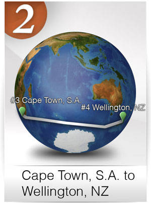
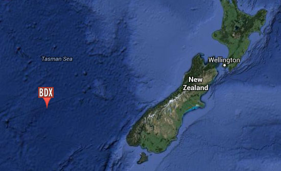
While maintenance and repair work continues on Bodacious Dream here in Wellington, I’ve found some time to review the many hours of Leg 2 video and photos I took on the voyage here from Cape Town, S.A.

big_wave_550
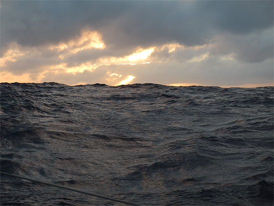
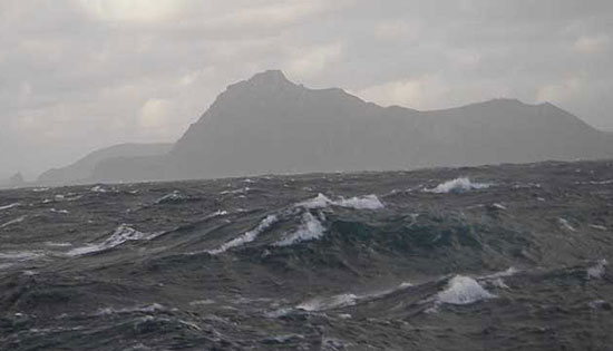
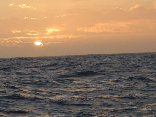
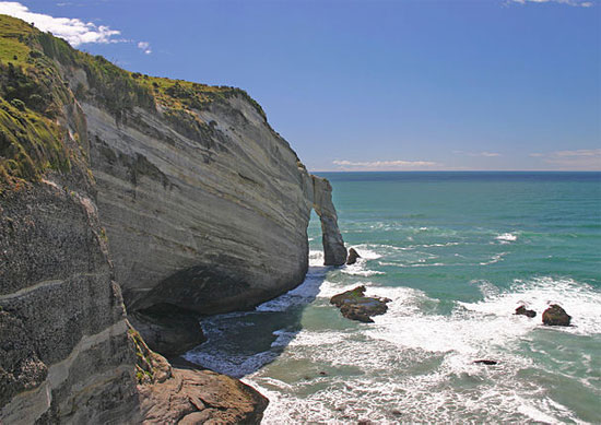
It’s a Very Wavy World Out There – 42.568808S, 120.320942E

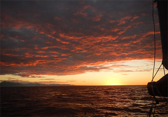
As you may recall, during that 7000-mile leg, we encountered quite a few tenacious storms – or what the weather people call “strong frontal passages.” I compiled some video clips from some of the storms into two briefer and more watchable pieces. I did some simple edits on them … which is all I can manage at the moment. Maybe soon, we can do a cool edit, but even without a thrilling musical soundtrack, you should still be able to get a feel for what it’s like out there on the open ocean when the winds and seas are “up.”


At the same time you are experiencing loneliness and fatigue, you are also carried along by something both energizing and mesmerizing.

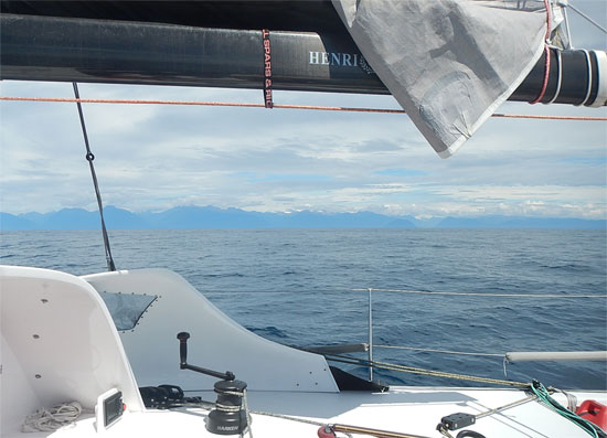
To remind you, these cold fronts blew up from the South (Antarctic) and progressed westward providing us with westerly winds that pushed us towards New Zealand. They generally announce themselves by a couple days of northwest wind, which then builds into the 30-knot range as the front passes through, after which the winds switch over to the southwest before gradually fading out.

Dave_Foulies_350One particularly interesting storm I wrote about previously, involved a spin-off of a low-pressure system from a cyclone, which teamed up with a passing cold front to amp up the winds and make our sailing a couple levels more extreme. While the strongest part of this front/low passed rather quickly over a 24-hour period, it was a week-long event of sailing as fast and as far east as we could to get in front of its path, so it could push us along instead of smacking us in the face. In the end, we did make it east of the storm, but just barely. During the height of the storm, we were clocking winds around 50 knots – and you’ll see in one of the video clips, the TWS (True Wind Speed) reading on the instrument panel showed gusts to 40 knots!


No matter how senseless and arrogant we humans are about using up the ocean’s resources and wasting its precious beauty, it’s hard not to think that it is the ocean that will have the final word.

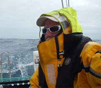
While all of this seems a bit edgy to the uninitiated, rest assured that Bodacious Dream is designed and built to handle these conditions, and in fact, is much more adept at it than I am! It’s specialized and custom-built for such tasks, whereas we humans are generalists who must keep adapting by learning new tricks. At the same time that the tempest tosses you around like a toy, you can’t help but succumb to the storm’s seductive beauty. To be in the center of such oceanic intensity, all the while knowing that there is so much more potential scale and force there yet to be unleashed, is humbling to say the least.

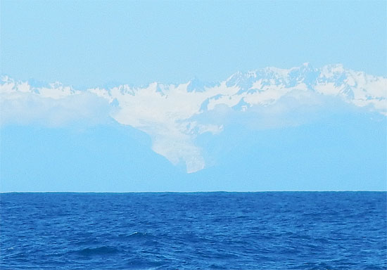
Coming up next, in a few days, will be some video that shows another side of Earth’s majestic powers. I’m talking about the glaciers of South Island, New Zealand. Stay tuned for that, as I think my visit to the glaciers was one of the most awe-inspiring experiences of my life.

Hope you enjoy the videos. I have a lot more footage and will try to compile them into more videos for those of you that have the time to watch.

Thanks and more soon….

– Dave

P.S. As a bonus for those of you who consider yourselves “veterans” of the sea, I have included another video of around 6 minutes in length that is mostly me talking through a week of strategic adjustments that I had to make in order to deal with the storm.


A sailor’s way of thinking about storms

Volcanoes and Sea Changes

I’m back in Wellington, where maintenance and preparations for the next leg of the circumnavigation continue. As the work goes on with Bodacious Dream, I find myself eating everything in sight and loading up on chocolate, in response to what I can only suppose are abnormally low chocolate levels.

The weather here in Wellington has varied dramatically. The past few days have been extraordinary beautiful, which stands in sharp contrast to the dreary, cold, wet and windy weather we encountered upon our arrival and for the following several days. As dynamic as the weather is, the landscape of this country is equally as powerful, from amazingly majestic mountains to gently rolling hills that spill down into bucolic farm fields.

Tongariro_nz4_550
Tongairo Alpine Crossing in the middle of NZ’s North Island

Tongariro_nz3_300Last week, I went off with some friends to hike the Tongariro Alpine Crossing, a 10-mile hike up, over and through an area of active volcanoes complete with sulfur-smoking fissures in the ground. Unfortunately, it was cold, wet and windy. However, we pressed on, even when some were calling for a turn back, because the “sailor” in the crowd kept arguing that the wind and rain were at our back and too early a return would put it right in our face! Though we made the crossing without incident, I could feel my legs had been greatly weakened from the 52 days at sea!

Tongariro_nz1_550Our Intrepid Crew

Bodacious Dream is getting such a thorough going over from the guys that know her best, the original builders, and so far, they have found no issues with any of the construction. This is more than just good news as it says much about the design and the quality of her construction. As I said in my previous post, Bo has over 32,000 miles on her now, and the 15,000 of those since the circumnavigation began, have been very tough miles!

In between work and jaunts out-of-town to explore this amazing land, I am trying to firm up plans for the next leg of the circumnavigation. As many of you know first-hand, everything in and around the ocean and the experience of sailing, is by its very nature in a state of constant change. This is no different for Bodacious Dream and myself.

Our original plans and timeline called for our leaving New Zealand no later than mid-February, to head east and around Cape Horn, the southernmost tip of South America, there to meet up with some of the most treacherous weather and water in the world. However in addition the various delays in the journey so far, there has also arisen a  pressing family matter that will require my return to the States for a short time, which means my departure from New Zealand may need to be postponed until the middle of March. A delay of that duration may have an effect on our course and timeline. Allow me to explain that a bit more.

Cape HornCape Horn – (Web Image)

As you know, the seasons are reversed here in the Southern Hemisphere, so that the March 21st Spring Equinox in the North, signals the Fall Equinox down here. What this means, is that with the delays, I might be sailing around Cape Horn in what would be the equivalent of late October back home. Cape Horn, at 58 degrees south latitude, corresponds to the northernmost border of the U.S.

Considering all this, my weather routers and I are considering an alternative route that would take me north through the Pacific Ocean and then through the Panama Canal. While not allowing me to capture the holy grail of sailing – rounding Cape Horn – such a course change might also offer other adventurous learning and discovery opportunities.

In life, I’ve found that sometimes the best adventures are those that life takes you on, rather than the ones you try and take life on. So, we will remain flexible as we continue to weigh our various options and do what we must do before deciding on the actual route that will bring us back to our home waters sometime in the middle of the summer. Naturally, we will keep you posted on our decision-making process here as it develops.

Thank you as always for your continued support and enthusiasm for our expedition. There are lots of photos and videos coming out here soon. I am captioning the last of the Leg 1 photos and the Leaving Bermuda album is ready for viewing. We hope you enjoy them as much as we did capturing them in those many magical moments we have experienced since we left now-distant Jamestown.

– Dave, Bodacious Dream, Franklin and our many Kiwi friends!

:: BDX Website :: Email List Sign-Up :: Explorer Guides :: BDX Facebook

Meeting up with My Mates

New ZealandHello from Auckland, NZ! I’ve driven up north to Auckland to pick up some equipment and to see some friends. I’m trying to get some downtime in between commencing the necessary work on the boat.

Not long after I arrived in Wellington, my “mates” who built Bo right here in 2011, started stopping by the boat. There was Matty G., who was the main foreman on the build, Gordy the main rigger, Lapo A. the uber-brain at BT Boats, along with Matt S. and David M. the electronics specialist as well as David from North Sails. The whole crew of them took over the boat and sent me off for some much needed R&R! I can rest easy though, confident that if anyone knows this boat as well as I do, it’s these guys – and I can see that they are taking to the inspections, maintenance and repairs as if Bo was their very own.

42.4027732S, 169.4447448E
First Sightings of New Zealand … 2.05.14 – 42.4027732S, 169.4447448E

Can’t say the weather in Wellington has been overly welcoming – cold, windy and damp most of the time, but nonetheless, the guys now have the mast and rigging down and out of the boat, in preparation for Bo being hauled out of the water on Friday. This is interesting because when I was initially making up the inspection and maintenance list, pulling apart the rig was not on the list … as I’d had this done in Newport before leaving. But then in talking it over, we realized that was over 15,000 miles ago or about half the sea-going life of Bodacious Dream, who now sports over 32,000 miles of travel under her keel! So, I guess it truly is time to inspect the rig once again!

43.230462S, 136.2241334E
300 Miles West of Tasmania  – 1.27.14 – 43.230462S_136.2241334E

Here’s the action list. We’ll have the mechanics go over the engine. The electronics are being upgraded and non-functioning parts are being replaced, the rigging is being inspected and some of it replaced. Also, we’ve come up with some modifications that we think will help a lot with the handling of lines. Some of the dings and bruises to the boat will be fixed, in addition to some enhancements on the cockpit protection. All in all, a host of mighty maintenance measures to be undertaken by the greatest crew imaginable, on the way to getting Bo all ship-shape for Leg 3, which will begin sometime in early March!


A calm morning after another storm – also 300 Miles West of Tasmania 

In the meantime, I’m going to skip out and see some of New Zealand! So stay tuned for some photos of the many pretty sites of this amazing country. I’m also beginning the upload the Leg 2 photos and videos … so we’ll have those for you soon as well.

Until later …

– Dave (happy in his dry clothes)

:: BDX Website :: Email List Sign-Up :: Explorer Guides :: BDX Facebook

All is Well-ington!

Leg 2Bodacious Dream, Franklin and I arrived in Wellington, New Zealand and the end of Leg 2 of our Circumnavigation on Saturday, just as the day was drawing to a close. Earlier in the evening, with the sun setting, I had pointed Bo’s bow towards the first Wellington Harbor light. From that point – about 3 miles out, we slowly made our way into the large bay. Before too long we were met by Lapo Ancillotti and some other friends on a powerboat, who helped guide us past the reefs and into the marina. What a relief and joy it was to see such wonderful old friends, after so long alone. Lapo and his gang at BT Boats were the builders of Bodacious Dream, so the return to Wellington had special significance for everyone, including Bodacious Dream!

Ocean Odyssey

As my email has been mysteriously unavailable for the past 10 days, let me begin with some highlights of the past week.

It was on a wilting breeze, that we first caught sight of the southwestern coast of New Zealand’s South Island. Instead of the forecasted cold front that we had hoped would propel us up the coast and into the passage between the North and South Islands, we fell behind a low-pressure system that took the winds with it, leaving us struggling our way north along the incredibly beautiful coastline. As I explained in the last post, thanks to the generosity of the fisherman aboard “Ocean Odyssey,” (pictured here @ 43.433024S, 169.37806E ) I was able to acquire more fuel to assist us in our northward progress.

Here’s a video I shot not long after that encounter …

Along the Eastern Coast of New Zealand’s South Island 

After a few days of traipsing along behind that low, we met up with a cyclone system coming down from the North Island. After that tossed us around for a while, we bumped into a high-pressure system pushing up from the eastern side of the South Island. Ultimately, we entered the famously windy Cook’s Strait, where 25-knots or so are considered to be a “rather appropriate amount” of wind. As it turned out, here and for most of the last 100 miles, we wrestled with 35-50-knot winds which we had to take right “on the nose” too – not exactly what I was hoping for after 50 days of sailing across the Southern Ocean!

DSCN1956_550
Eastern Coast of New Zealand’s South Island – 43.42444S, 169.328302E

As I approached the northwest corner of South Island, known as Cape Farewell (or Farewell Spit, which we discussed in our last post) – we came upon more of the wondrous bioluminescence, but this time it was doing something different still. The glowing orbs, instead of floating on the surface as before, were now submerged a couple of feet below the surface, giving an eerie sense of depth to the water. The bioluminescence on the latter leg of the trip provided me some of the most amazing sights I’ve ever encountered.

With a hundred miles still to go, there was nothing left to do but “grunt” it out. That’s what the mates here in NZ say. “You just have to “grunt” it out mate!” So grunt it out we did. Hunkering down, Bo and I sailed those last hundred miles in just less than 24 hours. Fortunately, the first leg of about 60 miles we were able to sail without a tack. Through the last 40 miles, Cook’s Strait fully lived up to up to its windy reputation, which made for quite “sporting” conditions with plenty of pounding waves and wet spray everywhere. I took heart in knowing it was the last 40 miles of the voyage and not the first!

As I made the last tack, I began to congratulate everyone … Bo, Franklin and Otto and began to partake of the final cookie from my secret emergency stash, when suddenly – all hell broke loose! With the boat in the middle of the tack, alarms started to go off! I took a quick inventory – the engine was overheating, the autopilot display had suddenly stopped working just as the ferry from Wellington began passing us … though too close for my AIS alarm to announce it. Somehow in the next frantic 30 minutes, I was able to put everything to rest. I shut the engine down, organized the sail trim, reset the course, got the autopilot driving again, shut down the AIS alarm and turned the inside of the boat upside down looking for the spare parts kit for the engine. With Bo bouncing up and down in 30-knot winds and seas and just a couple of miles offshore of the point, I changed the “impeller” (a rotor part) on the engine, then got it restarted at which point all returned to semi-normal. After a moment or two to review what had just happened, I chided (and reminded) myself to never ever congratulate yourself in advance of actually completing the task.

At that point, I wasn’t so much using the engine for propulsion, but rather to charge the batteries so the autopilots and navigation could keep operating, but I kept it going as a precaution when tacking through the heavy wind and seas. I do this because every once in a while, with the autopilot making the tacking turn, the progress of the tack is interrupted by a brutally large wave, which can stall and throw the boat back, taking away the forward motion and the ability to steer the boat. With just a touch of engine engaged, I can usually prevent this from happening. When racing where you can’t use the engine, I would instead use a slightly different but much more demanding (and multidextrous) tacking procedure.

DSCN1996_550Sometimes, time just stops and the world shows its soul. 43.4242114S, 169.33042E

So it was that within an hour, we were pointed towards the harbor in a darkening and misty fog that shrouded all landmarks, at which point the arrival of Lapo and friends was a terrific relief! Once tied up in Wellington Harbor, we quickly cleared though customs whereupon I was handed a cold Heineken beer. Now I could finally count my passage as accomplished! What a relief! Soon there would be a long and extra soapy shower and some grand and uninterrupted sleep!

At present in Wellington, it continues to be cold, rainy and typically windy, but it’s also time to take stock of the work list and to begin making arrangements for getting things done … so I guess I’m now “back to work.”

I’ll share more of the recent days of sailing here shortly now that I have email access. And stay tuned for videos and photos of this amazing leg!

Thanks again for all your support and words of encouragement. It meant an awful lot to all of us.

– Dave, Bodacious Dream, Franklin, Otto and Assorted Salt Monsters of the Southern Oceans

Some Key Links: Email List Sign-Up :: Explorer Guides :: BDX Facebook

The Mystery at Farewell Spit

A quick update from Dave followed below by a very interesting new science note from Tegan Mortimer on recent mass pilot whale strandings exactly where Dave will very shortly be passing.

Dave RearickDave Rearick: We’re in sight of land now and heading up the west coast of New Zealand here. The cold front that we hoped would push us up to Farewell Spit at the northern tip of the South Island and down into Cook’s Strait dissipated and left us fighting through wind right on our nose. It was an unusual weather pattern that made for very rough seas with lots of pounding waves. I kept trying to work my way towards shore to grab the best angle north against the wind – but it was a slog with very little progress to show for a lot of effort. As my weather guy commented … It’s kind of like sailing up Lake Michigan in the Mackinac Race, getting to the bridge, and losing wind. You can see the finish; you just can’t get there!

41.1179S, 171.47621E

Yesterday, I began to grow concerned about having enough fuel to carry me through the notoriously unpredictable winds of Cook’s Strait. I got on the radio to see about landing somewhere along the rugged and dangerous coast, when a commercial fishing boat named “Ocean Odyssey” picked up my radio signal and offered to help. Eventually, we got our boats close enough together, that I was able to tie my gas cans to a line and drop them over the side, where they picked them up and refilled them for me.

The whole operation took us about two hours, but now I am better set for Cook’s Strait, with 50 gallons of fuel intend of 5. The skipper Barry even suggested that I come onboard the Odyssey for a shower and a hot meal … but I begged off, preferring to stay crusty with a belly full of freeze-dried filler. Today is all stormy and bouncy and so I have to stay focused.  Oh well, onward we go! Looks like another great update right here from our Earthwatch scientist Tegan Mortimer  – and on a very important topic, so be sure to check it out! Be back soon with more!

Farewell_mystery_550

Tegan MortimerTegan Science Notes #4 – Whale Strandings

At the very northwest corner of New Zealand’s South Island, Dave and Bodacious Dream will round a sandy spit which stretches 16 miles out into the ocean like a great arm creating the northern shore of Golden Bay. This is Farewell Spit and it is the longest sandspit in New Zealand. Sandspits form when currents called “longshore drifts” move and deposit sediment laterally along the coastline. In the case of Farewell Spit, currents and strong winds carry eroded sediments down from the Southern Alps, the mountain range that stretches the length of the South Island. As the spit builds, it shelters the leeward  (or inward) side where additional sediment then builds up allowing mudflats to form.

farewell_mudflat_300At low tide over 30 square miles of mudflats are exposed at Farewell Spit which is an important feeding habitat for shore wildlife. Recently through the month of January, it was the site of a massive effort to rescue a pod of around 70 pilot whales which had beached themselves several times in a mass stranding event. Mass strandings of whales are a complex and still little understood behavior, which most unfortunately can be deadly for the whales. Why did it happen here?

What’s a pilot whale?

The pilot whales are actually two different species, there is the short-finned pilot whale and the long-finned pilot whale. The two species look almost identical and it is very difficult, especially where the two species’ ranges overlap in habitat, to tell them apart. Both varieties of pilot whales are toothed whales which usually frequent deep water habitats such as the edge of the continental shelf and along deep water canyons where they feed on fish and squid. Tagged whales have been known to dive to depths as much as 2,000 feet! They are highly social animals and live in pods of around 10-50 animals though groups can be of more than 100 animals. Pods keep in contact with each other through complex whistles and other vocalizations which are believed to be unique to individual pods. Animals will instinctively follow the calls of key animals such as mature older females which act as pod leaders or to the distress calls of young whales. This behavior makes pilots whales particularly susceptible to mass stranding.

Pilot Whales
Pilot Whales

Why do whales strand?

Around the same time that pilot whales where stranding on Farewell Spit, there was also pilot whales stranding in the Florida Everglades. Pilot whales together with other social and toothed whales like dolphins, killer whales, and sperm whales are the most common whales to become stranded. You might remember me talking about sea turtles stranding in my last Science Note when the turtles get washed on shore after becoming stunned by the cold water. Toothed whales seem to actively beach themselves, swimming into shallow water where they get stuck as the tide recedes. The tight social bonds between animals in a pod mean if just a few do this, then it’s likely that whole pods will follow suit and strand together. Why this occurs is a mystery and there is probably no single answer that fully explains the behavior.

There are a few causes which are often pointed to when whales strand. Individual animals may beach themselves if they are sick or injured. Other healthy animals may strand if they are unwilling to leave an injured pod member. This seems like it might have been the case of the pilot whales that stranded in Florida, they were not in very good condition and necropsies (animal autopsies) of the animals that died showed that they had nearly empty stomachs.

whales_300x200In contrast to the Florida pods, the whales that stranded on Farewell Spit were in good condition and seemed healthy, so probably they stranded from other reasons. These whales may have gotten trapped in shallow water as the tide flowed out of Golden Bay. Farewell Spit forms a long hook which can be difficult to navigate out of, which is made worse by the quick drop in sea level when the tide recedes. The soft muddy bottom doesn’t reflect the whales’ echolocation, which means that the whales can’t “see” the bottom. Essentially they don’t realize they are in shallow water until it is too late. There is also evidence that noise disturbances from seismic testing and military sonar could also be a factor in mass strandings.

Unfortunately, stranding is fatal for whales. Out of the water, whales as quickly susceptible to dehydration and overheating. Whales are designed for a weightless world, which allows them to grow very heavy. Out of the water, all this weight presses on their vital organs and can cause death in and of itself. Unless they refloat on an incoming tide there is little chance for a whale to get back to deeper waters.

whales_stranded

Luckily there are well-developed stranding response networks in many places around the world which can hastily mobilize volunteers and experts to attempt to rescue stranded whales. New Zealand has one of the best rates of successfully rescuing stranded whales. However it is still a difficult task and many whales die naturally or have to be euthanized, and even whales which are successfully moved to deeper water will return to re-beach themselves a second time.

Here are two particularly good articles about the stranding in New Zealand.
:: http://www.nzherald.co.nz/nz/news/article.cfm?c_id=1&objectid=11189886
:: http://www.nzherald.co.nz/nz/news/article.cfm?c_id=1&objectid=11191661

:: Also, if you happen to know other scientists, educators or journalists who might be interested in contributing on our Learning & Discovery side, we’d love to make their acquaintance @ <oceanexplorer@bodaciousdreamexpeditions.com>

Some Key Links: Email List Sign-Up :: Explorer Guides :: BDX Facebook

The Great Circle Game

For some reason yet to be determined, Dave has lost his Iridium email service. He still has phone and text capability, and is checking in frequently to let us know all is well … but for now, no email, so updates will be brief or will (as we do below) include some older updates that never got posted.

The following update was received over the phone.

“Going along real nicely here on a course headed for the northwest corner of South Island of New Zealand (Farewell Point.) We’re averaging over 8 knots the last couple days and likely for another couple of days as well. We do have a cold front weather system coming in Tuesday night, which will bring strong winds Tuesday evening into Wednesday, which should give us the push we need to take us down Cook Strait towards the southwest corner of the North Island, and into Wellington Harbor.

Cape FarewellFarewell Point, Northenmost tip of South Island of New Zealand (web image)

The bioluminescence is still around, though not to the spectacular degree I described it in the last post. Looking south towards Antarctica tonight, I can see a glow in the sky; similar to the sort of glow that a city makes when you are on the water and over the horizon. As we know there’s no civilization south of us here, so I can only think it’s the glow of the sun reflecting off the polar ice cap.

Had a fun time last night calling into the awards dinner for my friends in the Great Lakes Singlehanded Society. I spoke a bit and answered some questions. Thanks for the invite!

I know my Midwest and East Coast friends are getting hit with some dramatic weather of late … I’ll just say it’s summer down here … 55-60 out on the water. Food is getting down to final tally time. There are plenty of calories onboard … but the fun items on the menu are gone.  I’ll make up for that, when I get to Wellington towards the end of the week. Over and out!”

43.9857S, 159.55377E

:: As mentioned above, here’s an update though from some weeks ago that never got posted. It’s a navigation-related update, and its contents are still relevant to the current leg of the voyage. Enjoy!

Sailing long passages puts you in the middle of constantly shifting set of time and distance problems. These little mathematical calculations are always running through sailor’s minds when they’re not otherwise occupied with shipboard duties. Recently, I had one of those days where I had a whole bunch of interesting problems come up relative to navigation and latitudes.

I was trying to step back and figure out just how far it is from Cape Town to Wellington, NZ. Now I have a GPS locator onboard and it can give me a distance, but it works on what’s called the “Great Circle” route, which calculates the shortest distance along the curved surface of the Earth. Our own strategy though for sailing to Wellington is to stay along a particular latitude – namely 40 degrees south. We do this to maintain the best route through the least stormy weather. But back to the questions raised by the Great Circle method, let me explain a bit and also give you an experiment you can do on your own when you have a chance.

mercator projection mapOver time, all of us spend a good deal of time looking at maps and charts of various places. These might show us our hometown, or a route to a someones’s house, or a map of the country or maybe the large world map on a classroom wall. Typically, these kinds of maps that we are so used to, are as a class called “Mercator Projections.” They represent the three-dimensional world as if it were laid out flat on a tabletop. The problem with this of course is that the world is not flat but rather beautifully round and by creating a world map that is flat and rectangular; you end up distorting the actual distances – particularly so, once you start considering areas closer to the polar ends of the earth.

Here’s an amusing video clip from an episode of the TV show West Wing that deals with how the Mercator projections distort the actual size of landmasses as they actually exist on the globe.

South Pole GlobeIf you can find a globe and look at it carefully, then turn it so that the South Pole is facing you. Now if you can find a string, a shoelace or even take a piece of paper and cut a thin strip from it, then put one end on Cape Town South Africa and the other over to Wellington, NZ, you’ll see that the shortest route goes over the Southern Ocean and over Antarctica. This is what we mean by the “Great Circle” route. If you in were a plane, you could fly that route, but in a boat, it’s not an option. There are a number of reasons why, some of which are obvious such as the continent of Antarctica and the impenetrable ice, but also, the further south you get, the colder the water and the more dangerous the weather. So, that’s why we chose the route along 40 degrees south latitude. So, to get that distance, you have to work your way along that latitude with a measure of some kind and figure out the distance.

Now, while you still have that globe out, let’s take a look at something else. I believe I told you a while ago that the degree of longitude is widest at the equator at 69.172 miles (111.321) and gradually shrinks to zero at the poles. At around 40°N or S, where we are,  the distance between a degree of longitude is 53 miles (85 km). But as you can see, at the South Pole and the North Pole, all the degrees of longitude come together into one point. That’s pretty interesting isn’t it?

Nautilus 1958Here’s an interesting story I once read. Back in 1958, when the first Navy submarine (USS Nautilus) was able to travel under the ice pack of the North Pole and once they reached the pole, what do you think the navigator said when he called out his position? He sure must have enjoyed saying this … “90 degrees North latitude and ALL points longitude.” His meaning was that all the longitudes came together in one precise point at the North Pole!

So, I spend a lot of time trying to figure out some of these things when I have time, but if you’d like to, you can do the calculations to figure out how far it is along latitude 40 degrees south from Cape Town, South Africa to Wellington, NZ.  And if you can play the Great Circle game, how much shorter is that route than the one I am taking?

I think it’s worth noting that while I wrote this soon after leaving Cape Town, now that I’m approaching New Zealand I can see that my calculations at the time are still pretty much right on target.

– Dave, Bodacious Dream and Franklin (my onboard globe for this trip.)

Some Key Links: Email List Sign-Up :: Explorer Guides :: BDX Facebook