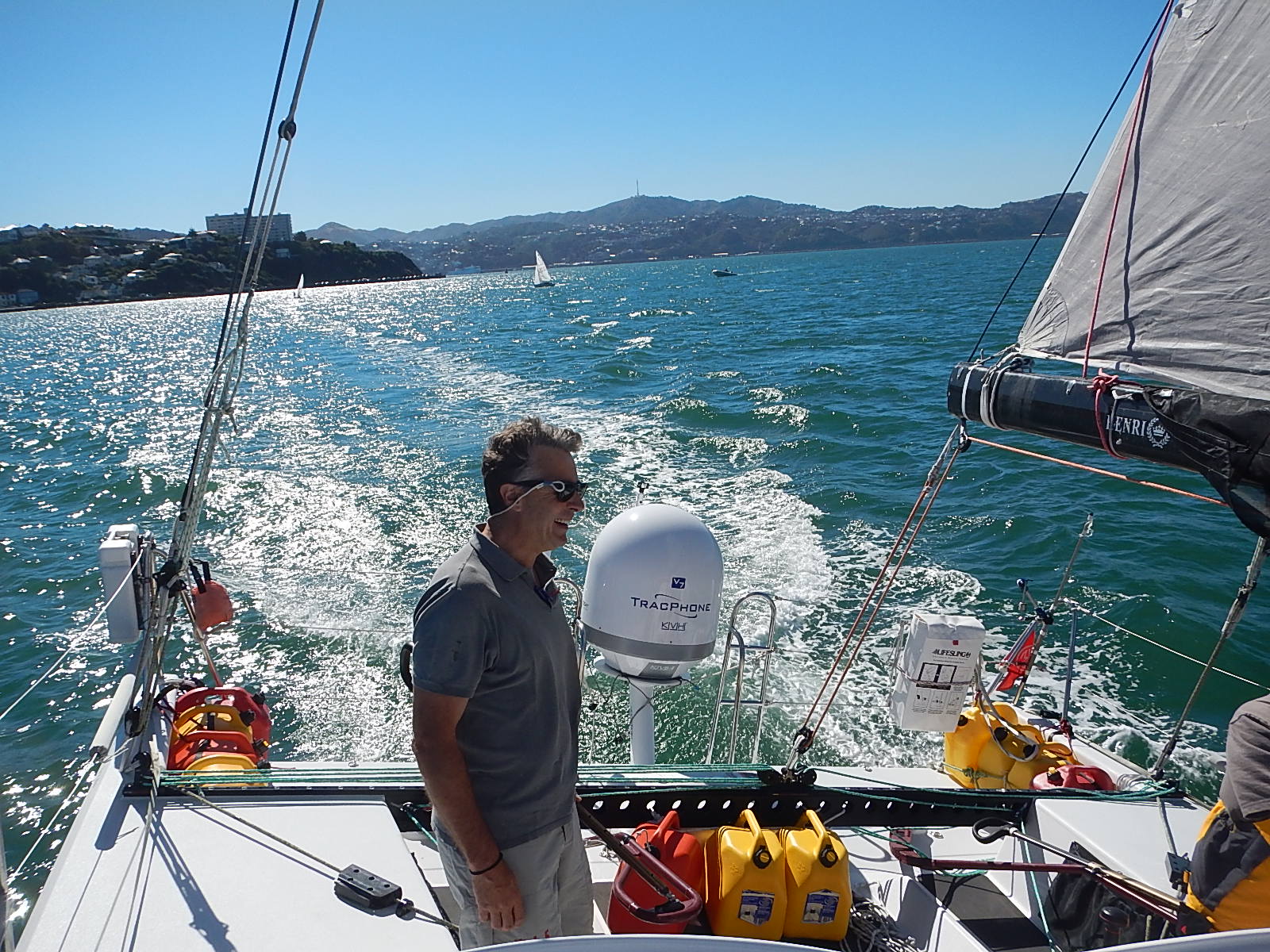
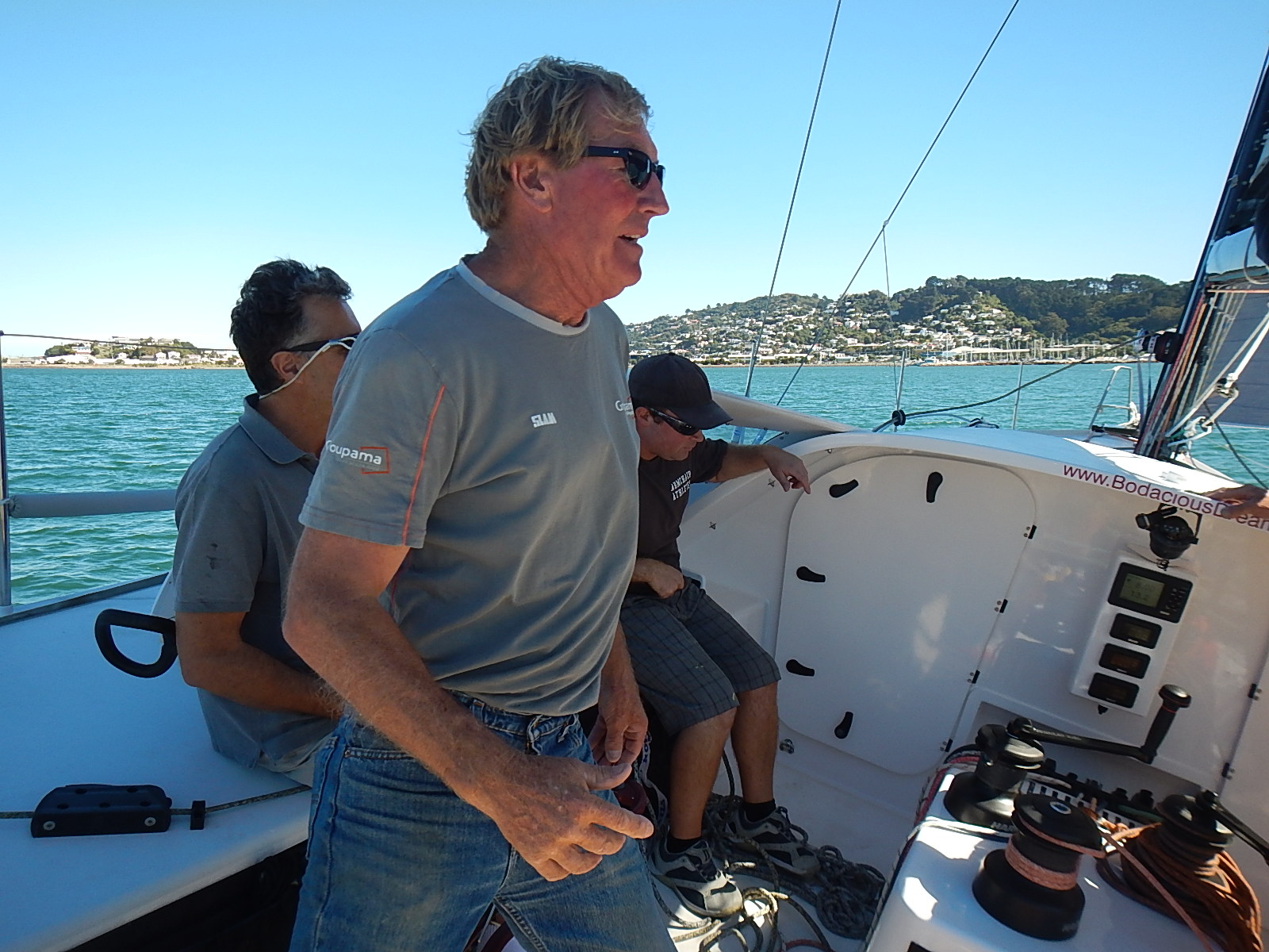
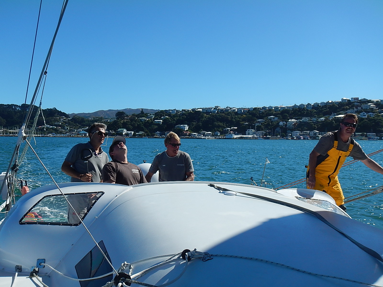
Some days are made interesting merely by their simplicity. Today looks to be one of those. The last 36 hours have made for some demanding sailing. Even though we’ve made good time, it’s taken a lot of patience and effort as the wind has increased, decreased and repeatedly switched directions. Each one of these changes has required that I adjust the course or trim the sails.
Today by dawn, things had settled down and we are now sailing steadily on course, which both simplifies my life onboard and gives me a chance to catch up on other things.
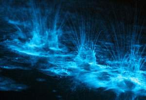
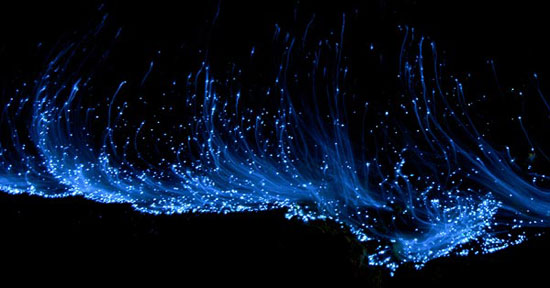
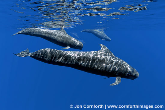
It’s pretty desolate down here in the Southern Ocean. There appears to be little visible sea life other than the mysterious bioluminescence I see occasionally at night and the plethora of seabirds that accompany me on my journey. For the first few days, there were a dozen or so albatross around, floating like soft music in the wake of the boat. Yesterday, I sailed through a flock of smaller white seabirds, but there were many of them – maybe 100 or so, and they kept up with me for several hours.
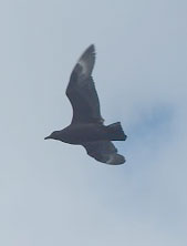
 Today, the crowd has moved on. In its place was one lone, dark brown bird, (I’m going to guess it’s a South Polar Skua) which circled us for quite a while. As if we had entered a courting dance, he would land on the boat, I would chase him with my camera and he would fly off … and shortly resume his same pattern – coming up from behind, drifting a bit, then swooping around behind the sails and stalling just in front of the boat before falling back along the weather side. I would follow him around the boat, probably a couple dozen times before I would give into dizziness and allow him another victory in our simple game.
 The days move along out here. I sail, navigate, check systems, watch out for ships, eat, sleep … and repeat. I’m grateful for the routine, as it has given me time to digest some reading material … one of which has been Ernest Hemingway’s Moveable Feast, a selection of short stories of his days in Paris. Two years ago, I found myself in the Lilas Café in Paris that he mentions. I sat on his dedicated stool, watching the many comings and goings of interesting people, just as it happened back in the 1930’s.
In the meantime, our ocean scientist, Tegan Mortimer has another wonderful science note for you directly below here – this one appropriately on seabirds! I strongly encourage you to give it a read. As I watch the birds soar day in and day out, I stand amazed before their beauty and the skill they bring to their aquatic lives.
Sailing along here … oh, let’s see … at coordinates … 46.81776S, 161.104W
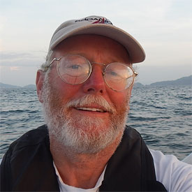
– Dave
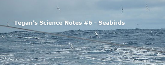
 Tegan’s Science Notes #6: Seabirds
Of about 9,700 species of birds on earth, only about 350 are considered seabirds. Think about that – 9,350 species occupy only 30% of the surface on the earth while those 350 species of sea bird ply the vast oceans which constitute 70% of the surface of the globe!
What is a seabird?
The definition of a seabird is a tricky one. Many people use the technical definition that a seabird is a bird which feeds in salt water. However, many coastal and wading birds feed in salt water, but aren’t considered seabirds because they don’t spend enough time at sea. However gulls are considered seabirds though they are strictly coastal and return to land regularly.
 The majority of sea birds spend the bulk of their time at sea and only return to land to nest. Therefore they depend on the marine environment for their food and float on the ocean’s surface to rest. The enormous wandering albatross will spend the first seven years of its life at sea before returning to remote islands to breed for the first time.
Who are the seabirds?
I mentioned albatrosses, which are the quintessential seabirds, and gulls which many of us who visit the coast are familiar with. The seabirds also include the petrels, shearwaters, storm-petrels, auks, pelicans, gannets, boobies, skuas, cormorants, shags, frigatebirds, tropic birds and last but certainly not least the penguins.
Many seabirds like the albatrosses and gannets have evolved strong, long wings which allow them to fly long distances without expending much energy, while other seabirds like the auks and penguins have sacrificed flying ability in favor of evolving features which allow for strong swimming ability.
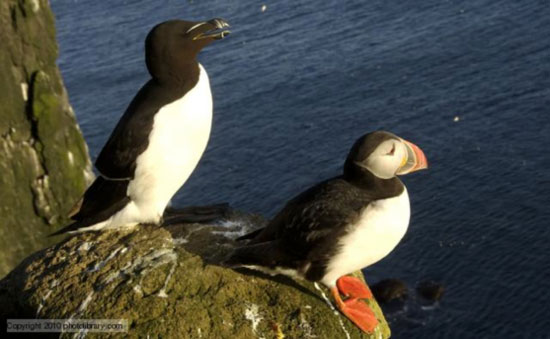
Auks: Razorbill and Puffin
So what birds has Dave seen so far?
Dave has had some fantastic bird sightings. Unfortunately, seabirds can be very difficult to identify, especially the albatrosses of which I am sure Dave has seen more than one species. But this is the list so far of what we’ve been able to identify.


Many of these seabirds are common and widespread in the oceans. In fact, the Wilson’s storm-petrel is believed to be the most numerous bird species in the world with around 12 to 30 million individuals! On the other hand, the gray-headed albatross, cape gannet, and African penguin are classed as endangered because they either have small geographic ranges, small populations or are experiencing significant population declines. So this makes a great list of both common and rare species. Dave spotted a white tern (actually it almost landed on his head!) off the coast of Brazil which is a very unusual sighting for that species in that area.
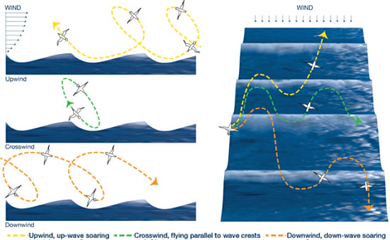
Dynamic Soaring
Albatross and some other seabirds use a peculiar flying pattern where they make large looping turns which take them up into the air and then they swoop down to almost touch the water and back up again. This is called “dynamic soaring” and it allows these birds to fly without expending much energy. These birds are using the difference in wind speed at different heights to soar. The wind is slower closer to the surface of the ocean due to friction and it becomes faster higher up. The bird starts by climbing up to higher wind speed, and then turns away from the wind and gains airspeed as it soars down the wind gradient. When it turns back into the wind at the water’s surface, the bird has extra energy which allows it to climb back up to higher windspeeds again. Birds which use dynamic soaring have evolved long, thin wings which they hold rigidly in the air as they soar a bit like the wings of a glider.
Additional Resources:
:: Source and good article: whoi.edu/oceanus/feature/a-robotic-albatross
:: Another interesting article: whoi.edu/oceanus/feature/of-wings–waves–and-winds
Seabird Conservation
While it may seem that seabirds that roam the vast oceans are less touched by human impacts that threaten other bird groups, the fact is that seabirds are the MOST threatened group of birds on earth! Of the 346 species of seabird, 101 species (that’s 29%!) are threatened globally and another 10% are classed as “Near Threatened.” And almost half of all seabirds are known or thought to be declining in population. The albatrosses in particular are the most threatened with 17 of 22 species classed as “Threatened by Extinction.” To put it into a little context, of the 10 species that Dave has seen, 30% are threatened and 70% have declining populations!
What’s happening here? Human activities are the greatest contributor. Historically, many seabirds breed on remote islands that are relatively free from land predators, so they often nest on the ground. When ships would occasionally land on these islands, pests like rats were unintentionally introduced. Rats are very destructive to ground nesting birds, eating both eggs and preying on chicks. Luckily, efforts have been made to eradicate such introduced pests from many of these islands.
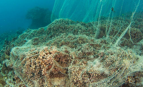
Today however, other more menacing threats face seabirds. Drowning in fishing gear is one of the greatest threats to seabirds. In the open ocean, fishermen set long lines, miles of baited hooks, which unfortunately catch much more than the fish the fishermen want. Many seabirds hunt from the air, diving to catch prey they have spotted with their sharp eyes. When these baited hooks lay near the surface the birds take the bait, get hooked, and drown. This situation is bad for the birds, but the fishermen don’t want it either as that is a lost piece of bait. Organizations like Birdlife International are working with fishermen in the most affected areas to modify fishing practices to reduce this “bycatch.” The good news is that simple changes can dramatically reduce the number of birds being caught and lost in this manner.
Another threat to seabirds is marine pollution. Laysan albatross are particularly affected with 97% of chicks being found with plastic in their stomachs. The adults are attracted to plastic objects floating at the surface, likely mistaking them for fish eggs or squid. They carry them back to the colonies where they feed them to their chicks. Forty percent of chicks born each year will die due to plastic blocking their guts or other effects of consuming plastic objects. :
::The heavy cost of marine pollution: ocean.si.edu/laysan-albatross-plastic-problem
Seabirds are majestic, elusive and true ocean wanderers, the lone occupants of the air above the ocean, but they could all too easily disappear from these winds. We all have a role to play to protect the ocean and its life, whether it is learning more about marine debris, attending a beach clean up, buying seafood caught with sustainable practices or any other action which improves the ocean environment for all.
– Tegan
(Tegan Mortimer is a scientist with Earthwatch Institute. Contact Tegan directly at Tegan Mortimer <tmortimer (at) earthwatch (dot) org>)
:: For more great science insights and opportunities, please check out our BDX Explorer Guides or stop by our Citizen Science Resources page, where you can also find all of Tegan’s previous Science Notes. Also, we welcome your input or participation to our BDX Learning & Discovery efforts. You can always reach us at … <oceanexplorer@bodaciousdreamexpeditions.com>
:: BDX Website :: Email List Sign-Up :: Explorer Guides :: BDX Facebook

 For now though, I am heading back home to the Midwest to recoup my energies and put back in order the parts of my life that were paused for the circumnavigation.
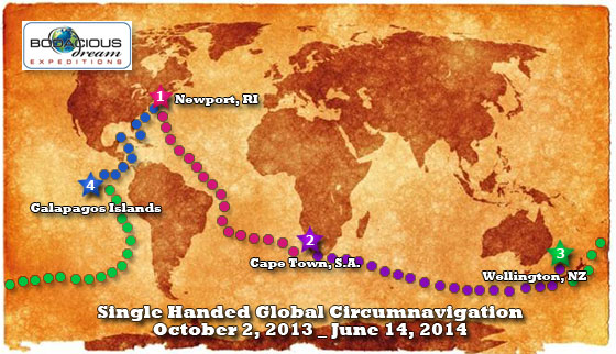
 Below are the summary recaps for all four legs of the circumnavigation (plus the pre-circum period) which can be found directly at the following links.
 Upon arrival back in Newport, I began to gather and respond to some of the more frequently asked questions that were put to me over the course of the voyage. We consolidated them all together on one page, which can be found right here!
 Throughout the voyage, our Earthwatch scientist, Tegan Mortimer provided us wonderfully insightful science “notes” in support of wherever in the world we were and whatever we were encountering. There were eleven of these reports in all, on a wide range of subjects and a list of those can be found right here!


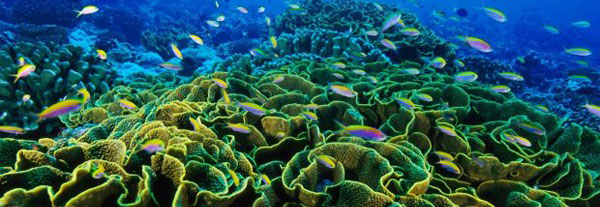
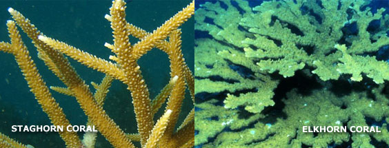
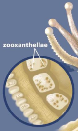 A coral reef is made up of many colonies of coral polyps which build the reef structure out of calcium carbonate. Tropical corals contain zooxanthellae, which is tiny algae that lives inside the coral where it photosynthesizes, creating food from sunlight. These algae are also what gives coral its brilliant and diverse colors. This means that coral can only occur in the “photic” zone, where sunlight penetrates the water. Corals polyps feed by extending stinging tentacles outwards to capture small prey and particles in the water column. Corals are related to other stinging animals including sea anemones and jellyfish.