BoDream Expedition (Baja – Day6)

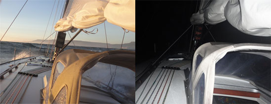
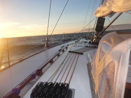
The heavy weather of last night subsided this morning and we got in a pretty pleasant day of sailing and making miles northward towards San Diego. “Heavy weather” is a sailor’s way of describing windy and wavy conditions. While the conditions weren’t actually stormy, we did spend a lot of time sailing in 25 to 30 knots of winds with ocean swells running as high as 3 meters (or 10 feet) … throwing thick spray into the air and water across the decks.

Day View/ Night View

As we get closer to San Diego, excitement builds among the crew in anticipation of the end of the passage. The Bo IV crew has been such a blast to sail with – right from the very beginning … but now, as we are approaching the end, we are all doing a lot of math trying to outguess each other as to how many miles we averaged over the last five hours, or what our average speed has been for the day, or what’s been our best distance made in 24 hours and of course, how many hours left until we finish. These are all fun things sailors like to do with numbers … that also underscore the need for them to have good math skills … especially if you are ever going to win any of these guessing games with your fellow crew members!

(So, have you figured out the difference between a knot and a mile per hour? That’s one of the bonus questions on our Explorer Guide for Math, if you want to check that out.)

QUESTIONS: Alongside questions of math, we have also had quite a few questions sent to us, that center on what goes on here, onboard a ship like Bodacious IV over the course of a near weeklong voyage.

For instance, people ask “How do we sleep?” “What we do at night?” “Do we stop somewhere?” “What do we eat?” “How do we stay warm?” Well, to each of those questions, there are various answers. So, let me respond to some of them.

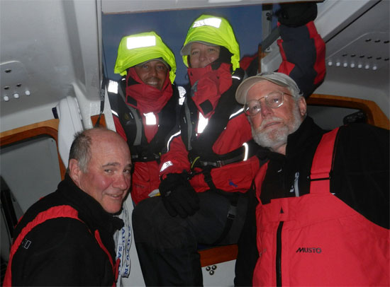
SLEEP: Typically, we sail all through the night without stopping. To do this, we break the night into two watches with each watch lasting three hours. After three hours, a new watch comes on and the old watch goes off to sleep for three hours. We sleep in what we call bunks or berths. These are narrow beds below decks and often at different levels, depending on the design of the boat. They are narrow, so that you don’t get tossed around in heavy weather conditions like we had the last few nights. This system works well for keeping people rested and alert when you are sailing over a longer period of days. Then there are other trips where you might stop every other night in a harbor, and so pass the time more leisurely. But even in those situations, there would still be a watch system to ensure that someone at all times is in charge of the boat and its safe operation. (You can see a few bunks in the photo below.)
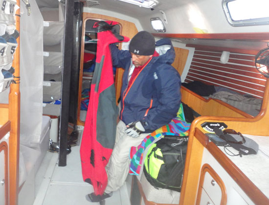
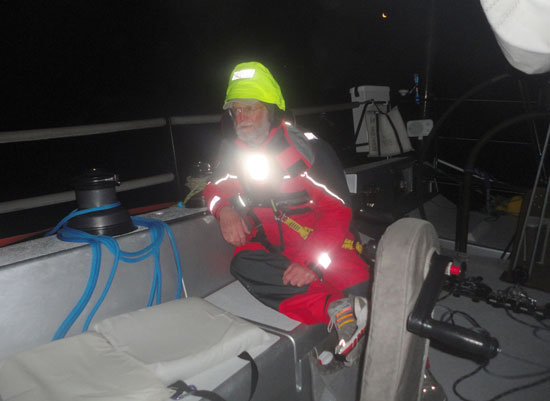
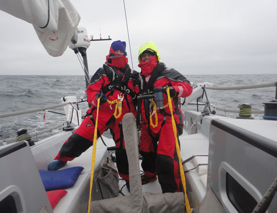
Jonathan Gearing Up for Foul Weather
Jonathan gears up for foul weather

FOOD/HUNGER: Eating is determined by a number of factors – the most important of which is having food available when you are hungry. But sometimes we have to wait until both crews are ready to eat, so that we can eat simultaneous to our changing watch. We eat primarily for energy, so depending on the level of work being called for, or how hot or cold the weather is, this can change what we eat and how often. When the weather is particularly rough, we often are only able to prepare sandwiches or snack foods. We steer clear of junk food as healthier whole grain breads, meats, fruits and vegetables give us more honest nutrition boosts and just a better and more energetic overall feeling. There is a good deal of math involved here too, as we calculate the energy, the food, the people and what their needs are, as each crew member has different dietary and calorie demands.

FOOD/ TEMPERTURE: Temperature also has a big impact on our diets. When it’s cold, people need to burn extra calories to stay warm … some people of course more than others. As we had heavy dew at night and temperatures down in the 40s, it wasn’t easy to stay warm, dry and alert when your body is trying so hard to find calories to burn. So you eat more when it’s cold out, so your body can keep burning calories and staying warm doing so. Can you see how important eating properly is and how math here too plays a role in the proper food fueling of a chip’s crew? And we haven’t even talked about cooking temperatures and times, and the math involved with doing all that.

To learn more about onboard nutrition, the video below is of an interview I recorded back in Cabo San Lucas with Chef and Master Provisioner Pierce Johnson (and noted nautical gourmand Jonathan Pond.)


Onboard Nutrition w/ Pierce and Jonathan

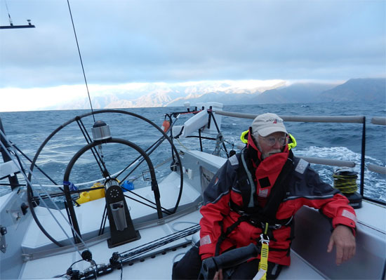
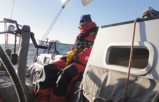
STAYING DRY & WARM: We also wear special clothes to help keep us dry and warm. Our base layers absorb the moisture from our body so that our skin feels less damp and wet. These materials are often a type of polyester mix of fabrics that have what are called “wicking” characteristics … meaning that they capture the moisture that evaporates from our bodies through sweat and transfers them to the outer layer of the cloth thus pulling moisture away from our bodies into an outer layer where it can evaporate. On top of those base layers, we wear fleeces and on top of those, our foul weather gear. In the old days, they used to just take cotton coats and soak them in wax or oil, so they would repel water when the waves and rain splashed on you.

Dave all duded up for foul weather
Bring it on!

Modern technology has developed a range of materials that have such small holes in them that even the most microscopic part of water (when it’s in a liquid form like rain or ocean water) can’t penetrate through the holes. At the same time though, when moisture is in an evaporated (vapor) form, like the steam from a teapot or like your warm breath in icy air … that no longer liquid moisture can flow out through the holes. Water can’t get in, but vapor can get out! Pretty cool – or warm – depending on how you look at it. So, with these special clothes, we get the help we need in order to keep ourselves warm and dry in windy and wavy conditions – just like we’ve experienced the last couple of days.

SAFETY: In addition to the foul weather gear, every crew member also wears what are called Personal Flotation Device (or PFDs.) These are automatically inflating life preservers that you wear like a jacket and that have built into then a harness and tether. We clip ourselves to the tether which runs the length of the boat, and prevents us from falling off the boat in rough conditions. Concerns for safety are obviously a very important part of our daily routine on the water. Respect for the power of the ocean must always be foremost in any good sailor’s mind. (In the photo below, Tim and Jonathan model the latest in PFD and tethering fashion.)  
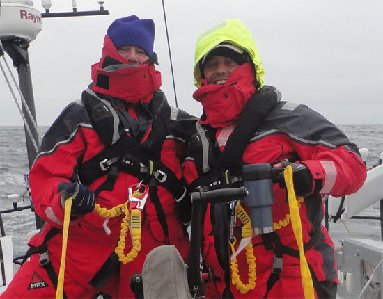
PFDs and Harnesses
T
im and Jonathan in their safety gear

HEADING FOR HOME: We’ll be drafting more detailed summaries not long after arriving in San Diego … but a few words before we land. Knowing what an incredible area this is for whales, we really hoped we’d have seen some whales here the last couple of days, but we haven’t. I think it may well be that they don’t like the heavy weather any more than we do … and so stay longer in the calmer climes below the surface. We did have a lovely visit today from a seagull though. He flew right up behind me and landed on the corner of the boat, just to my left. He traveled with us for a couple of hours before heading off to who knows where. We always feel these moments are special when nature comes to visit us instead of us coming to visit it. Here’s a short video of that encounter captured by Heather.


A Seagull’s Visit

As to the bigger wild life, we never say never though here in the Bodacious Dreamtime; so we will continue to keep an eye out for more whales, dolphins and other wildlife on this last part of our trip.

Again … thanks for following along.

– Dave R., Tim, Heather, Jonathon and Dave H.
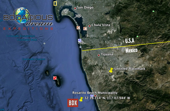
Google Earth/Ocean BDX 6Time: 05:00 PST
Coordinates: 32 18.714’ N 117 07.944’ W
Boat Speed: 6.8 knots
Course: 323 degrees

BoDream Expedition (Baja – Day5)

Bodacious IV, with all crew onboard, pulled out of Turtle Bay Wednesday evening … at about 20:30 hours as the winds were dropping off from 30 knots to 20. We headed towards the east side of Cedros Island and then across the bay towards the shoreline, rounding it just about sunset.

Sunset near Punto San CarlosSunset off Cedros Island

With the exception of the “lee” of Cedros … (lee being the side opposite of the wind … or the windward side) … we have been in powerful winds for the last 24 hours. It’s what we like to call out here “cold ‘n wet” … with very little sunshine to dry things off. Sometimes being on the water is all about the water part, which makes you happy as a sunfish, when the warm light returns. And then there’s the wind – no shortage of that … and all at around 28-32 knots. And if forecasts hold, it’s looking like it just may continue this way to San Diego.

The Bo IV Crew (4 out 5, anyway)
C
apt. Tim, Jonathan, Heather & Dave …

The Bo IV crew is just great. We’ve found so much to laugh about. Captain Tim is a hoot, and he and Jonathon have a regular routine going. For those of you who followed along with my Trans-Atlantic crossing back in December, there was the night when my PFD (personal floatation device) fell off the counter above me while I was asleep on the floor, causing me to shoot up and commence mortal combat with a giant and imaginary squid monster! (Click HERE for the link to that yarn.)

Anyway, this morning while I slept, my “pals” Captain Tim and Jonathon attempted to recreate that same event and video it while they did. The devious pair used a long pole that had a sponge and lines dangling from it that Tim then hovered over my sleeping head while Jonathon manned the camera … both of them a good safe distance away from me, just in case their prank incited a mad flurry of flailing arms and swinging knives. In the end, their game was only partway effective. Nevertheless, I will sleep with one eye open the rest of the way.

Capt. Tim & Dastardly Jonathan
The Pranksters … Tim and Jonathan

We were visited by some sociable dolphins today, and I got a clip of them alongside, as well as some fun shots of water splashing up and over the boat in the heavy breezes … some nice sunsets too. We’ll get those up for viewing as soon as we can.

I know boat talk can get confusing sometimes. It was (and still is sometimes) that way for me. Just to remind you then, the starboard is the “right” side of the boat (when facing front) – so when we say starboard tack, we’re talking about the wind coming over the right side of the boat, and when we say port, the wind would be coming over the “left” side of the boat. Here’s how I remember the difference … “Green + Right + Starboard“… all with a long number of letters. “Red + Left + Port” … all with a short number of letters.

Pondering David
Can’t remember what I was thinking here … something “deep” I’m sure.

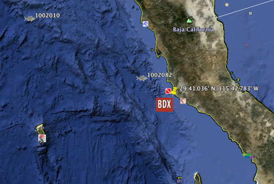
As I send this off, our coordinates are 29 41.036′ N, 115 42.783′ W tracking up the Baja coast in 25 knots of wind, on a sea full of water and a sky full of stars. We’re doing 6.5 knots of speed on a course of 283 degrees when on starboard tack and 013 degrees when on port track.

If you haven’t tried it yet, you might want to download Google Earth and then copy/paste the current coordinates (29 41.036′ N, 115 42.783′ W) right into the search box, and it’ll swoop you right to where we are … (just like the photo below.) There are other cool things there too, that other people have put there for you to see. We’ll add our own Bodacious photos and videos too before long … once we have had a chance to dry off.

Google Earth
Google Earth/ Ocean

So there you go … and here we are … tacking back and forth left and right up the coast on our way towards San Diego.

Be back soon …

– Dave R., Tim Heather, Jonathon and Dave H.

BoDream Expedition (Baja – Day4)

We arrived in Turtle Bay (Bahia de Tortugas) at about 10:30 am today, Tuesday – a neat spot on the trip north. It’s a bit more than halfway north from Cabo San Lucas and a nice respite for us … as the winds so far have been strongly against us.

This small village has just a few conveniences. Most important to us is the ability to refuel, so we can continue motoring north as the winds are still forecasted to be against us … or at best, light and variable.

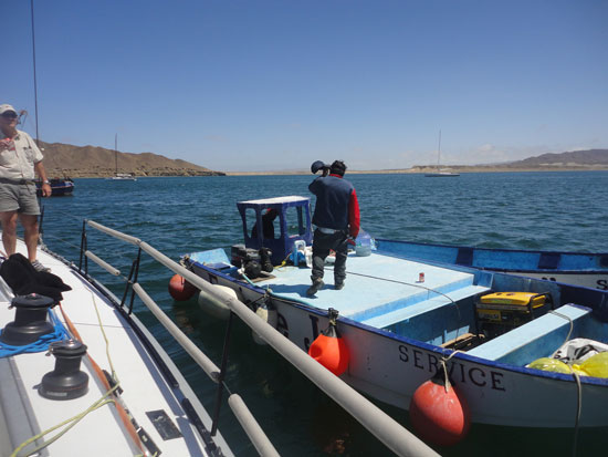
Within minutes of arriving at the anchorage this morning, we were approached by the local service that brings fuel out to you on the boat. Señor Enrique came first with his small launch to see what services he could provide and then, after leading us to a good anchoring spot, returned after a few minutes with a boat that is part fuel tanker. We took on nearly 85 gallons, which will be enough for us to make it to San Diego over the next three days.

Turtle Bay Fuel Service
Señor Enrique’s Welcoming Launch

While we had hoped to perhaps see some turtles here in Turtle Bay, we haven’t had such luck. We’re forever hopeful though to see more of the fascinating wildlife that abounds in these waters.

Approaching Turtle Bay
Approaching Turtle Bay …

The time at anchor here has been good, as we’ve gotten a chance to make a few repairs and fine-tune a few things that hadn’t worked out the way we wanted. Bodacious IV looks to be ready for another challenging night of winds, before forecasts say they will settle down Wednesday.

Anchored in Turtle Bay
A
nchored in Turtle Bay … a moment of stillness

After dark tonight we’ll head out around the point and Isla Natividad, and then make a course to the East of Cedros Island before crossing the Bay and continue up the coast. Off the north end of Cedros Island we will encounter competing currents that will cause the wave pattern to be very confused. With the level of particularly strong winds we’ve been seeing the past three days, we will probably have a few hours of uncomfortable sailing tomorrow … before things settle down.

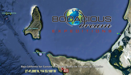
Google Earth - Turtle Bay
Position in Turtle Bay: 27 41.099’ N, 114 53.169’ W

We’ll keep you posted on our progress, and hope to share more videos and photos with you tomorrow.

For now, at anchor in Turtle Bay – comfy with a dinner of chicken breast and ravioli. Desert? Think I’ll try the cookies!

In the meantime … below is a video of an interview with Bo IV’s engineer, Dave Hardy, shot back in Cabo San Lucas, about the science of ship masts … what keeps them up, what kind of loads they can bear … and what kind of mathematics you need to know to figure that all out.

Dave R. & Dave H. talk Masts and Mathematics …

Also … in case you hadn’t seen these yet, we want to remind you about the six “Explorer Guides” that are a part of this site and which you might use to help you engage with the kids in your world around various subjects (Math, History, Wild Life, Sailing Glossary, Environment and Geography) all of which intersect in some way with what is going on and around Bodacious IV and our Baja Expedition. Here’s a link that suggests ways that you might “Get Involved” and use them … and here’s a link to the Math guide page.

Explorer Guide/ Math

Thanks for keeping watch on us!

– Dave R., Tim, Heather, Jonathon and Dave H.

Baja Coastline
The forever beautiful Baja coastline …

BoDream Expedition (Baja – Day2)

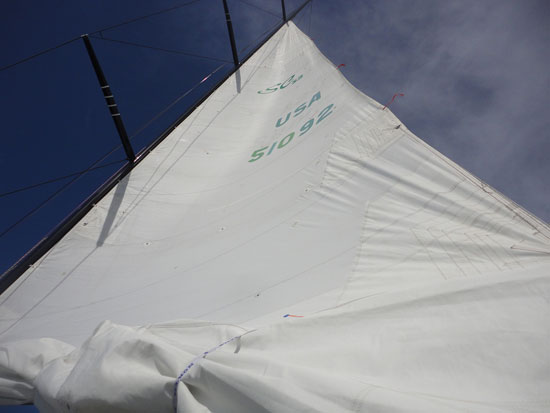
We’ve had a full day on the water this Easter Sunday. The winds stayed pretty solid, mostly 15 to 20 knots and kept pushing directly into our nose, making it difficult to sail … so we continued to motor. About noon, we did hoist the mainsail to a “2nd reef” position – about half its full size. This is done to help stabilize the boat in the waves. When the winds blow stronger, we make the sails smaller so we can better control the boat. 

Mainsail 2nd ReefMainsail in “2nd reef” position

Here Bo IV crewmember Heather explains what reef points are and why they matter when you’re using the motor on the boat.

We’ve been out here since noon on Saturday, and it’s now about 21:00 hours on Sunday, so that’s about 33 hours total time. So far, we’ve gone about 225 miles and have about 180 miles left before we reach Turtle Bay, where we’ll stop for more fuel before heading on to San Diego.

We’ve seen some fun wildlife today. First off, this morning we were visited by a colony of seals. There were quite a few of them and they kept us entertained by following along with us, playing in the wake of the boat and body surfing the waves alongside Bodacious IV. They look like they had nothing much else to do but play – which was entirely fine by all of us.


A seal colony comes to visit

Later in the day, we came upon a feeding frenzy. We could see a flock of pelicans diving into the water and making all sorts of commotion. I’m guessing there were 100 of them in the area. At the same time, we could see a lot of dolphins surfacing and jumping. What it looked like to us was that the dolphins had run into a school of smaller fish, and were forcing them to the surface as they fed on them, at which point those fish pushed to the surface became easy glistening targets for the pelicans.


A nearby bird and fish feeding frenzy

This is an example of what’s called a “food chain” in nature, where bigger fish feed on smaller fish, and other animals then feed on various even smaller species. It was sure interesting to watch the whole event unfold, which Captain Tim Eades did from his special little nest.

Captain Tim EadesCaptain Tim Eades

Given the wind and waves conditions, we’ve found the easiest course to stay along the
coast in about 60 feet of water. We’re not entirely sure just why at this depth, the waves and wind are less, but the advice we were given by local sailors has been holding true.

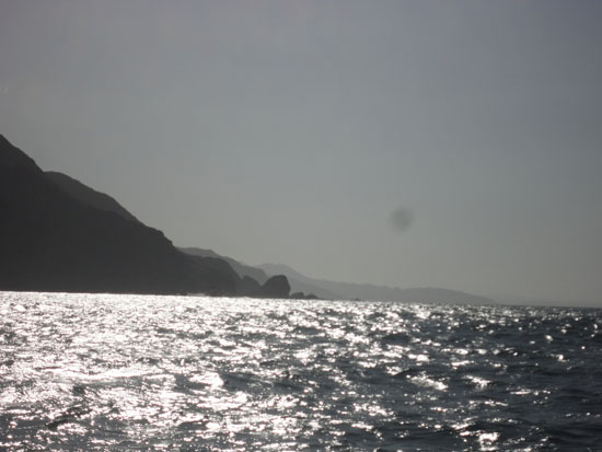
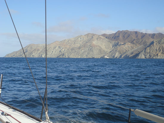
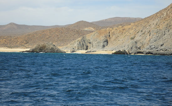
Baja CoastlineAs we watch the coast go by, we can see how dry and arid the desert landscape is. Often it is barren or sandy with only brush and cactus – very brown and dry-looking. Also, at night, there are very few lights on the shore which tells us that there are very few inhabitants, and those that are there are mostly small, subsistence fishermen who live in small shacks while they fish the area.

We were told that along this coast that fresh water is a valuable thing, and that if we need something from these people that offering them fresh water in return is a common courtesy.

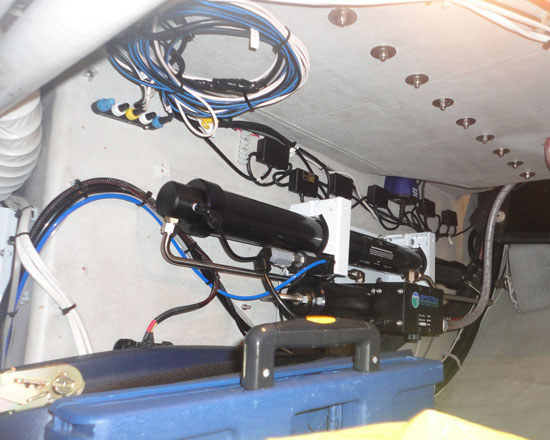
Watermaker and Wiring
This is Bo IV’s onboard watermaker.

Bo IV has a system on board that takes salt water and desalinates it in to fresh water. So, as long as we have engine power and can use this machine, we can create fresh water out of salty ocean water – which of course comes in real handy, if we are all to have our several precious cups of coffee.

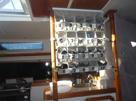
Crew Cups in Galley
The rack in the galley, where we store our cups.

After the long day on the water, we each take our turn keeping watch through the night, as we continue on to Turtle Bay.

More from this fantastic world tomorrow.

– Dave R., Tim, Heather, Jonathon and Dave H.

Bodacious Dream Expedition Day #2 Position:
25 44.205’ N, 112 08.983’ W
Boat speed: 7.3 knots
Course: 345 degrees