Tegan’s Science Notes #8: Glaciers

capt_dave_ac_125
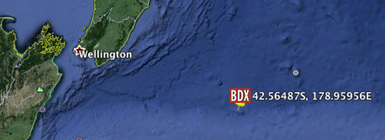
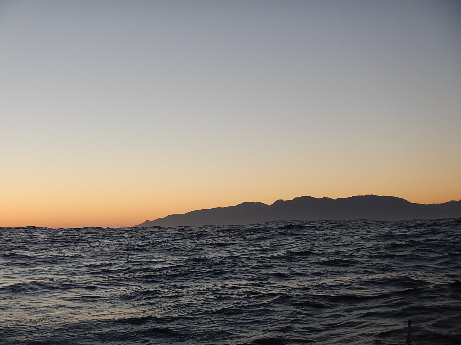
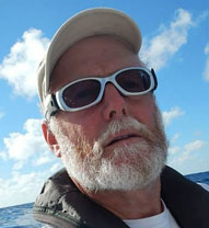
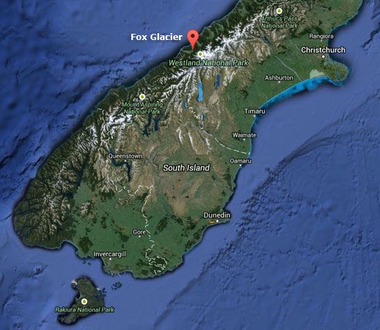
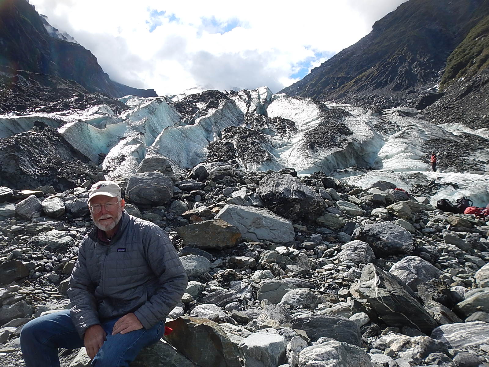
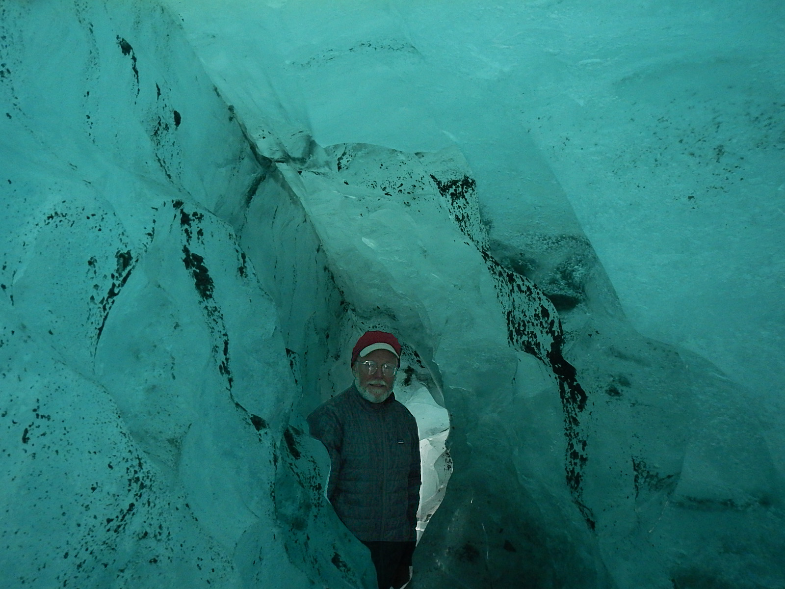
Dave Rearick: As promised, here’s the second half of our Glacier Report, the first part of which with my notes, photos and videos of my trip to Fox Glacier is viewable HERE!

Today’s follow-up post, from our Earthwatch Scientist, Tegan Mortimer summarizes much of what science has learned about glaciers. Tegan knows a lot about glaciers, so I encourage you to read on and learn more about this important subject.

And if you would like to share these learnings with those younger than yourself, be sure to check out our new (and easily printable) Explorer Guide on Glaciers – or engage Tegan or I with questions via email.

So, take it away, Tegan! 

_______________________________________________________________
1. The Power of Ice: Discovering the Glacial Landscape

Tegan MortimerTegan Mortimer: Did you know that Charles Darwin was a geologist? Many of the thoughts in his most famous work, The Origin of Species were influenced by early discoveries in geomorphology – a field of science which tries to explain how landscapes change based on the pressures placed upon them. Ice is one of the greatest creators of landscapes. Just as Dave described the Great Lakes being carved out by glaciers in his previous post, in that same way was Cape Cod along with many other features of my native Massachusetts coastline also carved out by glaciers. When you really look closer, it’s possible to discover much of the history of a landscape by the way it looks today.

The photo below is of a place in North Wales called Cwm Idwal (in Welsh a “w” is a vowel and is pronounced like “oo”) in the Glyderau Mountains.

cwm_idwal_560
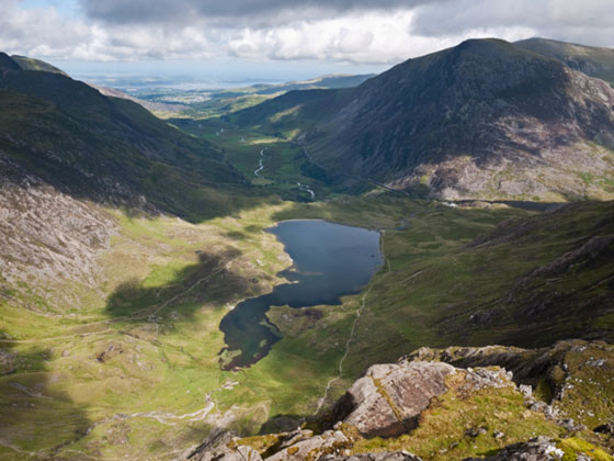
Cwm Idal in the Glyderai Mountains of North Wales

Charles Darwin visited Cwm Idwal in 1831 to study the many fossils of ancient marine life that were found in its rocks. What they showed was that this land was once the bottom of the sea! For Darwin and his fellow geologists who were trying to show that landscapes could be shaped and changed in this way, these findings were so exciting that they somehow missed something even bigger!

It was another 10 years before Darwin returned to Cwm Idwal and this time he noticed the very obvious evidence of glaciation on the landscape. Cwm Idwal is what geologists call a “hanging valley” (alternately called a cirque, or a corrie or a cwm), which is the area from which a mountain glacier originates. Below Cwm Idwal, stretches a wide glacial U-shaped valley, which reaches all the way to current sea level. Cwm Idwal and the surrounding area are a wonderful example of “typical” glacial features.

2. How glaciers change the landscape

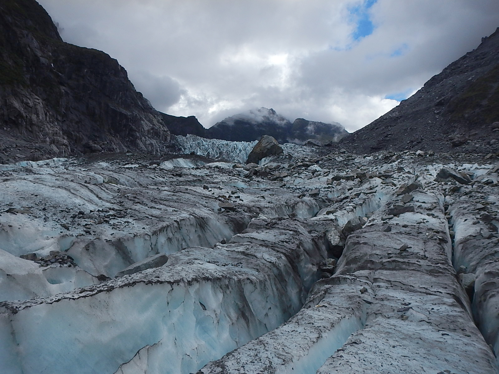
Glaciers and ice sheets form landscapes through two methods. The first happens when glaciers erode the landscape by scraping up the soil and bedrock after which they then deposit this material in other places.

NZ_scavenger_hunt_sidebarDepending on the type of rock that a glacier is moving over, different glacial features will be left behind. Soft rocks like sandstone or limestone are easily ground up by the pressure of the ice, while harder rocks like granite are usually eroded through a process called “plucking.” What happens here is that water from the glacier melts into cracks in the rocks which than refreezes. As the ice in the glacier moves, it plucks away pieces of rock which are then trapped in the ice. Water expands when it freezes and is capable of further breaking apart rocks in what is called “freeze-thaw weathering.

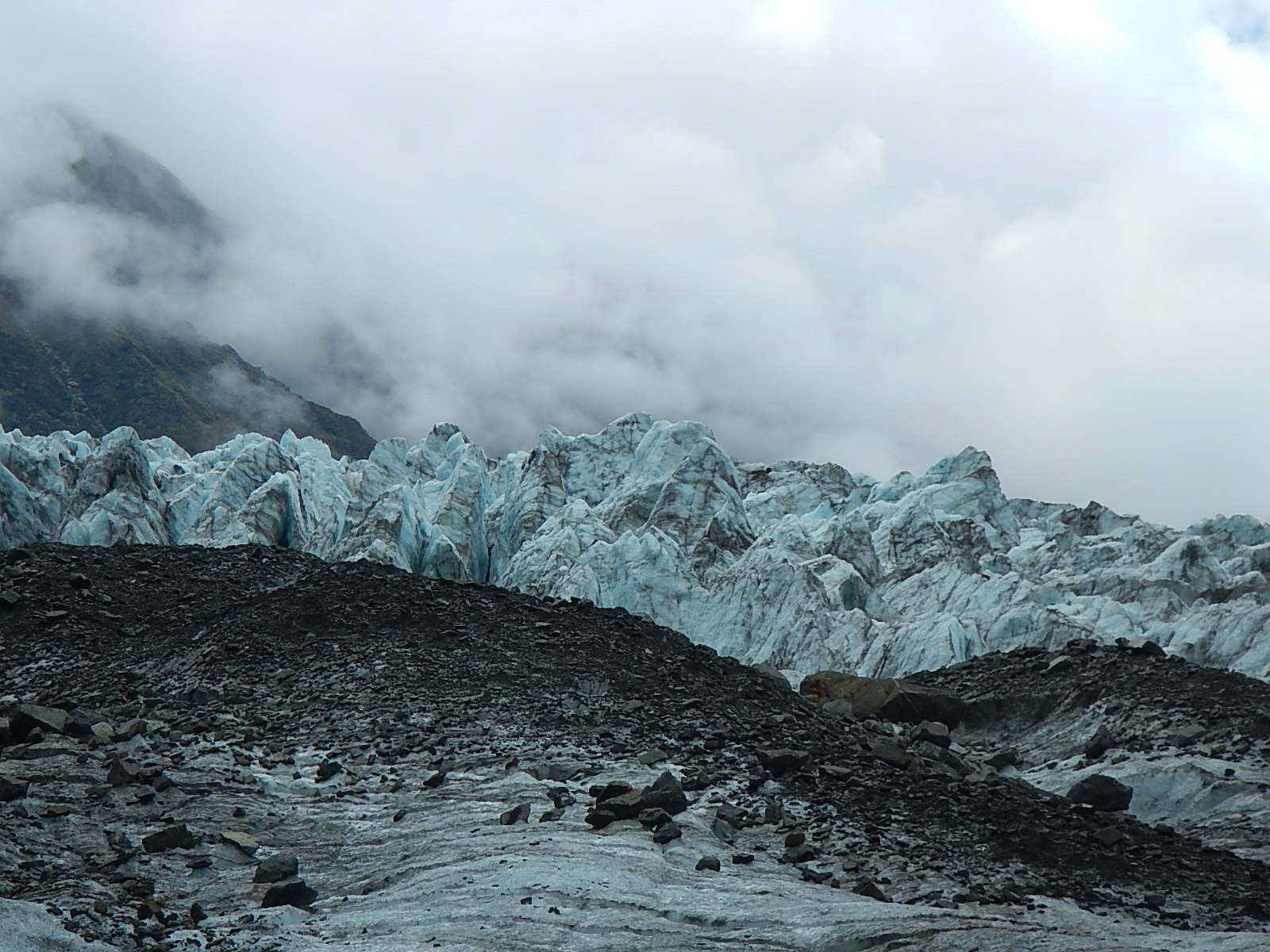
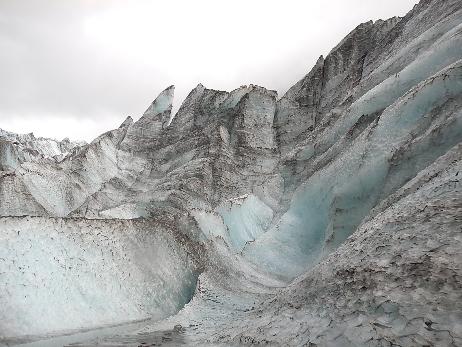
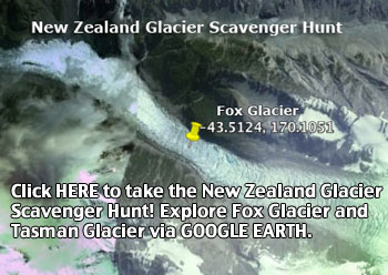
(:: For a fun sidetrip, explore Fox Glacier via Google Earth by clicking on this link or the image above!)

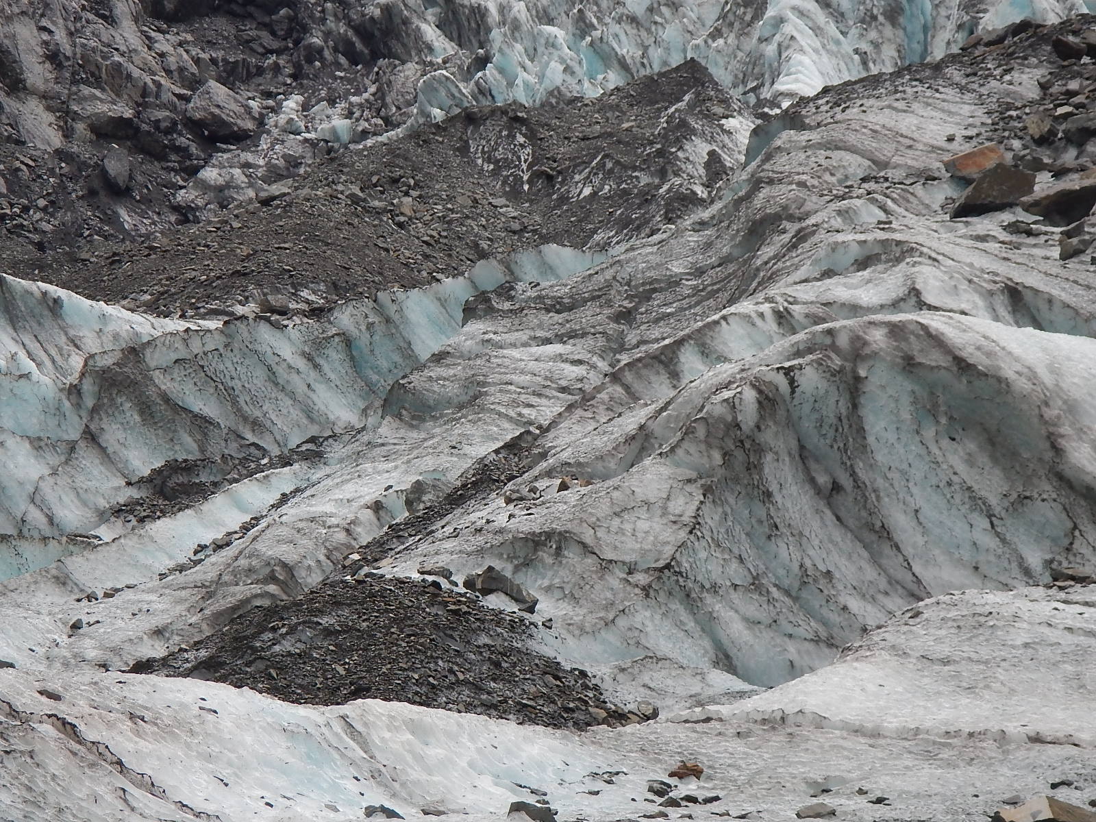
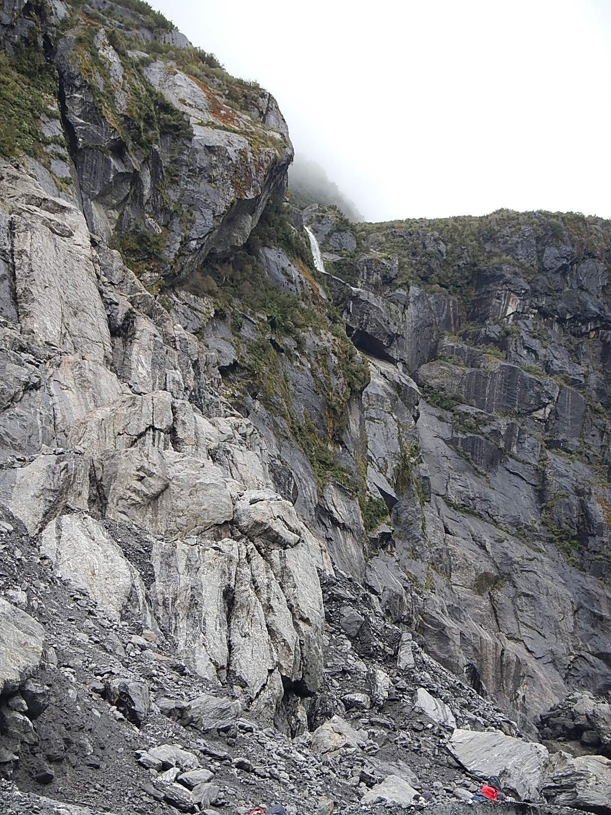
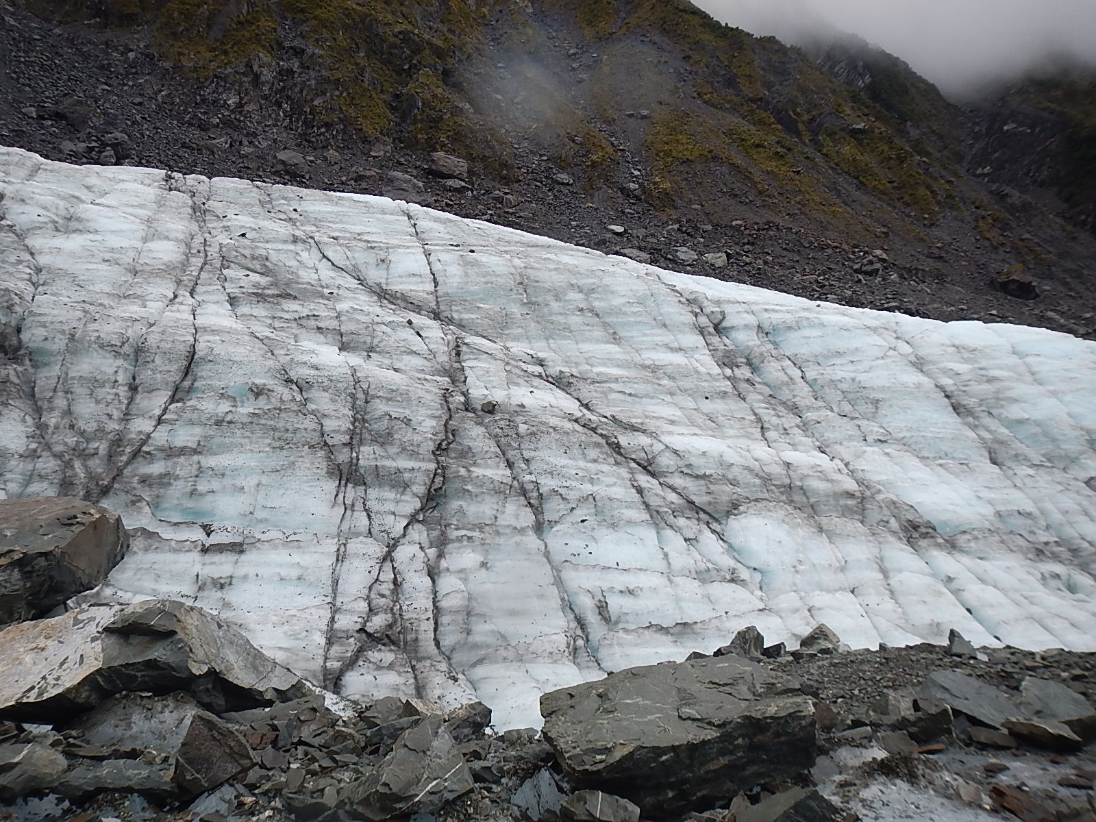
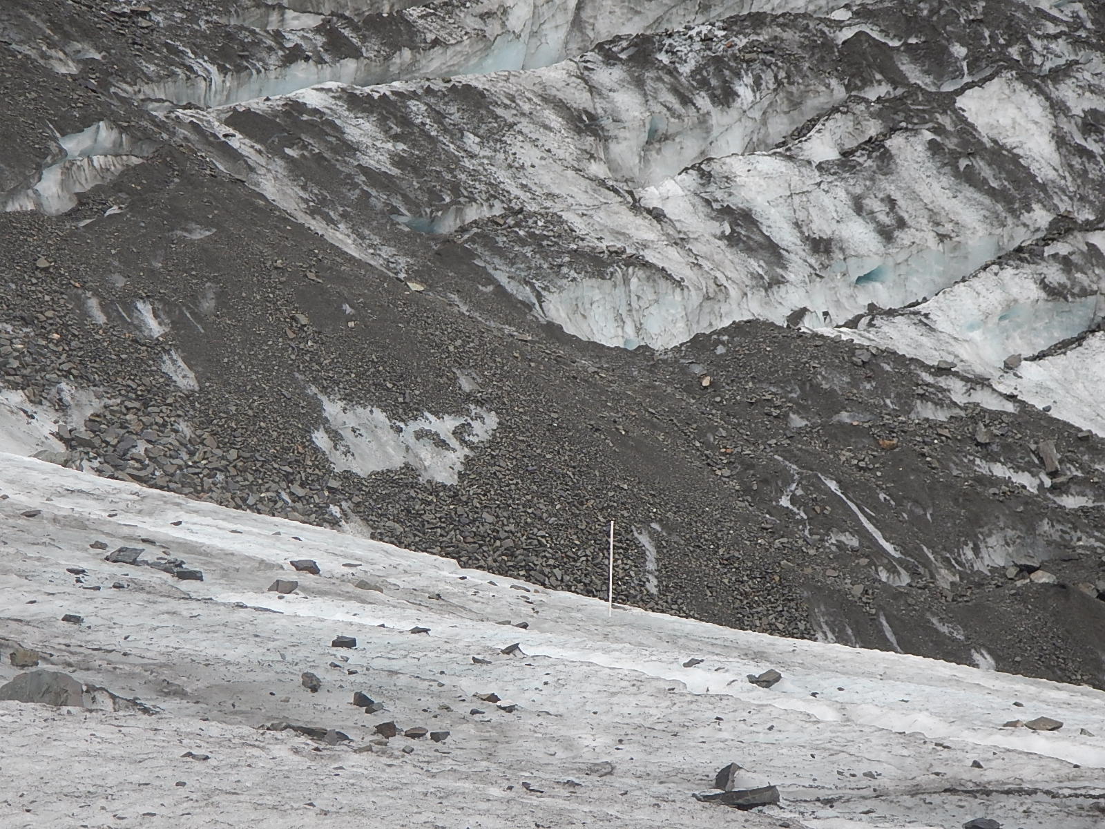
The second method of erosion results in a roche moutonnée or a whaleback, which is an area of exposed bedrock, which has a smooth gently-sloped side and a steep vertical side. The photo below shows a few roche moutonnées which are only a few feet tall, though it is possible to see very large ones as well. Based on the direction of the sloping and angle of the sides you can tell which direction the glacier was moving. Remember that fact, as it will come up again later. The sloping side is the direction the glacier was coming from and the ice grinds down that side of the rock. The steeper sided angle is the direction the glacier was going and here is where that process called plucking happens. The tops of roche moutonnées often have scratches called striations which are horizontal scape marks from the rocks and debris in the ice.
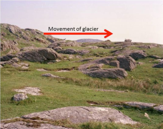
whaleback_535
Roche moutonnées

Crag and Tail
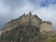
Another erosional feature is called a crag and tail which is a tall hill usually with exposed rock and a gently sloping tail of softer rock behind it. In this case, the steep side of the hill is the direction that the glacier came from. The most famous crag and tail is Edinburgh Castle (pictured to the left)  in Edinburgh, Scotland. The crag in a crag and tail is an area of very hard rock, usually a volcanic plug which forms when magma cools inside the vent of a volcano creating a column of very hard rock. When the glacier hits this rock, it can’t erode it, so it is forced to flow around the plug like water flowing around rocks in a stream. The plug protects the softer rock behind it leading to the formation of the tail.

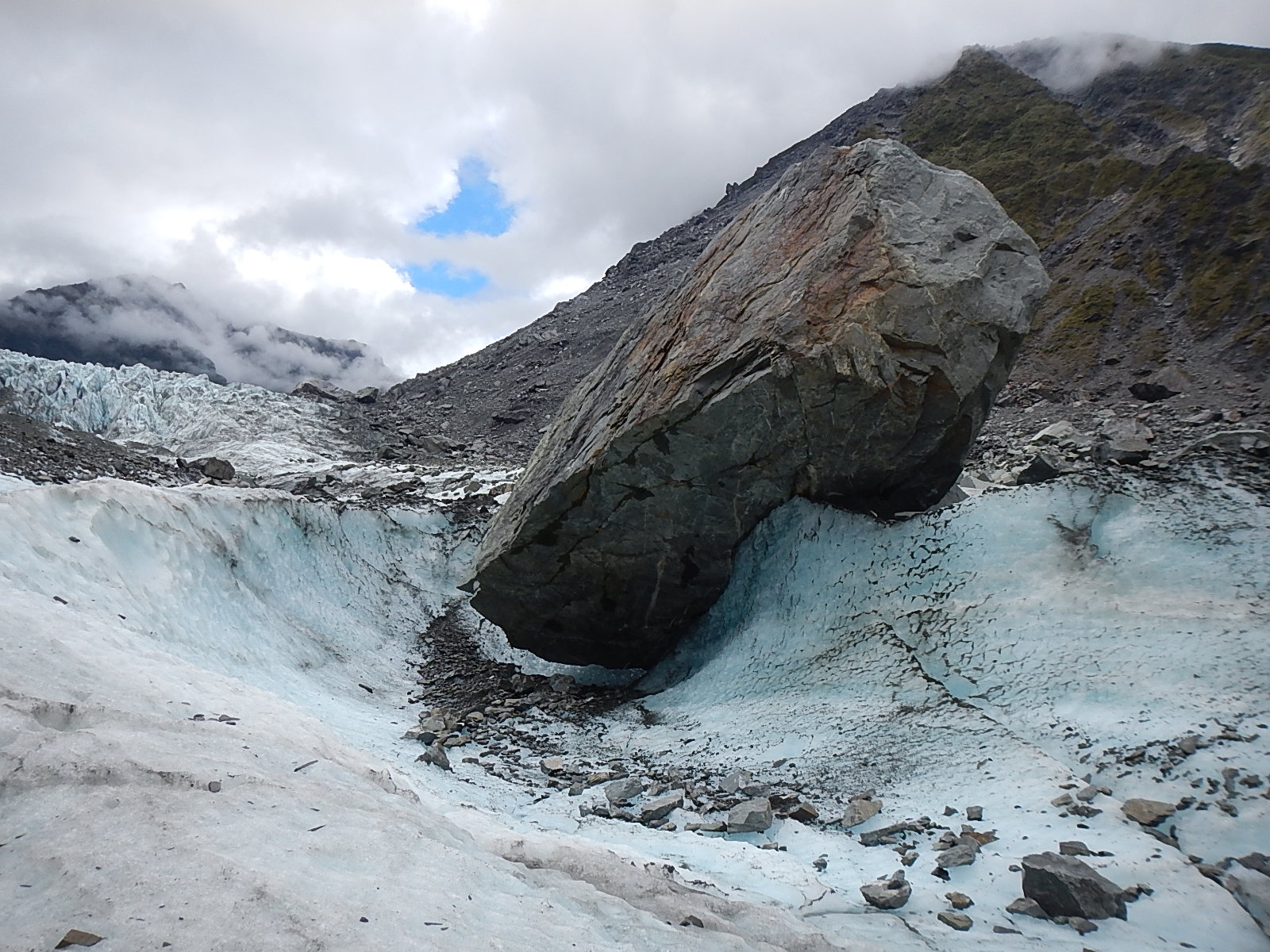
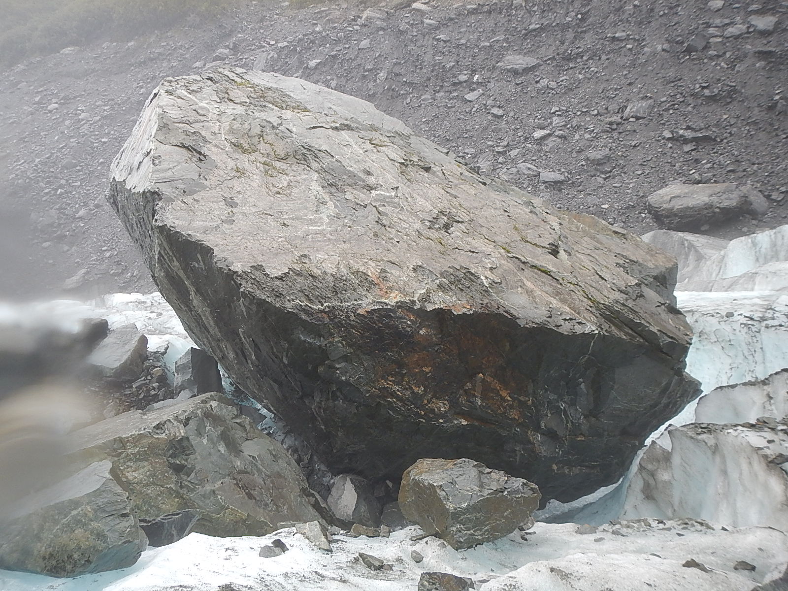
All that eroded material has to go somewhere, so it is that glaciers leave behind particular landforms made up of all that “stuff.” Sediment left behind by glaciers is usually called till, which is made up of sand and gravel and rocks of every size. Erratics are large rocks like the photo below which are left behind by a retreating glacier. Geologists study the mineral structure of erratics to learn where they come from and learn more about the behavior of glaciers and ice sheets.
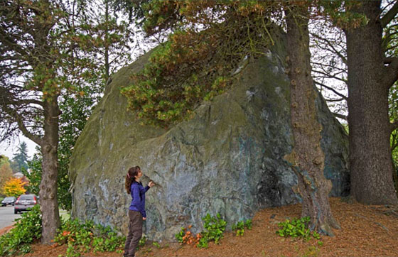
erratic_560
An Erratic

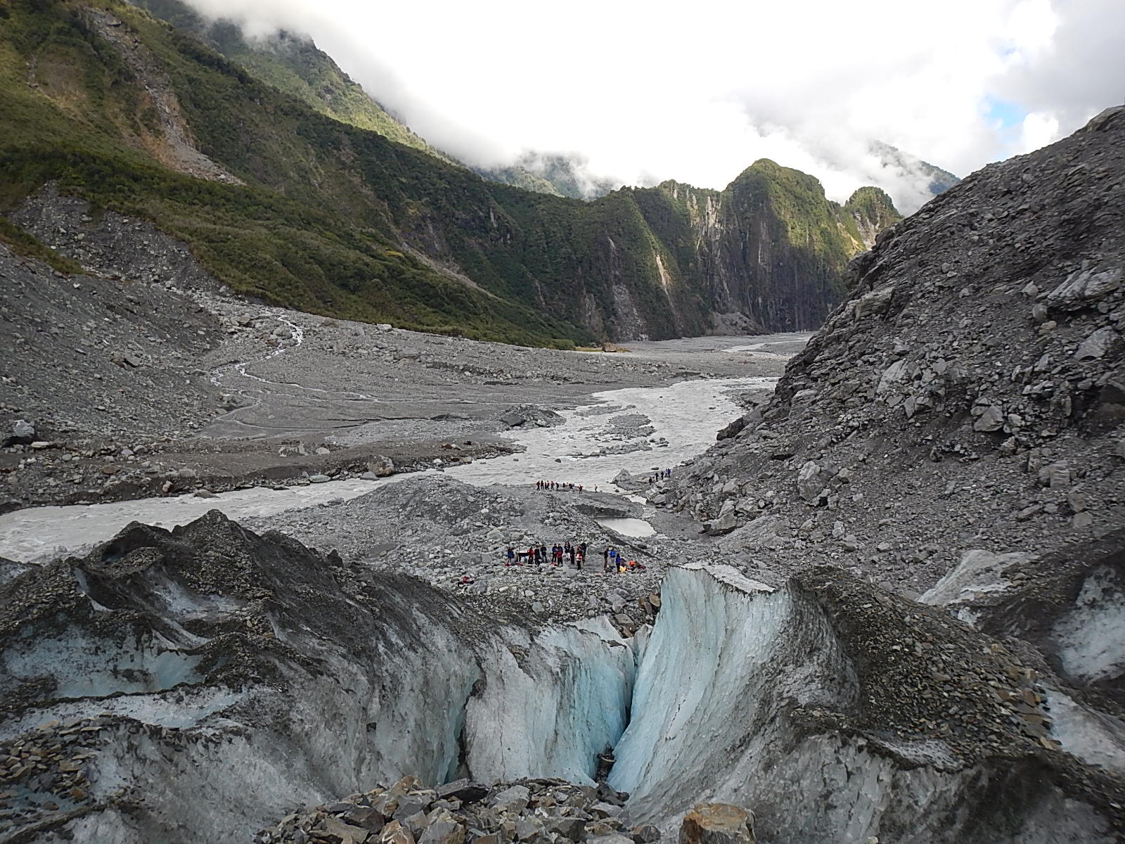
Glaciers push up ridges of material which are called moraines. These ridges can be formed at the base of the glacier which are called terminal moraines or at the edges of the glacier which are called lateral moraines. Cape Cod and Long Island on the US east coast are areas which have a series of terminal moraines formed thousands of years ago by the Laurentide ice sheet. As a glacier retreats, it can leave behind a series of terminal moraines which reflect the extent of the ice at different periods. Sometimes meltwater from a glacier will be kept from exiting a valley by a terminal moraine and will form a lake.

3. Glaciers Today

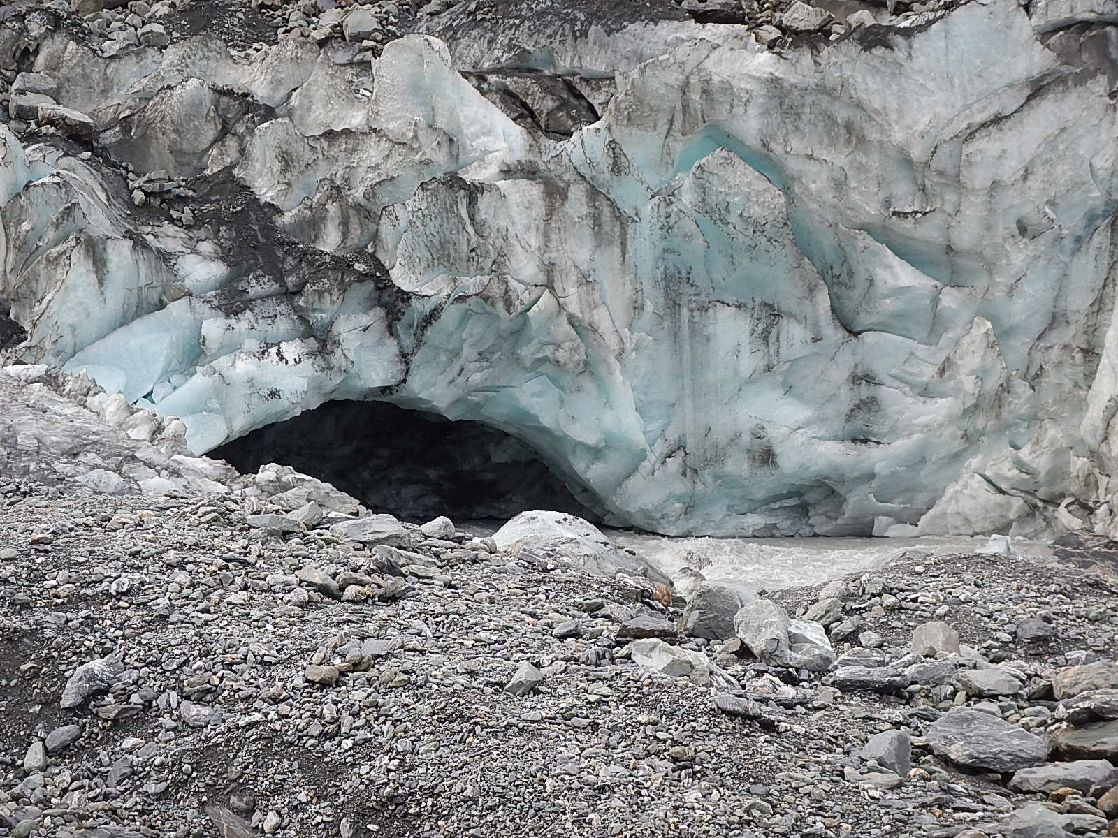
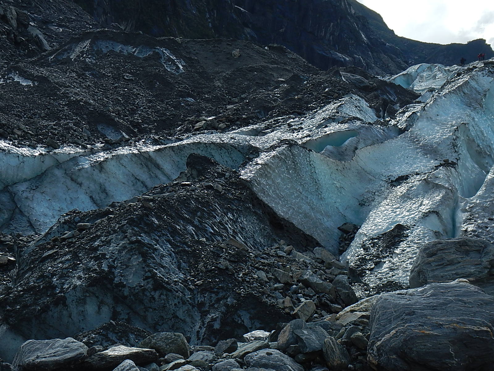
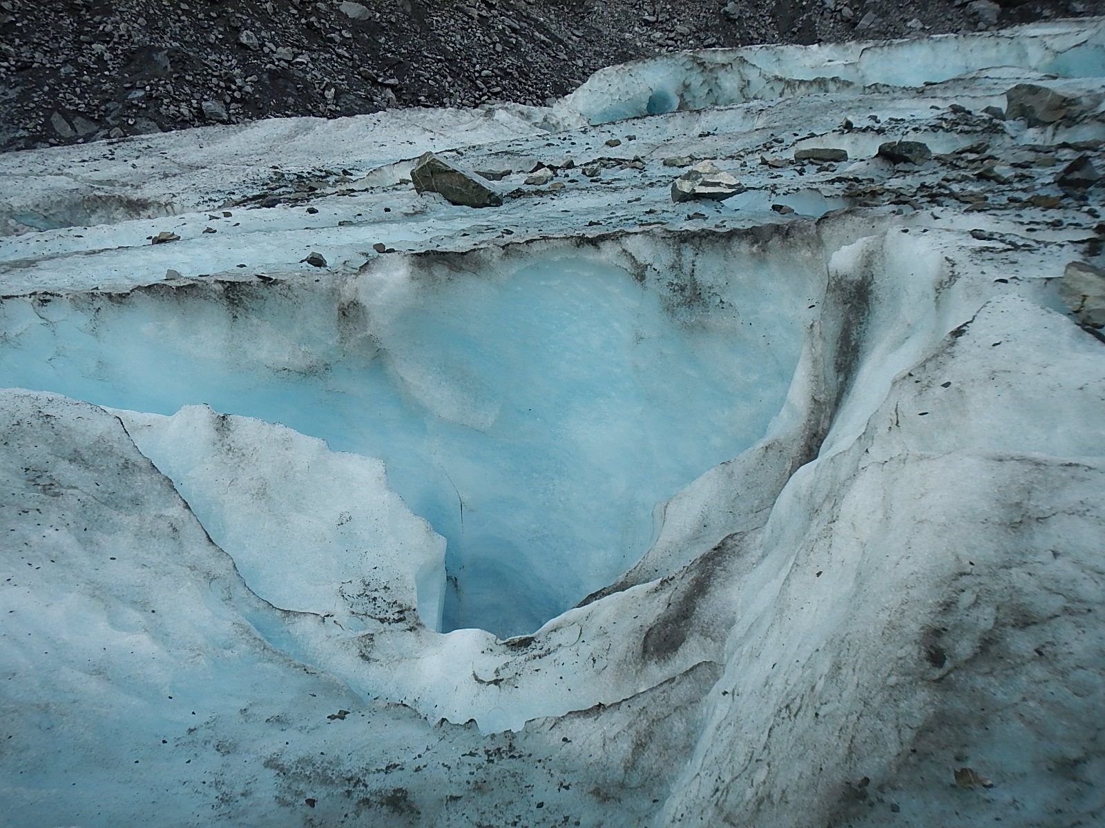
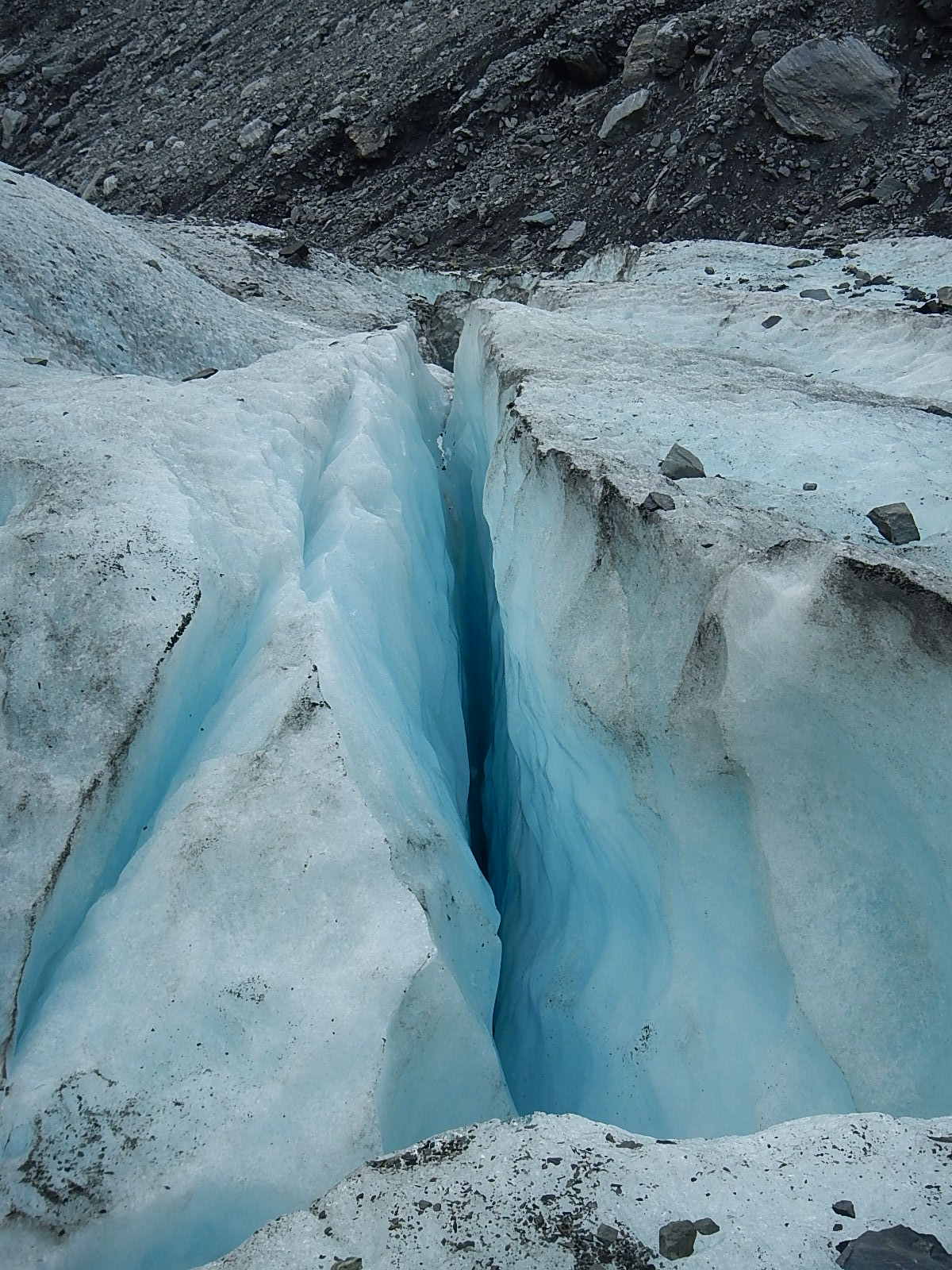
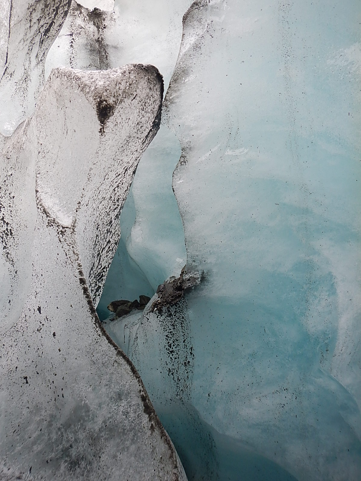
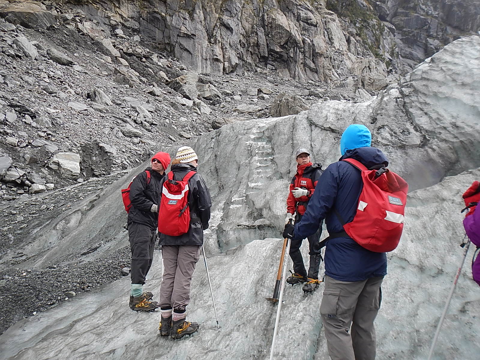
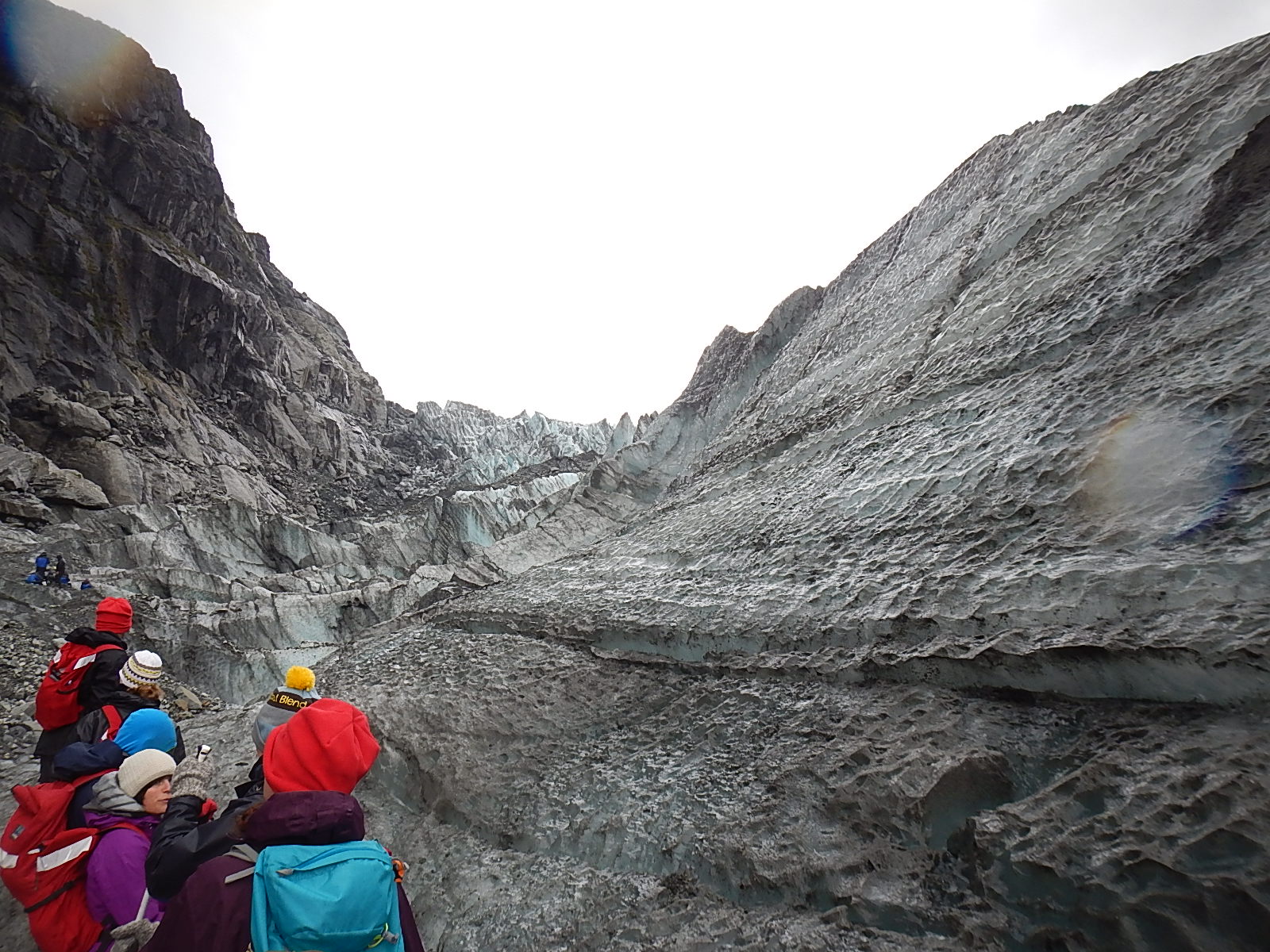
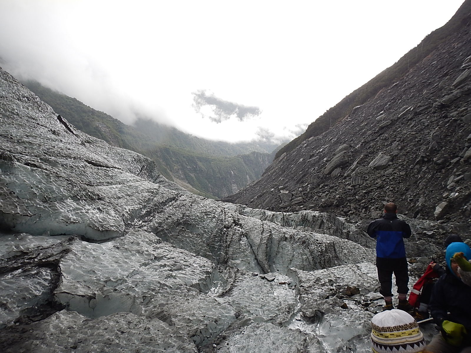
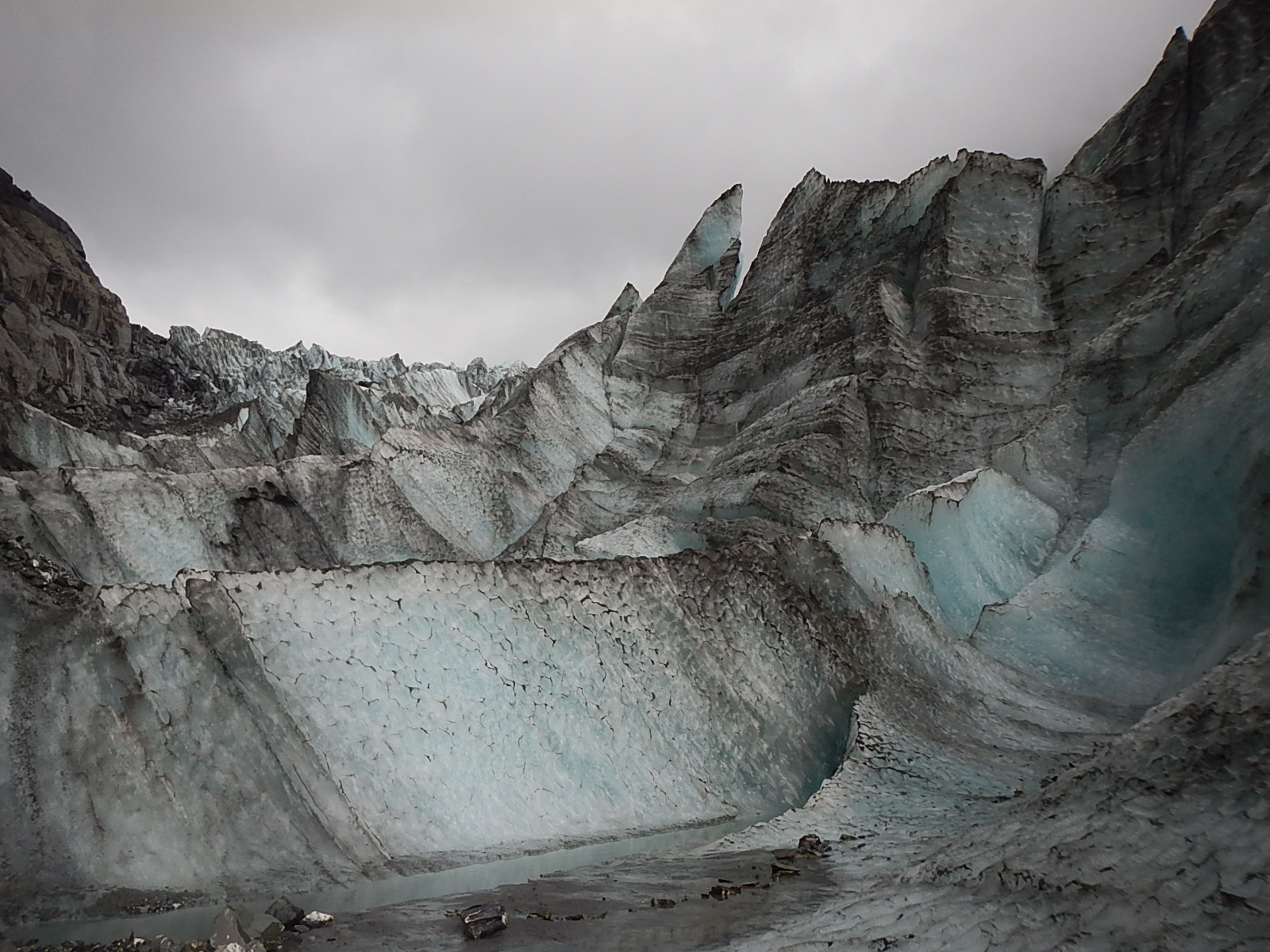
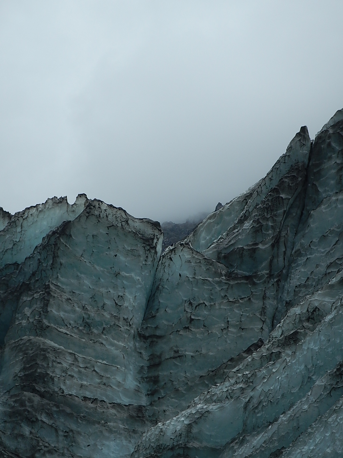
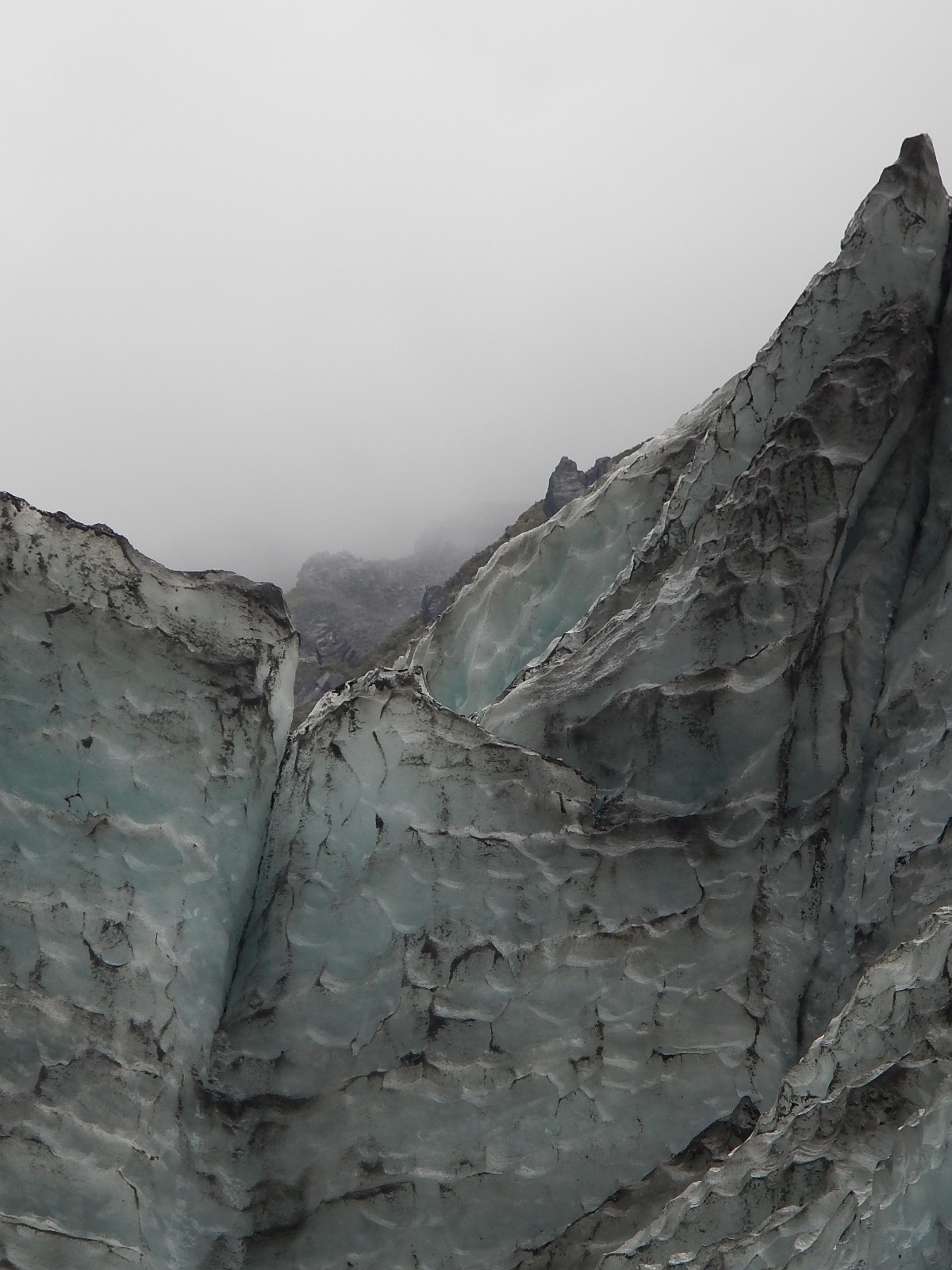
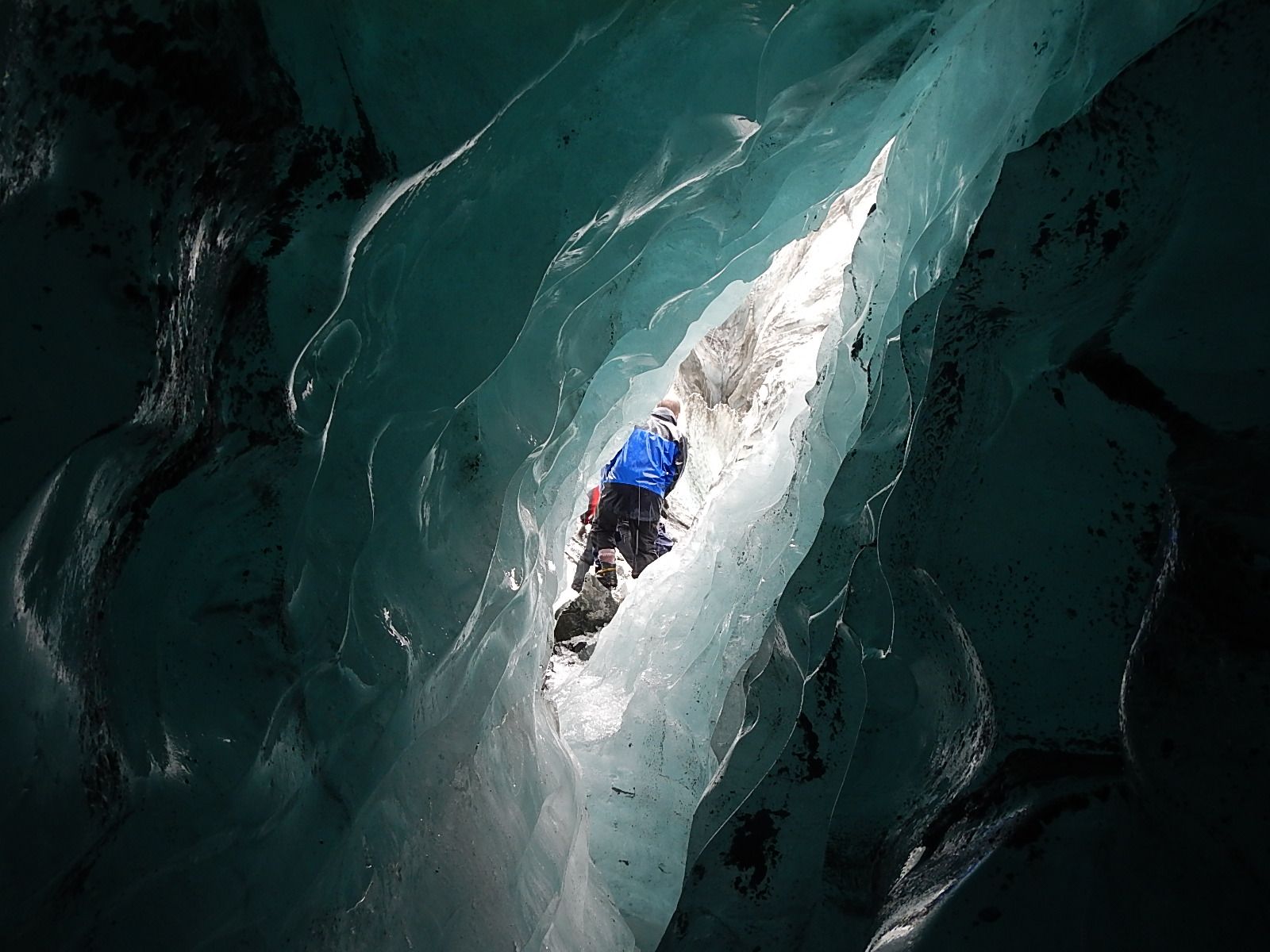
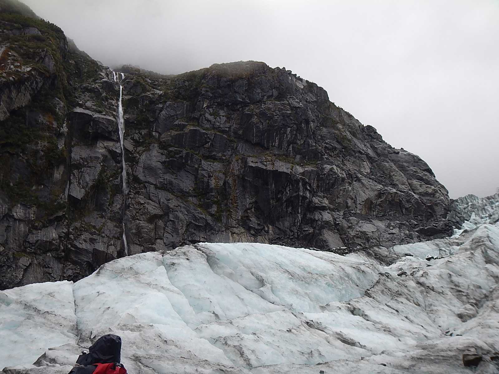
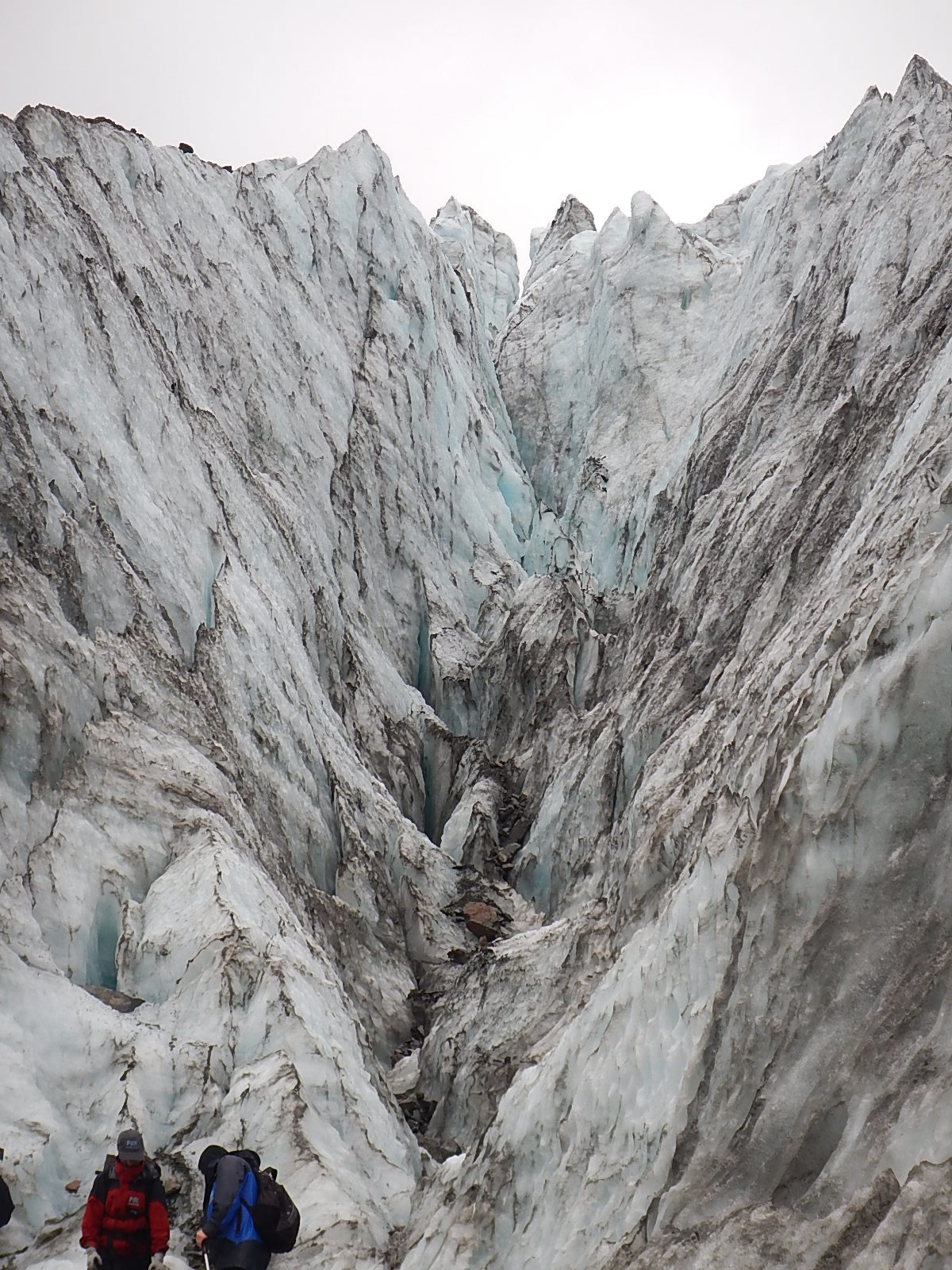
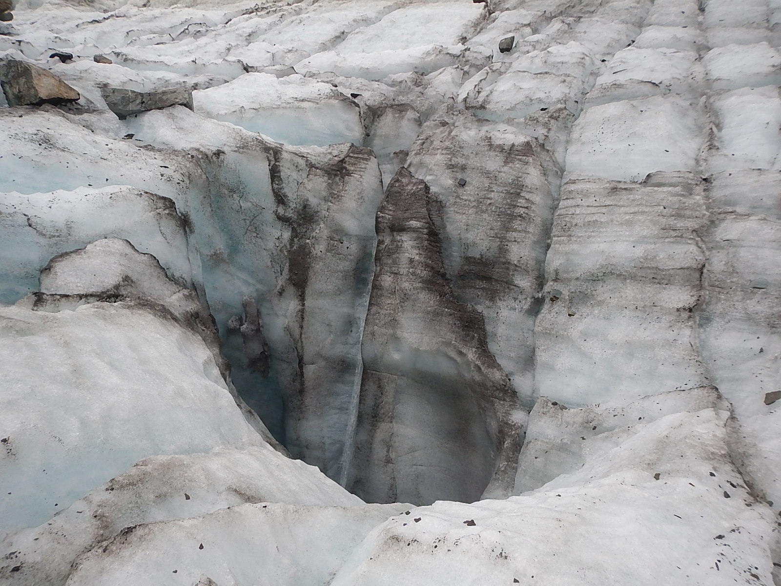
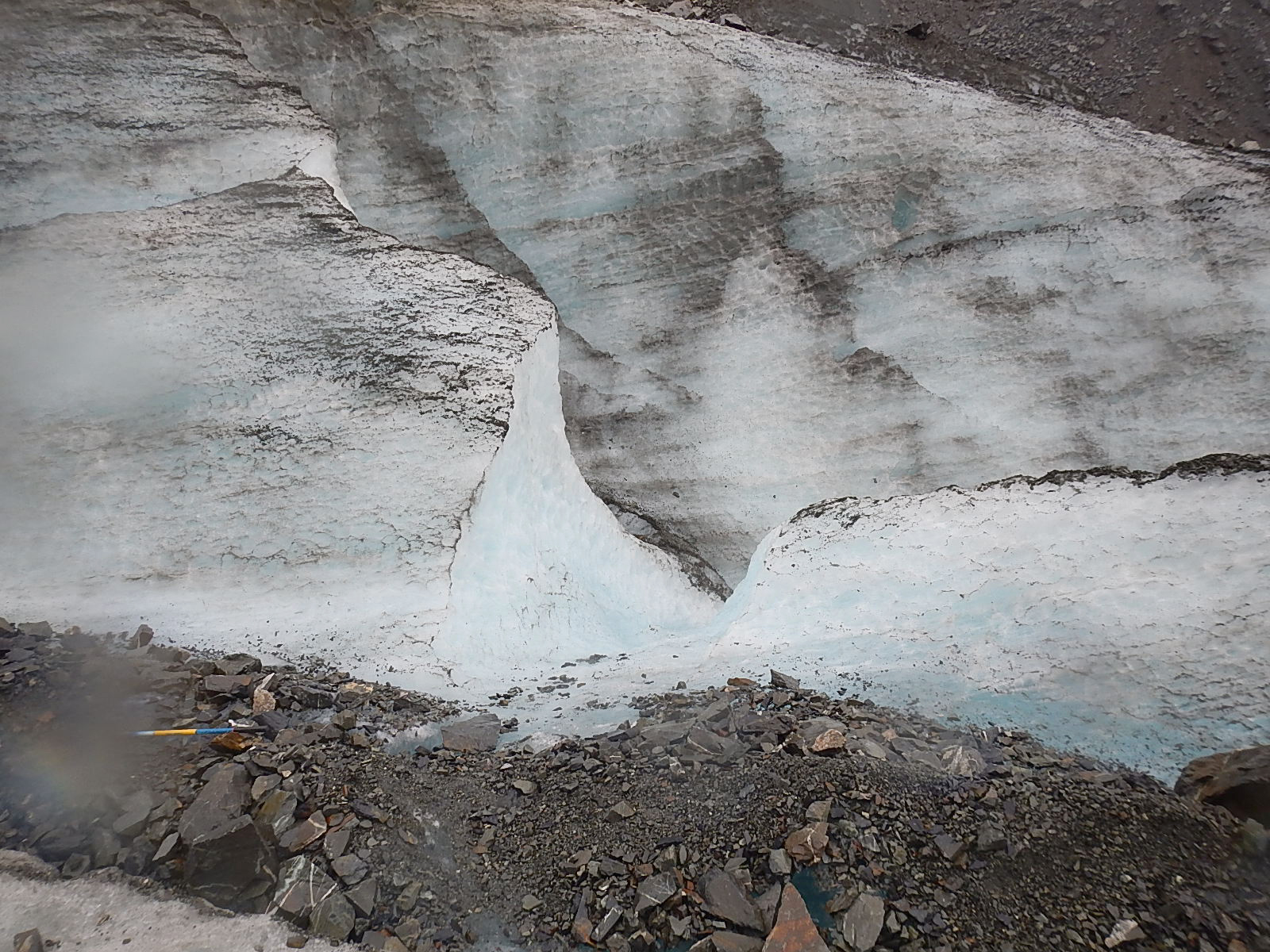
So what exactly is a glacier? Dave explained it pretty well; a glacier is essentially a river of ice. A river of ice? Since you can’t see it moving, how can that be? The fact is that glaciers are always on the move. The immense weight of the ice in a glacier causes it to deform internally, which results in unstoppable movement. Gravity and meltwater underneath the glacier can also help it to move downslope. The areas at the edges of the glacier are under less pressure so this is where great cracks in the ice called crevasses form. When pieces of a glacier fall off the base of the glacier it is call calving – which is happening lately at a much increased rate. Here is an incredible high-def clip from a recent movie called “Chasing Ice” that records the longest and biggest calving ever recorded.

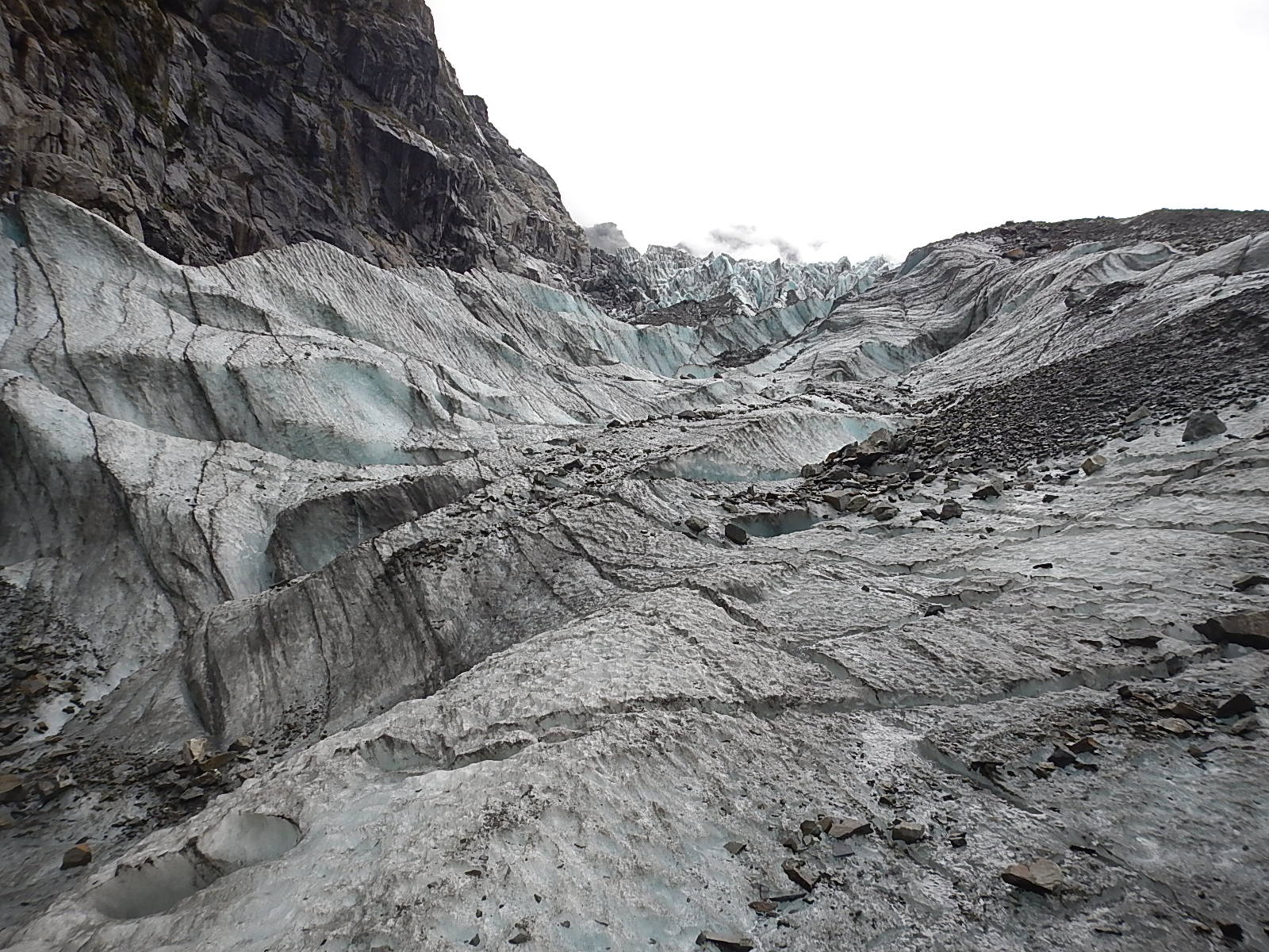
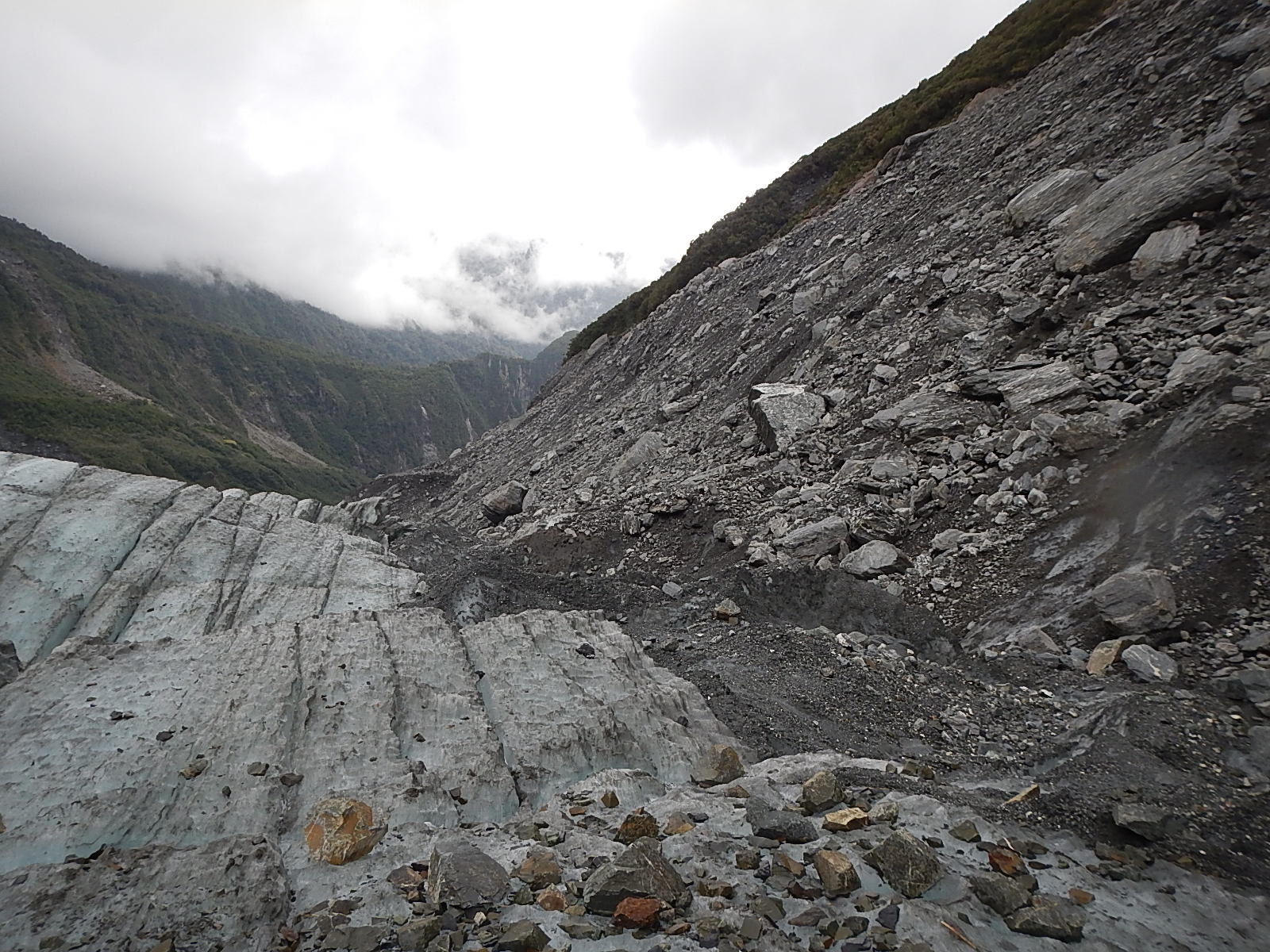
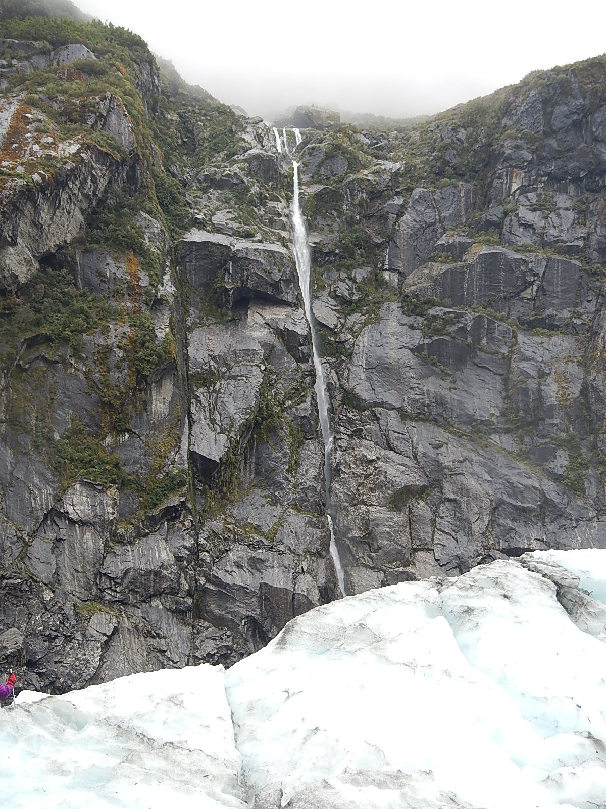
We know Fox Glacier is retreating, so how then is it moving downhill? The growth of a glacier is based on something called mass balance. Snow falls on the top of the glacier and freezes while ice from the bottom of the glacier melts or breaks off, a process that is called ablation. As long as the accumulation at the top outweighs the ablation at the bottom, the glacier will grow. However, if the ablation outweighs the accumulation, then the glacier will retreat. This is the case of the Fox Glacier, and unfortunately the case for many glaciers around the world.

4. Does it really matter if the glaciers disappear?

It would most certainly be a tragedy if alpine glaciers were to disappear due to the effects of human climate change. They are majestic places to behold and also provide revenue from tourism to areas in these regions. However, and more importantly, glaciers also provide huge stores of fresh water, which are released throughout the year. For example, about 1.3 billion people depend on Himalayan glaciers for drinking water and other water needs. If these resources were to disappear, it would have devastating effects on human populations.

5. Glaciers of the Past

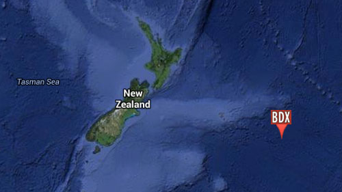
At times throughout Earth’s history, huge swathes of the planet have been covered by ice. We know that some of these ice sheets covered thousands of miles and could be several miles thick. Such ice ages can last for millions of years and go through a series of glacial and interglacial periods where ice cover increases and decreases. The last ice age started 2.6 million years ago and is still ongoing today. We are currently in an interglacial period called the Holocene, which started 12,000 years ago. When people talk about the “Ice Age” they are usually talking about the previous glacial period, which occurred from 110,000 to 12,000 years ago. The ice was at its greatest expanse just 22,000 years ago when most of the northern half of North America and northern Europe and Asia were covered in ice. In the Southern Hemisphere, the Andes in South America and Southern Alps in New Zealand had large ice caps as well.

glaciation_560
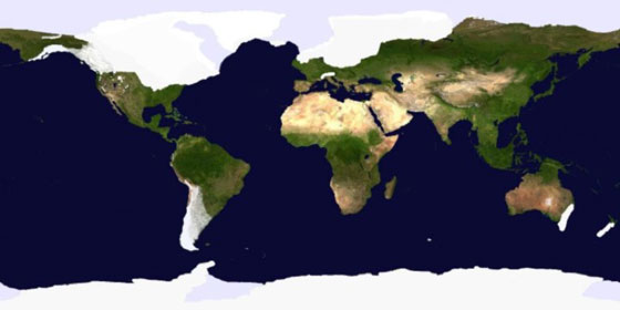
The glaciated landscapes of North America, Europe, South America, and New Zealand were formed during this Ice Age.

6. What happens when massive ice sheets disappear?

The most important thing to remember is that ice sheets (and glaciers) hold a huge amount of water. The sea level was about 120 meters lower during the last glacial period than it is today. We still have two major ice sheets on earth, the Antarctic Ice Sheet and the Greenland Ice Sheet. If these were to melt – which they give every indication of doing, and quite rapidly, we would see increases to sea level, which would threaten many coastal cities and sea-dependent communities across the globe.

See all Dave’s photos and videos from Fox Glacier right HERE!

– Tegan

:: Tegan Mortimer is a scientist with Earthwatch Institute. For more exciting science insights, check out our BDX Explorer Guides or stop by our Citizen Science Resources page, where you can also find all of Tegan’s previous “Science Notes.”

We welcome your input or participation on our BDX Learning Discovery efforts. You can always reach us here or via email.

A Day so Grey it Disappeared!

At some point over the weekend, we crossed the International Date Line … which meant I had to sail the same day all over again! As the world is divided into 24 time zones, there has to be a place where there is a difference in days, somewhere the day truly “starts” on the planet. Thus, the 180° line of longitude, exactly one-half way around the planet from Greenwich, England and 0° longitude is approximately where the International Date Line is located, and as we crossed the line from west to the east, a day was subtracted.

Looking around at the sky and sea, it sure looks like this could have been yesterday, as the conditions the past few days have been so much the same. What we have are grey Southern Ocean skies, grey Southern Ocean waves, moderate Southern Ocean winds patrolled by grey and white Southern Ocean albatross. Much the same, day in and day out … but that’s not a complaint – not at all! Actually, I’m quite grateful for the moderate conditions, which have allowed me to more gradually transition from land to sea and to work through the emotions of leaving friendly company to being alone and still far from home.

grey_day_500
Grey, like I said … 

Despite my love for the adventuring lifestyle, each time I leave harbor and set out again, I’m spent for a couple of days, as I transition from the more manageable life on land to the more unpredictable demands that await me at sea. After a few days though, the transition is mostly complete and my focus shifts back to the journey and destinations ahead instead of aft at the land and friends fading beyond the horizon.

So now, Bo, Franklin and I work our way east towards an imaginary point about 120°W longitude, where we will look for our chance to make a turn north towards the Galapagos Islands. Until then, I spend my days sailing the boat, looking out at the vast ocean, watching and studying the dozen or so albatross that glide over the undulating waves, up and down back and forth as they circle the boat, watching me with one eye as they soar by. I suspect they find my sailing as curious as I find their flying. Perhaps, as the old sailors believe, they are the souls of dead sailors guiding and watching out for me, as I sail through their neighborhoods.

albatross_500
Our boon companion … the Southern Ocean albatross

Today, we look to catch our first cold front. It’s not expected to be a strong one, but likely will bring with it with some mix of weather – a shift of winds, a drop in temperatures and a change in patterns – each shift playing some part in moving me along on his journey, though for now, they look to be gentle changes and positive movements.

Last night, we had rain … and more rain, refreshingly washing the last of the dust from land off this ocean-bound vessel. And in the dark of night, we had visitors … strange looking creatures that seem to only fly at night … flying squid! Two of them landed on deck and waited until morning for me to return them back to the waters, but not before I captured their unique features on camera.

flying_squid3_500
Night visitors

In some ways, they are ugly, and in other ways, beautiful … beautiful in the way that such creatures are that must adapt their appearance to a world in which they must struggle to find a place, to exist and to thrive … and to occasionally catch a lift on a strange passing vessel!

Screen-Shot-2014-03-31-at-1.5746.08018S, 169.01413W

So, we continue sailing … now about 700 miles east of New Zealand headed for that waypoint about two weeks away where we’ll make adjustments and the changes to our navigation that will take us in the direction of the amazing Galapagos Islands. So, off we go!

Thanks so much for following along. I’ll be back soon with more.

– Dave, Bodacious Dream and Franklin (who’s back to his bouncy self)

:: BDX Website :: Email List Sign-Up :: Explorer Guides :: BDX Facebook

Departing Wellington

Dave RearickAfter some last minute circus maneuvers, we finally pulled away from the slip in Chaffers Marina, Wellington, NZ about 11:15 AM local time in little or no air. (Because of the time differences, that was my Thursday and your Wednesday back in the U.S. … so it’s already Saturday here.) I had to motor for the first hour or so, until I got far enough out of the large harbor to pick up some air… which even then wasn’t much. It died off at sunset only to return later and build up to 30 knots during the night!

By late morning, the winds had diminished and by afternoon, I was drifting and motoring to keep forward progress. The seas have been huge and sloppy, which made for an uncomfortable first day, as I tried to regain my sea legs and get back into the rhythm of the boat and sea. That’s not always easy and can make accomplishing even mundane tasks rather difficult. But, that difficulty seems to be slipping away just as the silhouette of New Zealand’s North Island did in yesterday’s sunset. (See a slideshow of photos below.)

42.56487S, 178.95956E42.56487S, 178.95956E

Presently, I’m about 250 miles away from Wellington and headed east to pick up the trade winds… in a couple of weeks. Yes, you read that right – a couple of weeks away. That’s where they be. It’s big water out here in the Pacific. When I do catch them, we will begin to shift north to make the sail to the Galapagos Islands. That’s what you have to do… head pretty far east before turning north so that you can get the proper wind angles for sailing.

So, off we go! All the best to you all. I’ll be back with more in a few days.

– Dave, Bodacious Dream and Franklin (who’s back to his bouncy self)

Here are some photos of the departure in slideshow format. They play automatically, but you can click the arrows to move them along.


Leg 3 and the Winds of Change

Bodacious Dream and I just departed Wellington, New Zealand set upon Leg 3 of the circumnavigation! We’re very excited to be back at sea! I greatly enjoyed my stay here with all the close friends I’ve made, both recently and over the past two years, but the time has come to head once more beyond the horizon. Bo is looking and feeling good after a major maintenance overhaul – and we’re both all about getting rolling again!

DeparturesBack in the Flow … 

Sailing, as many of you know, is a practice that requires regular adjustments. You must constantly monitor weather, winds, seas and other conditions and then make the necessary changes to your course and trim. This global voyage we are on is no different, though sometimes it happens that the adjustments necessitated are more significant than usual.

After arriving in Wellington, I had to make a trip home to the states for personal and family reasons. It was good to visit with my people and to have that time with each other. But with the trip home, weather issues and other delays along the way, it has become necessary to make some changes to our gameplan so that we might continue in a proper and seamanlike manner.

prow_550The change I am talking about affects the route the circumnavigation will take. Cape Horn, which my good friend Tim Kent calls, the Everest of sailing, has always been on our course for the circumnavigation, as well as a long-held dream of mine to experience first-hand. Unfortunately with the delays, the season has become quite late, and by the time I reach Cape Horn, it would be the equivalent of November 1st in the Northern Hemisphere. Considering this and other factors, it appears that I will have to sadly leave sailing around Cape Horn for another time.

I have decided to head instead up through the Pacific Ocean, which will allow me a stopover in the amazing Galapagos Islands followed by a transit through the Panama Canal. Both of these experiences will be exciting and rewarding and have long been on my list of must-do’s. I’m hoping to arrive in the Galapagos sometime in early May. Once there, I will explore some of the amazing sites that these islands have provided scientists with incredibly unique research opportunities, ever since the days when Charles Darwin first visited on board the H.M.S. Beagle in 1831. I look forward to sharing this amazing place with you all.

bd_welling_550
Wellington Harbor and that long, low white cloud …

It’s not easy to leave New Zealand, land of the long, low white cloud. I’ve become quite fond of its beautiful landscapes, mountains and glaciers and the many wonderful people who have shown their support to me and to our venture: from David Minors, the great crews at Duffy Rigging, Matty G. at MG Composites to the awesome guys at North Sails and Barton’s Marine. And then there are my friends at the Royal Port Nelson Yacht Club, Chaffer’s Marina as well as a host of others including Lapo and Renata Ancillotti.

lapo_175

Lapo, Renata and I began our friendship about three years ago when Lapo was commissioned to supervise the building of Bodacious Dream. He and Renata have become great friends and Lapo’s genius in the design and construction of the boat continues to amaze me. Many thanks to everyone in New Zealand, and for their part in creating the best Class 40 in the world!

So, as we set off on our journey, change, as it always does, has entered the picture. While the course change was not in our original plan, the lesson we keep in mind is that life is the journey and not the destination. Dreams do come true, though sometimes differently than you planned. And while you may grumble and grouse about it for a while, at some point, you see and accept the way things are … and you realize it’s time to let your sails out and move forward!

There will be more exciting news coming soon.

And thank you for your support and many good wishes!

– Dave, Bodacious Dream and (the newly re-inflated) Franklin

:: BDX Website :: Email List Sign-Up :: Explorer Guides :: BDX Facebook

Tegan’s Science Notes #5 – Penguins in Africa?

With Bodacious Dream back in the water in Wellington, a quick update from Dave followed below by an earlier but previously unpublished “science note” on African penguins from our ocean scientist colleague, Tegan Mortimer. 

Dave RearickDave Rearick: Wellington, NZ has a worldwide reputation for windy weather. For the past few days though, it has instead offered up absolutely gorgeous days of clear and sunny skies with winds at less than 15 knots. This has made for perfect conditions to test sail Bodacious Dream after the recent work and refit she just underwent. So far, everything is coming together just fine. Our awesome crew has done a great job getting Bo into shape for Leg 3! (See some pics below in slideshow format.)

Today, we’ll begin the sorting and packing of the boat as forecasts are for wet and windy weather to return this weekend. Our hope after that front passes is to get the go-ahead weather window that we need to depart early next week!

Test sailing … Click the arrows to advance, and scroll over to read the captions.

While we get ready for all that and I head off to do some major provisioning, we wanted to revisit some of Tegan Mortimer’s Science Notes, we didn’t have a chance to publish before now.

We are also readying a wonderfully informative science note on “Seabirds,” which includes a list of all the seabird sightings we’ve identified so far on the voyage. But before we do that, we want to focus in on one particular seabird that holds a special interest for people all over the world – and that’s penguins!

During our post-Leg 1 Cape Town stopover in December, we were treated to the unique experience of visiting a large colony of African penguins that reside near the Cape of Good Hope (the southernmost tip of Africa.) While the overall distance from there to Antarctica is pretty substantial, it is still within the habitat range for penguins, for reasons that Tegan will explain in her excellent report. And I’ll be back soon with more.

– Dave

Tegan MortimerTegan Science Notes #5 – Penguins in Africa?

When Dave and Bodacious Dream reached Cape Town and the end of Leg 1 of his circumnavigation at the beginning of the year, he took time to explore some of the many diverse natural wonders of that region.

One of his first trips was to see the penguins. Yes, you heard that right, penguins in Africa! The African penguin is only found along the west coast of South Africa and Namibia, though it is also one of the most common species kept by zoos and aquariums.

penguins_dave_550Dave’s Photo  …

We usually think of penguins as only occurring in the snow and ice of Antarctica, but there are actually quite a few species that live in more temperate habitats along the coasts of South America, Australia, New Zealand and of course Africa. All species of penguins are native to the Southern Hemisphere, so you would never find penguins interacting with Northern Hemisphere species like polar bears and walruses.

penguins_benguela_550The areas in which penguins are found do have something in common though: cooler water. When we look at charts of surface water temperatures around South Africa, we see that there is colder water around the western coast of South Africa and Namibia, in exactly the area that African penguins are found. This is called the Benguela Current. This current carries cold water northwards and creates an upwelling zone near the coast. The South East trade winds then push the surface waters away from the coast which draws the deep cooler water up to the surface.

Cold water carries more oxygen and nutrients in it because it’s denser than warm water. When phytoplankton undergo photosynthesis, they use up nutrients and oxygen from the surface water; unless this surface water is replenished then photosynthesis will stop due to a lack of oxygen and nutrients. This is why upwelling is so important; it continually brings new oxygen and nutrient-rich waters to the surface. High levels of plankton support rich ecosystems of small schooling fish, krill and squid that then help sustain larger predators such as whales, sharks, and sea birds.

penguins_map_550

African penguins feed on small schooling fish, particularly sardines and anchovies which are supported in huge numbers by the Benguela Current ecosystem. Sardines and anchovies are some of the most important commercial fish species and are caught in large numbers throughout the world. In South Africa, penguins compete with fishermen for these precious fish.

Unfortunately African penguins are considered to be endangered. Their population has declined by about 60% in the last 30 years, which is a very rapid rate. It is thought that a lack of food is the major cause of the decline. This lack of fish is due to both the huge numbers that fishermen remove, as well as environmental fluctuations in fish numbers and distribution.

Earthwatch scientists are active in studying the nesting colonies present on Robben Island; trying to understand their rapid decline and formulate strategies, which will increase their chance of survival. One success so far seems to be the addition of artificial nesting boxes to the colony. These birds typically nest in burrows, but many of their nesting sites have had the naturally thick layer of guano removed for use as commercial fertilizer leaving nothing for the penguins to burrow into. Penguins now seem to actually prefer the nesting boxes, which allow them to be more successful at rearing chicks than if they were in a burrow or out in the open.

penguins_arkive_550

It is very easy in this instance to blame fishermen for catching too many fish, which reduces what is left behind for the penguins. It is true that many fishing practices are very destructive, both to fish populations and to the marine ecosystem, but it is also important to remember that the ocean is an ever-changing eco-system. If the lowest levels of the marine food chain (plankton and small school fish) change, we see changes in the higher levels too. Climate change is driving these changes, just as we humans are driving climate change. Everybody has the ability to make a difference by way of the choices we make every day. We all can help to save the African Penguin.

To close things off, here’s a cute internet video that shows the ups and downs of being a penguin.

– Tegan

:: Tegan Mortimer is a scientist with Earthwatch Institute. For more exciting science insights, check out our BDX Explorer Guides or stop by our Citizen Science Resources page, where you can also find all of Tegan’s previous “Science Notes.” We welcome your input or participation on our BDX Learning Discovery efforts. You can always reach us here or @ <oceanexplorer@bodaciousdreamexpeditions.com>

Fox Glacier Excursion

The South Island of New Zealand generously provided a number of amazing experiences over the week I toured it recently, but the one experience that stood out for me was a visit to the Fox Glacier, located near the coast in the Westland Tai Poutini Park near the small town of Fox Glacier.

Fox GlacierFox Glacier in New Zealand’s Westland National Park

We’ve all heard news reports that drum into us how the glaciers of the world are melting away, and what significance this might have. Getting the chance to see a glacier firsthand and up close made clear the pressing reality behind those reports. As you may know, I am a student of the world at large and especially of the natural wonders of the ocean, but nothing in my many wanderings prepared me for the transcendent beauty and force of a glacier.

DSCN2321A sample of the visions to be found. See slideshows below for much more.

The Fox Glacier moves down from a bowl area that sits higher up in the mountains where the snows collect and remain year-round. These snows pile up and compress under the weight of many years of previous snows, which turn into this massive river of ice that works its way down through the rocky passes and towards the ocean. In the case of the Fox Glacier, its terminal face, curiously enough, ends in a rainforest on the coast of the South Island.

crampons_300Upon arriving at Fox Glacier Guiding, we were fitted with boots, crampons (spikey boot attachments for walking on ice), special waterproof coats and pants, gloves and hats, after which we got special instructions and training from our guides. Once ready, the 20 of us boarded a bus for the three-mile drive to the parking area at the base of the glacier.
As we began our hike to the glacier, our guide Jess explained that the barren rock on the walls of the river canyon gave clear indications of where the glacier was as recently as 2008. Just five years ago, the ice was significantly higher up the walls of the canyon – (over 125 feet) and it reached a good deal further down towards the ocean. Maybe “significant” isn’t a powerful enough word … perhaps the photos can tell a better tale.

#1 – Click arrows to advance! Scroll over to read descriptions.

We hiked up to the terminal face and then up into the glacier itself, where for the rest of the afternoon, Jess took us past enormous holes where melting water runoff was eating away at the glacier. We hiked past caves and crevasses, up into ice canyons and through ice tunnels, all of such pristine beauty and stillness that it was hard to keep in mind the stark reality that this glacier was melting away at an alarming rate.

 #2 – Click arrows to advance! Scroll over to read descriptions.

As we came down from our last ascent, we looked across about 30% of the glacier that was too dangerous to traverse. Jess explained to us that this area was being eaten away by the river, and the unseen melt below was causing a collapse inward. From where we stood, we could see the unstable cave from which icy water rushed out. Jess further explained that by the end of this season, the entire area might well wash away and that within a couple of years, the entire terminal face of the glacier might be too unstable to access by foot.

 #3 – Click arrows to advance! Scroll over to read descriptions.

These monumental forces of nature, not unlike the ocean, do indeed work away at a glacial pace – one drop of water at a time, one blade of grass at a time, one gust of wind at a time, one wave at a time, and as they do, they slowly alter the face of the planet.

Here are some amazing facts I learned about the Fox Glacier:

· There are over 3000 glaciers in New Zealand!
· The Fox Glacier is one of the few in the world that ends in a rainforest before emptying into the ocean.
· The glacier is over 1000 feet thick (300 m) at its deepest point
· The glacier flows at the rate of 600 feet (183 m) per year
· The thickness of the ice near the terminal face is up to 100 feet (30 m) thick
· The river is about 80% melt off from the glacier.
· Measurement of the amount of change in ice thickness is done by placing long pieces of pipe called ablation poles, vertically into the glacier. They start level with the ice surface and gradually become exposed as the glacier melts. At the time we were there, one meter of pipe was showing, indicating about two weeks’ worth of change (melt).
· Estimates are that in about two years’ time, the glacier’s terminal face will no longer be accessible by foot.
· Half the glacier is contained in the upper “bowl” area where the snow collects and compresses into ice.
· The other half is called the “tongue,” which is the mass that flows down to the river area.
· The fissures and crevasses happen perpendicular to the compression stress of the glacier; closing and opening as the great masses of ice move and shift daily.

I feel humble and fortunate to have had the chance to experience these things firsthand and to share them with you. Rather than continue at this point with more words, how about we leave you review the photos of this amazing place in the three slideshows …  or view them as an album on our BDX Facebook Page – and check out this video below that shows that slow moving boulder … more videos to come soon here … and on our BDX YouTube Channel.

And also very soon too, we will have ready for you a new Explorer Guide on the Fox Glacier, so that you can read and learn more about this world landmark.

Big Thanks,

– Dave

P.S. Here are a few Wikipedia links … to Fox Glacier, located near the coast in the Westland Tai Poutini Park near the small town of Fox Glacier.