Tegan’s Science Notes #10 – Protecting Marine Biodiversity

This is the tenth in a series of “Science Notes” from from our ocean scientist colleague, Tegan Mortimer, who works with Earthwatch Institute. These postings follow from encounters with nature that I have on the water. Links to all her Science Notes can be on our Citizen-Science Resource Page. – DR

Tegan Mortimer
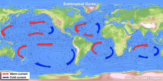
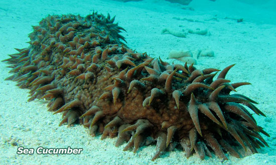
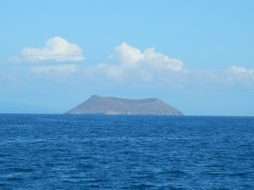
Like gigantic conveyor belts, the tropical oceans span the areas closer to the equator where water temperatures are over 75°. These warm and clear waters tend to have low levels of oxygen and nutrients, the opposite of the cold, nutrient rich waters I’ve written about in earlier Science Notes. This means that though tropical areas in general have low productivity, there are distinct ecosystems in tropical areas like coral reefs and mangroves that have very high productivity and are in fact, some of the most bio-diverse habitats on earth.

:: Coral Reefs: Gardens Under Siege

coral_reef_600

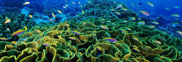
Despite the lack of nutrients and oxygen present in these warm waters, tropical areas play host to one of the most diverse ecosystems on earth: coral reefs.

Screen Shot 2014-05-30 at 11.59.50 AM
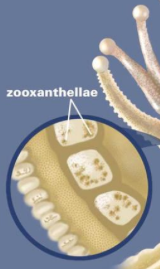
A coral reef is made up of many colonies of coral polyps which build the reef structure out of calcium carbonate. Tropical corals contain zooxanthellae, which is tiny algae that lives inside the coral where it photosynthesizes, creating food from sunlight. These algae are also what gives coral its brilliant and diverse colors. This means that coral can only occur in the “photic” zone, where sunlight penetrates the water. Corals polyps feed by extending stinging tentacles outwards to capture small prey and particles in the water column. Corals are related to other stinging animals including sea anemones and jellyfish.

The complex physical structure of a coral reef, some of which are thousands of years old, creates an ideal habitat of many other animals to thrive – from small invertebrates to large animals like sea turtles and sharks. The productivity of many tropical marine areas as well as the related economic activities that center around fishing and tourism are highly dependent on the health of coral reefs.

coral_nets

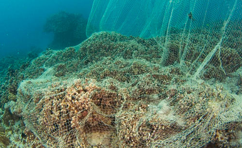
In today’s changing ocean, coral reefs are under siege. Sea surface temperatures are increasing, atmospheric carbon dioxide is driving up ocean acidity, and overfishing is removing critical fish and invertebrate species at the same time that coastal land development is increasing in many coral reef areas. All of these pressures are contributing to the unprecedented and rapid collapse of coral reefs along with the loss of the unique ecosystem that goes with them. Scientists are racing to learn more about how these ecosystems are functioning under speedily changing conditions and how we might increase the resilience of corals, and help them cope better under a variety of different stressors.

Dr. Carrie Manfrino is an Earthwatch scientist studying just this area, but with an exciting twist called “coral gardening.” A great obstacle to coral resilience is that when large areas of corals disappear, it greatly reduces the ability of larvae to successfully settle in to form new baby corals in new areas. Staghorn and Elkhorn corals are branching corals which are a critical part of the coral ecosystem, but in the Caribbean these corals have decreased by as much as 90% in some areas, due to climate change and development pressures.

two-corals

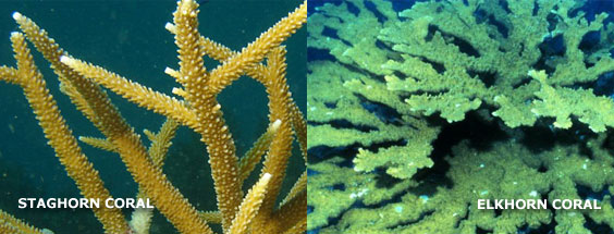
In the Cayman Islands, where Dr. Manfrino works, these corals are showing some very promising recovery, and her team is working to find out what characterizes sites where these corals are doing well. Once new sites are identified that match these characteristics, scientists and volunteers transfer baby corals that have been grown in a special coral “nursery” to these new sites. The idea behind this method is to both increase coral cover as well as to maintain islands of coral that are better connected with each other which help increase the production of new coral naturally. This is super exciting science, which is using a variety of new technologies to better understand and manage our impacts on the natural environment. (Here’s a video w/ Dr. Manfrino and her colleagues.)

:: Protecting Special Places

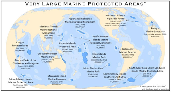
Just like anywhere on earth, special places need special protection. The unique biodiversities supported in tropical areas means that there are many special places in need of protection. This process is usually achieved through the creation of multi-nationally supported Marine Protected Areas or MPA. An MPA usually has one of two purposes, to protect an area that supports rare or important species, or to provide a refuge for animals from fishing. MPAs can vary in size from very small local protected areas to vast areas like those in the map below. The most important thing is that an MPA is large enough to matter and located in the right place so that it can provide the most benefit and achieve its purpose. The idea of designating marine areas to be protected is a relatively new one (2000) when compared to the creation of national parks, which started as early as 1872 with the creation of Yellowstone National Park in the U.S.

Currently just 1% of the ocean is fully protected.
mpa_600

So that the right places can be protected, scientists are studying how different animals use their habitat. It is important to be able to know what places are used for feeding, breeding, and resting so that these important functions can be maintained.

Screen Shot 2014-05-30 at 12.54.31 PM

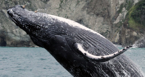
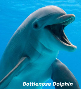
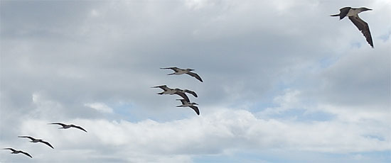
On the Pacific coast of Costa Rica, in an area called Gulfo Dulche, Lenin Oviedo, an Earthwatch scientist, is conducting a research project to study how this pristine area is important to resident and migratory species of dolphins and whales. Bottlenose dolphins, Pantropical spotted dolphins, and humpback whales use this area either as their permanent home or as a way stop during larger migrations. Along with mapping how these different species use the gulf, the research team is interested in how boat traffic and boat noise overlaps with important whale and dolphin areas.

It is common that special places for animals are usually special places for humans too. Healthier ecosystems support the wildlife, which also benefits economic activities like fishing and tourism. It is important to understand how these activities impact the environment to see how they might be better managed.

sea_turtle_505

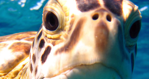
Farther east in the Bahamas, Annabelle Brooks is another Earthwatch scientist whose research is in studying the spatial movements of juvenile green and hawksbill sea turtles. All species of sea turtle are endangered, so it is very important to protect areas, which are crucial for feeding. This research also allows the team to understand naturally occurring cycles of abundance and movement. As impacts from human activities and climate change become more widespread, this research allows scientists to spot disruptions, which are outside the naturally occurring changes in populations.

Researchers like Oviedo and Brooks use the power of computer modeling to better understand natural change and movement in populations. By combining observations of animals with data about the environment, they create a computer model that tells them which areas are important for specific animals or animal activities based on the environmental characteristics. Then the research team goes back into the field and collects more data which is used to validate the models, to see how good the models are at predicting observations in real life. This technique is very useful for pinpointing large areas that are important for specific animals. The aim of both these projects and many others like them is to better understand essential habitats for these important species so that we can better protect them in a changing ocean.

– Tegan Mortimer <teg.mortimerATgmailDOTcom>

Dreaming with the Dolphins

Six days now since I left Panama, and the time has just flown by! Bodacious Dream and I are now around the western tip of Cuba, heading through the Gulf of Mexico and towards the Straits of Florida. The winds have gone very light this morning, after a most beautiful sunrise.

6421_sunrise_55022.267439N, 84.488512W

Over the course of the week, we’ve sailed through waters steeped in maritime history. This general region is named the Caribbean Sea, or around here the Western Caribbean. It is where many of the early explorers sailed and claimed new territories for their countries – most notably Spain, Portugal and France. You see that old world Spanish influence in many of the Central American countries, along with the occasional French accent. Actually, construction of the Panama Canal was begun by the French! After Columbus’ initial “discovery” of the new world, his subsequent 4th voyage of 1502-03 came through the same area I have traveled this past week.

columbus_map_550
A map drafted for Columbus in 1490. Can you imagine navigating with that?  

The nights out here have been cool, which lets me relax after avoiding dehydration and sunburn during the day. Sitting out on deck at night, I watch the hazy clouds drift across the sky as I wait for the sliver moon to rise and then hours later, just around daybreak, the morning star. I find this time under the stars is the best time for reflection.

6166_slivermoon_550
A Sliver of a Moon … 

I find myself drifting back in time and imagining what it was might have been like to be an early explorer in these waters. I have the luxury of modern technology as well as the charts and notes of earlier sailors’ experiences to guide me; they had nothing.

6109_providence_550Providence Island

When they would come upon an island unexpectedly, such as Providence Island, they would have to take great precautions not to end up on shallow reefs or rocks. They would often drop anchor quite a ways out and put a crew in a small boat to explore the area and coastline looking for an acceptable bay or harbor in which to anchor. The dangers were many; the buffers of safety few.

Gulf StreamAnother notable natural phenomenon of this area that adds to its historical significance is the presence of the Gulf Stream. Actually, this area I’m passing through now, is where the Gulf Stream rises back to the surface and begins to drive currents north from the western tip of Cuba, along the Florida coast and up the eastern seaboard to Cape Hatteras before it veers off across the North Atlantic towards Ireland and the British Isles. As it moves eastward, it cools, submerges and then travels, deep in the ocean like a conveyor belt, back to this region where, heated by the tropical sun, the current resurfaces once again.

As Tegan Mortimer has shown us in her excellent Wind & Weather Science Note #2, the effect these powerful currents have on local waters when they converge with them help to create large and active zones for sea life to develop and thrive.

6437_splash_550

For the past few days, there were times when I sensed a positive current pushing me along at a knot or more. At other times, there was no current or even an adverse current slowing me down. Stepping back to a more macro-view, we know now that the Gulf Stream waters swirl around erratically as they develop. Depending on where you are, you can have any range of positive or adverse currents. As I move closer to Florida, I will slip more solidly into the current, which will definitely speed my travel. And at night, in those warmer waters, I hope to see eruptions of marvelous bioluminescence!

So, as we travel on towards more familiar home waters, I will leave you with this video of a stampede of dolphins that visited me for a time the other day. What a thrill for me to have them fly alongside of us!

A Dolphin Stampede! (Here’s another shorter clip.)

Watching them leap skyward can’t help but take you back to what life on the seas was like before the arrival of all the whizzy gizmos that we surround ourselves with today. Following their fluid movements reminded me how much has NOT changed in the eons of the gulf stream flowing, the trade winds blowing and great marine mammals swimming – a comforting perspective for sure!

More soon,

– Dave, Bodacious Dream & (the sun-burned) Franklin Screen-Shot-2014-05-28-at-12.39
23.03448N, 84.10796W 


Harmonics of the Great Gyres

Approaching the end of a week in Panama that saw Bodacious Dream transiting the Panama Canal… from the Pacific to the Atlantic Ocean in just 12 hours!

6013_panama_300
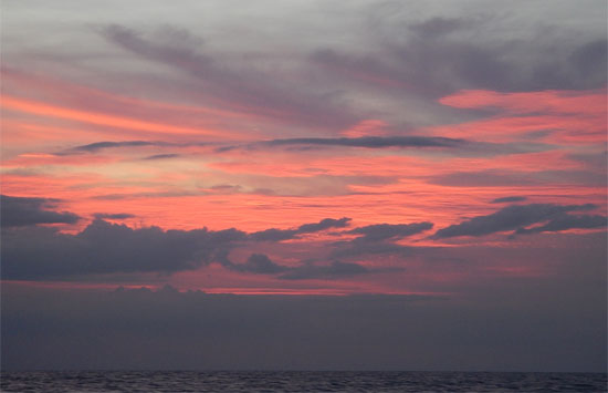
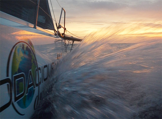
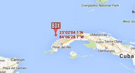
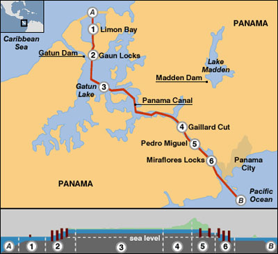
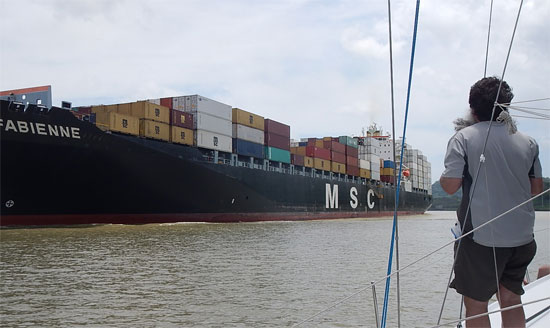
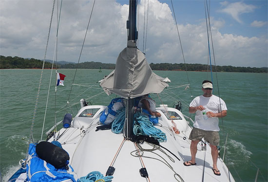
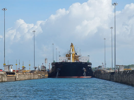
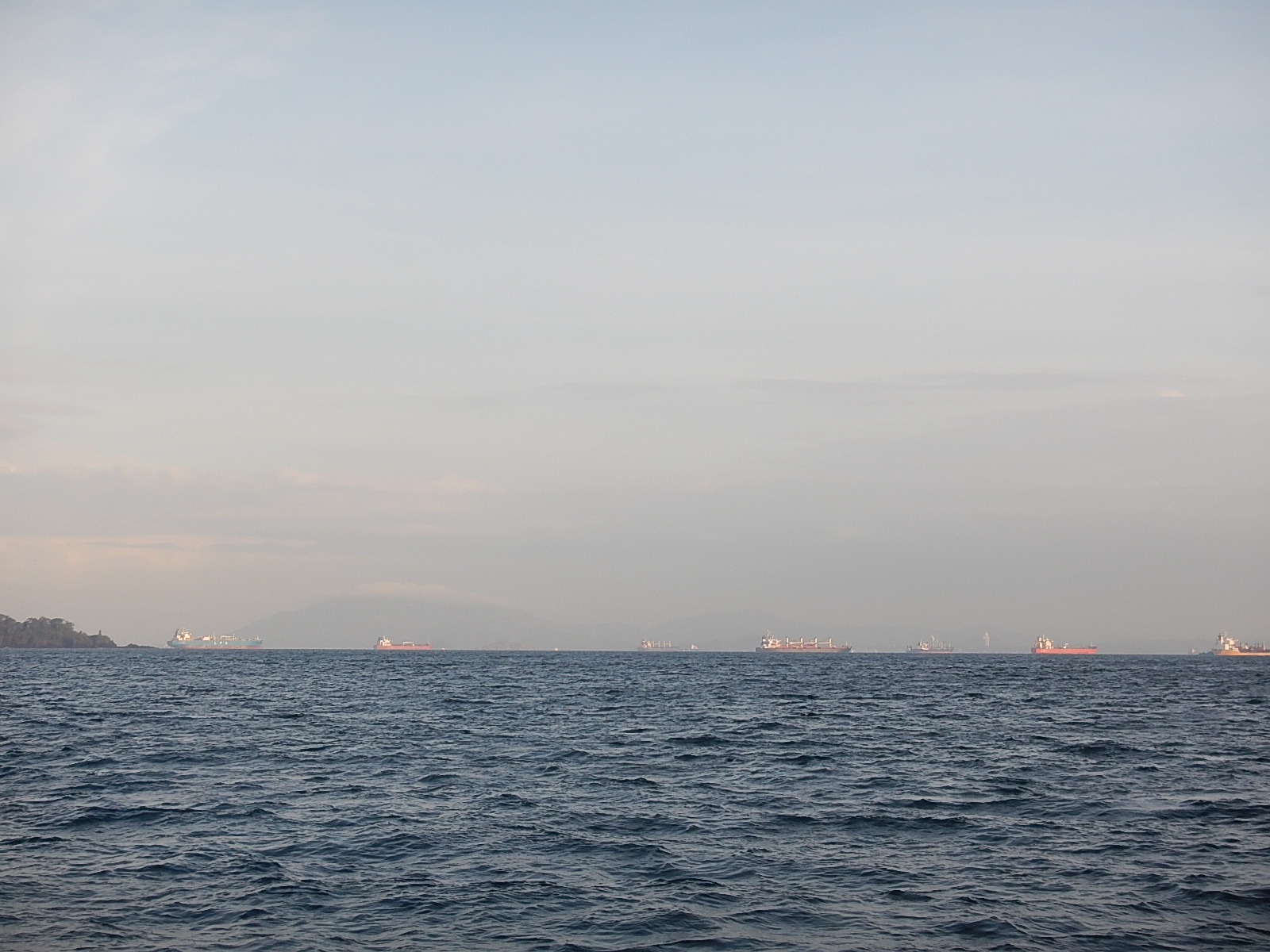
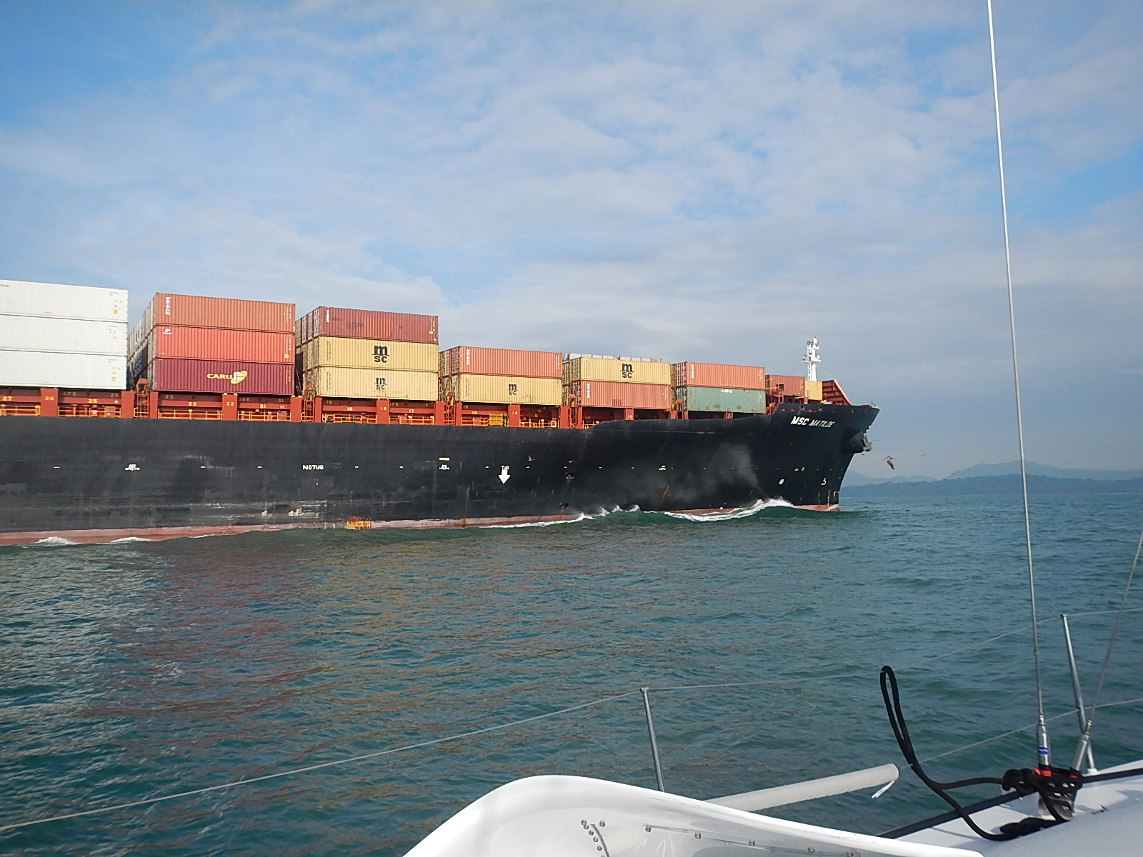
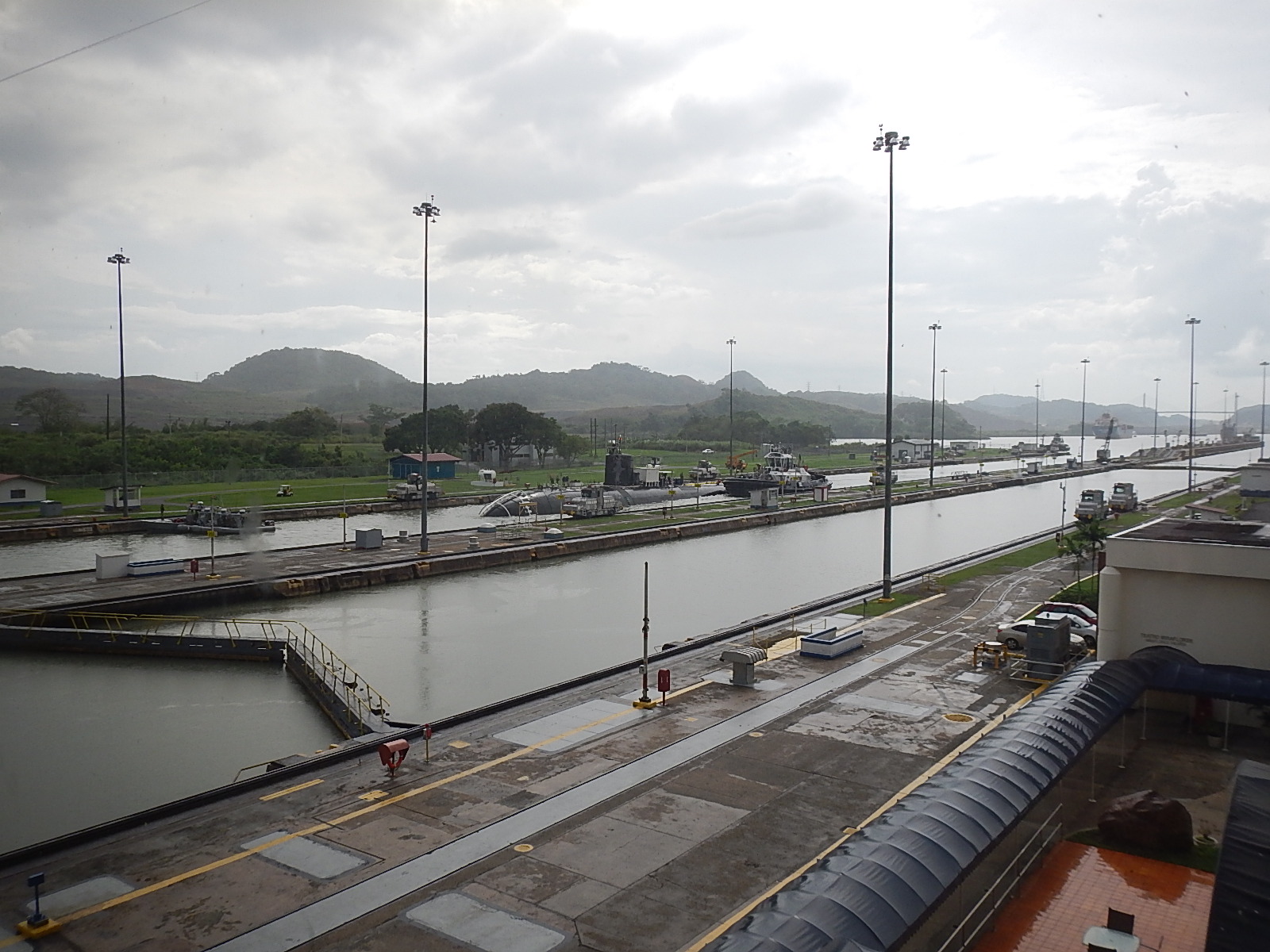
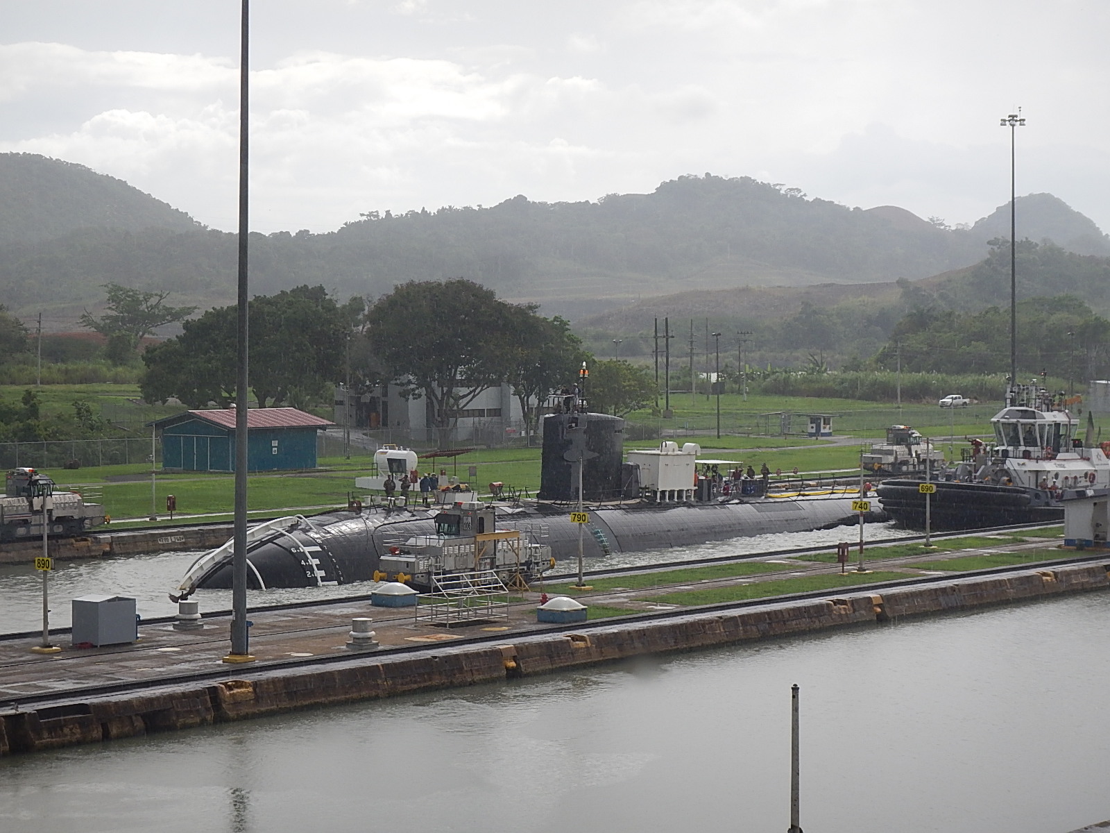
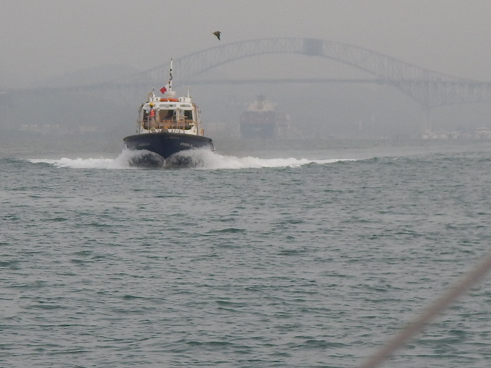
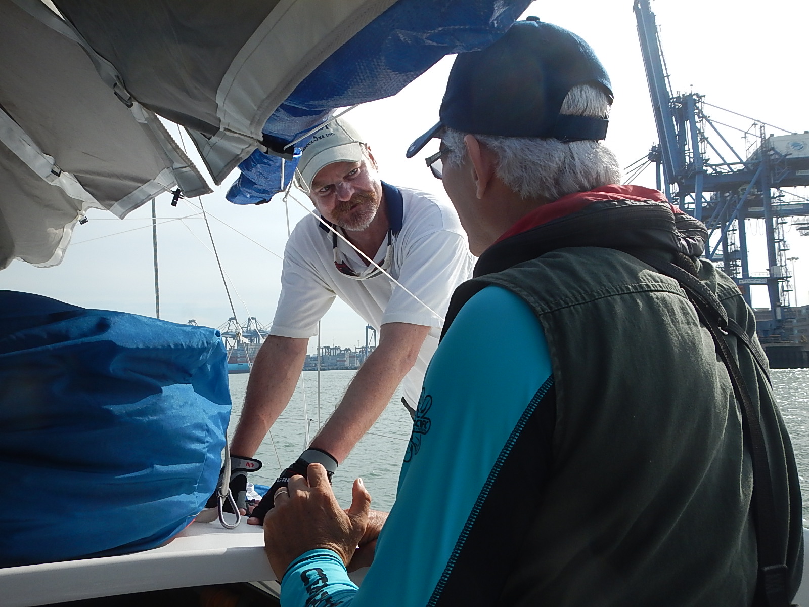
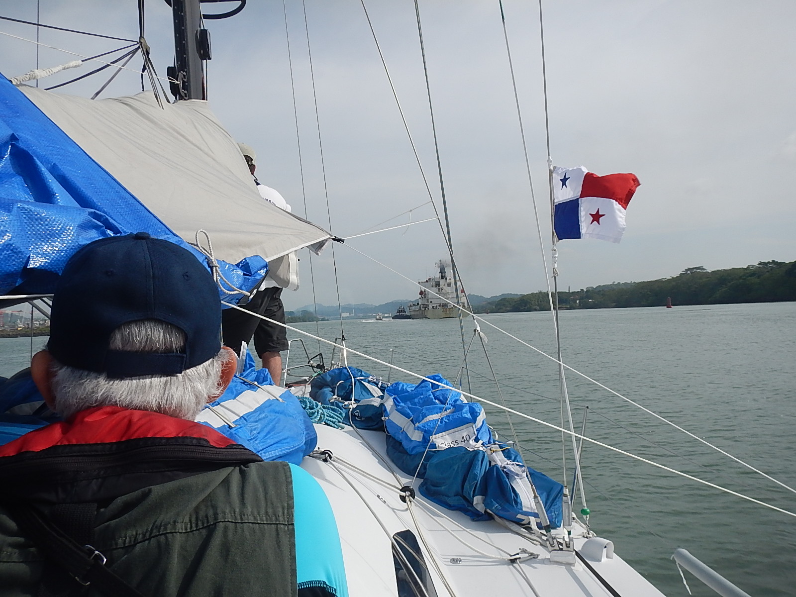
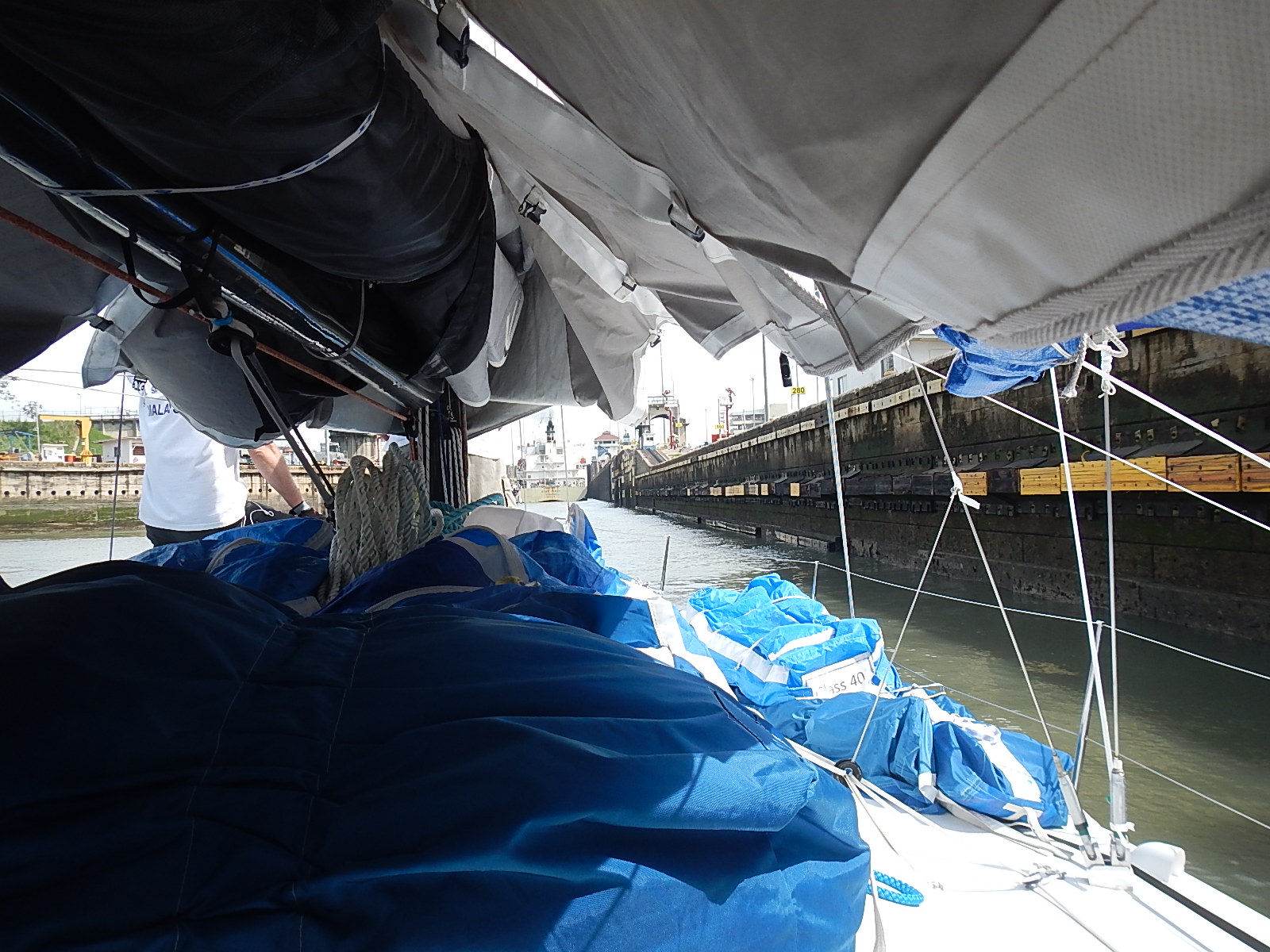
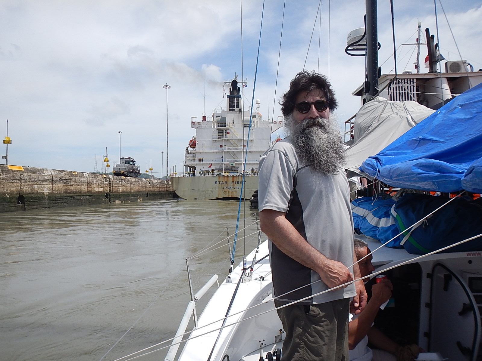
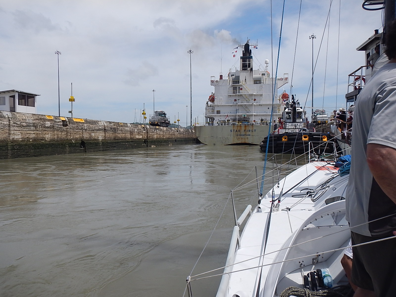
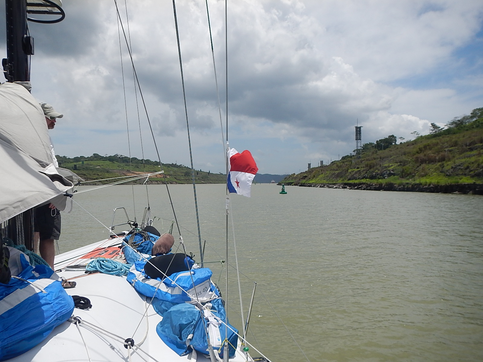
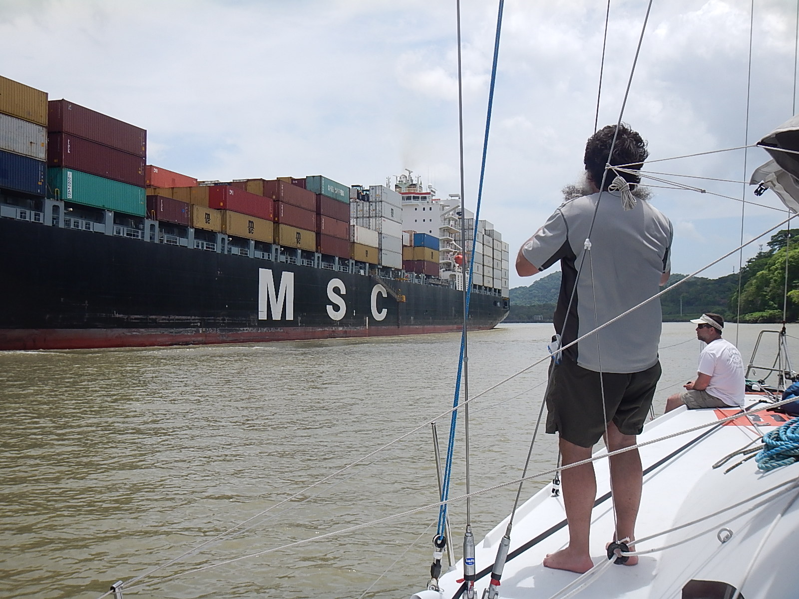
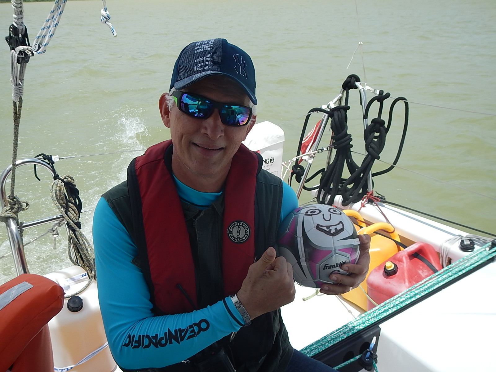
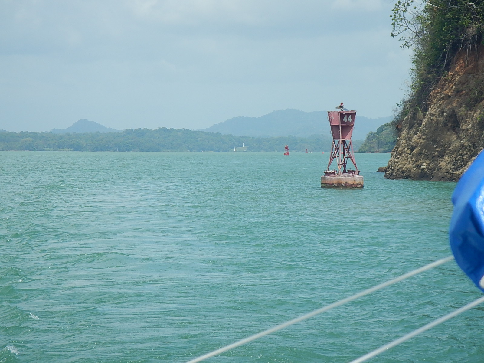
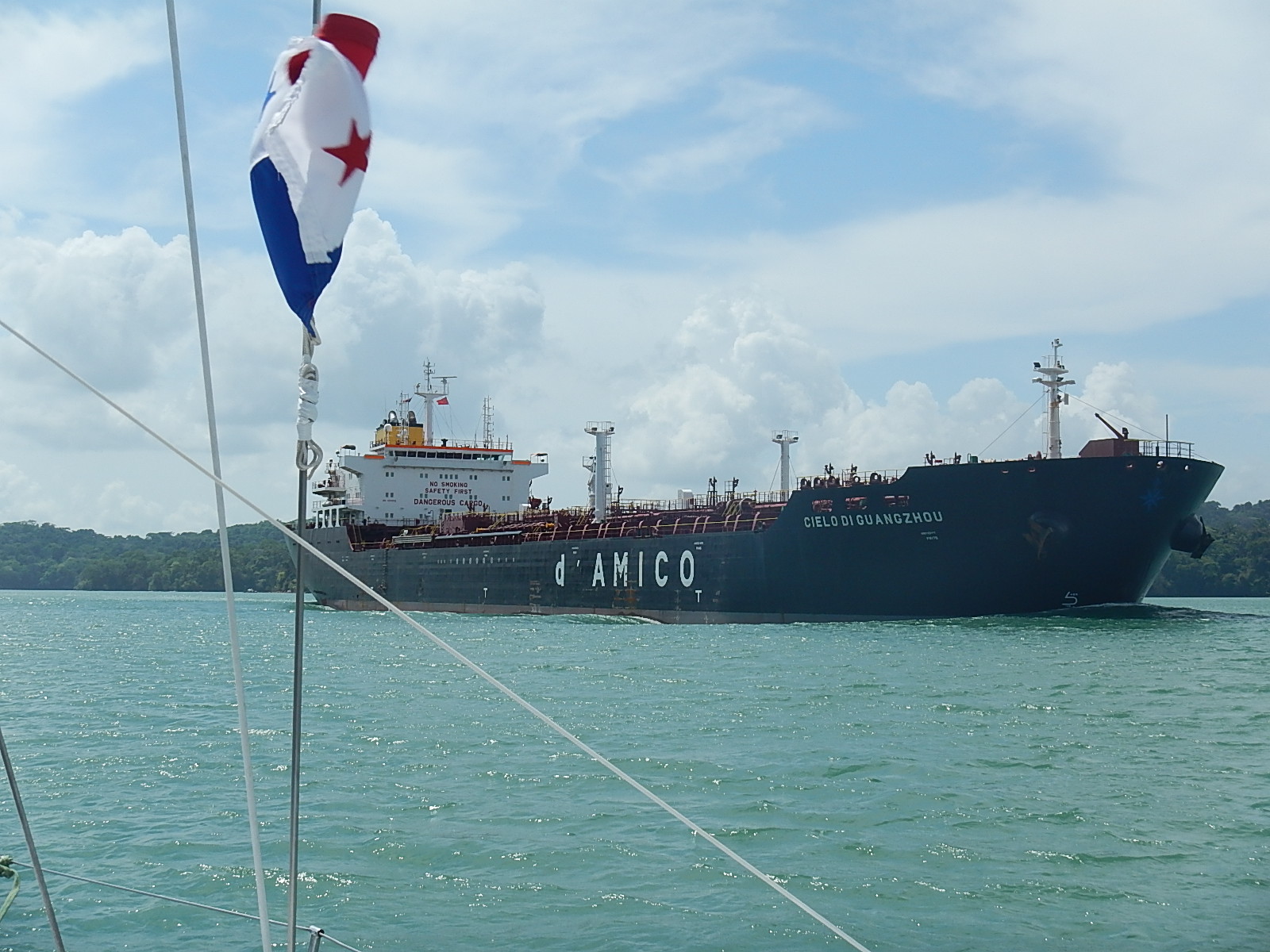
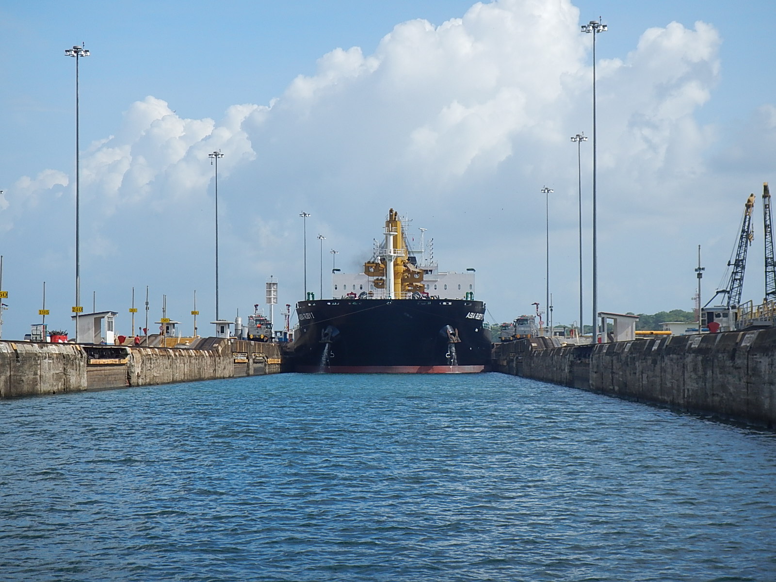
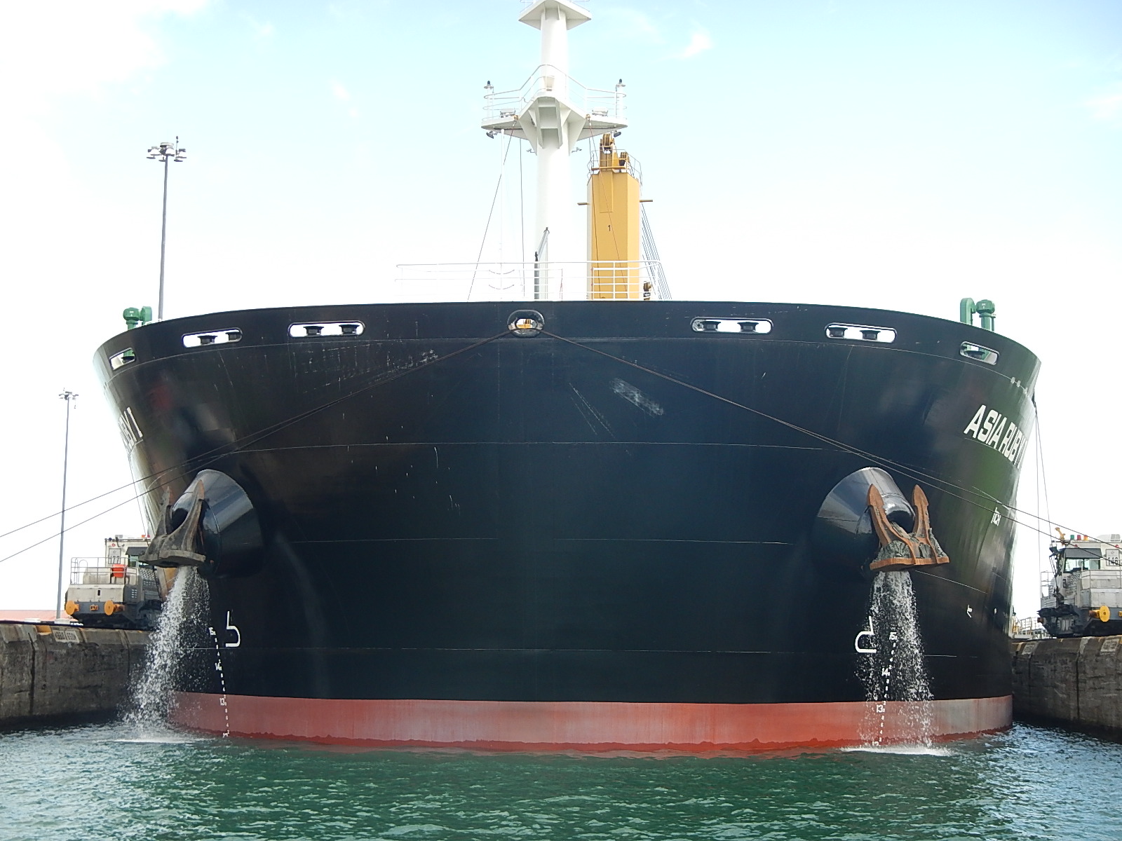
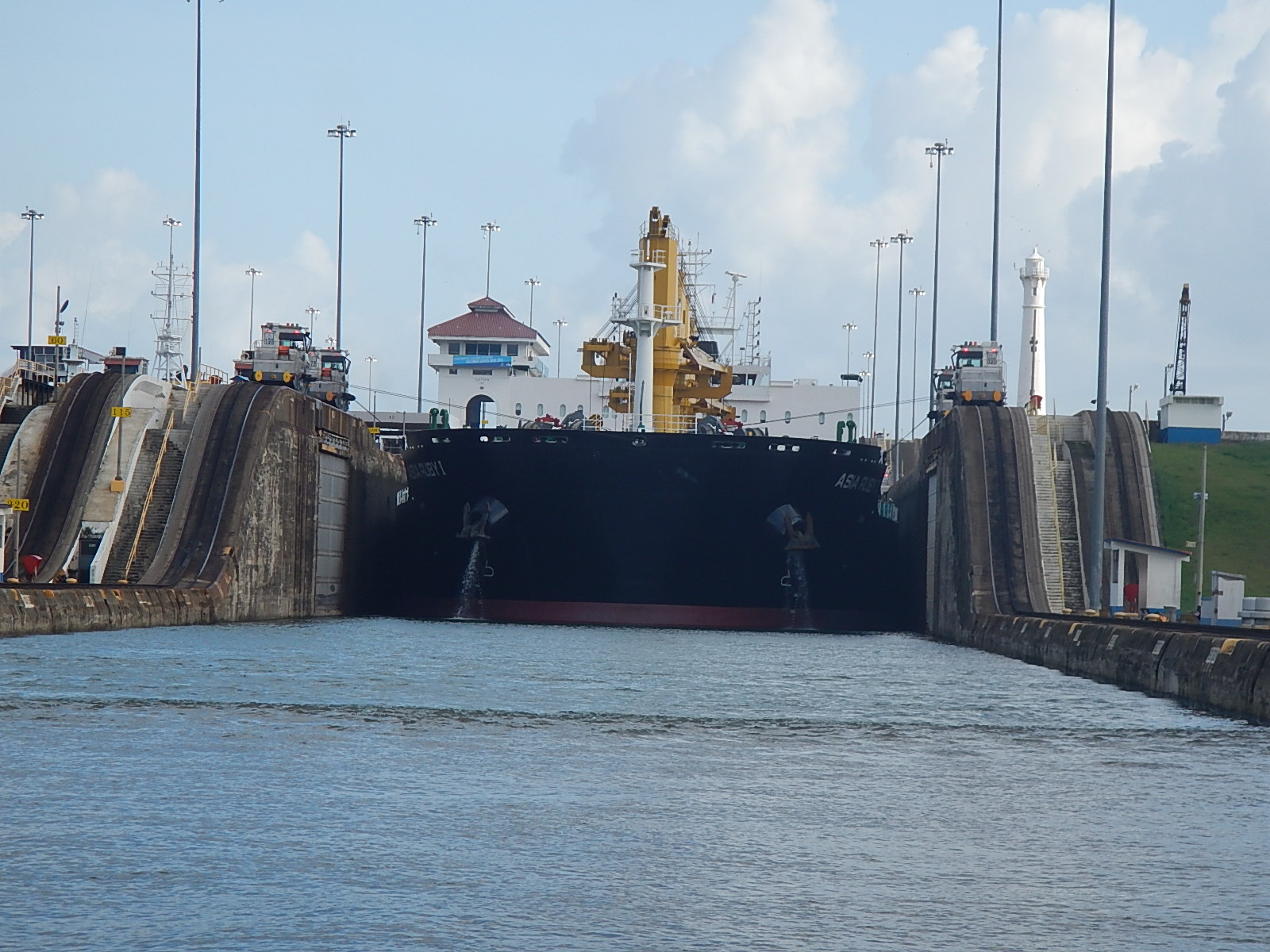
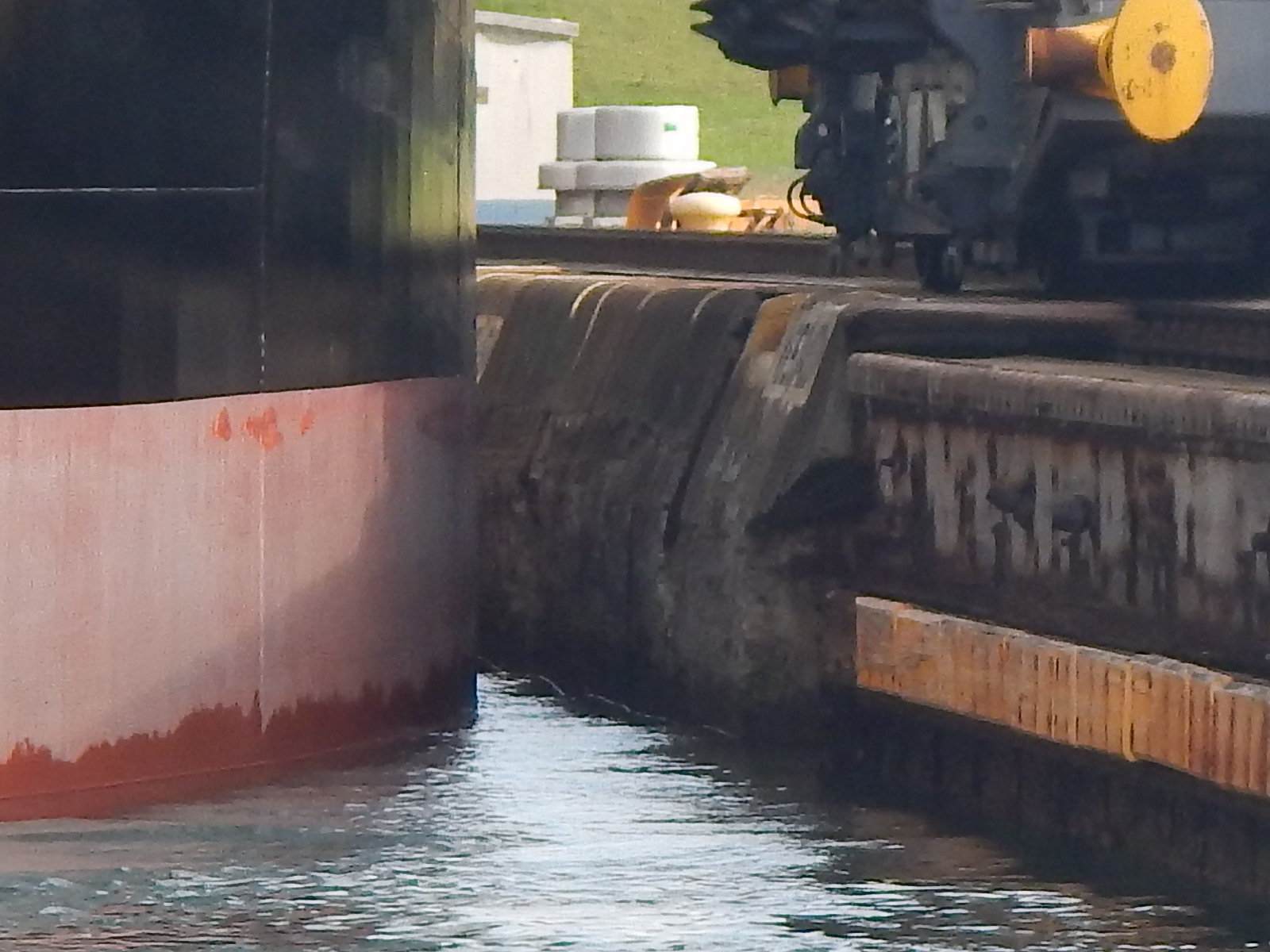
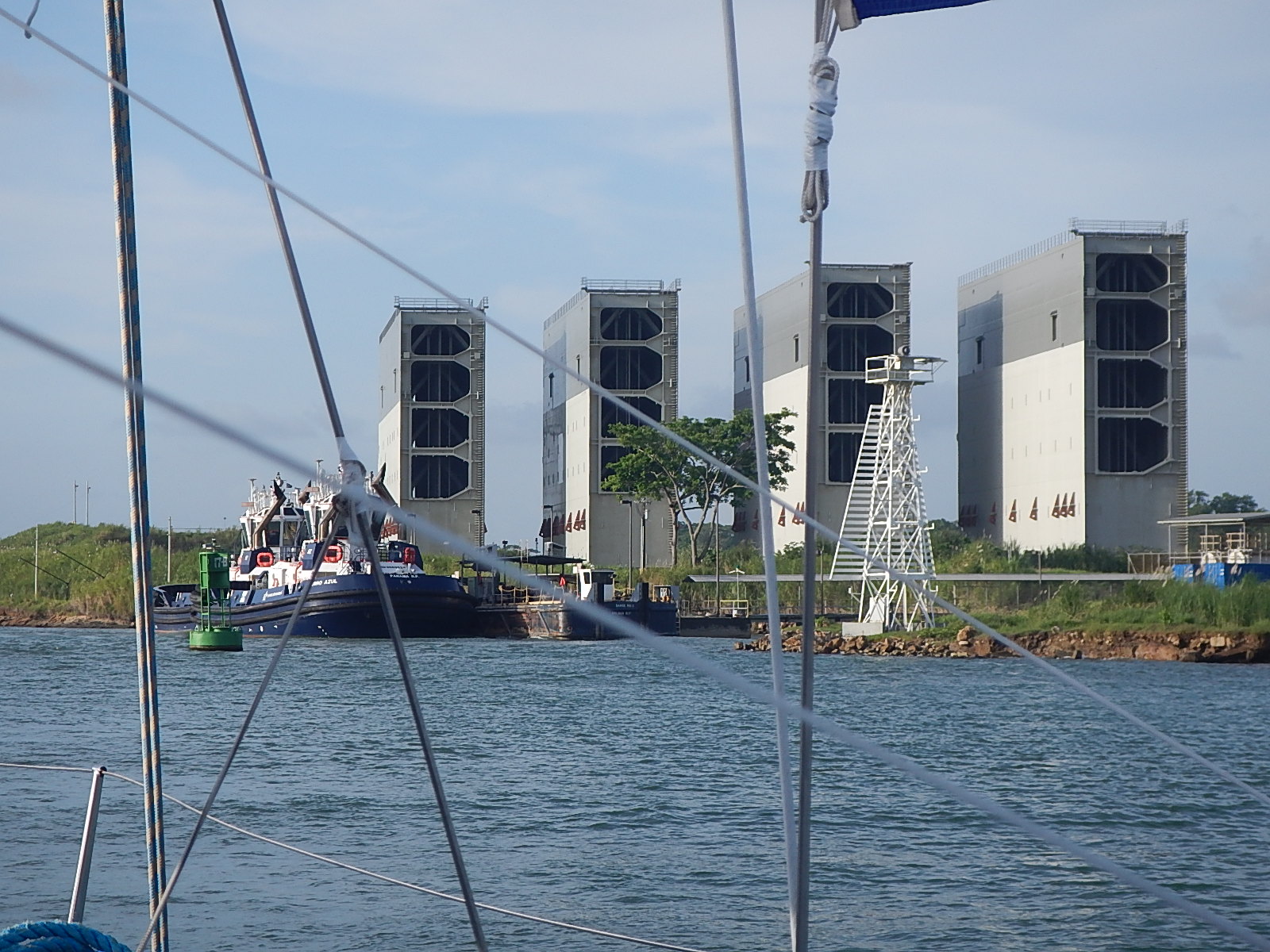
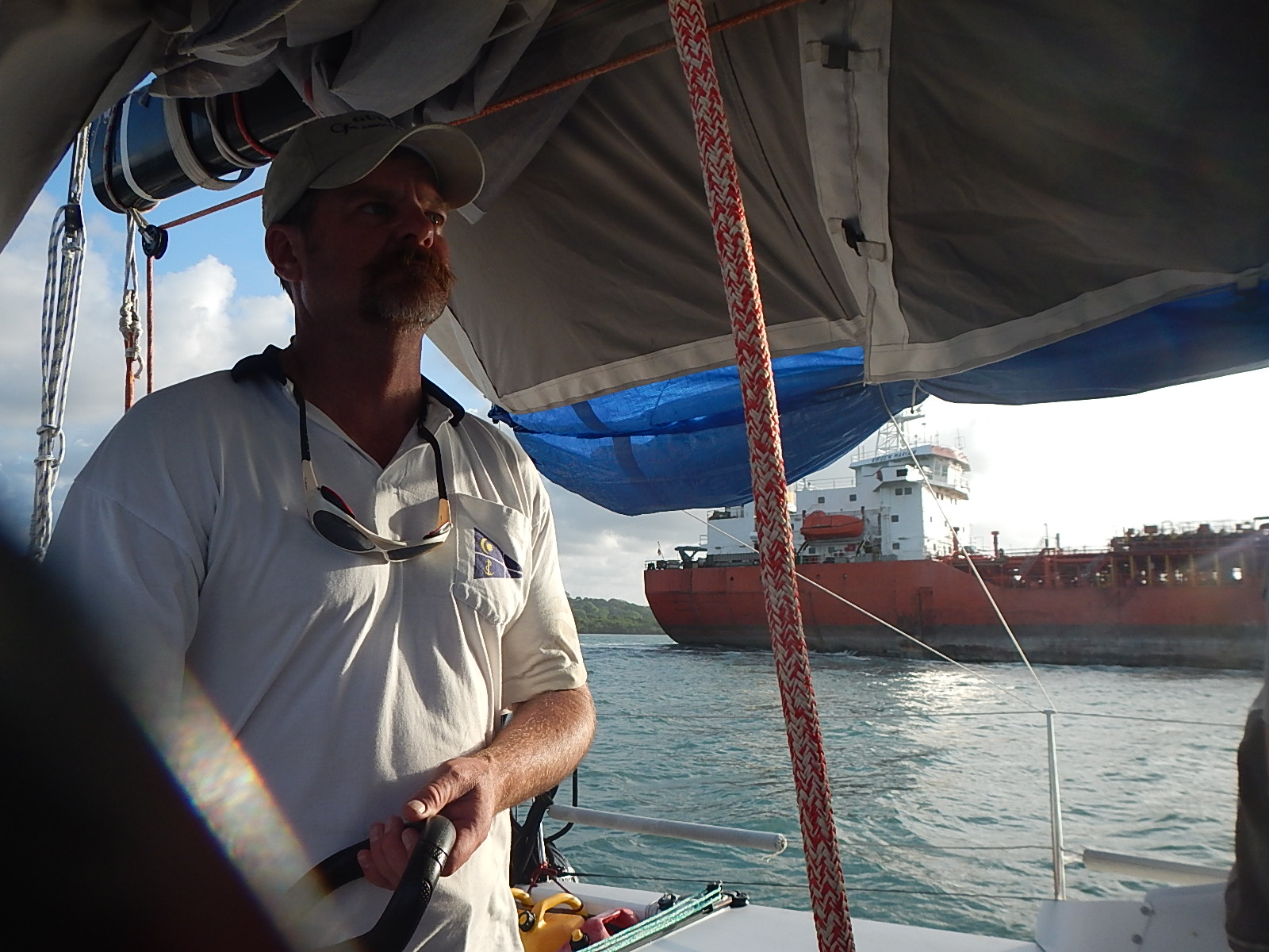
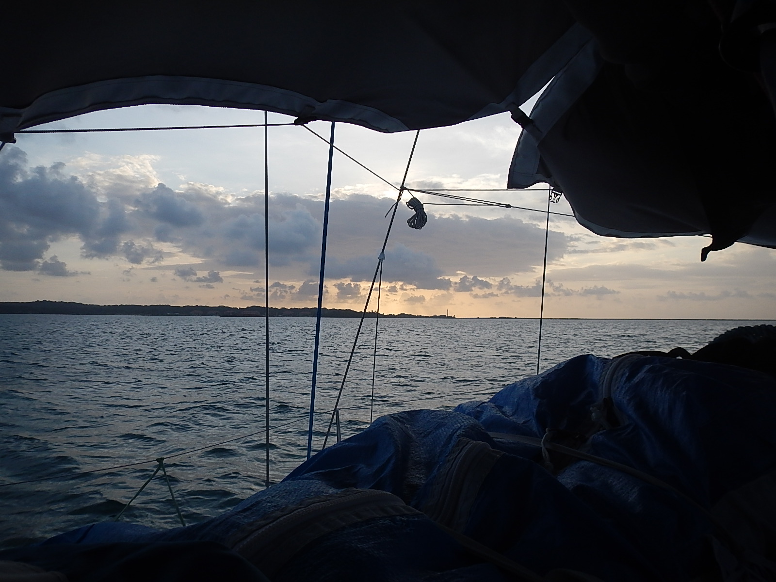
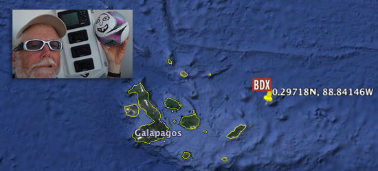
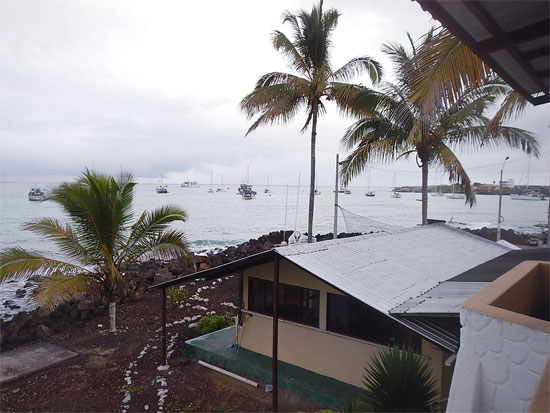
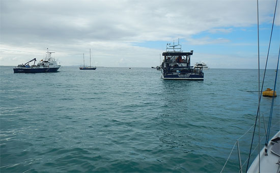
It’s early morning on Thursday and I’m heading down to the marina to put final provisions and water onto the boat and hopefully, by the time you read this, I will have departed. Our course will take us north towards the Yucatan passage that runs between Mexico’s Yucatan Peninsula and western tip of Cuba. From there, I’ll cross the Gulf Stream and skirt the Florida coast as I head to a stop-over in West Palm Beach.

The time here in Panama City has been fascinating. The city is lively and full of folks from all over the world. There is a great rejuvenation going on in the old part of the city where fine old buildings are being restored and renovated to accommodate stylish shops and fancy restaurants. The feel around here is vibrant. However, as all good journeys must continue, so must this one as well.

I expect the next few thousand miles will unleash a rush of memories that have stored up inside me since I departed Jamestown, RI on October 2nd of last year. I have no doubt that among those thoughts will be some more philosophical in nature … reflections on our amazing oceans and planet Earth. The time left on the voyage will pass quickly, but the memories I am sure will remain with me for many years to come – so I will try to share them with you here as they arise.

:: Marine Debris

One of the questions I get asked often is how much debris I see out on the water. I have to say that for most of the voyage and especially in my crossing of the desolate Southern Ocean, I didn’t see that much debris. Remember though, my course has taken me very far from land … except when arriving or departing from my scheduled stops.

Recently however, as I got to about 150 miles from Panama, I began to see floating debris everywhere. I would no sooner spot a floating piece of plastic and watch it trail off behind me, then I’d see another in front of me. One night on the approach to Panama, I heard the sound of something hard hitting the deck. I was below and suspected a piece of mast hardware had come loose and fallen. With flashlight in hand, I scanned around and found an old plastic cigarette lighter that had somehow been tossed up across the bow. I picked it up, and thought to myself …”This is not supposed to be here.”

As I learned on this trip, there is quite a field of scientific study that has built up around how man-made debris moves around in the ocean. Some special learnings for me came from a book I read called, Flotsometrics, written by Curtis Ebbesmeyers and Eric Scigliano.

Curtis spent his life as an engineer and oceanographer, first working on important issues with oil platforms: wave heights, sewage disposal and things of that nature. But along the way, as he studied the waters of Puget Sound in the northwest corner of the U.S., he became more and more fascinated with the general drift of ocean waters and what are known these days as the great “Gyres.” At present, oceanographers have identified five of these great gyres and 5 more minor ones.

World's GyresClick here to get a larger version.

The book was one of a selection given to me, just before I departed by Tegan Mortimer, our scientist colleague from Earthwatch, who thought I might find it intriguing. The book explains how through the centuries “drifters(items tossed into the sea to see where they would end up, like notes in a bottle, etc.) have been used to satisfy people’s wide-ranging curiosities about the world. From Columbus, who in observing various items floating in the sea and washing up on the shore, took it as evidence that there were other continents not that far away, to ancient peoples who commonly gravitated to specific beaches that collected the flotsam of the ocean. In many cases, these items helped provide these people with some of the necessities to help grow their civilizations. I found this book just fascinating, and especially how it was told in such a wondrous and whimsical way.

rubber duckyAs Curtis’ lifetime unfolded, he became more and more focused on these floating objects, and with the help of another software engineer friend, he began to use computers to model and predict the travels of the “drifters.”

Imagine the fun he had following and logging data on the 80,00 pairs of Nike shoes lost when a container ripped open off the coast of California, or that other famous lost container full of 28,800 actual yellow rubber ducky bath toys! Along the way, he also tries to solving the mystery of those duckies that floated upright, guided more by the wind, as opposed to those that floated upside down, more directed by the water.

This is truly a book that I can see reading and sharing with kids, as it inspires one to think and imagine more grandly the many interesting and serendipitous ways the oceans of the world interact with each other.

FloatsametricsThe part that especially captured my imagination and provoked me to write this came in the final chapter, Harmonics of the Gyres. With the sun setting into the western sea, I squinted to keep reading about how after years of study, he came to see that these gyres spin in predictable revolving patterns – revolutions that could be measured in years, and he saw how each gyre when compared to one another were separated by factors of two.

As he thought about it, it occurred to him that this was also the basis for our typical musical octave – our common scale – do, re, me, fa, so, la, te, do. So he saw that potentially, though far below the audible range of human beings, the earth’s oceans may have a similarly harmonic scale to them; a rhythm by which the watery worlds vibrate and sing to us, even if it is only our subconscious that hears it.

subtropical_gyres_550

It caused me to wonder in new ways about why it is I’ve always been so pulled to the waters of the world. How can I sit on the shore and stare off to the horizon for such long lengths of time? Why am I drawn to do what I’m doing, sailing across the oceans totally immersed in the environment, the boat, the sea and the weather? Perhaps this theory helps explain why some very basic part of me has always been so entranced by the music of the sea.

If you can find the time, grab this book and a map of the world and sit down with your children and explore the world with this whimsical oceanographer as your guide. In fact, I think when I grow up; I want to be an oceanographer too!

– Dave, Bodacious Dream and Franklin (who really liked the rubber ducky part)

:: BDX Website :: Email List Sign-Up :: Explorer Guides :: BDX Facebook

Our Panama Canal Adventure!

Wow… what a day!! Saturday we watched the sun rise in the Pacific and set in the Atlantic! Across Central America we traveled, from the sea to shining sea all in about 12 hours… via the 48-mile Panama Canal of course!

Rob, Pierce, Joe, Bruce – my crew of trusted old friends who had traveled here to be my required crewmates for the crossing joined me Saturday morning at 5 AM CDT, so that we could pick up our pilot at 6:30 close to the Canal’s Pacific entrance. Tito, a local line handler recommended by our agent, Francis from the Panama Agency, also joined us. Tito had taken a night bus from the Atlantic side of the isthmus and was waiting for us at the boat when we arrived.

pan_am_bridge_550Under the Pan-American bridge on the way to meet our convoy mates …

We were soon loaded and ready-to-go, when we got a delay notice. We’d pick up the pilot at 7:30 instead of 6:30. But then, right at 7:30, the pilot boat approached and Raphael, our pilot, hopped onboard and began giving us our orientation on how we would proceed through the canal.

5954_rafael_300Rafael (pictured to the right getting acquainted with Franklin) informed us we would be traveling through the first two sets of locks as a convoy with two other ships; one was a large (over 500 feet long) cargo ship from Singapore and the second, a smaller 95-foot passenger tour vessel named Islamorada, which by the way, originally belonged to the Chicago gangster Al Capone!

With much anticipation, we proceeded slowly up the channel, en route to meet the “big” ship and Islamorada.

5983_big_ship_550
No question which of us was going to get the big bunk …

The term “lock” refers to these various sub-divisions of the canal through which you must pass. Each lock has chambers, which are like steps. So, the first lock (Miraflores) has two chambers. The big ship entered the chamber first, then Islamorada and then Bodacious Dream came in and tied alongside the Islamorada.

5926_turbulence_550
A bit of turbulence as the water floods in … 

At that point, the gates closed and the chamber filled with 100 million liters (26.4 million gallons) of water, which had the effect of lifting all our vessels up to the level of the next chamber.

pc_map_400

This process was repeated with the second chamber. There are two locks on the Pacific side; each with two chambers, which take you up to at 85 feet above sea level and release you into Lake Gatun – an artificial body of water in the middle of the isthmus. We then motored 21 miles across it. Once across it, we entered the single Pacific-side lock (which has three chambers) – which resulted in our descent to the Atlantic coast.

long_ship_550
Joe keeping an eye on a long ship …

The canal is active 24 hours a day, during which time from 33 to 42 ships pass in both directions… every single day of the year! An astonishing volume of commerce and traffic from all around the world goes through these narrow 110-foot wide canals!

Every moment of the trip had us wide-eyed and excited as kids, as we watched the passing of huge freighters and listened to Raphael and Tito tell stories from some of their past trips. We also saw and heard about the construction for the new expansion of the canal which, when open in 2015, will allow much larger ships to make the passage.

5965_Bruce_550Bruce balancing as we motor across Lake Gatun …

Our crossing of Lake Gatun in the middle of the trip also gave us a beautiful view of the interior of the country of Panama. We even saw a crocodile, though it took me too long to locate it in the camouflage to get a decent photograph of it!

Pushing as hard as we could to keep on schedule against an often strong wind, we were running 30 minutes behind in reaching our appointed time at the Atlantic side locks, but somehow Raphael and our agent Francis worked it out so that the authorities waited for us to arrive. At that point, we passed through and gently down the three chamber steps to where the final gates opened up at the level of the Atlantic Ocean, thus delivering Bodacious Dream back into her home waters, after six months of circumnavigating adventure.

5977_big_ship_550Tonnage before beauty …

There is SO much history in the 100 years of the operation of the canal that it’s hard to know just where you might start to tell the story. The displays at the Visitor’s Center Museum do a fine job of depicting the enormous task of cutting a channel through the country from one ocean to another, all the while being forced to invent new construction machinery and new engineering techniques to make that possible.

Panama_Canal_Construction_550One of the Wonders of the World … I believe it …  

The task at that time was so enormous and so full of unforeseeable challenges, that the greatest obstacle was lack of imagination, which could only be overcome by extending the reach of the builders’ imaginations into new and uncharted territory.

The US took over construction of the canal from France in 1904, and it would be a decade before it opened. From that time on, the U.S. was the administrator of the Canal Zone. In the late 1970’s, during President Jimmy Carter’s administration, a treaty was signed which turned operations of the canal over to the Panamanian government by the end of the century.

Since that time, Panama has operated the canal, maintaining it and making improvements to increase it capacities… including the new larger canal I mentioned, which will make it possible for more and larger ships to traverse the Isthmus. This has also spurred much new development and economic rejuvenation in Panama City and the surrounding areas, making Panama an increasingly attractive and popular travel destination. I was also surprised to learn that the Chinese were planning to construct a new competing canal passage through Nicaragua!

Well, as there’s quite a few more photos, we put together a few slideshows on the page here with photos of our day travelling through the Canal. You can also view it in a bigger format as a photo album on our BDX FACEBOOK page … http://on.fb.me/1lBIbz3

SLIDESHOW #1

#1 – Click arrows to advance! Scroll over to read descriptions.

SLIDESHOW #2

#2 – Click arrows to advance! Scroll over to read descriptions.

Now that we’re through, I’m collecting my thoughts and catching my breath, before I resume the final leg of this amazing circumnavigation later this week.

From all of us on Bodacious DreamJoe, Rob, Pierce, Bruce, Tito, Raphael, and Franklin, who had some great fun rolling with all those new people… thanks for following along.  Back soon with more!

– Dave

:: BDX Website :: Email List Sign-Up :: Explorer Guides :: BDX Facebook

Crossing the Panama Canal Today!

The few days since I arrived in Panama on Wednesday have been pretty non-stop. First, I had to go through the procedures and inspections that are required before you can get clearance to transit the canal. Then I spent all day yesterday and today getting the boat ready, buying provisions and making on-the-fly adjustments to the plan as they came up.

:: We will start our transit of the canal today SATURDAY morning at 6:00 AM CDT!

We’ll have to leave the harbor and motor out to Buoy #6, where we’ll pick up our pilot and then continue northward into the canal and the first set of locks at Miraflores. If all goes according to schedule, we’ll be passing through that lock about 8:30 AM – so if you are up and so inclined, there will be live cameras along the way and you can hopefully spot us as we go through the locks and make our way through the 40-mile passage to the Atlantic Ocean.

:: Here is the Link for the LIVE WEBCAMS… pancanal.com/eng/photo/camera-java.html

5838_big_ship_550
Up close and personal  with some of the big boys around here!

I’m lucky to have a great crew of four guys joining me for the passage – old friends who came down just for the passage – Pierce Johnson, Rob Plotke, Joe Yoffa and Bruce Dickinson. So far, we’ve had a great time getting Bodacious Dream ready to make the transit and learning about all the things we’ll need to do to make the transit properly.

5893_canal_ship_550
From the viewing deck at the Miraflores Locks

One of the things we’ve done is to visit the Visitor’s Center at the Miraflores Locks and watch a few of the big ships go through the canal. Today, we watched one ship enter and pass through at which point we opted to head to the nearby restaurant for some lunch. During the middle of lunch, we saw an amazing sight – a submarine coming into the locks for transit through the canal! That can’t be something they see everyday!

5909_canal_sub
A submarine passing through at lunchtime today … 

It’s pretty thrilling really being surrounded by all these gargantuan structures. What a monument to human industry and ingenuity – and uncanny when you realize it’s 100 years old this year! Imagine what it must have taken to conceive, design and construct such a thing. If what I’ve experienced so far is any indication of the things to come, then there should be some great stories coming your way in a day or two.

It’s after midnight now and I have to be up early to start what is sure to be a long day, so off to bed I go. I’ll try to send a few photos and updates while we’re underway. Hopefully, by this time tomorrow, Bodacious Dream will be back in the Atlantic Ocean! It’s been about 6 months now since she left her home waters.

Stay tuned for more!

– Dave, Bodacious Dream, “Panama” Franklin & the great crew of Joe, Pierce, Rob and Bruce!

The Roaring World – Galapagos #4

5815_DR_275By the time you read this,  I will have landed in Panama and commenced the next phase of the journey… traversing through the Panama Canal.

From the amount of large shipping traffic I have been seeing the last few days, I fully expect the experience to be very different from that of the Galapagos Islands, where so much work is being done to better understand, research and protect the islands.

Here in Panama, over 100 years ago, it was of the highest importance for the governments of the world to find a quicker and safer passage between the Pacific and Atlantic Oceans. The amazing canal that was created up and over the wild Isthmus of Panama profoundly changed the course of world commerce, travel and development. Both of these desires – the one to preserve nature as it is, and the other to remake nature to human purposes, are important – though oftentimes, they stand at opposite ends of a lively and ongoing debate.

So by now, you have hopefully had a chance to check out Tegan’s excellent Science Notes on the Galapagos. Before I begin to explore Panama, I have a few more observations to share on the Galapagos.

While I have sent along updates on my initial visit to the Charles Darwin Research Station, and my subsequent visit to North Seymour Island… not to mention my close encounter of the near disastrous kind… my time on the Galapagos Islands also provided me the opportunity to meet quite a few interesting people and to learn something about their particularly unique and passionate pursuits.

While visiting the cafés of Santa Cruz in the evenings, I met turtle experts, tour guides, and other global citizens, not so different from myself… as well as several scientist/sailors who were researching local sea life.

One interesting encounter was with a crew member with the Sea Shepherd organization, widely known for their activist opposition to commercial whaling, who educated me as to some of the organization’s less publicized efforts. As regards the Galapagos specifically, Sea Shepherd has given assistance to local authorities in two different areas; the first was in providing trained sniffing dogs to detect the illegal smuggling of exotic pets like iguanas and sea cucumbers, and secondly, by providing local commercial fishermen with AIS (Automatic Identification System) transmitters so that the authorities, as well as other local fishermen operating legally, can better enforce fishing regulations in their territorial waters and thus better promote the health and vitality of the regional fishing stock.

sea_cucumber_550

As Tegan explains in her report, there have for long been a variety of research projects going on in the Galapagos. She points us to one that our colleagues at Earthwatch are undertaking with the island’s famous Darwin finches.

bottlenose_275Once in Panama, we will be close to another great Earthwatch Research project – this one involved in safeguarding whales and dolphins in a still remote southern bay of Western Costa Rica, with the intent of protecting them when tourism starts to expand in that area. The project monitors three species of cetaceans in the gulf: the pantropical spotted dolphin, the bottlenose dolphin, and the humpback whale. By focusing on these cetacean species, they hope to gain knowledge on how to more effectively preserve this beautiful marine ecosystem.

While the Galapagos are a special place that has in recent times become a “hot” destination for the eco-tourism industry, the fact is that places just like the Galapagos exist in one form or another just about everywhere in the world. Most, if not all of these under-developed areas are under similar pressures to withstand the immense pressures put upon the local environment and their populations.

Think about the Galapagos going from 600 residents to 20,000 in less than four decades all the while working to accommodate the growing stream of tourists that come – all of whom need food, lodging and services. Imagine the effect this has on indigenous populations and their traditions, which can easily be overwhelmed by such demands.

One last memory of my time on the Galapagos I would like to share. Last week at the end of a long day working on the boat (and in the rain…) I found myself growing increasingly frustrated with how long it was taking me to get things done. At the end of the workday, as I stepped off the water taxi, I suddenly knew I had to take a walk to Turtle Bay – some 40 minutes away. I had only an hour before public access to the beach was to close, so I hurried off.

4786_catcus_550

The hike took me through a broad patch of cactus and trees, then through low brush and across lava fields at which point, l cleared a rise where ahead of me opened up one of the cleanest and longest stretches of white sand beach I have ever seen.

4838_beach_550Turtle Beach

With only a few moments until I had to turn around and walk back, I dug my feet in the sand and watched as surfers rode the waves, hikers walked along the beach, photographers with extra long lenses looked for epic photographs and ghost crabs played tag with the waves and with each other. In just a few minutes’ time, all the frustrations of the day evaporated, and I found myself tucked under nature’s wing … preserved there at the shifting border between sea and shore.

Turtle Beach – Santa Cruz Island – Galapagos

It struck me in that moment how very important it is that places such as Turtle Beach be allowed to exist – specifically such places that still ROAR with a natural beauty that has not yet been compromised and transformed by commercial development, excessive tourism or resource extraction.

How can we keep these places as natural and undisturbed as possible yet still allow them to be publicly available to all? How can we maintain their raw and yet fragile beauty so that they might remain pristine for generations to come?

It’s places like Turtle Bay that help to keep us in touch with our natural world – and with our natural selves! We are not separate from the natural world. Rather we are an absolutely integral part of it – the world’s fate is our fate. As the great Henry David Thoreau famously wrote… ”In wildness is the preservation of the world.”

As the miles click off behind me and I near my transit of the Panama Canal, I come to the close of my time traversing the Pacific Ocean. I know that the crossing of the Canal will be another amazing experience and of an entirely different nature than any that has come before it… but an experience entirely new and unexpected I know it will be… which I suppose is what people like myself awaken each morning intent upon experiencing.

– Dave, Bodacious Dream and (the ready-for-anything) Franklin

:: BDX Website :: Email List Sign-Up :: Explorer Guides :: BDX Facebook

Tegan’s Science Notes #9: The Galápagos

Dave RearickAs I write this, I am less than 100 miles from Panama where I will commence a whole new adventure by traversing the Panama Canal. 

I do have a few more observations to share about my time in the Galapagos, but while I write those up, I’d like to hand-off here to our ocean scientist colleague Tegan Mortimer, who will share with us yet another in her wondrous series of “Science Notes” (See them all here!) – this new one on the Galapagos, naturally… as seen through the awesome lens of science! Take it away Tegan!

________________________________________________________________________
:: Tegan’s Science Notes #9 – The Galapagos

Tegan MortimerSailors called them the Enchanted Isles because strong currents and swirling mists could cause the islands to disappear and reappear right before their eyes. The Galápagos were made famous by Charles Darwin’s visit in 1835 during his voyage on board the HMS Beagle. The observations Darwin made on the islands had a direct impact on the development of his theory of evolution. Today these islands are still an unmatched source of biological wonder and continue to contribute to our study and understanding of the process of evolution.

Despite straddling the equator, the Galápagos do not have a tropical feel. In fact this archipelago is home to the northernmost penguin colony in the world, the only native penguins to be found in the Northern Hemisphere (though the penguins do spend most their time in the Southern Hemisphere, as only the most northern island is above the equator). You’ll remember from my African Penguins post (again, they are all listed on the Citizen Science page) that the KEY is in the water: cold, nutrient-rich water.

ocean_currents_470
Source: http://cmi2.yale.edu/galapagos_public/data.html

The Galápagos Islands are located in a unique area in which can be found the convergence of several currents of tropical and subtropical waters that upwell around the islands. For a long time oceanographers thought that the cold waters surrounding the Galápagos came from the Humboldt Current (also known as the Peru Coastal Current) which runs along the western coast of South America carrying cold Antarctic water northward. However another type of current, called an undercurrent, which runs below and opposite to a surface current, was discovered in 1956. This current, called the Equatorial Undercurrent or Cromwell Current after its discoverer, is now seen as the reason for the island’s cool waters. The Cromwell Current flows eastward the entire length of the equator in the Pacific Ocean at a depth of about 100 meters below the westward flowing surface currents. As the current approaches the Galápagos, it is forced upwards by underwater seamounts forming an upwelling system. The waters then flow westward again as part of the South Equatorial Current.

galapagos_map_550

There is a reason why Darwin’s visit to the Galápagos (as well as other islands) had such an effect on his ideas about evolution and natural selection. Islands often have a large number of endemic species, i.e., those that are found nowhere else. The Galápagos are no exception to this. But why do islands have so many unique animals? Geologically, the Galápagos are fairly young, they are volcanic islands formed sometime between 80 and 90 million years ago. In that time animals had to colonize the newly formed islands from the closest landmass, which is the mainland of South America, over 500 miles away. Of all the animal colonizers that reached the Galápagos, only a few would be able to survive and establish populations, which are the animals that still survive today – many of which Dave talked about in his updates.

Island_500

When animals colonize islands, a few things often happen. These animals have been ‘released’ from pressures like competition and predation that they were under in their original locale. so they can quickly diversify to take advantage of the many different ecological niches that are available in their new home. These animals often don’t have to worry about predators any longer so they lose many of their anti-predator behaviors. Dave’s story about the baby sea lion illustrates this very point. The parent seals can leave the babies alone while they go hunting, knowing that no predator will attack the vulnerable babies. It may also help explain why the baby sea lion in Dave’s story came right up to the tour group without any hesitation. Among birds, this absence of predators can account for why birds may become flightless (like the cormorant) or lay their eggs on the ground, just as the blue-footed booby does.

These traits make islands very susceptible to the effects that follow from introducing animals like cats, dogs and rats which can easily prey on native animals. Humans too have had a heavy impact on island populations by hunting some animals to extinction. Luckily, today we have come to realize just how fragile these ecosystems are, which has caused many people and organizations to take up the work of protecting such special and “endangered” places… including the Galápagos.

Darwin’s Finches

There’s one group of animals from the Galápagos that needs a special mention. Darwin’s finches are a group of 15 species of birds found throughout the islands which Darwin specifically mentions in his Origin of Species. In this way, these birds became an important part of the scientific history of evolutionary thought, and as I will explain still maintain an important role in our modern understanding of evolution and the ways humans can impact it.

darwinsfinches_500

These birds are the classic example the adaptive radiation I mentioned earlier. A colonizer species to the island, the finches diversified into these 15 species all of which have different shaped beaks, each of which is related to what type of food that particular species eats. These birds are thought to be the fastest evolving animals on earth, which means that researchers can follow them, year to year, and track the natural selection pressures which define which species thrive and which do not.

However, another pressure is being placed on them as well. Human foods, like rice, are now widely available in much of these finches’ range. Birds that feed on human foods can lose the characteristics that make them evolutionary ‘fit,’ as earlier selection pressures are no longer being placed on them. The loss of these characteristics can erode the differences between the various species of finches leading to a loss of biodiversity. So instead of 15 different species, which are highly evolved to eat different food sources, it’s possible we may end up with just a few species that feed on human scraps. It would be tragic loss of such an amazing group of birds.

This study of the finches is actually a research project that my colleagues at Earthwatch are conducting in the Galapagos not far from where Dave moored Bodacious Dream. You can find out more about their project called Following Darwin’s Finches in the Galapagos at the link.

– Tegan 

:: For more exciting science insights and opportunities, please check out our BDX Explorer Guides or stop by our Citizen Science Resources page, where you can also find all of Tegan’s previous Science Notes, Also, we welcome your input or participation to our BDX Learning and Discovery efforts. You can always reach us at …  <oceanexplorer@bodaciousdreamexpeditions.com>

:: BDX Website :: Email List Sign-Up :: Explorer Guides :: BDX Facebook

Stalking the Wild Galapagos #3

Blue Footed BoobieIt seems to me that there are three things that people most immediately associate with the Galapagos Islands; 1) Charles Darwin, 2) Giant Tortoises and 3) Blue-footed Boobies!

Since I’d already made my pilgrimage to the Charles Darwin Research Station to meet the giant tortoises (and land iguanas,) the next stop on my tour was to track down the blue-footed boobies!

At 8AM last Tuesday morning, I (kinda sorta) sprang from bed to meet the bus that would take a number of us visitors on a day-long excursion to North Seymour Island, one of the more ecologically-important islands north of the central island of Santa Cruz. Sparsely populated as it is, North Seymour is famous for its many blue-footed boobies along with its equally legendary frigate birds, land iguanas, marine iguanas and sea lions. We would also have a chance to snorkel along the shoreline. Needless to say, I was pretty excited at what the day would bring.

My fellow touristas on the bus seemed to be from everywhere in the world – South Africa, Holland, New Zealand, France, Texas, London and Indiana (no, not me, someone else!) – all of us equally intent on spotting a blue-footed booby. George was our guide and the boat; the Galapagos Shark would be our vessel.

The Galapagos Shark

The bus ride to the north end of Santa Cruz Island took about 30 minutes. As we drove up and over the center of the island, we rose up to a height of 1600 feet… from which we could see across the tops of the ancient volcano craters out of which the island had originally formed. Then we headed back down to the shore on the north end where we left the bus and jumped into a small inflatable dingy that took us out to the awaiting Galapagos Shark. Once on board, we were given a brief safety talk and description of our day. We learned that the trip to North Seymour would be another 40 minutes passage along a beautiful shoreline pocked with small sandy beaches. Let me tell you, I made the most of my time having someone else drive the boat, by just riding along, sitting on the bow and watching the world roll by!

4883_tree_275At first look, North Seymour looked none too inviting. Dark reddish brown lava rock met us at the difficult landing spot. Once on land, we were introduced to an array of scruffy trees, all about five feet tall… that looked next to dead. We were told that the environment this time of year is very dry and desert-like, and that this is as tall as the trees grow. It was good to know that they weren’t dead at least, but simply in a state of “summer hibernation.”

4880_sea_lion_275Once we were all regrouped on shore, we were in short order greeted by a small and precocious baby sea lion, barking as if insisting that we all come and play with him – right now! Our guide George explained to us that mother and father sea lions travel long distances out to sea during the day to feed and to bring food back for the little ones who stay behind on the island were there (lucky for them) there was an absence of predators.

Soon after commencing our walk, we began to see frigate birds – another iconic species of the Galapagos. These birds are known for their exceptional ability to float and soar for long periods of time, as well as their unique mating habits, all of which are observable there on North Seymour.

4941_frigate_550
A fully inflated frigate bird …

One fun thing about the frigate birds is that the male bird has this bright reddish-orange sac under its chin which once engaged in its mating rituals, he inflates to a disproportionate size all in the hope of attracting a female, while they in the meantime, are soaring overhead scanning the group of puffed-up male birds looking for the one it finds the most attractive. Once paired off, the male presents the female with a stick as a sort “down payment” gesture to signal his readiness to begin nesting and breeding.

At this time of year, you can see a number of young in the nests who wait for the mother to bring food back to them. At the same time, other frigate birds were just initiating new mating cycles. So, there was quite a visual and sound mix of bloated red chins and chirping baby frigates going on as we tramped about the island.

Towards the northern side of the island, we at last happened into a blue-footed booby neighborhood. I am happy to report that these birds do indeed have very blue feet. I mean it … really blue! I’m not talking blue-ish or fill-in-the-blank blue, but blue like a robin’s egg blue!

4889_bf_booby_550
A blue-footed boogie avec œufs …

We walked through their nesting area and among the many nests, there were a number of birds actively incubating their eggs. The boobies use their blue feet to roll the eggs directly beneath them and then cradling them with those big blue feet, they lower themselves right down onto the eggs to warm them and so incubate them to hatching.

While the frigate bird nests up in the trees, the blue-footed booby nests on the ground. As we walked along and encountered both species, it was hard not to see them as eco-friendly collaborators, what with the boobies nesting on rocks just a foot or two off the ground and the frigates nesting in those tress, closer to five feet off the ground!

While it was fascinating to see the bright red necks of the frigate birds and the bright blue feet of the boobies, it was extra exciting to see these fairly substantial creatures ascend to the sky and fly with such grace and power over our heads in ballet-like formations of ten to twelve.

4961_birds_550For these formidable aviarians, the sky’s the limit …

4717_land_iguana_275As if the blue-footed boobies and red-necked frigate birds weren’t enough, from time to time, we’d see large land iguanas as well, moving around under cactuses. As you can see, these creatures are vibrantly colored yellow and orange to blend in with their surroundings. Many of these iguanas live to over 40 years old!

Having had my curiosity about the blue-footed boobies satisfied, it was time to head back to the boat and see about doing some snorkeling along the shore of the island.

While the past several years, I never seem to be far from the ocean, the fact is that it has been many years since I’ve snorkeled – and this didn’t look to me to be a very inviting area to make my underwater comeback. But what the heck… ever the good sport, I donned my mask and flippers and slipped into the warm waters along with everyone else.

Starting in about 25 feet of water, I could see below me some rays slipping along the bottom. As I swam closer towards the rocks nearer to the shore, the water got shallower, and as it did, more and more different kinds of fish started to appear. From tiny darting fish to bigger, slower moving and more brightly colored fish – it was quite the sight to be down there swimming right alongside them. Darn! I’d forgotten how much fun snorkeling was!

eagle_ray_275We had been snorkeling for half an hour or so when out of the corner of my eye I saw something large coming up right alongside me. Suddenly there appeared a rather large and very beautiful Eagle Ray propelling itself along so very gracefully – as if it were a bird in the air. So mesmerizing it was – its body black with white spots on the top and lightly colored underneath. I just floated and let it swim around me, as if I wasn’t even there! Alas, I had decided earlier not to risk bringing my camera … but that was at the cost of not having any photographs to show you of that magical Eagle Ray – except the one above, graciously provided by our dear been-everywhere seen-everything friend, the Internet.

As if this wasn’t enough, and after a great lunch of grilled fresh fish onboard the Galapagos Shark, the Captain steered us towards a sandy beach where we landed and began to investigate the lagoon just inside the shore. On our way there, we saw the remains of a sea turtle nest. These were fairly large craters dug into the sand – some maybe 5 feet in diameter. This is where the sea turtles lay their eggs and from where new hatchlings scurry (if turtles can be said to scurry) across the beach and out to sea.

4985_flaming_450At the lagoon, we were also treated to the sight of two pink flamingos. Elegant and long-legged, with one leg artfully pulled up under its body; they rested and preened their feathers, as all in our tour group fell over each other in the rush to take photographs.

The Galapagos is such a unique marine environment that I would have to say that just showing up by boat on a random Tuesday without some kind of plan in place is not exactly the best way to take in all that’s there. As it was, by the time I began to call, many of the tours were booked and I was lucky to get on the one I did. Should I return, I’ll be sure to plan ahead so that I can catch even more of the deep-in-time experience that awaits you there.

On the bus ride back to town, we stopped for a moment at a huge sinkhole in the middle of the island. It was explained to us that this was not a volcanic crater, even though it looked like one. Nope, this was an actual sinkhole and it was no less than 1000 years old! The ground around it was a honeycomb of volcanic rock, and it was an earthquake that caused the ground to collapse. What a beautiful and amazing site it was.

So much to see on these islands that has remained largely undisturbed for thousands of years – an amazing place to explore… a place where you get the curious feeling that time has slowed down perhaps to better accommodate the great turtles.

Now that I’m back on the water and continuing my sail to Panama, I continue to reflect on the beauty that I witnessed on the Galapagos Islands. I hope that I’ll get the chance to visit once again and to see more of it all at a more leisurely pace. Until then, memories of blue-footed boobies, red-breasted frigate birds, eagle rays and giant tortoises will have to suffice.

– Dave, Bodacious Dream (and the sea lion) Franklin
Screen-Shot-2014-05-10-at-1.37
3.67462N, 83.3392W 

A Close Call in the Galapagos #2

It’s been quite the eventful 24 hours since I began my final preparations for leaving the amazing Galapagos IslandsBodacious Dream and I departed yesterday, Wednesday the 7th about 14:15 hours from Puerto Auyro on Santa Cruz Island, and headed west and then north around the western side of the island through the late afternoon and evening. No particular reason to go that way instead of the shorter, eastern way other than after so many weeks of sailing through vast oceans with vistas of only ocean and sky, I thought I’d like to sail along the shoreline for a while. That and the fact that Panama, my next destination, is only 935 miles away and I’m not feeling super rushed to get there! A short hop to be sure, compared to all the others!

Crossing the EquatorThe “Ballboy” and I cross the Equator … 0.29718S , 88.84146W

While my list of typical pre-departure “things to do” like closing out my bills, shopping for fresh food, clearing out of customs and immigration, packing and stowing things on the boat, checking the gear and the engine usually go on without too much fanfare, yesterday wasn’t to be such a day.

Santa Cruz, Galapagos
An overcast morning looking out on the harbor of
Puerto Auyro 

:: Early Wednesday morning, I met up with Peter and Diego who run Galapagos Ocean Yacht Services, who have not only been great hosts but a tremendous help in guiding me through the local bureaucratic requirements. Diego and I were headed out to Bodacious Dream to put the fuel onboard, which meant we had to have a water taxi come over and pick us and the fuel up and then take us out to the boat. That part went smoothly. After securing the fuel on board, we called for another water taxi to come take us back to shore.

While waiting for the taxi, we noticed something strange. It’s that kind of slow to dawn on you change in your visual field that suddenly causes you to wonder… “Hold on, wasn’t that boat over there before?”

Sure enough, we were moving… and Bodacious Dream had come adrift from it’s mooring! Yes, we were still tied to it – but we were both adrift! The mooring had broken its anchor which meant we were loose and drifting backwards towards the surf and shore that was less than 75 yards away – maybe less than five minutes away from the rocks!

Mooring Broken
Just before this, we were moored right between these two steely dudes! 

5026_sc_moorings2Thankfully, Diego with his command of the native language was able to raise help from the water taxis as well as from the crew of one of the large steel research vessels next to us.
In short order, we were unhooked from the floating mooring and secured to another mooring, while others stood by scratching their heads and wondering how that happened! Had we been just a few minutes later to arrive, who knows WHAT might have happened.

As I counted my blessings and made my final preparations, I noticed the two 100-foot steel research vessels disconnect from the moorings they were attached to and instead set their own anchors! I guess if you’re that big a boat and you see a little 40 foot boat that weighs less than a 10th of what you do, break a mooring, you wouldn’t trust it either!

Once secured, Diego and I headed back to shore to finish up my to-do list, so that I could get underway as soon as possible. It was obvious to me by then that Bodacious Dream and I were both ready to leave the Galapagos!

:: So, now after having run steadily through the night, we are on our course toward Panama and the Panama Canal, which I expect will be quite an experience on its own.

3278_200_32.333568S_103Checking the log and distances, here are the interesting numbers for today! Panama is less than 900 miles away. Bodacious Dream has sailed over 40,000 miles since she was launched in Wellington, NZ in November 2011. I’ll have to do the math on the circumnavigation totals, but off the top of my head, I’d say it’s around 25,000 miles since Newport. As I write this, I am just north of the Equator. If my mental maps are correct, you can ONLY cross the equator in two oceans. This trip, I crossed going southbound in the Atlantic, and have just crossed going northbound in the Pacific!

:: I learned a lot in the Galapagos Islands. There was so much more to see that I just didn’t have time to do. In my next update, I will share with you some observations on the incredible wildlife I saw, but for now let me share with you here a bit of what life is like in the in the Galapagos Islands, and specifically in the town of Santa Cruz where I stayed.

I learned from locals that in the 1960’s there were only 600 people in the Galapagos. Since then, the population has risen to over 20,000. As Peter told me, it is famous now as an eco-tourist destination. You can see that the locals must struggle to both capture the tourism economy and to manage the growth that has come so quickly to the islands.

Santa Cruz, Galapagos
The Tourist’s Main Street

While walking along the newly built promenades, you see restaurants, jewelry shops, art galleries and the inevitable t-shirt shops. Just a few blocks away though are the older buildings with apartments and storefronts of a more local nature. All these buildings are built with concrete! Wood is scarce here and has to be imported from the mainland, while concrete can be made from the volcanic ash of the islands.

4852_sc_volleyball_550Volleyball and Socializing … 

The weather while I was there was hot and muggy, so many businesses observed siesta time by closing up for a couple of hours in the middle of the day and then reopening in the afternoon and evening. As they have for years long before the tourists showed up, it is a tradition for the locals to come down to the waterfront in the evening and to enjoy each other’s company in the town square. Every evening about 6 o’clock, the men began to gather at the volleyball court in the center of town for a pick-up game, while many of the families sat around the perimeter and watched, and the children played. It seemed to be quite the town event.

4770_sc_cafe_550Music and Talk in the Cafés …

:: By this point many of us touristas were wandering back to town from either a tour or a local hike, stopping by the small sidewalk café and enjoying a cold drink before heading our respective ways. In these impromptu gatherings, I heard a full range of languages… from German and French to Swedish, English (in several varieties) to Polish and Russian. I experienced so many great conversations through the few days I was there, but the one that I will share with you here sheds some light on one of the more memorable events in my circumnavigation.

If you remember, back in the Southern Ocean east of the southern tip of the African continent, I encountered a night with floating bioluminescent globes in the water – hundreds of them as I sailed through this area. Well, one of the folks I met at the sidewalk café was a scientist and captain of one of the sailing boats in the harbor, and they were conducting research for a magazine story. Somehow, we got onto the subject of the bioluminescence and he thought that what I had seen might have been bioluminescent squid that sometime float with surface currents.

Screen Shot 2014-05-08 at 2.17.47 PM

He told me of an experience they had one night while sailing. Apparently, there is only one type of seagull that feeds nocturnally and there are many of them around the Galapagos. (In fact, just last night, I had two of them flying around the boat and playing in the slipstream of the airflow off the sails.) Anyway, he described a night when they saw one of these bioluminescent squid flying through the air… obviously in the clutches of one of these nocturnal feeding gulls. Now wouldn’t THAT have been a sight to experience?

Sitting in the cafés at night, I was enthralled listening to scientists, researchers, and regular folks like you and me sharing with each other their own unique experiences and stories of the oceans and the earth.

Blue Footed Boobie:: Over the next couple of days as I make my way towards Panama, I’m setting myself the task of writing down some of the amazing things I witnessed and learned while exploring the Galapagos Islands. I’ve got some great photos of the wild life too … and believe it or not, if you haven’t seen a blue-footed boobie, they actually do have blue feet! I can confirm that as fact!

So, as I make my way north, I’m hoping for gentle days of sailing and some better weather. It rained every morning in the Galapagos, and I can still see showers around me on the horizon here. The locals kept saying that the rains were unusual this time of year. Normally, it’s dry and getting a bit cooler by now as the sun makes its way towards the Tropic of Cancer. Actually, I suppose it’s not so curious but one of the consistently reoccurring stories from each place I’ve stopped on the voyage is that the weather systems are different this year. It’s a great and mysterious world we inhabit … full of telling signs and full of deep wisdom, if only we take the time to listen.

– Dave, Bodacious Dream (and galloping) Franklin!

P.S. While I was in the Galapagos, While he was there, the Jamestown Press back in Rhode Island caught up with me and got the updated story on the circumnavigation.
4756_dr_jamesp_550

In the Galapagos Islands #1

Time sure does fly. I arrived here in in the Galapagos Islands and moored Bodacious Dream in Santa Cruz Harbor on Thursday morning. It took a bit of time to get settled before I could grab a much-needed shower and a great local breakfast complete with passion fruit juice and delicious fried plantains. The rest of Thursday and Friday were taken up with governmental errands, working around their annual May Day Holiday, catching up with emails and tracking down the best Wi-Fi hot spots!

crab2_550Red Rock Crab – Lives along the shore … used mostly for bait …

Each day I must take a trip out to Bodacious Dream‘s mooring. To do this, I need to take a water taxi; these boats run by locals hold about 12 people. There are probably a dozen working at any one time, wandering around the harbor moving people and supplies to and from boats, as well as to one of the farther corners of the harbor where people can land on a beach and hike inland. There are no roads to these beaches, so your only option is the water taxi.

water_taxi_550
A fancier Santa Cruz Water Taxi

I have to visit Bodacious Dream each day to check the lines and gear and to make sure that nothing is rubbing or wearing out that could cause big problems if undetected! This slow rubbing action is called “chafing,” and it’s one of those nagging and ongoing problems sailors face. A line rubbing back and forth across a hard surface doesn’t take long to wear through!

In the few days I’ve been here, I’ve had the pleasure of meeting a number of other sailors from around the world. Most are headed where I’ve come from – deeper into the South Pacific or to New Zealand or Australia – so we’ve have had fun exchanging stories and information. As you might imagine, they come from all walks of life. Some are life-long sailors, some are new and have dropped out and are cruising around the world. Some are doing research on various projects, but each one had an interesting tale to tell, which has made evenings hanging out the local sidewalk cafés very lively and rich with conversation!

station_darwin_550Entrance to the Estacion Charles Darwin

Saturday afternoon, I took a walk up the road about a kilometer to the headquarters of the Park Nationale and the Charles Darwin Research Station. This is where they do much of the research on the giant tortoises and land iguanas, and where they have been able to hatch, incubate and raise tortoises in captivity and so help to keep the range of the various species strong on the islands.

land_iguana_550
A Land Iguana… 3-5 feet long – weighs up to 25 Pounds – can live 50-60 years!

Being more than a bit nosy, I tagged along with a tour group, eavesdropping in on the guide’s talk to pick up a few facts.

tortoise1_550Galápago is the Spanish name for Turtle … some of these near 500 pounds

Years ago, the tortoises were hunted by sailors who killed them for the meat and took them with them on the boats, keeping them alive until they were needed later for food. As a result, the tortoise population was nearly wiped out; hence, the need for a protected preserve and research area. One of the most famous turtles from around here was named Lonesome George. He was over 100 years old and the only surviving giant “pinta” tortoise. He died in 2012 and sadly, with him went extinct that entire species of tortoise.

tortoise4_550The number of tortoises on the islands today is around 15,000.

Most of the tortoises look the same until someone explains how they have each adapted to their various habitats. The most obvious differences in the tortoises I see are in the size and patterns of their shells and the lengths of their necks. Their necks range from short to medium and to long. They think this is because of the height of vegetation in the various islands and habitats from which they come. Low vegetation favors short necks; higher vegetation requires longer necks. Much of this is what Darwin discovered and documented during 1835 when aboard the HMS Beagle; he landed here for five weeks and studied various species of birds (finches in particular) and other wildlife.

There is so much to see here. Unfortunately, time is passing quickly so I won’t get the chance to do too much exploring on this trip. I am taking a tour on Tuesday to the island of North Seymour where I should get a chance to see all sorts of interesting and infamous species of birds and wild life. I’m especially looking forward to encountering the Blue-footed Boobie … that, believe it or not, actually does have blue feet! I’ve seen pictures before; now I can’t wait to see them in real life!

giant_prickly_pear_550
Giant Prickly Pear Cactus – Iguanas love their fruit

For now, I’ve got more chores to do with the boat today. As you can imagine, using the water taxi to get fuel and provisions to the boat takes up a lot of time. Then I hope this afternoon to get the chance to explore one of the other beaches that is close to the downtown area of Santa Cruz. I know I’ll enjoy the hike, since my legs don’t get all that much exercise when I’m on the boat.

By later afternoon on Wednesday, I hope to be back at sea, headed to the Panama Canal. So, we’ll update you before I leave and along the way.

Thanks for following along!

– Dave (on land with no Bodacious Dream and no Franklin with some people!)