Tegan’s Science Notes #5 – Penguins in Africa?

With Bodacious Dream back in the water in Wellington, a quick update from Dave followed below by an earlier but previously unpublished “science note” on African penguins from our ocean scientist colleague, Tegan Mortimer. 
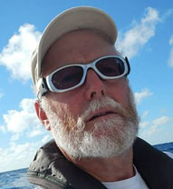
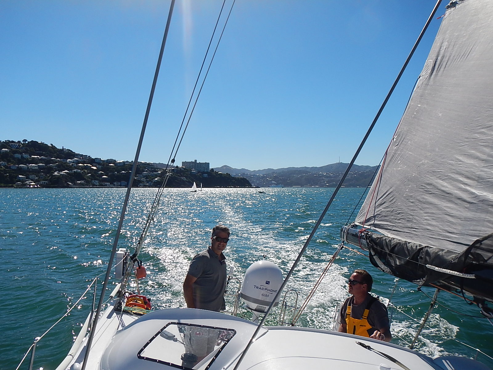
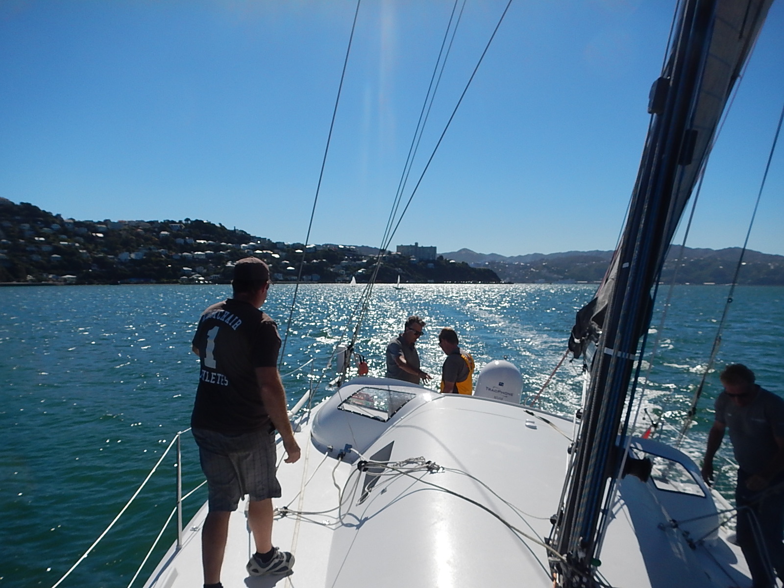
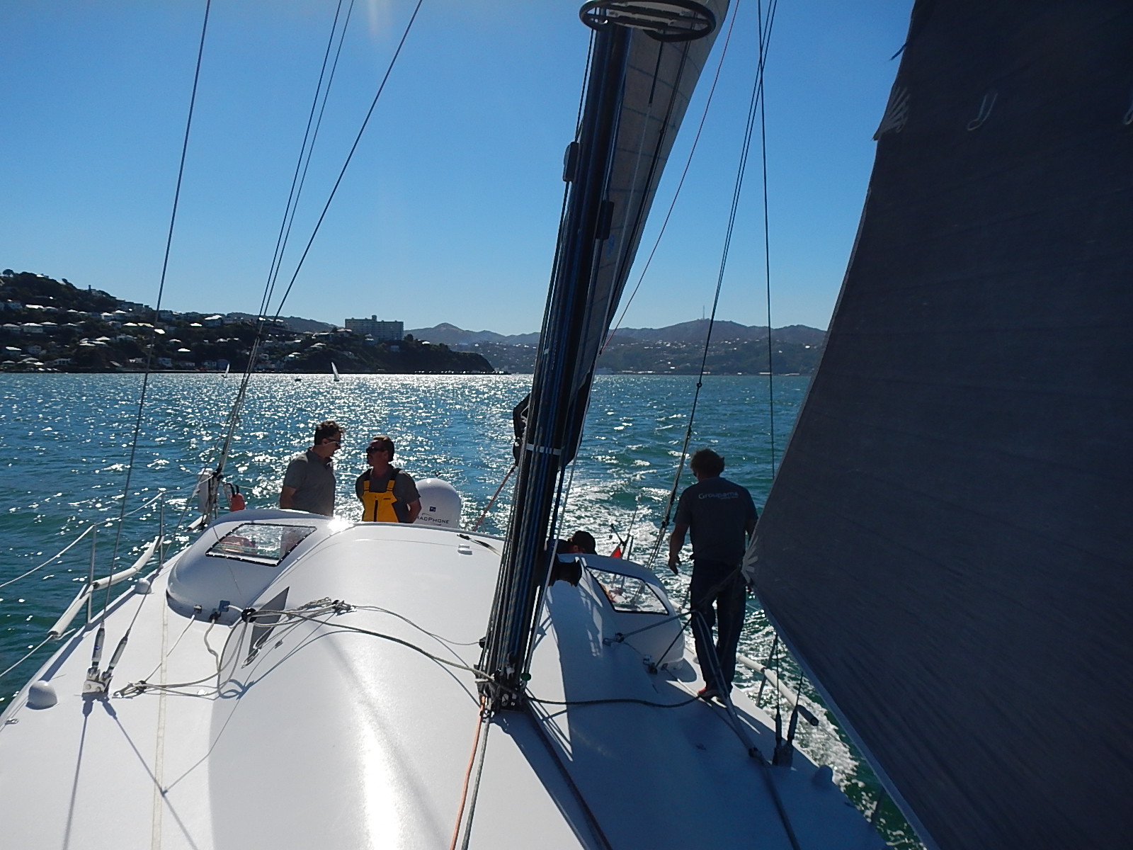
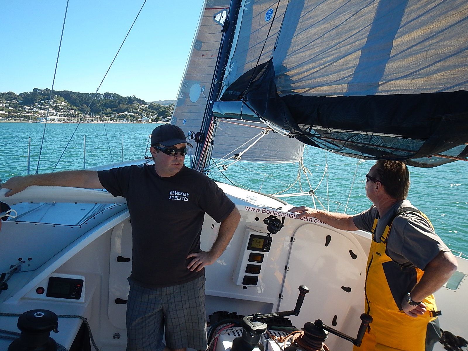
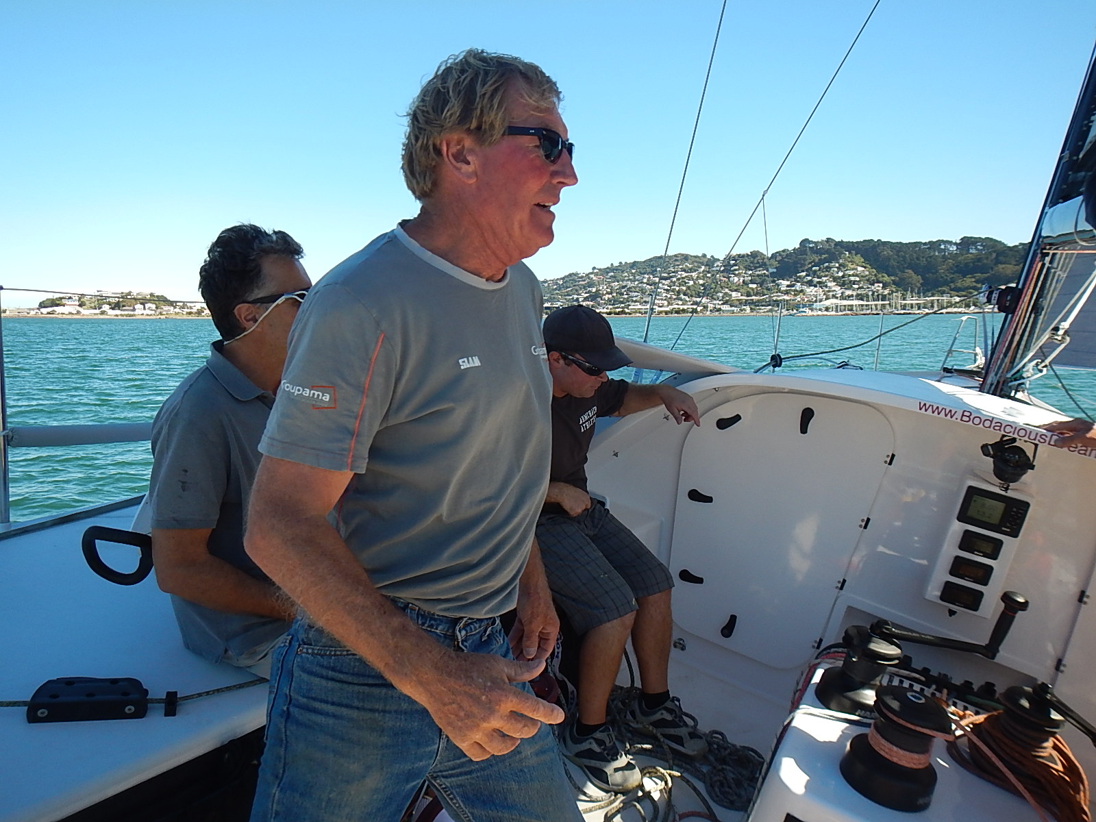
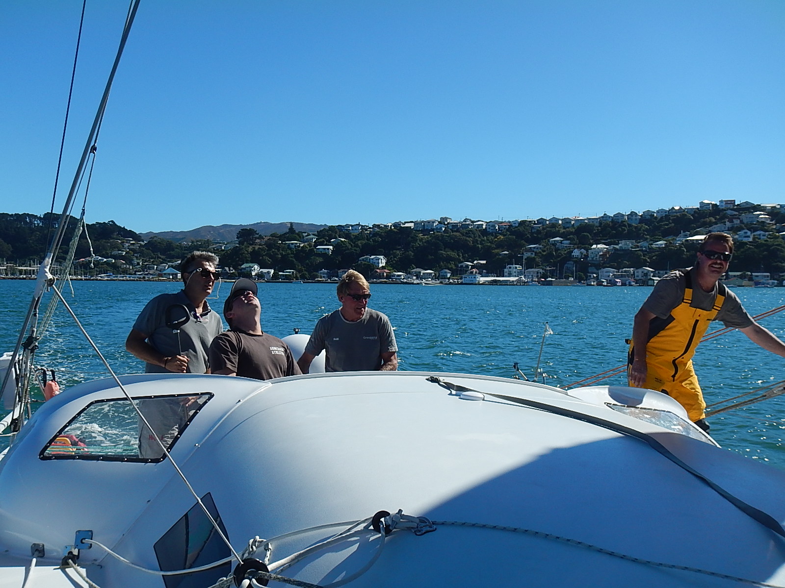
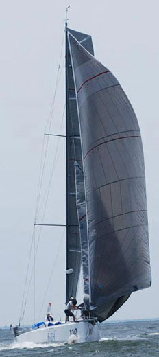
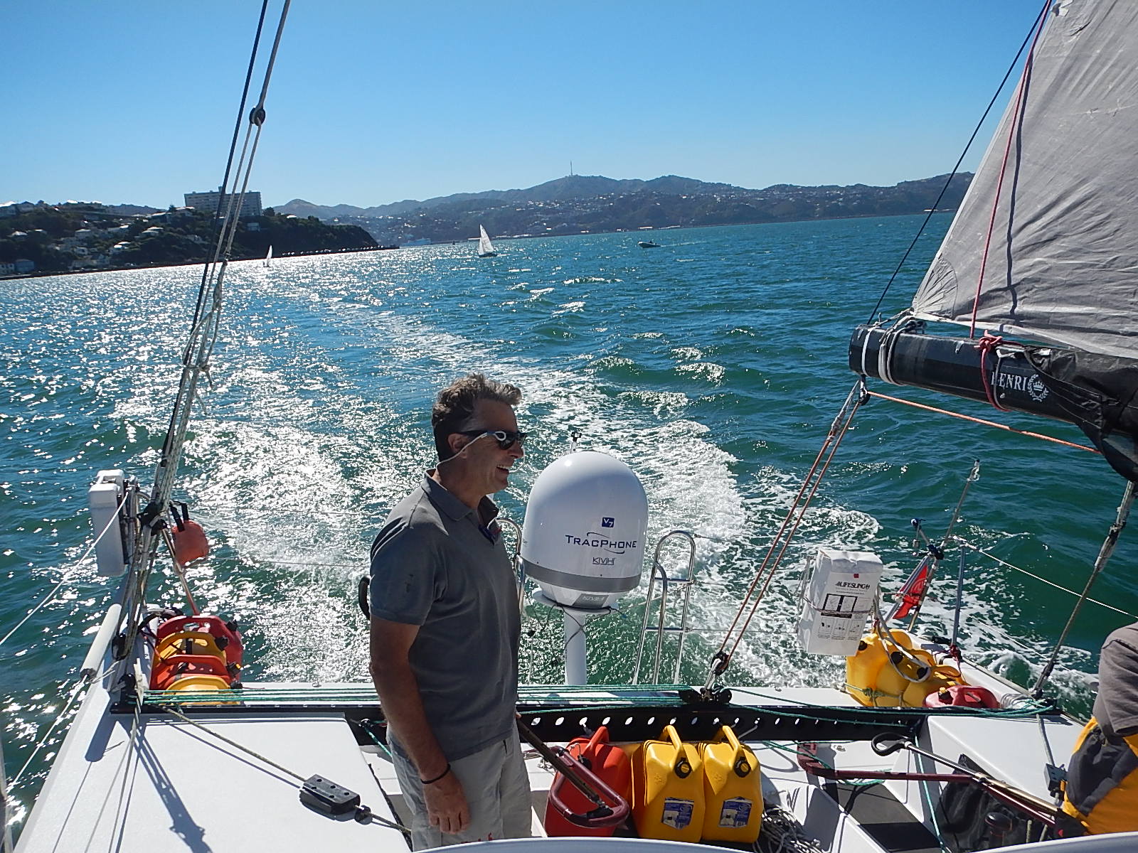
Dave RearickDave Rearick: Wellington, NZ has a worldwide reputation for windy weather. For the past few days though, it has instead offered up absolutely gorgeous days of clear and sunny skies with winds at less than 15 knots. This has made for perfect conditions to test sail Bodacious Dream after the recent work and refit she just underwent. So far, everything is coming together just fine. Our awesome crew has done a great job getting Bo into shape for Leg 3! (See some pics below in slideshow format.)

Today, we’ll begin the sorting and packing of the boat as forecasts are for wet and windy weather to return this weekend. Our hope after that front passes is to get the go-ahead weather window that we need to depart early next week!

Test sailing … Click the arrows to advance, and scroll over to read the captions.

While we get ready for all that and I head off to do some major provisioning, we wanted to revisit some of Tegan Mortimer’s Science Notes, we didn’t have a chance to publish before now.

We are also readying a wonderfully informative science note on “Seabirds,” which includes a list of all the seabird sightings we’ve identified so far on the voyage. But before we do that, we want to focus in on one particular seabird that holds a special interest for people all over the world – and that’s penguins!

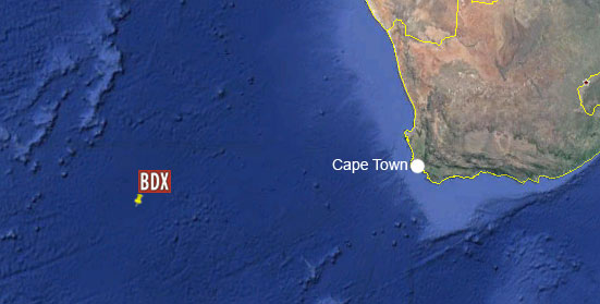
During our post-Leg 1 Cape Town stopover in December, we were treated to the unique experience of visiting a large colony of African penguins that reside near the Cape of Good Hope (the southernmost tip of Africa.) While the overall distance from there to Antarctica is pretty substantial, it is still within the habitat range for penguins, for reasons that Tegan will explain in her excellent report. And I’ll be back soon with more.

– Dave
Tegan MortimerTegan Science Notes #5 – Penguins in Africa?

When Dave and Bodacious Dream reached Cape Town and the end of Leg 1 of his circumnavigation at the beginning of the year, he took time to explore some of the many diverse natural wonders of that region.

One of his first trips was to see the penguins. Yes, you heard that right, penguins in Africa! The African penguin is only found along the west coast of South Africa and Namibia, though it is also one of the most common species kept by zoos and aquariums.

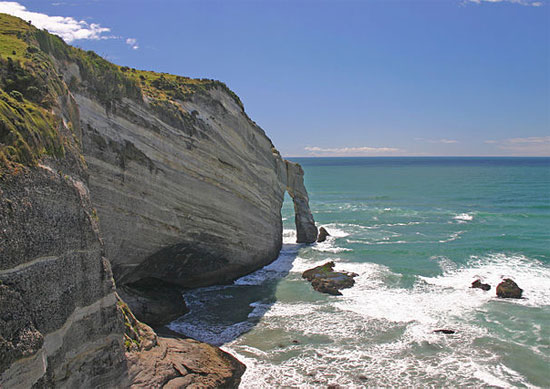
penguins_dave_550Dave’s Photo  …

We usually think of penguins as only occurring in the snow and ice of Antarctica, but there are actually quite a few species that live in more temperate habitats along the coasts of South America, Australia, New Zealand and of course Africa. All species of penguins are native to the Southern Hemisphere, so you would never find penguins interacting with Northern Hemisphere species like polar bears and walruses.

penguins_benguela_550The areas in which penguins are found do have something in common though: cooler water. When we look at charts of surface water temperatures around South Africa, we see that there is colder water around the western coast of South Africa and Namibia, in exactly the area that African penguins are found. This is called the Benguela Current. This current carries cold water northwards and creates an upwelling zone near the coast. The South East trade winds then push the surface waters away from the coast which draws the deep cooler water up to the surface.

Cold water carries more oxygen and nutrients in it because it’s denser than warm water. When phytoplankton undergo photosynthesis, they use up nutrients and oxygen from the surface water; unless this surface water is replenished then photosynthesis will stop due to a lack of oxygen and nutrients. This is why upwelling is so important; it continually brings new oxygen and nutrient-rich waters to the surface. High levels of plankton support rich ecosystems of small schooling fish, krill and squid that then help sustain larger predators such as whales, sharks, and sea birds.

penguins_map_550

African penguins feed on small schooling fish, particularly sardines and anchovies which are supported in huge numbers by the Benguela Current ecosystem. Sardines and anchovies are some of the most important commercial fish species and are caught in large numbers throughout the world. In South Africa, penguins compete with fishermen for these precious fish.

Unfortunately African penguins are considered to be endangered. Their population has declined by about 60% in the last 30 years, which is a very rapid rate. It is thought that a lack of food is the major cause of the decline. This lack of fish is due to both the huge numbers that fishermen remove, as well as environmental fluctuations in fish numbers and distribution.

Earthwatch scientists are active in studying the nesting colonies present on Robben Island; trying to understand their rapid decline and formulate strategies, which will increase their chance of survival. One success so far seems to be the addition of artificial nesting boxes to the colony. These birds typically nest in burrows, but many of their nesting sites have had the naturally thick layer of guano removed for use as commercial fertilizer leaving nothing for the penguins to burrow into. Penguins now seem to actually prefer the nesting boxes, which allow them to be more successful at rearing chicks than if they were in a burrow or out in the open.

penguins_arkive_550

It is very easy in this instance to blame fishermen for catching too many fish, which reduces what is left behind for the penguins. It is true that many fishing practices are very destructive, both to fish populations and to the marine ecosystem, but it is also important to remember that the ocean is an ever-changing eco-system. If the lowest levels of the marine food chain (plankton and small school fish) change, we see changes in the higher levels too. Climate change is driving these changes, just as we humans are driving climate change. Everybody has the ability to make a difference by way of the choices we make every day. We all can help to save the African Penguin.

To close things off, here’s a cute internet video that shows the ups and downs of being a penguin.

– Tegan

:: Tegan Mortimer is a scientist with Earthwatch Institute. For more exciting science insights, check out our BDX Explorer Guides or stop by our Citizen Science Resources page, where you can also find all of Tegan’s previous “Science Notes.” We welcome your input or participation on our BDX Learning Discovery efforts. You can always reach us here or @ <oceanexplorer@bodaciousdreamexpeditions.com>

The Great Circle Game

For some reason yet to be determined, Dave has lost his Iridium email service. He still has phone and text capability, and is checking in frequently to let us know all is well … but for now, no email, so updates will be brief or will (as we do below) include some older updates that never got posted.

The following update was received over the phone.

“Going along real nicely here on a course headed for the northwest corner of South Island of New Zealand (Farewell Point.) We’re averaging over 8 knots the last couple days and likely for another couple of days as well. We do have a cold front weather system coming in Tuesday night, which will bring strong winds Tuesday evening into Wednesday, which should give us the push we need to take us down Cook Strait towards the southwest corner of the North Island, and into Wellington Harbor.

Cape FarewellFarewell Point, Northenmost tip of South Island of New Zealand (web image)

The bioluminescence is still around, though not to the spectacular degree I described it in the last post. Looking south towards Antarctica tonight, I can see a glow in the sky; similar to the sort of glow that a city makes when you are on the water and over the horizon. As we know there’s no civilization south of us here, so I can only think it’s the glow of the sun reflecting off the polar ice cap.

Had a fun time last night calling into the awards dinner for my friends in the Great Lakes Singlehanded Society. I spoke a bit and answered some questions. Thanks for the invite!

I know my Midwest and East Coast friends are getting hit with some dramatic weather of late … I’ll just say it’s summer down here … 55-60 out on the water. Food is getting down to final tally time. There are plenty of calories onboard … but the fun items on the menu are gone.  I’ll make up for that, when I get to Wellington towards the end of the week. Over and out!”

43.9857S, 159.55377E

:: As mentioned above, here’s an update though from some weeks ago that never got posted. It’s a navigation-related update, and its contents are still relevant to the current leg of the voyage. Enjoy!

Sailing long passages puts you in the middle of constantly shifting set of time and distance problems. These little mathematical calculations are always running through sailor’s minds when they’re not otherwise occupied with shipboard duties. Recently, I had one of those days where I had a whole bunch of interesting problems come up relative to navigation and latitudes.

I was trying to step back and figure out just how far it is from Cape Town to Wellington, NZ. Now I have a GPS locator onboard and it can give me a distance, but it works on what’s called the “Great Circle” route, which calculates the shortest distance along the curved surface of the Earth. Our own strategy though for sailing to Wellington is to stay along a particular latitude – namely 40 degrees south. We do this to maintain the best route through the least stormy weather. But back to the questions raised by the Great Circle method, let me explain a bit and also give you an experiment you can do on your own when you have a chance.

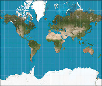
mercator projection mapOver time, all of us spend a good deal of time looking at maps and charts of various places. These might show us our hometown, or a route to a someones’s house, or a map of the country or maybe the large world map on a classroom wall. Typically, these kinds of maps that we are so used to, are as a class called “Mercator Projections.” They represent the three-dimensional world as if it were laid out flat on a tabletop. The problem with this of course is that the world is not flat but rather beautifully round and by creating a world map that is flat and rectangular; you end up distorting the actual distances – particularly so, once you start considering areas closer to the polar ends of the earth.

Here’s an amusing video clip from an episode of the TV show West Wing that deals with how the Mercator projections distort the actual size of landmasses as they actually exist on the globe.

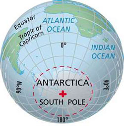
South Pole GlobeIf you can find a globe and look at it carefully, then turn it so that the South Pole is facing you. Now if you can find a string, a shoelace or even take a piece of paper and cut a thin strip from it, then put one end on Cape Town South Africa and the other over to Wellington, NZ, you’ll see that the shortest route goes over the Southern Ocean and over Antarctica. This is what we mean by the “Great Circle” route. If you in were a plane, you could fly that route, but in a boat, it’s not an option. There are a number of reasons why, some of which are obvious such as the continent of Antarctica and the impenetrable ice, but also, the further south you get, the colder the water and the more dangerous the weather. So, that’s why we chose the route along 40 degrees south latitude. So, to get that distance, you have to work your way along that latitude with a measure of some kind and figure out the distance.

Now, while you still have that globe out, let’s take a look at something else. I believe I told you a while ago that the degree of longitude is widest at the equator at 69.172 miles (111.321) and gradually shrinks to zero at the poles. At around 40°N or S, where we are,  the distance between a degree of longitude is 53 miles (85 km). But as you can see, at the South Pole and the North Pole, all the degrees of longitude come together into one point. That’s pretty interesting isn’t it?

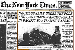
Nautilus 1958Here’s an interesting story I once read. Back in 1958, when the first Navy submarine (USS Nautilus) was able to travel under the ice pack of the North Pole and once they reached the pole, what do you think the navigator said when he called out his position? He sure must have enjoyed saying this … “90 degrees North latitude and ALL points longitude.” His meaning was that all the longitudes came together in one precise point at the North Pole!

So, I spend a lot of time trying to figure out some of these things when I have time, but if you’d like to, you can do the calculations to figure out how far it is along latitude 40 degrees south from Cape Town, South Africa to Wellington, NZ.  And if you can play the Great Circle game, how much shorter is that route than the one I am taking?

I think it’s worth noting that while I wrote this soon after leaving Cape Town, now that I’m approaching New Zealand I can see that my calculations at the time are still pretty much right on target.

– Dave, Bodacious Dream and Franklin (my onboard globe for this trip.)

Some Key Links: Email List Sign-Up :: Explorer Guides :: BDX Facebook

After the Deluge

Well, it’s been quite a week here on Bodacious Dream! If you recall, last Sunday, I said we passed the 3000 miles from Cape Town waypoint. Well, this Sunday, we passed the 4000-mile mark, which leaves us with something like 3200 miles before we reach Wellington, New Zealand and the completion of Leg 2 of the Circumnavigation!

BD_232

As I was going back through the trip logs on the computer, I noticed that Bodacious Dream and I have logged nearly 30,000 miles together since she was launched in late 2011 in Wellington, NZ, and right where we are headed next. Amazing how the time and the miles fly by!

I’ve been onboard for every one of those miles … some in New Zealand, then after she was shipped to Charleston, SC, racing up the Atlantic Seaboard, then into the St. Lawrence Seaway and to Québec City, followed by a trip across the North Atlantic, in and around France, England and the English Channel – then down to Portugal, back across the Atlantic to Antigua in the Caribbean and back up the Atlantic Coast for the Atlantic Cup this past spring before prepping and launching the Circumnavigation which has taken us to Bermuda, Cape Town and now 4000 miles through the wild and desolate Southern Ocean. Such is the life of a vagabond sailor! At this point, both the sails and I are beginning to show some signs of wear and tear – but onward we go, into the wind – and daily grateful for the chance to do so!

In the last update, (the one before Tegan’s Science Notes) I said that we were looking for one of these now famous Southern Ocean cold fronts to pass us mid-week, and that we were setting up for a showdown with a cyclone by Friday. Our strategy at the time, was to sail with the winds of the cold front, as quickly east as possible in order to get us to a position about 95E Longitude which would put us just in front of the cyclone come Friday night.

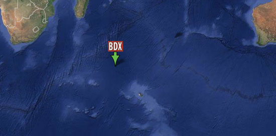
38.57215S, 100.361912E
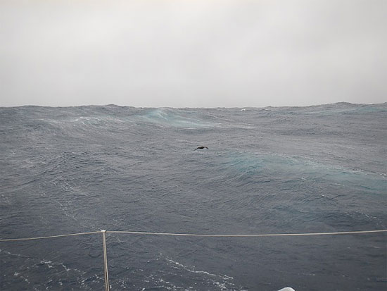
A lonely bird in grey seas … 38.57215S, 100.361912E

We sailed well and tapped some of the power of that cold front Tuesday, but fell into light winds on Wednesdays. Stressed at the possibility of NOT getting ahead of the cyclone, which would deliver us headwind punches (right on the nose) instead of the MUCH preferred tailwinds (from behind), I worked extra hard all day Wednesday trimming the sails, until the winds filled back in late Wednesday night.

By Thursday, the path of the cyclone had become clearer … and we could see it wasn’t going to play fair. We had expected it to move south and diminish in strength, and then hitch itself onto another passing cold front to form an even more powerful cold front, passing through our neighborhood at about 85E Longitude. As we tracked its progress though, we could see it had decided to zero in on a little sailboat called Bodacious Dream and to change its course to the southeast with the aim of crossing our path at around 99.5E Longitude. Fortunately, Bo is a quick boat and we were able to beat the cyclone to 99.5E and get ourselves to about 100E before the cyclone caught up to us and gave us the tailwinds we wanted! I know that all may sound a little abstract, like blips on a radar screen – but let me tell you, when you’re dancing all around the deck, doing everything in your power to extract a couple extra knots of speed … it’s all very real … but very fun too.

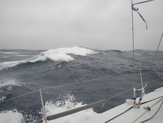
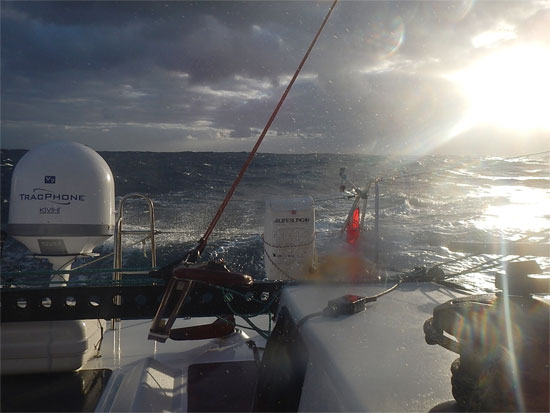
38.57215S, 100.361912E Grey and white … 38.572169S, 100.361104E

The flip side of the story is that though we got the tailwinds we wanted, we were close enough to the cyclone for those winds to be rather substantial! For the next 18 hours, Bo and I sailed through tempest winds from 35 to 50 knots and seas the size of small countries. Bo handled it with class and dignity, while I cowered down below decks waiting for something to go wrong! LOL!

There was one rather funny moment I’ll share. The winds had gotten into the 40-knot range, which was pushing Bo just too fast for safety into the waves in front of her, and so the only option I had was to go forward onto the bow and take down the small orange sail that was flying. Normally, this is an everyday job on a sailboat and done without much concern, but when the winds are gusting over 40, and the boat is flying along at 12 knots and crashing into and bouncing off of waves, it’s really quite a thrilling (and at the same time, discombobulating) experience. With all my gear on and my integrated harness and inflatable life vest, I clipped on my tether and ventured forward – bouncing and stepping across the deck like an uncoordinated booby bird doing the Charleston. Once to the bow, I tackled the flogging and soaking wet sail and pulled it down like I was wrestling a small animal. Once down, I began to tie it to the deck so it wouldn’t blow away. Just then I heard this rushing sound pushing my ears. I looked up and was eye-to-eye with a huge elephant-sized wave, which smacked me solid, drenching me in a torrent of water. I couldn’t help but let about a laugh – the totally disproportionate size advantage that ocean has over humans is inherently comical whenever ocean decides to exercise it.

Anyway, I went back to tying down the sail with I heard this “pop,” followed quickly by my automatic life vest inflating, leaving me on the foredeck with this huge tire around my neck … making it doubly difficult (and triply comical) for me to finish my task! But finish it I did, and got back below decks, deflated the life-vest, replaced it with another, all the time wishing I’d have had some video of all that! I guess it’s good to know the life vests work, though they’re only supposed to inflate when fully submerged. I guess that wave was even bigger than it looked!

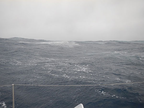
38.57215S, 100.361912ELost horizons … 38.572138S, 100.361666E

Well, the storm was everything it was forecasted to be and lasted a full 24 hours. I’ve had very little sleep since it began, but fortunately, the forecast for the next three to four days is for some far more relaxed sailing, so I hope to use the time to catch up on my rest and get some warm food in me. It’s now about 18 hours since the storm passed, but I guess nobody told the waves that, because they are still burly and strong causing us to shudder and shake with each big roll. Oh well, what to do, but look to the horizon (if you can see it for the waves) and to whatever tomorrow might bring.

And, with about 500 miles to go before we are officially ‘underneath the down under’ (Australia,) I’m getting excited at the thought of hot showers, fresh food, cold beer and seeing old friends in Wellington. I’m figuring maybe 18 days. As you probably know by now, my mind can’t help but take miles, time and speed and turn them into a series of math problems.  So, let’s see … if there are 3200 miles left to Wellington, New Zealand and I am making 7.2 knots average a day, how long will it take me to get there?? Have some fun of your own folks!

Until later,

– Dave, Bodacious Dream and (the math challenged) Franklin

Be sure to check out our new Explorer Guides!
The mailing list sign up, as always, is here!

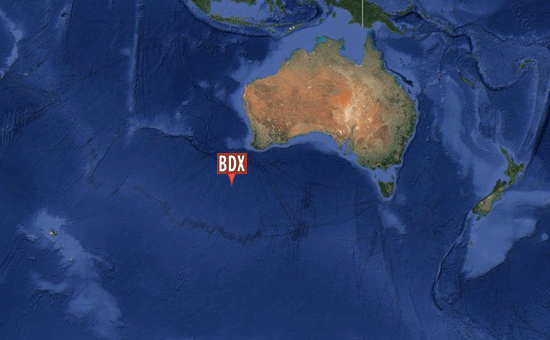
https://goo.gl/maps/Kp6pnAlmost down under down under … 41.81022S, 110.78864E

Surfing Along Latitude 40

I trust you all had a good New Year, and are cast off now on the open seas of January. Bodacious Dream, Franklin and I had a good one, and have also been experiencing some very good sailing here the last few days.

As some of you know, I have a proclivity for mapping out waypoints. Typically, these are specific points on a nautical chart, but they can be more abstract goals as well, such as personal markers you set for yourself. Anyway, I use waypoints, so I have some gauge as to how things are progressing. When the distances you’re sailing are in the thousands of miles, you often can’t get your current position and your intended destination on the same chart, so by setting waypoints, you can give yourself a sense of accomplishment as you go along.

Screen-shot-2014-01-05-at-1.30.16-PM
In the Middle of the Deep Blue Sea … 41.4829S, 59.4750E 

Today we marked off a couple of milestones. First, we passed 2000 miles sailed since leaving Cape Town on December 21st. So, now I’ve punched in my next waypoint at a point on the map that is 3000 miles from Cape Town! And also, when I zoom out on the electronic chart navigation system, I can see both where we are now AND Western Australia on one screen … which is kind of cool … not having the boat being the only thing on the screen!

So, Western Australia is about 2300 miles east of here and with any luck, in about two weeks, I should be cruising below that longitude and heading towards Tasmania … and then onto New Zealand. Now, Tasmania is about 3800 miles from here and New Zealand, currently about 5000 miles. So, there’s still a long way to go!

(Now, I’m not able to upload the new VIDEOS I’ve been shooting out here until we get closer to land … BUT I do have an earlier video that you haven’t seen and that I’m adding here because curiously enough, it was shot at an earlier milestone, when I was 2000 miles from Cape Town (as I am now) but on the Leg #1 side … as well as 5000 miles from our Jamestown, RI starting point, which is exactly as far as I am right now from our Wellington, NZ endpoint. (Lots of wind noise in this video – sorry about that, but you’re not missing much in this case.) 

2000 from Cape Town, but in the opposite direction … 

The past couple of days we’ve had some really sweet and steady winds, so I was able to keep up the speed and knock off some miles. Last night, I was able to surf off waves and so raised the speed up to 12 and 15 knots a couple of times. You can make some good miles this way, if you can keep it going. Unfortunately, by mid-morning today, the high-pressure system that follows the cold fronts pulled in … so now, I’m back to moseying along at 4 and 5 knots. But, the good thing is, I’m tracking straight east along Latitude 40 with yesterday’s total distance at over 200 miles!

It looks though like we’ve got some complicated weather coming in this week. There are a couple of low-pressure systems headed our way, and then there’s also a tropical cyclone that is presently up near Madagascar that just might spin off some energy into one of these southerly moving lows and intensify it. So, we’re hoping to make some good progress in the meantime, so we can stay in front of that storm and take advantage of its pushing winds, rather than fall behind it and have heavy wind in our face. So, I’m spending extra time trimming the sails and making sure the boat is open and moving the best she can. If all goes well, by Sunday of next weekend, we can say we’ve passed the 3000 miles from Cape Town mark, which is about half the distance to New Zealand!

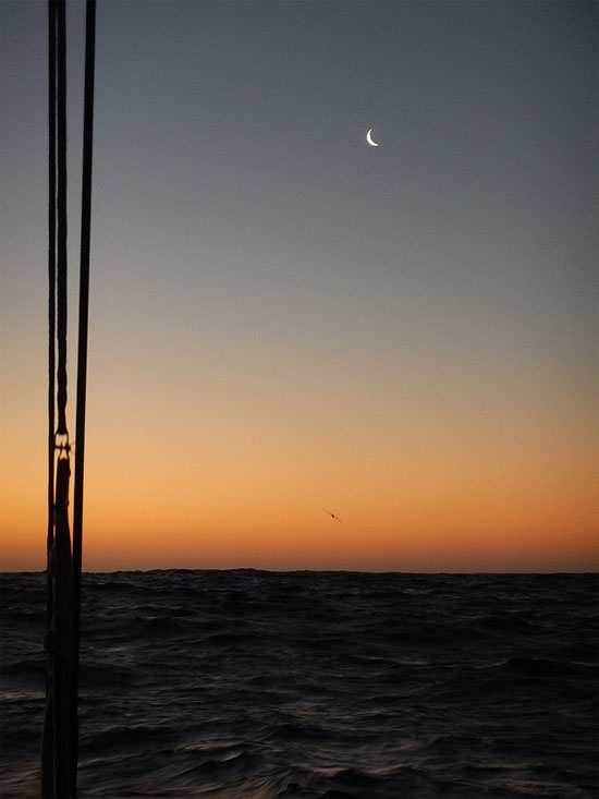
sliver_moon_550This is a moment …

In the midst of all this sailing, there is always some startling beauty out here in the watery world. This photo I took of the sliver of a moon in the gold of the setting sun and one of my entourage of birds all came together just right. The beauty and balance of sea and sky, light and dark, movement and stillness all combine sometimes to give me this great feeling of peace and pleasure.

But for now, it’s back to the routine of sailing the boat, looking out for phantom ships, hoping to see whales and dolphins, making dinner, doing maintenance and eating chocolate … though I’m getting a bit worried I’ll run out of Hershey’s Dark Chocolate Kisses before the end of this leg. (Are you listening Jenny? Jenny’s my friend AND my Hershey’s contact!)

Again, thanks for following along. There will of course be more to come soon. And watch for our new Explorer Guides launching the middle of this week! The plan is to launch two of these every week for the next three weeks. This new set will be bigger and cover many more subjects than the earlier sets. They will have plenty of fun facts and provocative questions that will hopefully be of interest to learners of any age. I even learned from working on them!

So, until later …

– Dave, Bodacious Dream and Franklin (who recently realized that the earth is shaped the same as he is)

Schooling in Wild Wind and Weather

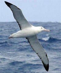
Albatross_200Saturday marked one week since leaving Cape Town, South Africa on a course through the Southern Ocean towards Wellington, New Zealand. The Southern Ocean is known for its cold northward flowing waters, its extreme weather but also for its large population of Albatross birds, who have the uncanny ability of seeming to fly forever without ever flapping their wings! This first week, I didn’t make the 1200 miles I was hoping for, as so much time was spent trying to escape the clutches of those high-pressure weather systems that keep the southern tip of South Africa insulated from the steady march of cold fronts that move southwest to northeast off the Southern Ocean.

This mix of cold fronts which are low-pressure systems, rotate clockwise here in the southern hemisphere while the high-pressure systems rotate counter-clockwise – and which generate a mostly steady stream of westerly winds, which is what I need to ride to get me to New Zealand. The dynamic combination of these two systems is what generates productive sailing winds. However, this past week, the highs have dominated the region and I have only had two cold fronts pass, one rather weak and the other last night rather robust.

Coming as I do from the far milder climes of the Midwestern Great Lakes, I am having to quickly learn these new weather systems and waters and to synchronize my experience and intuitions with this new ocean. Overall, this has made the past week pretty challenging. However, as the blustery front moved on today and the 30-knot winds diminished, a more steady westerly wind developed that allowed me to sail quite quickly through last night with wind speeds in the 17 knot range. That pace is more manageable on a boat like Bodacious Dream than the far pushier 30-knot winds.

Bodacious Dream, being a racing boat and so light in weight, can really move! While other world-crossing sailors often have larger, heavier boats and can make use of all the wind 30 knots can provide, I only need 15 to 20 knots for a really quick ride. So, when the winds get much higher, it becomes a lot of work for me to single-handedly keep this racehorse under control and not have her gallop off too fast.

splash2_550Earlier in the week … 35.394364S, 13.294403E

I know all this high-pressure, low-pressure extreme weather talk is dominating my narrative since leaving Cape Town, but that’s what’s happening, my friends! So, to recap, here’s the pattern as best as I can explain it.

The routine repeats itself every couple of days. First off, the winds begin to build up from the north and the northwest as a cold front approaches, pulling the winds from the high-pressure system in toward it. I set my course to the east and sail with those winds and watch for the telltale signs of the approaching cold front, typically about 24 hours away. Once I see squally conditions forming, I know that the front is approaching and that at some point, without warning, the winds will start to diminish, indicating the coming of an abrupt wind shift over to the southwest as the actual line of the front passes. At this time, I gybe the sails, but keep the boat on the same course, which means, I move the sails to the OTHER side of the boat and keep on sailing. Often, for an hour or two, the only difference is a change in temperature downward until a few hours AFTER the front has passed, at which point the clouds start to part and the sun begins to shine. Then, maybe 6 to 8 hours after that, the skies have cleared up and we continue sailing eastward on the southerly breezes … UNTIL they shift around to the north again and the pattern starts all over again.

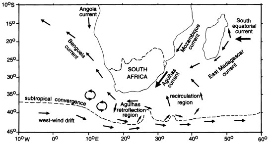
south_african_currents_550
I’m not even going to TRY to explain this map! 

This basic pattern is the one that is expected to continue for about 5 weeks, until we hit New Zealand where more local weather conditions will dictate different strategies for our arrival. This is probably why the Southern Ocean is so often referred to as a “desolate” sea. How many people would want to put up with these kind of knockabout conditions, unless it served some larger purpose, as it does in my case!

So, my daily routine has readjusted itself to match up with these weather patterns. This means that unlike at home when you get up and start your day, out here, I never quite know when the day begins as I am almost always somewhat awake and working to manage the boat or take care of something … sleeping only for brief intervals of 15 to 20 minutes. Such short intervals bring a little extra peace of mind as well as allowing me to keep an eye on the boat and to look out for other ships.

iridium-photo_500
A not untypically beautiful Southern Ocean sunset … 40.54816S, 34.195064E 

In the midst of all this, I try to hold to some semblance of a personal routine as well. I’ll share that with you, if you care to read a little further.

Around sunrise, I take a couple of quick naps and then toast the day with my personal favorite beverage … an orange juice box! I’ll then set up the computer and send out a position report, as the Spot Adventures tracker, which did that automatically on Leg #1, isn’t active in this “desolate” part of the world. Once that is done, I’ll check instrument readings and write in my ship’s log the goings on for the past hour or so. After that, I might settle down and read for a bit or watch the waves and the sky.

I don’t generally take a lunch, but rather snack on foods through the day. Beef Jerky, crackers, cheeses, fruits and chocolate make up my most important food groups. At least a couple of times during the day, I’ll take over driving and allow Otto, the auto pilot a chance to relax. Once sunset happens, I leave it to Otto drive through the night. All through the day, depending on the wind direction and speeds, I make adjustments to the sails, plot navigation and make notes in the ship’s log. As I said, higher winds mean more sail adjustments … from reefing the mainsail to reefing the jib to taking the jib down and resetting it again.

I like to have my dinner late at night, after the sun has set and the winds have stabilized for the night. I’ll search through my “pantry” of freeze-dried foods and pick out something that sounds good … not that the choices aren’t already well known to me! Somewhere between 22:00 and 24:00, I’ll boil my water, mix up my food and then sit out on deck and dine al fresco under the stars! Something about the setting makes the food seem worthy of a five-star Michelin award – though last night the outside deck was closed due to inclement weather!

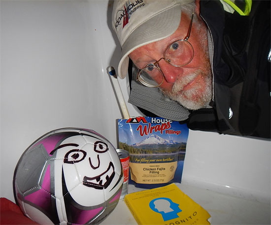
Dave_Franklin_550
Franklin, Food and Fine Reading

I’ll then spend the rest of the night reading and napping on and off waiting for dawn to arrive at which point the routine begins all over again.

I wish there were more exciting events to report, but for the past few days, life has been a bit mundane … with the exception of the occasional big waves that crash over the cabin top and deck, the 30-knot winds and the incessant squally rain of last night. But aside from that, there’s nothing too exciting going on around here! Believe me, last night, even though all my Midwest friends tell me how cold it is there right now, I still found myself wishing I was there … that is until the clouds broke and the sun started to shine again!

That’s it for now … Wow, the new year is almost upon us! All good wishes to all of you for a great one!

– Dave, Bodacious Dream and Franklin (my bouncing buddy)

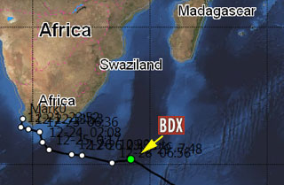
BDX1
Currently @ … 39.803250S, 35.970750E 

Christmas in the Southern Ocean

It’s Christmas Eve here in the Southern Ocean. Bodacious Dream, Franklin (the ball boy) and I are enjoying the day even though today’s winds have been less than generous. Last night the winds kicked up, but against a strong current, which made for very confusing seas and sailing that was less than comfortable. This morning, as the sun rose, the winds flat out disappeared, and the seas settled down, such that we are just barely moving along at the moment. This gives me some time to relax, to nap and even to sing a few Christmas carols to myself! (Franklin just winces!)

Now, I know some of you may not have gotten over to Facebook to get the word that we departed Cape Town Saturday morning. Before we left I had spent a few days up at the top of Bodacious Dream’s mast making some repairs. Here again is the link to the small FB photo album I included in the last post, but here’s a never before seen short video I made of the splendid views from the top of that mast.


A Grand View of Cape Town 

Truth be told, I’ve been a bit melancholy since leaving, missing my friends and thinking of my family and the holidays. This year, as I did last year, I am spending the holidays away at sea. Next year, I’m planning on staying home and enjoying them properly amidst fine company.

The next five or six weeks will likely consist of our encountering an ongoing series of frontal weather passages. Every couple of days, a cold front should arrive, moving winds from north to south, followed by a day or two of erratic winds before another cold front arrives. I’m told this will prove a regular routine that I’ll soon grow used to. So we’ll see if things play out that way. In any case, I’m already looking forward to getting to New Zealand and seeing old friends there! In the meantime, I’ll distract myself tonight by keeping an eye out for miraculous happenings in the Christmas Eve sky!

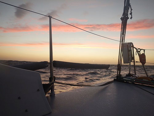
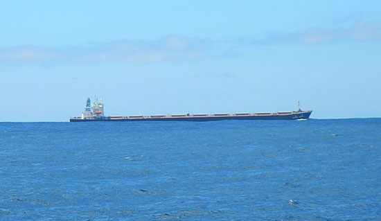
long_boat_550
One of the longer ones … 

There has been a rather regular flow of ships passing me the last couple of days; most of them coming from or going towards the Pacific Ocean. Some are very large, some not so large at all. Yesterday, I had a fishing boat pass by very close to me and we talked on the radio for a bit. He asked where I was sailing to, as he could tell I was heading east, and he was excited when he heard I was headed to New Zealand – and even more excited to learn that I was sailing alone. He wished me the best of sailing and a safe passage. That’s a pretty kind gesture coming from a fisherman, as these gentlemen make their life on the sea and have a rather protective relationship with it. I feel in a way as though he crossed my path just to welcome me into his waters and to wish me a safe passage.

Any other visitors I’ve had, have flown in to see me … lots of birds and flying fish, but I still have yet to see a whale. I was certain that by now, that I’d have spotted one, as some of the sailors in Cape Town had indicated there were a few pods roaming in these waters. I did see a few seals near Cape Town. It seemed as though I had surprised them, as they stopped what they were doing and watched me for a while before plunging back underwater. You can be sure, I’ll continue to keep an eye out for interesting wildlife.

So, as night has arrived, my attention turns to food. For dinner tonight, I’m planning Chicken Fajitas (from which I’ve painstakingly removed the beans) and fresh tortillas. I’ll toss in an extra ration of chicken (from my special supply) and then a dash of Worcestershire sauce. I’ll finish with some fresh cookies. That sounds a little bit Christmassy, doesn’t it?

In any case, the simplicity of the fare will stand in humble contrast to the magnificence of the sea around me. The meal may soon fade from memory, but where I was on Christmas Eve 2013 will not. My Grandmother once told me, make sure you have memorable experiences in life … someday, you may have very little, but you will always have your memories. Thanks for that advice Granny! I’m doing what I can.

happy_holidays_550
35.23570S, 19.14.7133E

In closing then, a little card wishing you and your friends and your families, a most memorable holiday. I’ll be thinking of you all, as I take my short Christmas Eve walk tonight around the decks!

– Dave, Bodacious Dream & Franklin (who just keeps rolling with it)

Goodbye to Cape Town

Bodacious Dream and I are set to leave Cape Town first thing tomorrow morning! I’ve got just a few more things to find at the store – a pair of fleece pants I want to purchase and some additional books that I can read. I’ve got quite a library going onboard now with the help and interest of friends. With the historic passing of Nelson Mandela, I’m thinking his book, A Long Walk to Freedom would be an appropriate read for this next leg.

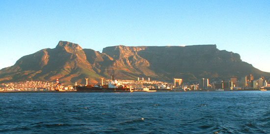
Cape Town has been a marvelous place to harbor. I can honestly say, my opinions of Cape Town were forged from the 1990’s and earlier, and were much in need of updating. I can’t wait for the opportunity to return to this beautiful place and enjoy more of it. Table Mountain, the coastline, the town, the country and nearby wine growing regions all make it a great destination to put on your list. I’m afraid that if this weather window had not opened for me to leave tomorrow, I’d be one of those who contract “CapeTownitis” … the inability to leave this place! Now I just wonder when I’ll be able to return.

One trip I took was up to McClear’s Beacon on the top of Table Mountain. The beacon was used nearly 170 years ago by surveyors  to map out the coastline around Cape Town. In this video, I try to explain how that worked.

McClear’s Beacon up on Table Mountain …

The folks at the Royal Cape Yacht Club have been marvelous hosts. I can’t thank them enough for all their guidance, answers and hospitality. They have their major race coming up here after the first of the year. It’s the Cape Town to Rio Race … so they are ramping up for a very busy time, which also makes it an opportune moment for me to move on.

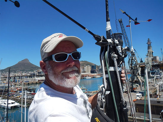
Here’s a shot of me up on top of BoDream’s mast, where I spent a good part of this week. You can check out the set of “Top of the Mast” photos over on our BDX Facebook page. Click here to see that album.

dave_mast_face2_550Top of the Mast to you!

Many people have asked if I’ve recovered from the trip down yet. I’d have to say that another week or so with not so much work to accomplish would really help, but at the same time, I’m pretty well recovered now from the fatigue and lack of sleep and so taking off isn’t an issue. I wonder too if another week would put me past my “edge” and then I’d have to reset all my internal gears to get back to long distance sailing. So, for now, the answer is YES, I’m ready to sail onto New Zealand though I may take a little more time in New Zealand this time through!

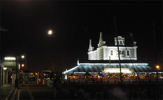
moon_capetown_550Moon over Cape Town …

Last night as I walked along the waterfront after dinner, I saw the still full moon in the night sky. Tucked in-between and camouflaged by the streetlights and the busy waterfront harbor, she still shone bright and I felt the draw to be back in the serenity of night on the open ocean with the bright moon and stars. With Christmas just a few days away, and the weather forecast for pleasant conditions, I’m hoping for a spectacular Christmas Eve at sea. I’m already thinking about my freeze-dried Christmas night meal! And this time, I’ll have enough cookies to make it a real holiday celebration!

As you can imagine, over the years, I’ve made friends with so many people from so many different walks of life. Each of us has our own ways of commemorating holidays. I have always enjoyed Christmas, though I know many friends who have other traditions they celebrate. I find it calming inside that we have all found common ground to tolerate and respect each other’s traditions, knowing that we all, in our own ways, are celebrating and honoring the gift of our lives on Earth. May we all discover more of those generous dreams in the coming New Year.

So, tomorrow morning, at 06:00 hrs I will head to the harbor. It will take me a couple of hours to put the final stuff away, bend on some sails, check some of the rigging and make one last check of things before I untie the lines, slip from the harbor and head out to sea, bound for Wellington, New Zealand and the continuation of my solo passage around the world.

Thank you all for coming along with me and for being there to hear the stories, share the explorations and marvel at the amazing spectacle that is life.

Dave, Bodacious Dream and Franklin (who is really ready to get back in the swing of things.)

Cape Town Views #2

Tuesday here in Cape Town was crazy windy. Actually, it’s been crazy windy for a couple of days. Sunday was nice enough, but Monday and today had the wind blasting us with both barrels. Yesterday, Tim Eades and I were working on Bodacious Dream at the same time we were experiencing gusts over 40 knots … with sustained winds in the 30’s all around the harbor.

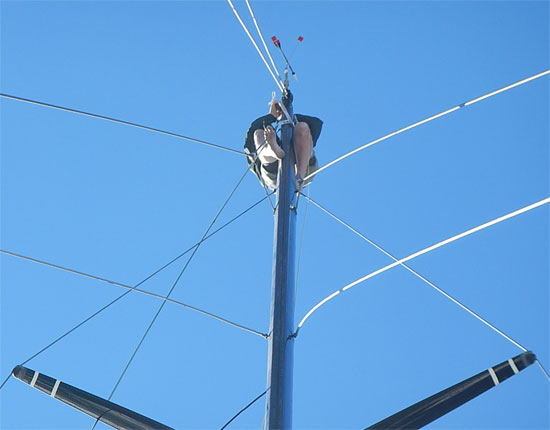
Today, I had to climb to the top of the mast to make some repairs to the wind wands and so Tim, Steve (an instrument guy) and I tried to avoid the worst of the winds by starting early. So there I was at 7:30 am at the top of the mast where for a couple of hours I worked on the mast sensors while rocking back and forth in 45-knot winds! We heard that other boats clocked winds as high as 62 knots! Wild! It was quite a game of patience and nerves handling tools and small parts and screws. Unfortunately, when I got done with the work we had planned, we came upon another problem, which means I will have to go back up the mast tomorrow. I cringe to even look at the weather forecast!

up_the_mast_550
Dave really up at the “top” of the mast … 

Cape Town is renowned for its winds this time of year as the weather systems compress the winds that push around Cape Point and move on up the Western Coast of South Africa.

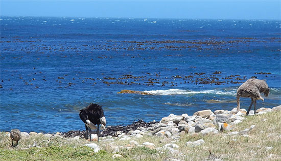
I’ve added some photos taken along the coast as I made a trip to see the actual Cape of Good Hope. Along the way, we happened upon a pair of wild ostriches and their young down by the sea.

Cape of Good Hope OstrichesWild Ostriches

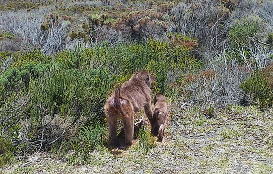
We also came across some wild baboons. As I learned, baboons are quite smart, and have caused quite a few problems in the neighborhoods around the area. At the same time, the animal control and various management services have to work hard to keep the animals safe and independent.

Cape of Good Hope BaboonsBaboons

And, of course, there were penguins as well. But I’ll have more to say on them later.

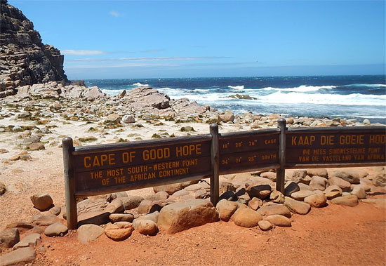
Cape of Good Hope
Right there at the Point … 

In the meantime, for the past week or so, work has been progressing on the boat as I make the necessary modifications and repairs so that this next leg proceeds even more efficiently and enjoyably than the last. Some of the repairs we’ve made have been to the mast instruments, hydro generator mount, spray shields and engine. Boats are always in use and so require regular maintenance to keep them working properly.

Salt, the main difference in the water of the ocean compared to the fresh water of the Great Lakes where I grew up sailing, causes all sorts of corrosion and it’s a constant battle to stay ahead of those effects. It really takes some careful thinking to try and anticipate where it’s going to cause the next problem. Zippers are a particularly persistent problem. You wouldn’t think so, but the metal part of a zipper condensates and attracts the salt, and since zippers sometimes don’t get much use, the salt cakes up in the mechanism and freezes the zipper in place – so coat pockets, bags and such are always giving me problems!

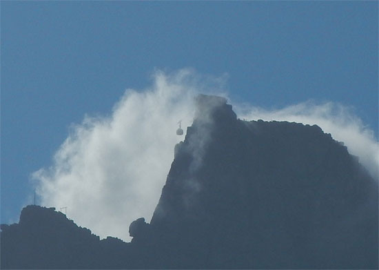
Table Top MountainCable Car up on Table Mountain with the “Table Cloth” Spilling Over …

So, as of today, we’re in pretty good shape with Bodacious Dream. The action list is down to a few minor items, and some shopping for fresh foods. Tim has been a tremendous help, not only with man-hours, but with his many suggestions and reminders as well. He’s heading home tomorrow as I begin looking for a weather window that will allow me a clean getaway from Cape Town. As of today, we’re hoping for some time Friday, Saturday or else, Monday morning for that chance. I’ll be keeping you posted … but soon enough we’ll be off, and commencing the 7000-mile voyage to Wellington, NZ.

So, it looks like I’ll be spending Christmas at sea again this year, as I did last year when I approaching the end of my Trans-Atlantic crossing from Portugal. Once again, I’ll be looking up into the night sky hoping for a glimpse of Santa as I take my traditional midnight walk … even if once gain, it’s just a couple loops around the boat!

So, stay tuned, the next leg is soon to start!

– Dave and Bodacious Dream

Arriving in Cape Town!

At the moment, I’m less than 100 miles from Cape Town, South Africa! My mind is excited and alternately entertaining the thought that I’ve been sailing for seven weeks straight now, and two months (today!) since I left Jamestown, RI … with the thought that in 24 hours, I’ll be walking the streets of a large and unknown African city!

(NOTE: Dave arrived safely in Cape Town, mid-day on Tuesday, December 3rd)

These past two months condense in my memory into a large and very wet block of time, one in which I was near constantly awake and working steadily around the clock. There’s not much to punctuate time on the open water other than sunrises and sunsets; that follow each other in a steady succession, all of which remakes your perception of time in a very singular way. With this first leg likely being the longest leg of the entire circumnavigation, some part of me worries that the other three legs will pass even quicker, and that this whole expedition will be over before I’ve had a chance to fully grasp the meaning of it all.

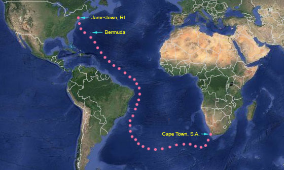
12.02.13So, this is what 8000 miles looks like … 

I opened the paper charts today of the North and South Atlantic oceans, to make some notes and to look things over, and I was amazed when I drew my finger across the nearly 8000 miles course that brought me to Cape Town. And to think, I’m actually just about there! If all goes well, I should arrive sometime tomorrow afternoon, hopefully in time to do a thorough rinse down of the boat, before checking into a hotel, scrubbing myself down and then catching a relaxing, fresh dinner – something with no freeze-dried chicken, please!!

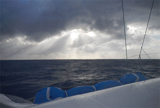
I’ve been sailing the past three days through a full-spectrum mix of weather, with last night being the toughest, marked as it was by a broken halyard and a dropped jib! I’ve been trying hard to play the weather patterns to our best advantage, positioning Bodacious Dream to the south of Cape Town so as to get the best angle of approach through the heavy SE winds. There are almost constant SE storm force winds that blow up the African Coast, so in order to more easily negotiate that vein of wind; you stay as far south as you can until the wind “bends” you back into Cape Town. We were ready for that scenario, but then a rather unique thermal low pressure system slid down over Cape Town and began to cancel out much of the heavy SE winds … but not all of them … which is what we fought our way through last night.

halyard_200Imagine if you will, the impact on your psyche of a loud bang landing out of nowhere in the middle of some heavy weather sailing? It happend just before sunset, and thankfully when I was steering. BANG!! My first thought was literally, “There goes the mast!” But quickly enough, I saw the jib falling to the deck and into the water, giving me every indication that the halyard had parted. At this point, I’m thinking (or at least hoping) that it’s only the shackle that broke and that the halyard will still be intact at the top of the mast when I get into port! Otherwise, it’s a long string with weights on the end of it to fish a new halyard down the length of the mast without twisting it around something already in the mast!

So, after a rather difficult and physical night of sailing, we are tonight, nearly becalmed. There are very light winds from the SW nudging me along towards Cape Town. The forecasts are for the breezes to freshen up here tonight, which would give me a good final push towards the harbor. But for now, it’s a beautiful night out here … so beautiful in fact that the thought crosses my mind of not stopping, but rather of sailing on to New Zealand. I mean it’s only another 6000 miles, and probably faster miles than this trip! Should I keep going? You know … on second thought, I think I could use a break from all this constantly alert busyness, so I think it’s best to stop … not to mention the fact, that I haven’t had a cookie in weeks!

32.8112W, 0.7929S 32.8112W, 0,7929S

So, the plan is to spend a couple weeks in Cape Town making some repairs and changing some of the setups on the boat to better sail the Southern Ocean, that vast expanse of water that flows under the four major capes of the world. That’s where we are headed next! There are also many interesting natural wonders around Cape Town, and I hope to be able to bring you some learning programs on them as I visit them. Cape Town has quite a history to be explored, and it’s definitely time to pick up our learning and discovery agenda!

Also, once I can hook back up to the Internet, I’ll be downloading lots of photos and videos … so stay tuned to email and to Facebook to catch up on the fun of the past two months! Forgive me though, if it takes a couple of days to get those photos and videos uploaded … as I’ll likely to be stuck in the shower for quite some time.

Until later,

– Dave, Bodacious Dream and Franklin (who is finally beginning to get the idea that we’re going all the way around the big ball!)

Days of Thanks

Less than 900 miles to go to Cape Town, and things are looking all right! We started on this direct line to Cape Town several days ago, racing ahead of a cold front. We rode those winds forward until they passed us by. At that point, the breezes shifted to the opposite tack and we rode those for another few days before they dropped us off here early Tuesday morning. In the dark before dawn, the winds began to weaken and the seas began to calm which made for more comfortable sailing for a change, until they dropped off so much as to make it pretty slow going. The high pressure that was pushing the cold front had finally overtaken us and left us with only occasional minor gusts of wind. However, this isn’t so bad, as there’s a particular strategy commonly used when arriving in Cape Town, South Africa.

Cape Town, known as the “Tavern of the Seas” for its rich and raucous history as a ocean port sits at the point of land known as the Cape of Good Hope, which is one of the windiest areas in the world. The winds persist from the south and southeast around the Cape and can make for a very lively arrival. So, the idea is to get as far south as possible so that we can approach Cape Town from the southwest and have the heavy southeast winds hit us perpendicular on our beam. Currently, we are on a port tack heading southeast down to about 37 Degrees South latitude. From there, we’ll proceed east riding an approaching front before a second expected front helps us begin the final turn to Cape Town.

36.43976S, 4.14354E 36.43976S, 4.14354E

With any luck, we’ll approach in the late afternoon and evening on Tuesday next, getting to the coast after dark when the winds have lost their “thermal enhancements” (which add speed) and quieted down for the evening. This will give us the chance to work our way up the coast to Cape Town and arrive before noon when the “Cape Doctor” is scheduled to  arrive. They call the afternoon wind the Cape Doctor because it blows away pollution and cleans the air. Anyway, it is a wind that picks up every day at about noon, thermally enhanced by the valley behind Table Mountain, the crowning mountain jewel above Cape Town.

Table Mountain - Cape TownTable Mountain above Cape Town – Think I’ll know it, when I see it?

So, a quiet evening here on the South Atlantic, moseying along at 4 to 5 knots. Tomorrow will likely be the more of the same and then we’ll start all that crazy stuff again.

It’s coming on 7 weeks since leaving Bermuda and I’m sure I’m starting to show signs of it. I take a picture of myself every so often, so I can see what I look like. Today’s picture shows me with a much longer beard and mustache, tired eyes and “sunny” completion –  but bedraggled looks aside, I’m feeling pretty good, a bit tired, yes and certainly looking forward to getting to shore soon to take in some of Cape Town’s legendary attractions. I know a hot shower and a cold beer are two of the top attractions on my list.

Thursday marks Thanksgiving in the United States. Those of you who know me or have followed me a while, know that Thanksgiving is a pretty special day for me – my favorite holiday of the year. For me it is the occasion to gather friends from everywhere – to laugh, sing, tell stories and share a bountiful meal. For the past dozen or so years, my house has been the gathering spot for this event. However, this year I won’t be in attendance … but my sister Nancy is flying in from Texas, to host the event for me at my house, and I’m sure it will be filled with just as much fun and warmth and chatter as ever! Here is a shot from last year.

TG 2012Indiana Thanksgiving 2012

While I won’t be having turkey with all the trimmings, I am fortunate enough to have some of the best freeze-dried chicken breast around and a few still crispy Ritz Crackers that will do me just fine. I’ll finish up my repast with some Hershey’s chocolate kisses and a few special liqueur-filled chocolates from my friend Joe Harris that will partly displace the longing for that pumpkin pie I love so much. And lest you think I’m all alone out here, remember there’s Franklin and Bodacious Dream, two of my best friends are with me … and of course, in my heart and memories, there are all of you.

So, to all of you, I wish you a great Thanksgiving, a chance to share your past year’s successes and to express “out loud please!” your gratitude for dear family and close friends. These are indeed the moments of our lives.

Life is a grand adventure, live it all, live it always!

– Dave, Bodacious Dream and Franklin!
36.43976S, 4.14354E