Sunshine and Squealing Winds

Following our slow trek south, once we found the trade winds last Saturday, life took quite the dramatic turn. From days of frustration with slow going, we were suddenly thrown into days (and nights) of constant squalls and struggling with the heaving waves, quick wind changes, steady pounding as well as the squealing sounds and lack of sleep that accompany them.
November 1, 2013
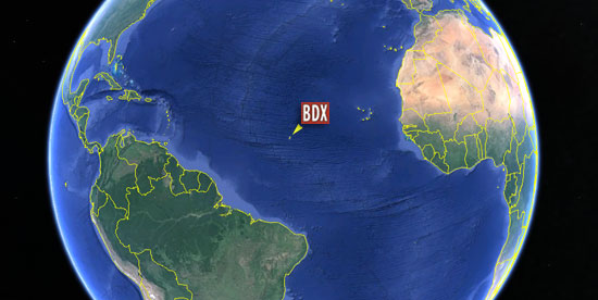
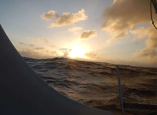
A moment of “relative” calm … 44.8432W, 20.3332N

Last night, Thursday, was a night of incessant squalls, during which an analogy for them jumped into my mind. Imagine crossing a 6-lane expressway where there are a lot of bigger trucks mixed in with the cars. So, the trade winds are similar in that there are lanes of clouds (cars) right next to lanes with squalls (trucks.) And since I can’t run fast enough to go between them without getting hit, I just keep getting run over by the squalls – again and again.

Sea DragonNow that I think of it though, if this were a thousand years ago, and there were no expressway analogies, I can totally see how sea dragons would be a logical alternative. In fact, I’m finding it’s kind of hard NOT to personify the weather … especially when there’s no one else on board with whom I can commiserate.
Typically on a regular night, by midnight, the squalls have calmed down, and we only see a couple more before dawn … but last night, they never stopped. From the time the sun set, to well after dawn, they just kept coming … so, with my first mate, “Otto” auto-piloting the boat, I ran around making adjustments to the lines, as we ploughed our way through the chaos of increasing wind speeds, sudden shifts in wind direction and the constant and crazy waves.At present, we are less than 400 miles from our waypoint, which is where we will cross into  the 100-mile band of sea known as the “doldrums” (again, that’s the low-pressure area around the equator where the prevailing winds are almost always calm.) In joking with the weather gurus over at Commander’s Weather, they are assuring me that by Saturday, I’ll be complaining about not enough wind. So, it’s always something, isn’t it?
November 2, 2013Where in the Wide World We are … 37.96625W, 11.67275N

As all this action has pretty much consumed my day and nights, I haven’t seen or done much else. You can bet the local sea life knows where to go when weather’s like this. For us, with no shelter and about as far from an Irish pub as one could be, we must proceed with our regular but now increasingly difficult-to-perform tasks. Especially challenging is boiling water and pouring it into the freeze-dried dinner pouch at night; lately this is being done with great care I can assure you.candy wrappersDuring one of the bigger squalls last night, a big wind shift caused the bucket of seawater that contained my little citizen-scientist project of decomposing aluminum foil from the candy wrapper to tip over. But I can say, at this point, 50% of the foil was still intact with the balance broken into smaller pieces. In time, I suspect it would all disappear. How long? Not sure.

I’ll finish with something from the “too-beautiful-to believe” file. On Wednesday night, the winds dropped into the high teens, which made for more comfortable conditions. As I sat there in my spot in the cockpit, looking aft (backwards) out of the boat, I saw the first of what turned into a flurry of shooting stars. I was blessed with many more that night – several dozens of stars fell across the night sky. If I remember correctly, this is the time of year for the Leonid meteor shower – and I guess I had the perfect seat for it. I remember late in our sailing season back home (in Indiana,) some of the older sailors trying to get me to go out on the lake and watch the Leonid shower. I never went, thinking how cold it would be. Now I can see why they went, and why I was silly not to as well.

OK, that’s about all I can think of right now, except that it sure smells like an old sailor lives onboard this boat!

– Dave and Bodacious Dream
37.96625W, 11.67275N 

The Reality is a Little Wetter

10.31.13 - afternoonIt’s been a tough few days out here. We reached the trade winds on Saturday evening, at about the time we expected to. So while we are now in steady winds, all the finagling we did with those sparse winds east of Bermuda cost us extra time and fuel. The idea was to get a better angle on the trade winds, so we could sail them to our waypoint at the beginning of the doldrums. That wasn’t bad as far as ideas go. The reality however is a little wetter – LOTS of wave action, lots of pounding and lots of spray … everywhere. Fortunately, it’s all warm air and warm water, but still a challenge in that it makes sailing and life onboard more difficult.

With winds gusting up to 30 knots, squalls through the night and morning, waves coming at us from three directions, it’s a constant game of adjustment to keep Bodacious Dream sailing forward in the direction we want to go. Needless to say, it also increases the difficulty of typing these updates.

For those of you who were following us last year, these are the same trade winds I sailed through coming back from Portugal. However, last year, I was sailing WITH them instead of ACROSS them, so the sailing was a lot smoother.

Blue Blue
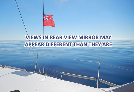
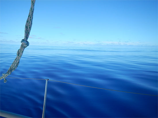
As I have no photos of current conditions, try this one … Ahh!  50.4951W, 28.6556N

The current situation wouldn’t be so bad if the wave sets were more consistent. There are three different angles to the waves, one driven by the force of the trade winds, and the other two created by squall wind shifts and an erratic low-pressure system. On the main wave, we slide along as if we were parallel to it – which isn’t so bad, and if that were all that was happening, we’d be looking good. The second set though comes in threes and at irregular intervals. Also, it’s more directly face on to us, so it throws the bow straight up and then in the trough behind the wave; the bow comes crashing down … with a ridiculously huge boom! This happens about three times in a row, before Bo can get back to sailing again – and at anytime during the sequence, the third wave can show up (pretty much out of nowhere) and throw a frothing gusher of water into the cockpit along with a head-banging slap upside the boat.

So picture this … I’m dressed in my foul weather gear, looking like the guy on the box of frozen fish sticks, trying to squeeze out a short nap on the deck, when I feel the boat lurch upward and I know the next movement it’s coming straight back down and landing with a big BOOM! And right when that’s over with, and I’m sitting back, ready to nod off again, a new wave comes pouring over me! This process repeats about 10 times a night and about 5 or 6 times in the morning. Fortunately, the afternoons and generally after midnight, things settle down and the skies clear up some. Maybe the sea needs to get some rest as well -though I know that’s wishful thinking.

It’s all good fun really … nothing that we didn’t sign up for … though to be honest, I’d be fine if these conditions were to change. As it turned out, today the wind speeds slowed for a good length of time. Projections are for them to come back into the low 20’s for the remainder of the 750 miles to the waypoint, which means that hopefully I can arrive there by Sunday or Monday. From there on, the strategy changes for entering the doldrums and the South Atlantic.

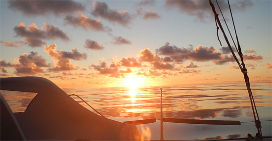
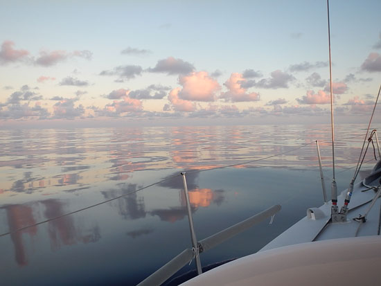
SunsetJust a memory to me now … but a sweet one … 50.4136W, 28.4363N

So, life onboard has been limited to eating what I can, resting when I can and keeping track of things and navigation … oh, and waiting out the clock. Back home, I can never slow the clock down enough to get through my lists. Out here, I can hardly get the minutes to pass! Time is such an elastic dimension. Soon it will be sunset, and we’ll head into another dark night, as the moon is down to just a sliver now and doesn’t come up until just before sunrise. With a gentler night of winds, perhaps the sleeping will be easier with fewer of Neptune’s rude poundings.

Extended situations like the one I’m describing here put your body to the test … and force you to manage it with some caution and care. There are three things I need to keep aware of … 1) hydration, 2) nutrition and 3) fatigue. Each of those factors takes a conscious effort to govern, especially in more demanding conditions such as these.

First off, I have to keep a steady flow of water in me. Even though it doesn’t seem like I sweat it out or eliminate it, I am. So, constant note to self … “Drink more water!”

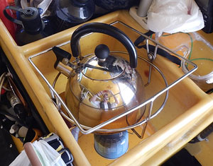
TeakettleBy dinnertime tonight, I was feeling tired and pretty uninterested in food. If I was that tired back home, I’d have just gone to bed and had a big breakfast when I got up, but out here, I knew I needed to put some calories into my body in order to stay warm at night and to have the energy I might need if in the middle of the night, something happened that required my going into overdrive. Believe me, boiling water to make lasagna isn’t so easy in a rolling and pitching kitchen. So, while it would have been easier to just forget about it, I pushed through – at which point, the seas calmed for a time, allowing me to have a nice meal under the stars. Ahhh!

Now the third factor, sleep, is something that simply amazes me. I often wonder why and how it works the way it does. When I am busy or stimulated by something, I rarely can sleep. With all the sounds the boat is making lately and with all the motion of the sea, I am having a hard time sleeping, even though I know I am fully tired. Still, I have to keep trying, even if only to lay my head down and rest. Eventually, my body decides that the stimulation isn’t as important as sleep is … and I nod off.

In my 15-20 minute nap intervals, I often have great dreams, and I regularly come back to the same one once I’ve been up and checked things out and gone back for another nap. I guess dreams are like an old well pump; once you prime it, it keeps pumping out a steady stream. Once I get into a sleep groove, I can keep returning to the naps for quite some time. But once I stop, I have to go through the whole start-up process all over again. It’s pretty fascinating this play between the conscious and unconscious mind and between the physical world without and the one within. I know there are a lot of brilliant people who study and write about sleep, and could probably explain it all to me, but for now I will have to trust my own internal sleep scientist.

Well, that’s it for now. I’ll send more as the weather allows.

Until then, we remain … soggy and sailing,


- Dave and Bodacious Dream
41.67044W, 15.54240N
Our Spot Adventure Page

So Spill the Pleasures of Life

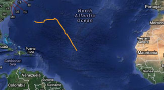
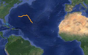
Screen shot 2013-10-28 at 12.44.47 PM:: LATEST NEWS: MONDAY AM – 10.28.13 – I pulled into the trade winds Sunday morning, and have since been sailing with them. Windy and bumpy conditions are making it hard to write anything. Lots of squally conditions that require constant attention to the boat. At present, I’m about 1100 miles from my first waypoint. Click the image on the right (or the link here) to follow our path on a fun site called Spot Adventures!

So, going back a few days and catch up on a few things …

:: FRIDAY AM – 10.25.13  Early Friday morning, the wind shut down as predicted by our weather gurus, and I had to turn on the motor and begin working my way south toward the trade winds … approximately 240 miles away. Initially, we moved through water which had this weird oily slick on it … not a breath of air anywhere – a kind of surreal stillness overall.

Oily Water
Oily Looking Water
– 50.4135W, 28.4361N

I motored all day Friday and for a while after sunset, when a hint of wind began to fill in. I thought perhaps I had gotten lucky and the trade winds had come north to meet me! So, I set the sails and enjoyed a night of gentle sailing to the southeast and towards my waypoint! It was easy sailing, which made napping through the early morning hours unusually comfortable … until near sunrise. At that point, the wind shifted more to the south and a sky full of squalls began developing to the southeast.

The first set of squalls missed us and I began to feel left out, as I was looking forward to another fresh water rinse. We did catch the edges of the last couple of squalls and we did get rinsed off some. You could see though that this fun would be short-lived, and soon enough fairer skies returned along with calmer winds. So it goes … puffed by the winds, rebuffed by the winds … the ways of the sea and Mother Nature … asking you to make progress in whatever way she allows. By sunset, with the winds diminishing even more, I returned to motor sailing.

Still Blue Water
Still Blue Water – 50.5058W, 28.6860N

Once I get into the trade winds, I should be able to sail pretty much in the direction I want at a pretty positive pace which should have me crossing the equator and entering the southern Atlantic Ocean towards the end of the week. I certainly hope so! At less than 100 miles a day, it feels right now as though Cape Town is a couple of years away!

Hurrican Island Outward Bound School:: RECALLING THE DAYS: Frustration in the face of nature is a constant in any sailor’s life. I remember back in the late 1970’s when I was working with one of our now sponsors, Hurricane Island Outward Bound School, that a big part of our “curriculum” and our experience was working through frustrations each and every day we were out on the water.

Putting everyday people into situations that required them to collectively problem-solve, overcome fears, and work past the fatigue and irritation can push you to your limit, but in the end anyway … leave you with many grand memories and life lessons. It usually took a week or so for everyone on the course to come to grips with being always tired and worn out, always a bit hungry, always a bit dirty but also always a bit closer to one’s core instincts and energies for life and survival.

I remember one particularly frustrating morning, rowing the pulling boats all morning up the bay and then realizing we weren’t going anywhere, because the tide was flowing in as fast as we were rowing out. But once the tide changed, life for all of us changed as well … grumpy people turned funny, hungry people turned optimistic, tired people turned excited. And, let me tell you, dinner NEVER tasted so good.


A Golden Sunset

:: ONWARD WE GO: So, recalling the many hard-won lessons of that time, I look forward to following the changes in my own attitude once the winds start to take me where I want to go. When you come to be able to put the pluses and the minuses side by side, then you can better recognize and more fully appreciate the value of each. I mean, can you ever really know the pleasure of warm and dry, if you haven’t experienced cold and wet?

So it is, I’m thinking now about things like a frosty Pepsi, hot French fries, warm freshwater showers, soft places to sit … all those things … that float out there like reflections on the water … and in contrast with what is right in front of me. Out of this back and forth … spill the many pleasures of life. That’s another advantage to logging thousands and thousands of miles … you learn to hang in there, because you know that eventually, you’ll get where you’re going.

So, at the moment, I’m about halfway between the start in Newport, RI and my first waypoint heading into “the doldrums” … it’s about 1,400 miles each way now. That’s always a good feeling, hitting those halfway points! And, if the winds provide, I can make that distance in about a week. It would be nice to end October and start November in a new waters being pushed by new winds!

More when the seas settle down.

– Dave & Bodacious Dream
46.4851W, 23.2120N

Tegan’s Science Notes: #1 – Bird Migrations

So, while I’m out here at … oh, let’s see … 32.74017W, 0.61875N, getting pretty close to the equator … and still spending a lot of time dealing with the unruly elements, it seemed like a good time to introduce you to Tegan Mortimer. Tegan is an ocean scientist with Earthwatch who you might remember from the Boston Harbor whale watch videos. Tegan is helping us on the expedition on several levels.

  • Curating our Citizen Science Resources page
  • Advising us on our Explorer Guides (working to get them up there soon!) 
  • Fielding my questions and helping with identification of wildlife sightings
  • Posting those wildlife sightings to a cool site named iNaturalist.org
  • Receiving and recording all the research data that we gather

Thank you Tegan, it’s great to have you along for the trip!

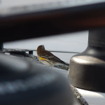
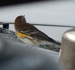
Yellow Rump WarblerNow, if you recall, when I was 200 miles off the coast of New Jersey, a bird landed on the boat. Tegan helped us to identify it as a yellow-rumped warbler. The whole issue of bird migrations struck a spark and we asked Tegan to tell us more about bird migrations – because after all it is that time of year. This then is the first of her series of “Science Notes” … and I think you’ll find it worth your while to follow along … and especially good to share with the young’uns.. Take it away, Tegan!

:: TEGAN’S SCIENCE NOTES: #1 – BIRD MIGRATIONS

A songbird over 200 miles from land? That seems like an unusual sighting! How could a little bird get that far from land? Did it get caught in a storm? It’s certainly true that birds can get blown off course and end up in strange places; this is usually followed by storms of excited bird watchers camped out in the hopes of catching a glimpse of a rare sighting!

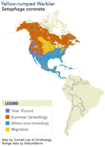
Dave’s visit from a Yellow-Rumped Warbler on his way to Bermuda was probably not one of these lost birds. If you read my response in a recent post, then that you know that this tiny songbird is probably migrating; heading south to the Caribbean Islands to spend the winter while food in its northern summer home is hard to find.

Warbler PatternsSome yellow-rumped warblers fly farther than others; the maximum distance is about 2,500 miles from right up at the top of the tundra down to the Caribbean, but that’s really nothing compared to species that fly 8,000 to 12,000 miles in a single migration.

Some yellow-rumped warblers, like those that summer here in New England might only go as far south as the Carolinas, but those that spend the summer farther north tend to go much farther south. Still other varieties can survive a cold winter where other species of warbler would just starve. This is because they have a secret weapon! They are some warblers which are able to digest the waxes found in wax-myrtle berries and bayberries, thus providing themselves a wintertime food source without needing to fly as far south as other warbler species.

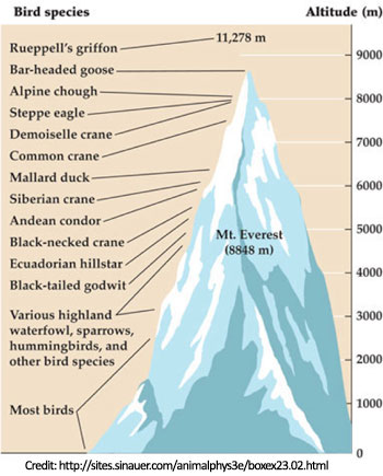
Bird AltitudesEvery fall millions of birds ranging in size from small warblers like Bodacious Dream’s visitor, to shorebirds and hawks fly to the Caribbean, Central America and South America to wait out the winter. These huge flocks of migrating birds often go unnoticed because they fly very high up in the air and often fly at night. Flocks of songbirds crossing stretches of water, like the Gulf of Mexico, usually fly around 10,000 feet up, but they have been recorded flying twice as high as that! Migrating birds have even been identified by passenger jets at cruising altitude. An amazing example is the bar-headed goose which migrates over the highest mountains in the world, the Himalayas, at heights of 29,500 feet. Even more amazing is that these geese fly over the mountains in a single day!

So how do these birds find their way, especially if they’re flying over the water? It was thought for a very long time that migrating birds flew at night so that they could use the stars for navigation, but then researchers realized that these birds are still able to navigate on cloudy nights. How exactly they navigate over such long distances is still a mystery, but scientists think that they may use many different senses to navigate including using the stars. Pigeons have been proven to be able to use their sense of smell to navigate and birds contain small amounts of the mineral Magnetite which is thought to help them sense the earth’s magnetic fields and see polarized light which can all help to navigate.

Animals that migrate are of special conservation concern because they travel so far and often traverse many countries with different laws. A species that is protected in one country may be hunted heavily in another. Luckily, the yellow-rumped warbler and many other migratory birds are protected by a treaty between the United States and other countries which protects these birds and their habitats as collective natural heritage. Additionally, the yellow-rumped warbler is widespread and has a large population so for conservation purposes it is considered to be of “least concern.” This species is not expected to face extinction any time in the near future. However that does not mean that climate change, habitat destruction, and human impacts won’t have effects on it which could possibly lead to declines or even extinction.

Earthwatch scientists are studying migratory songbirds that nest in the Rocky Mountains. Over the past 5 years these researchers and Earthwatch volunteers have seen a trend which indicates that many of these common and widespread songbirds are less successful nesting closer to human development. Human development is pushing further and further into “wild” land in some parts of the world, what could this mean for even our most common animals and birds?

Birds might be the most remarkable migrators, but they are hardly the only animals that Dave will see mid-migration. Can you think of some other ocean animals that migrate? Where are they going and why are they going there?

(Tegan Mortimer is a scientist with Earthwatch Institute.  Contact Tegan directly at Tegan Mortimer <tmortimer (at) earthwatch (dot) org>)

Dolphins, Candy Wrappers & Question Time

:: LATEST NEWS: Tuesday we were really cooking for a while. Starting around sunset, we had a thrilling night of fast sailing as we rode the winds of the squalls on the inner edge of the cold front. That lasted until about 10 pm – about 4 hours, during which time, we were blasting along at over 10 knots in swirling rains. Let me tell you – most refreshing … and with the winds pushing in the right direction too. But unfortunately, we  missed catching up to and riding the outer bands of the tropical storm Lorenzo … (which has begun to dissipate anyway.) So, as I write this then late Wednesday, we’re drifting along at just 2 to 3 knots.

There may be some westerly winds coming tomorrow, but after that, I’m going to have to head south until I catch the trade winds … one of those “whatever it takes” scenarios. This will likely mean some motor sailing, which will put me back again to the fuel calculations. It’s a long way to Cape Town yet – still about 5700 miles and probably more with the course changes. Overall, I’m just over 1000 miles from Newport, RI, where we started. So, that’s the brief update.

That said, allow me then to catch you up on some recent happenings.

:: DOLPHINS: Sunday, while working below decks, I heard strange noises. I came up to discover a pod of dolphins swimming around the boat. I could see more a ways off in the distance. This was my first sighting of the dolphins on this trip, and what a thrill it always brings to me. They are such thoroughly graceful and magical creatures, swimming wherever and however they want, gliding through the water slowly or swiftly and never once getting hit by the boat. I took some video of them and that’s here. (Be patient, they do appear towards the end.)


A  Dolphin Drop-by …

I believe, from looking in the books that Tegan gave me, that these particular guys were “Pantropical Spotted Dolphins.” Hopefully, Tegan can confirm that when she sees the video.
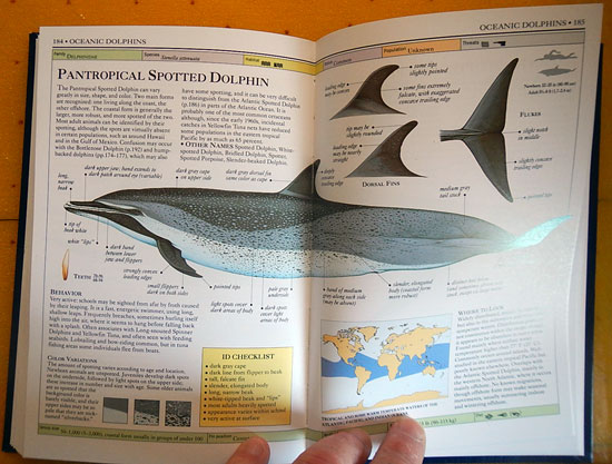
Pantropical DolphinsPantropical Spotted Dolphins … 

There were just a few that swam near the boat, but I could see a larger group of them … off in the distance, for about an hour – along with other fish jumping and swimming about. Just imagine having a playground that is as expansive as the oceans are? Travel where you want, swim, play, eat and carry on. Find a boat to swim around, an island to visit, and some waves to jump. They seem so free and expressive and connected to each other. Somewhere in my heart, I can’t help but think the dolphins are trying to tell us something – something they want to share with us. I hope it’s something good! I will keep observing and listening and let you know as soon as I get a good translation.

:: CITIZEN SCIENCE EXPERIMENT: After so many years of sailing on the Great Lakes and the world’s oceans … (I can’t begin to tell you how many days or how many miles that’s been,) but one thing that has always bothered me, is how fellow sailors have this habit of taking an empty aluminum can, crunching it and then casually tossing it overboard. I would always try to rescue then cans before the crunch and toss happened. Now, I’ve heard guys say that aluminum cans only last 3 days in salt water … but submerged without oxygen, I doubt that very much. But what if it is exposed to oxygen? What then?

Since I occasionally have some time on my hands here, and I have a bucket as well as the small, aluminum wrappers that my consumed Dark Chocolate Hershey’s Kisses come in … I thought … let’s put them all together and see what happens. So, I have floating in a bucket of seawater, one wrapper from a Hershey’s Kiss. It’s been three days now, and I’m seeing some discoloration on it, but it’s entirely still intact and hasn’t disintegrated yet.

Candy Wrappers
Candy Science? 

Now this is pretty thin foil compared to aluminum can … so I don’t think at this point, three days is anywhere near the right number. While I do know that aluminum corrodes quickly in salt water as do so many other things, it’s not going to disappear in three days. Yesterday, while I was closely inspecting the foil, I thought to myself … so why would you throw a can overboard anyway? Why go through the whole process of making a new can from scratch, when the one you just tossed overboard could be recycled and re-fabricated into another can? At the bottom of the ocean, even if it disintegrates, it can still never be recycled? Well, there’s just my personal take on the subject. I’m going to keepthat foil in the bucket and change the water ever couple of days. I’ll let you know if it’s still there when I get to Cape Town!

:: ASK DAVE A QUESTION (#1): I’ve received a number of questions (many from kids) that I’d like to begin to take some time to answer here. I really enjoy the way young inquisitive minds work, and I’ll bet some of these questions and answers will prove interesting to older friends and to adults too.

Here’s the first one … “How do you sleep and drive at the same time?”
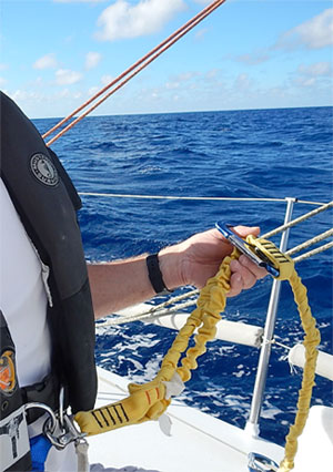
Dave's TetherWell, the first step is putting the boat on autopilot – a very critical part of modern-day solo sailing – (and I will explain it in more detail very soon.) But just because the autopilot is steering the boat doesn’t mean I can stop being aware of everything that’s happening. Sleeping out here is not the same as how you sleep at home. Here, I just nap – maybe 15 to 20 minutes at a time. I have two spots I like to curl up on the boat. One is in the cockpit where I wear my harness and tether when I’m sleeping, so if I have to jump up in a hurry, I don’t trip over something and end up overboard. This spot also allows me to see the instruments, the helm and the waves or stars at night.
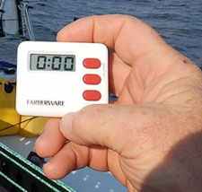
Dave's Alarm ClockTypically, we figure that the horizon is about 15 minutes away. By that we mean, at the speed we are traveling relative to the closing distance of a ship still just over the horizon (the curve of the earth) the two vessels would take about 20 minutes to cross each other. That means that any ship that I can’t see that is just over the horizon, is about 20 minutes away. To keep me in the game then, I set a small kitchen timer for 15 minutes and rest my head down.

Over time, I’ve also gotten very good at “feeling” the boat, especially when the sailing is smooth and steady. I’ve become quick to sense when anything is “different,” at which point, I will get up and check it out. It might be a sound, a different breeze on my feet or face, a change in the angle of the boat or a shift in motion relative to the waves … all of these variables get ingrained in your sailor’s senses and when any of them change, you know you have to change something with the boat.

My other favorite resting spot is down below – on the floor and in-between two walls. I’m pretty comfortable there on my camping mattress. I can still see my instruments and I can sense the water flowing under the boat as I’m lying on top of its lower skin. It’s actually a pretty amazing place to sleep. Sometimes when I’m at home, I wish I could sleep there!

So, that’s it for the moment. I’ll be back soon with another update. We just got one from Tegan Mortimer too, on Bird Migrations … so expect that one shortly, as well.

Also, as the certainty that you will see these updates on Facebook gets sketchier, I encourage you to sign up for our Email List.

Thank you, and take care …

– Dave & Bodacious Dream
(as of 10.24.13 @ 2:35PM (CDT)
051.69974W, 30.06824N 
Storm-Riding, Rain Squalls and Science

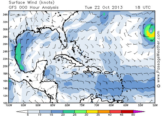
The last 36 hours or so have been a bit frustrating and a bit exciting too. On one hand, we’ve had little or no wind which has made the going slow and with little cloud cover, the days have been quite hot. On the other hand, we’ve been monitoring a growing tropical depression, which has developed into a storm called Lorenzo. Presently, Lorenzo is south and east of me, and the interesting recommendation this morning from our online naval guidance system, Commanders Weather is … “Let’s go try to catch it!”

Weather _LorenzoLorenzo appears to the right there …

STORM-RIDING: Now, I know that may not sound too smart … and in most cases it wouldn’t be. But in our particular case, and at this particular time, we are trying to get to a point where I can pick up the NE trade winds and ride them down to the waypoint where we will enter and cross the “doldrums.” (The doldrums, being the term for that low-pressure area around the equator where the prevailing winds are almost always calm.) So, in order to move forward, we need whatever wind we can get, and if I can use the cold front that is supposed to pass through today to push me in that direction, and so catch the outside bands of Lorenzo, then it can help pull me east, which is just what we want to do.

With tropical storms and hurricanes, there is never a truly good side to them, but what is considered the generally navigable quadrant is the forward left corner. So if the storm is moving, as Lorenzo is to the North and East, then the left forward corner is where Bodacious Dream and I can hitch a ride around the underside to the East. Guess we’ll have to see if this works or not. Right now, the winds from the cold front, which began to pass over us just an hour ago, are still less than 8 knots, but we expect them to build to 15 and maybe 20 later this afternoon. If that happens, I’ll sail those winds to the Southeast, and hopefully catch those outer bands of Lorenzo.

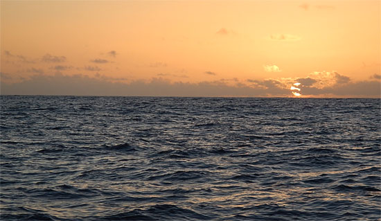
sunset1_550Sunset Passing …

WATER CONSERVATION: Yesterday, as the day went on, we had a squall pass over us. What a grand and refreshing thing it is to stand in the middle of the ocean in a fresh water rain! It’s easy to lose track of how important the little things in life are, until you don’t have them.

I have not discussed this before, but Bodacious Dream has no onboard freshwater shower, so cleaning up (or “bathing” – if you want to get real liberal with the term) involves using a bit of saltwater, followed by just a bit of fresh water on the face. I don’t want to use up too much fresh water for such purposes … as I’m never sure how much I’ll need for drinking on the trip to Cape Town. I also have to keep in mind, that I’m only into Day 6 from Bermuda of what is likely going to be a 40-day trip to Cape Town. So, the 60 gallons of fresh water I have will be pretty close to gone by then. I plan to drink or use up to 1 gallon a day, but we always want to take precautions in case something were to go wrong. What if one of the jugs springs a leak? What if I get a cut and have to wash it regularly … or who knows? What if the mast breaks and I had to drift across the ocean? What if? What if? What if? This is the song of the sea, and it is why the art of careful preparation is so important for extended adventures like this.

sail1_400
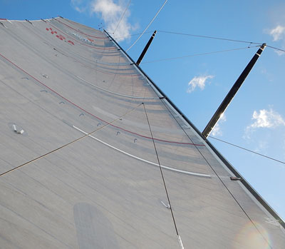
What I see when my eyes drift up …

CITIZEN SCIENCE: In my role as a fledgling citizen scientist, we’re taking regular readings for Earthwatch Institute. These include filtering water, observing debris in the ocean, watching for wild life, taking readings with the “Secchi Disc,” as well as using these updates to help educate people on the interesting ways of the ocean.

citizen_science_200

As far as debris goes, I’ve only seen two pieces of plastic so far. One looked like a storage box or container, the other some ort of plastic cylinder. I’m sure neither were buoys marking fishing nets. I’ve taken pictures of them with the geo-tagging camera, so they can be logged onto the iPad and when I’m next in port, I’ll upload the information to the research sites.

Take a look at our CITIZEN SCIENCE PAGE … it’s chock full of great resources, put together for us by our Earthwatch ocean scientist, Tegan Mortimer.

In fact, I heard from Tegan the other day, about that Yellow Rump Warbler that joined me onboard a couple hundred miles off the coast of New Jersey. Here’s what she had to say.

Screen shot 2013-10-22 at 2.58.11 PM“I’m happy to report that Dave’s bird sighting has been uploaded to iNaturalist and has had the species id confirmed which makes it a “research grade” observation. This means that it will be included in a global biodiversity database, which provides scientists and managers information about the distribution and movement of animals. So very exciting!
As unusual as this sighting seems, it’s actually probably a bird, which was on its fall migration from Canada down to the Caribbean, maybe got a little tired and caught a little ride with Dave to get a rest! Bird migrations are pretty interesting (and migration in general) so I’m writing up a little piece for some educational background on it.”

Thanks Tegan, we look forward to reading the piece!

So, enough for now. I have to get back to business here … and catch up on our gusty “friend” Lorenzo. Be back soon to tell you what happens.

We all know how spotty Facebook can be, so make sure you’re getting the major updates by signing up for the email list here! Thx!

– Dave & Bodacious Dream

Coordinates as of 12:30 UTC (06:30 CDT)
054.5947W, 33.3195N 
Our Speed Over Ground (SOG) – 5.5 knots.
Our Course Over Ground (COG) – 130 Wind speed – 8 knots.
Cookies left- Not enough!

Under a Full and Balmy Moon

While its 05:00 am in the morning and a most beautiful night it has been, we’re wind and speed challenged at the moment. Most of Friday was spent moving steadily east but at only about 6 or 7 knots along the 32 degrees latitude. The strategy here is to stay north of 32 degrees latitude until I can get far enough east to avoid the worst of a no-wind, high-pressure weather pattern that is setting up. The slow winds suggest I may not have gotten far enough north to avoid it. The beautiful part though is that it is exceptionally serene out here. The full moon eases across the sky pulling constellations in its wake. Both nights, I have watched Orion the hunter transit across the bow of the boat from one side to the other. I can almost tell the time of night by his passing.

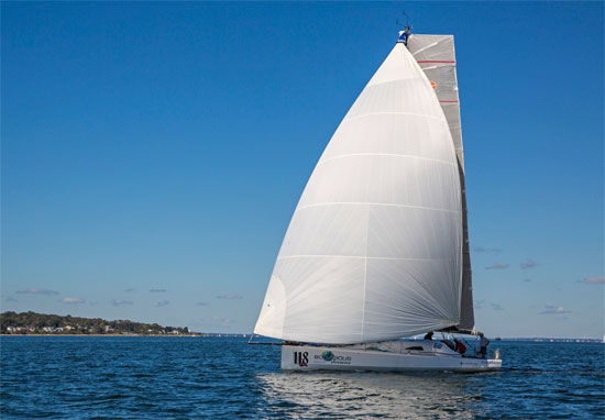
Bodacious Dream in Rhode IslandBodacious Dream back in Newport, RI

Much of the past 24 hours has been spent trying to get online and access information. The KVH system has not been locking onto its intended satellites, and so I have not been able to get normal Internet access, which means no receiving or sending emails. So, if you’ve sent me something recently and I haven’t responded, that is likely the reason. Once I get reconnected and online again, I’ll do my best to get caught up.

My back-up system is an Iridium satellite phone with a computer hook-up, which allows me to get very basic text emails for weather and updates. It’s been working just fine, so I’m hoping that continues to be there for the duration.

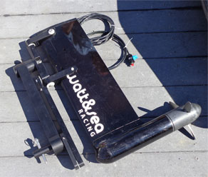
IHydro-Generator was able to get the hydro-generator deployed today. I’d had problems with a sticky pin that caused the unit to hang up, and it did it again today. I went to Plan B, which was to dismount the unit, make the deployment and then remount it in the proper pin location. This went well until I dropped the mounting pin … and no, it didn’t float! On to Plan C, the more traditional approach – which was to jam a screwdriver into the hole! And so far, that seems to be working just fine, and the hydro-generator is generating electricity – so all is cool on that front. Now, a little wind and boat speed will allow it to prove itself a most useful tool.

One of the calculations you often hear me talk about is fuel consumption, and if there is enough fuel to make the next destination or not. The matter of conservation of fuel and energy in order to make the next destination comes down to actual mathematical calculations. I will be throwing out some more calculations here in another day or so, but they will get more complicated by the addition of the hydro-generator … which once it begins generating electricity sufficiently, will greatly extend the duration of time between engine chargings … which should free up more fuel for use when I get to the “doldrums” and hopefully allow me to pass through them at a little better pace. Add that to the list of hopes – hoping for a narrow band of doldrums too … at least something less than the 100 mile band that is projected at this point in time!

Circumnavigation - Day 17

So, other than the day-to-day routine of napping, setting up the boat, navigating, checking systems, eating cookies (yes, there is still a fair supply, though not likely enough) and writing updates, things are pretty cool out here. Well, cool in the sense of neat anyway … because as far as weather goes, it’s been hot and up in the 80’s during the day. I am trying to stay out of the sun … not an easy task when there are so few big shade trees around!

So, until later, we’ll just keep on sailing!

– Dave and Bodacious Dream
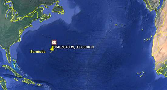
060.2043 W, 32.0508 N

Sign up for Email Updates!

Sails Hoisted … Heading East by Southeast

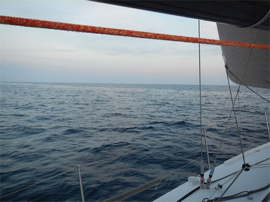
Well, we’re finally on our way heading east by southeast out of Bermuda. I slipped the dock lines at 14:20 Thursday afternoon and made my way out to the “SB” buoy (“Sea Buoy” is the first buoy marking the entrance to a harbor,) clear of the shallow reefs around the entrance to St. Georges Harbor and hoisted sail. I can’t tell you how good it feels to be Outward Bound! Such a great feeling one has when headed out to great experiences. In fact, there is a Hurricane Island Outward Bound School in Bermuda as well and they came and visited me while docked at the St. George Dingy and Sport Club.

The last few days before departure have been mostly uneventful, but Wednesday night brought its share of worrisome moments. The winds built up to a husky 25 to 30 knots and the harbor was all big bouncing waves. Fortunately, Bodacious Dream was docked in a good location, slightly away from the concrete pier, but any slight shift in a wind direction could have caused me problems. Needless to say, I slept very little as I turned and shifted too with the waves and the hum of the wind. Fortunately at about 03:00, the winds let up and the harbor settled down. By dawn, I was up to take care of the last bits of business before leaving.

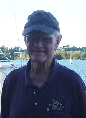
Bermuda BernieBermuda was a great stopover and the people were extra accommodating and gracious.

Here’s a pic to the left of 82-year old Bernie, who set the tone by helping me out when I first arrived, and who I wrote about in my Day 7 post.

There have been about three or four of us single handers hanging around the harbor, all waiting for a weather window to leave and we all crossed paths this morning at the Custom’s Office … all of us checking out of Bermuda at the same time. The others though are heading south to the Caribbean, while I head east to Cape Town, South Africa.

I’ve been sailing on an “easy reach,” meaning the wind has been from the side of the boat and this makes for easy, quick sailing. This has given me a great chance to relax, catch up on the missed sleep and organize the boat some more. Unfortunately, the forecast suggests that today will be the best winds I’ll have for perhaps a week. But you know, any chance to go sailing and in the “general direction” I want to go … is plenty welcome at this point in time.

Near Bermuda

So, right now, the seas are a bit lumpy with leftover swells from the heavier winds of the past few days, so I’m not sure I’ll be able to get the KVH satellite connect back until the motion settles down some … but when it does, I’ll upload some photos and videos of leaving Bermuda.

Still looking for my first dolphin sighting. Hopefully they’ll show up soon and cast their magic upon our marvelous expedition.

And to be sure, you’re getting the major updates, sign up for the email list here!

Until later,

– Dave and Bodacious Dream

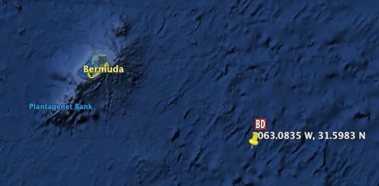
063.0835 W, 31.5983 N

 BDX_Coords_10.17.13


Deliverance – Story of an Early English Ship

(I have a story to tell here, but before I do, a quick weather and departure update, in case you missed it on Facebook yesterday. While the weather here in Bermuda is inviting; mostly sunny and breezy, for us, its not entirely what it seems. Those breezes are quite brisk at the moment and coming directly FROM where we need to be heading. In order to properly time our departure from Bermuda, we must wait for south or southwesterly winds, which it looks like we’ll have later in the week. We’re ready to go, but, sometimes, this is just what sailing is like … and what properly responding to your environment requires. Thanks. – DR)

Now, as I am discovering, the Islands of Bermuda have quite a colorful history. The first European vessel that landed on its shores was in 1505; a Spanish ship captained by Juan de Bermudez. Unlike many of the nearby Caribbean Islands, the island had no indigenous population at that time. In 1515, de Bermudez returned to the island that would eventually bear his name, landing a dozen pigs and sows for any unlucky mariners who might later be castaway there.

Of somewhat more relevance to the history of Bermuda is the early 17th century English ship named Deliverance. A replica of the Deliverance stands here in St. George, and I visited her the other day. I’d like to share her amazing story with you.

Deliverance in Bermuda
A replica of the English Ship Deliverance … 1609

In 1609, a convoy of nine ships, led by Sir George Sommers, left England bound for Jamestown, Virginia, to bring supplies to the new colony that had been established a few years earlier. Long before the days of weather forecasting and National Hurricane Prediction Centers, there were no ways to predict weather changes. So, it was that these ships were caught up in a hurricane. One of the ships, Sea Venture fell behind and ran aground on the treacherous reefs of Bermuda, amazingly with no loss of life. The crew and passengers spent 10 months salvaging equipment and supplies from the wrecked ship and with wood harvested from the local trees built two new ships. One was called Deliverance and the other called Patience. As the ships were small in size, the second ship was needed to haul the additional provisions and supplies they had gathered.

Once the ships were completed and ready to sail for Jamestown, they were stocked with all sorts of bounty from the local environment – live animals, pigs, fruits, vegetables and many other goods the shipwrecked survivors found valuable to their survival.

Deliverance in Bermuda

After an approximately two week sail, Deliverance arrived in Jamestown to a rousing welcome from the settlers there. Not only had they been presumed lost at sea, but the settlers in the intervening time had once again taken to suffering from starvation and such serious health issues, that their number had dwindled from the original 200 settlers down to just 60. The new supplies were critical to the colony’s survival and thus to the success of the longer term colonial experiment.

Deliverance in Bermuda

As sea-traffic between Europe and the American colonies grew in the 1700s, pirating and smuggling along the eastern seaboard of the Americas made Bermuda a welcome hideout for those who practiced such activities. From its calm natural harbors, these outlaw ships preyed on ships from Europe and the Americas right through the American war of independence, and the buildup of a dedicated U.S. Navy … which grew rather slowly out of the Continental Navy, which had come into existence when George Washington commissioned seven cruisers to intercept and capture British supply vessels.

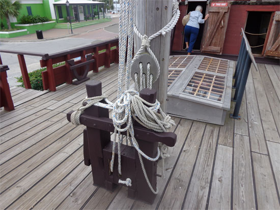
Deliverance in BremudaHalyards at the base of the mast

It was an incredibly exciting period in sea travel, as ships of different nations fought each other and pirates too … both for their sovereignty and for the right to transport the abundant resources that the “new” world possessed.

In any case, to get back to Deliverance, it was only 40 feet long (curiously enough, the very same length as Bodacious Dream.) As you can see from many of the pictures, it was of a very different design of boat than Bodacious Dream, and even different from other boats of the period. Boats of this type sailed very seldom to windward (sailing into the wind) and mostly sailed the “trade wind routes.” Such routes were typically downwind and cleaved closely to the major weather routes.

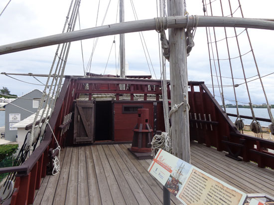
Deliverance in BermudaAft, (in the rear of the ship) there was a large cabin for the Captain, which also held the navigation table and from which control of the ship was managed. In those days, there was a captain, navigator and a sailing crew, as well as the passengers and supplies.

To the left here, is a capstan of the period, a vertical-axled winch to apply force to ropes, cables, and hawsers.

In those days too, the tiller, which is the long arm that is used to steer the boat, was controlled by a whipstaff, a vertical pole extending to the top deck and pushed or pulled from side to side – similar to a modern-day tillers, but in the vertical orientation rather than the horizontal orientation.

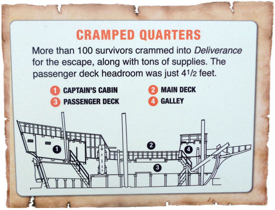
Somehow, 100 passengers crowded onboard Deliverance along with all the supplies! Below, the space was divided into two decks – each with less than 5 feet of headroom! Squatting and crawling were the main means of maneuvering around the boat.

Walking around that boat the other day, and picturing what it might have been like for those 100 intrepid people, filled me with admiration for the raw courage and deep skill that those adventurous sailors of that earlier era possessed.

We may have advanced technologically, but there is still something in the encounter between humans and the sea that remains remarkably unchanged over the centuries.

– Dave and Bodacious Dream

Email Sign-Up Is here!

Sailing … Weather or not!

Lava lightWEATHER is without question the most essential variable in our getting to and from wherever it is we want to go on the water. High pressure systems, low pressure systems, troughs, omega blocks … all these terms refer to things that remind me of those blobs in a Lava Lamp! There are all around us these great bubbles of air masses that move about, pushing and blocking or sometimes combining to create bigger blobs that move their way through and around the Earth’s atmosphere. Certain areas of the globe constitute more definable weather regions where scientific measuring instruments are used to predict – with some fair degree of accuracy, how different winds and weather systems will behave over time. Still, in spite of constantly improving tools for data gathering, it remains a fairly complicated and uncertain science.

On an expedition such as ours, where we’re traveling through so many different weather regions, a lot of time is spent planning a route that avoids the worst of the weather. In a perfect world, we would love to leave harbor in fair weather with a following breeze (a breeze that’s from behind and not on the face) and route ourselves to avoid areas of bad weather and no wind. Racing sailors don’t get the luxury of choosing when to depart – races start and are sailed regardless of the weather that’s encountered along the course —adding an edgy and challenging element to the sport.

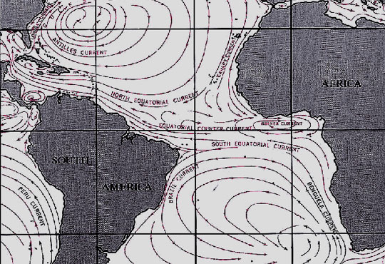
This part of the Atlantic Ocean where we are now, is a very complicated weather region and especially at this time of the year … with the Northern Atlantic entering winter while further south, hurricanes are being generated off the African coast. As the North Atlantic edges into the fall and winter season, the weather systems move from North America towards Europe. Then, south of us here in Bermuda, is an area called the “doldrums”  – more technically called an “Intertropical Convergence Zone,” where there is little or no wind. Farther south of that, the trade winds blow from Europe and Africa to the west towards North America, and occasionally bring with them tropical waves, which can build into tropical depressions that can further intensify into hurricanes. Hurricanes, as we well know, can take on a life of their own sometimes, spinning around before being swept up into another increasing pressure system … or not finding one, then dissipating altogether. While some of this is predictable, beyond five days it’s very difficult to forecast specifics with any accuracy.

Atlantic Ocean Currents

My trip to South Africa will take over 30 days, so making weather decisions with only a few day’s accuracy can be difficult and unsettling sometimes. But that said, this IS the conversation that sailors have always had with the sea. It is the encounter with nature as she is, and thus something you must adapt to if you are going to venture out into open water.

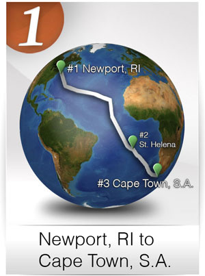
leg1_lg_300This time of year is not the easiest time of year to be making this passage into the South Atlantic, but if done with some caution and an eye (and ear) open to sound advice, a safe passage can be designed. Personally, there is this strange adjustment that I need to make to change my land-based and goal-orientated state of mind to the more flexible and patient approach better suited to life on the water. As I write this, my mind is focused on Leg #1 of the circumnavigation and on trying to get to St. Helena Island and then onto Cape Town, South Africa before Thanksgiving … but here I am in Bermuda, unexpectedly now for four or five days.

So, flexibility and patience require me to weigh all alternatives, one of which may be skipping St. Helena Island altogether and sailing directly to South Africa. The reason for this is that the winds this time of year are coming directly from St. Helena, which would require a lengthy, upwind sail which isn’t ideal or comfortable in a vessel like Bodacious Dream. A more traditional approach would be to sail across the trade winds on a more comfortable southerly angle until you get below the winds from St. Helena Island and there pick up the prevailing winds that blow from the west and towards Cape Town.

My own basic knowledge of weather was formed in predicting the strength of storms and winds in the Great Lakes region, but when considering more complicated sailing regions around the world, I need more experienced help. I use a service called Commanders Weather, to help me predict and plan my routing. Presently, we are looking at a nice weather window for leaving Bermuda on Friday or Saturday, but then after a couple of days, the winds are expected to diminish, which may well leave me sailing slowly and somewhat vulnerable to a couple of tropical waves that may (or may not) develop into depressions that might conceivably strengthen into hurricanes. So for the moment, I am waiting to get the most current weather analyses, so I can feel confident that I am making the soundest decision I can.

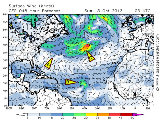
I’ve included a few screenshots here from another site called PassageWeather.com that show some of the options I am considering.

Weather Map 10.13.13

Let me TRY and explain what you’re seeing here. Triangle A is Bermuda with light winds engulfing it. Triangle B shows the development of the tropical wave in the band of wind to the south, which may or may not grow in intensity. Triangle C is the circle with darker green, yellow and orange that shows winds that have already intensified.

Weather map 2 - 10.13.13

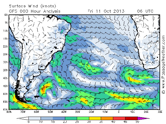
This second shot shows the more typical winds of the South Atlantic. The arrows are pointing in the direction of the wind, and the number of “feathers” indicates their speed. One full feather is 10 knots, a half is 5 knots and so three full and a half would be 35 knots.

So, bottom-line here, what these shots indicate is that the best route with the winds behind us, would be to head down along the Brazilian coast and then swing east under the empty area keeping ourselves aligned with the winds pointing in the direction of Cape Town.

I know this may be new stuff for many of you … but I include it (and in some detail) because it is such a big part of what makes this whole expedition so amazing. As navigating sailors we must align ourselves with these dynamic current and climate shifts, as they are the forces that propel us forward … as well as what constantly renews and refreshes life on our planet. These seasonal and cyclical changes bring renewal to Earth’s bio-systems, affecting all various levels of the ocean’s food chain, which thus support the migration patterns of whales, birds and other marine life.

While we humans may have a say in deciding just when we weigh anchor, once we do, we are as much a part of that migratory process as the rest of nature. In the world, and especially on the water, everything is a part of some larger flow, and we are no exception.

– Dave and Bodacious Dream

Email Sign-Up Is here!