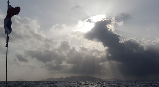
 The ocean is one of the last unexplored frontiers on earth. We know more about the surface of Mars than we do about the bottom of the ocean. For thousands of years, humans have been undertaking voyages of discovery. Whether the goal has been to find land beyond the horizon, to map the ocean currents or to find new animals unknown to science, the ocean has always been and will continue to be a deep source of knowledge which will always change the way we view and understand the world around us.
Today, science is moving in many new directions at once, and a great civic awakening is happening as everyday people armed only with some time and a passion to explore begin to help shape the future of scientific discovery. I have spoken many times in my previous “Science Notes” about what’s happening in the area of “Citizen Science,” but in this post, in recognition of Dave’s incredible feat of single handedly circumnavigating the globe, I’d like to look back at the relatively brief history of oceanic exploration.
The Great Voyages
Until quite recently scientific knowledge of the oceans was very limited. During the 1700s and 1800s, the British Royal Navy dominated the world’s oceans, which made surveying coastlines and mapping the oceans a practical priority for both the navy and for commerce. It was during this period that accurate navigation (and mapmaking) became gradually more dependable in locating precise positions on the earth, using a combination of latitude and longitude, celestial readings and chronometers. Many of these survey voyages carried additional passengers who acted as naturalists collecting botanical, biological, and geological samples which greatly expanded European scientific knowledge of the natural world.
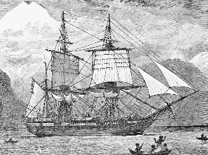
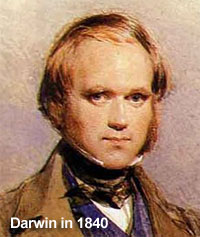
The most famous of these ‘gentlemen naturalists’ was Charles Darwin. I referenced him before in my science note on glaciers, as he was first and foremost a geologist. Over the course of the five years from 1831-1836 that the HMS Beagle surveyed the coastlines of the southern part of South America and tested the accuracy of 22 chronometers at pre-determined points, Darwin was collecting copious observations and samples of geological, biological and botanical nature in these far-fling regions. It was Darwin’s unique ability to weave his observations together into a theoretical whole that so challenged the accepted thought of the day and elevated the Beagle’s second voyage into one of the most famous scientific voyages made in history.
 Nearly 40 years after Darwin sailed on the Beagle, a dedicated scientific expedition set off on board the HMS Challenger with the aim “to learn everything about the sea,” – a lofty goal indeed! Findings from this Challenger Expedition laid the groundwork for what would become the science of oceanography. Over the course of five years, Challenger traveled over 70,000 nautical miles conducting scientific exploration with freshly designed equipment and discovering over 4,000 new species of plants and animals.
Mapping the Ocean
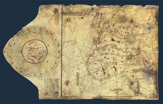
 No one person has explored and mapped more of the ocean than James Cook. Captain Cook came from humble origins but his skill at mapmaking and navigation led him in 1769 to be put in command of the HMS Endeavour on an expedition to Tahiti to observe the transit of Venus across the Sun. Cook’s mapmaking skills were so accurate that an early map of Newfoundland was used for more than 200 years after he drew it and differs little from modern satellite images.
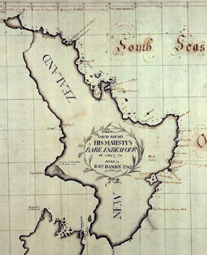 After visiting Tahiti, the Endeavour continued west to locate the famed “Terra Australis.” There Cook mapped the entire coastline of New Zealand before continuing east to Australia as the first European to land there. Over the next 12 years, Cook would make three voyages on board the HMS Endeavour and HMS Resolution, which explored and mapped previously uncharted areas of the world. As well as providing accurate charts for navigation, Cook’s expeditions also carried scientists who made important observations, especially related to botanical discoveries.
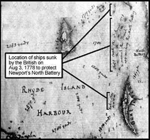 There is a second special connection of Captain Cook’s expeditions to Bodacious Dream. Both his ships, the HMS Endeavour and HMS Resolution are fairly certainly believed to lie as wrecks at the bottom of Narragansett Bay! The Endeavour, after coming out of Cook’s service, was renamed the Lord Sandwich and is one of several vessels which were sunk to blockade Newport Harbor during the American Revolutionary War. The HMS Resolution was sold and rechristened La Liberté, a French whaling vessel, which was damaged in Newport Harbor in the 1790s and left on the shore. Efforts are ongoing by the Rhode Island Marine Archaeology Project (RIMAP) to map and locate not only the Endeavour but also other shipwrecks in Rhode Island waters. You can visit their very informative website, and learn about RIMAP’s work right here, or go to the page on the sunken ships here.
Marshall Island Stick Charts
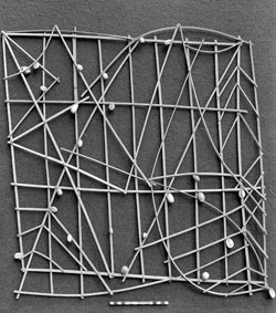 Not all voyages of discoveries (that we know about) were made by Europeans. The Polynesians and Pacific Islanders had been navigating the South Pacific for thousands of years and likely explored the entire region, an area of over 10 million square miles, well before the period of written history. Along the way, they developed a complex system of navigation, which used stars, the sun, the moon, planets, weather, winds, currents, tides, and natural phenomena like bird migration to help them to travel between the many islands.
An important addition to the history of ocean mapping was the discovery of “stick charts” used by seafarers from the Marshall Islands. These are deceptively simple grids made from small sticks and coconut fronds, which represent the major ocean swells in the South Pacific, with small shells showing the location of islands. The charts showed how the swells interacted with the island shores, the undersea slopes, and currents coming from different directions. While the stick maps were easy to construct, it took many years of study to be able to accurately interpret the real ocean dynamics which they represented.
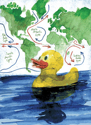
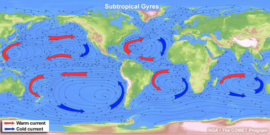
Mapping the Gulf Stream
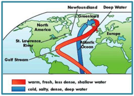
As you are well aware from Dave’s journey, the Gulf Stream is a major current in the North Atlantic, which carries warm water from the Caribbean north to the northeast Atlantic and is the strongest surface current in the Atlantic. The impact that the Gulf Stream can have on the length of voyages is tremendous. The first reference to the Gulf Stream is found in a written account of Ponce de Leon’s voyage from Puerto Rico in 1513. American fishermen and whalers plying the waters off the American colonies knew of the current in the late 1600s.
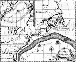 It actually took the insights of none other than Benjamin Franklin, the colonial deputy Postmaster General to make clear the existence of the Gulf Stream when in 1769 he published a chart that showed the direction of the flows. His chart of that time is still remarkably accurate. You can read more of Franklin’s very interesting writing about the Gulf Stream and other marine topics in NOAA’s historical archive right here.
Pathfinder of the Seas
Before the late 1800s, there were few comprehensive charts that showed wind and currents across the whole globe. This changed owing to the efforts of one man, Matthew Fontaine Maury.
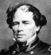 Maury joined the US Navy as a young man in 1825 and was posted to the Naval Observatory in 1842, where he began to study ocean currents. By studying and compiling thousands of ships logs he was able to map and calculate the speed of ocean currents based on the deflection of ships from their intended path. He was able to produce maps of average ocean speeds for much of the ocean, which allowed vessels to dramatically reduce the length of their voyages. Maury was nicknamed the “Pathfinder of the Seas” and was integral to the creation of international cooperation in producing accurate hydrological charts for all mariners. He is also referred to as the father of the modern oceanography as well, and his book, The Physical Geography of the Sea, published in 1855, is one of the first books on oceanography.
Modern ocean mapping: Satellites, robots and sonar
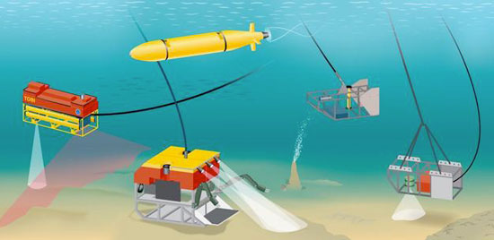
Even today, we have only begun to map the ocean. Fortunately, today we have technologies that help us to see below the waves, to scan the ocean floor, to analyze the composition of the water, and to observe how the currents work in real-time. Satellites use the reflectivity of the ocean surface to measure chlorophyll content and sea surface temperature changes. Unmanned robots explore the depth of the ocean collecting readings of temperature, pressure, and salinity. Sonar is used to create high-definition maps of the sea floor. Computers are used to model the movement of currents, the future conditions under changes to currents, temperature and sea level.
Check out these cool websites: Perpetual Ocean and Ocean Motion.
“Standing on the shoulders of giants”
Modern science knows so much more and can do some much more than our predecessors could ever have imagined, but our greater knowledge is only possible because of the amazing feats of those ‘giants’ who set off to explore the world and to challenge the commonly held beliefs and superstitions of their day.
Darwin and the rest, they figured out how the world worked in a more complete sense. Today we are finding out how in flux the natural world is, and how delicate is the balance necessary to sustain life. We now can see with factual accuracy just how fast the natural world is changing.
Every observation Dave logged on iNaturalist (click to see all his sightings listed) or eBird is an important scientific finding, which adds to the wealth of scientific knowledge, now being collected by citizen scientists all over the world. Collecting the type of data needed to understand the broad scale patterns of change occurring all over the globe is increasingly difficult for individual scientists to collect on their own, but by relying on citizens (like you!) to help collect this vital information, it becomes easier to approach important questions.
No matter who or where you are, YOU too can be a scientist!
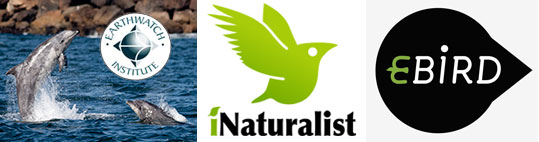
Join an Earthwatch Expedition. Join iNaturalist or eBird yourself and start tracking what you see around you.
 Build a Secchi Disk and use the Secchi App to record your data. Download the mPing App and record your weather. Join Zooniverse and be a scientist from the comfort of your couch. The possibilities are endless!
Explore, discover, and most importantly… have fun!!
For myself, I would like to say that I have had a great time sharing my enthusiasm for the natural world with all of you over the past nine months. Thank you to those of you who reached out and contacted me with thoughts or questions. Keep the Bodacious Dream going and get out and discover!
Wishing you fair winds and following seas,
– Tegan Mortimer
teg.mortimer(AT)gmail(DOT)com

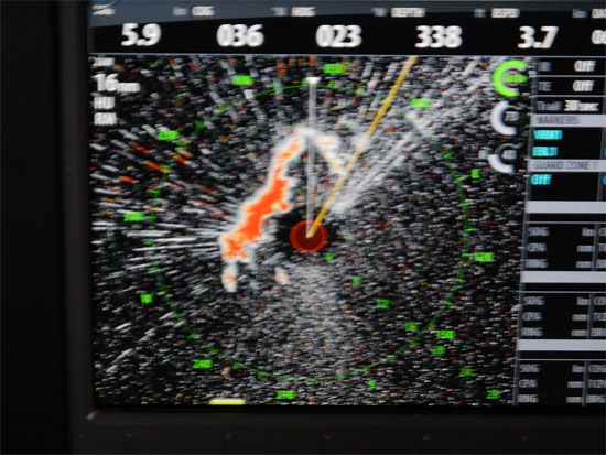
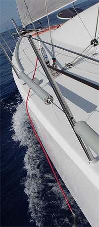
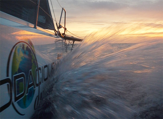
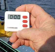 As I’ve explained before, I try to sleep in 15-minute increments. That’s the length of time it would take for another vessel that is beyond my field of vision and just over the horizon, to get to me. So, the vast majority of the time, I sleep in 15-minute intervals (with the help of my egg-timer) and in areas like the coast of Florida, I might even cut that back to 10-minute naps. I know that doesn’t seem like much time to sleep, (and it isn’t) … but you do get used to sleeping in sets of 4 to 5 of these naps with just a few moments awake in between to check the boat and horizon. In our day-to-day lives, we sleep 8 hours, so we can be up for 16 hours. I take these naps so I can be up for an hour or two during which I’m constantly looking for any opportunity to take additional naps, so that I’m most able to function if something important comes up and requires my time. I do think there were times in the deep Southern Ocean where I might have slept for as long as 45 minutes, but such periods were few and far between. I’m sure I never slept more than the 45 minutes at any one time during the entire voyage.
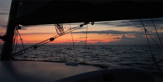
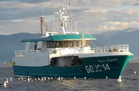 The trip between Cape Town, South Africa and Wellington, New Zealand was 52 days, and I remember I saw one long tanker about three days out of Cape Town and then didn’t see another ship until I met up with the friendly fishermen of the Ocean Odyssey who lent us a hand off the South Island of New Zealand. The Southern Ocean is considered some of the most remote waters in the world and you often hear the remark, which is true, that the closest humans to us in those waters are the folks on the Space Station maybe 50 miles above our heads! From New Zealand to the Galapagos would have been the next longest time at 35 days and the last ship I saw out of New Zealand was that first night after I left NZ!
 Of course, coming back into Jamestown and being greeted by so many family and friends was a wonderful experience… but the hum of activities that followed and that kept me moving continuously the last couple of weeks has kept my mind from wandering much or encountering too many emotions of the sort that typically arise for people who have gone through long and challenging experiences. From adventurers who have thrown their all into achieving arduous goals to veterans of wars who have fought intensely for their comrades and their own safety, once the extraordinary conditions disappear and life returns to a more everyday pace, it sometimes happens that an energy “hole” appears… one which can sometimes suck you into some type of depression.
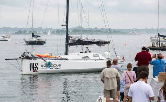
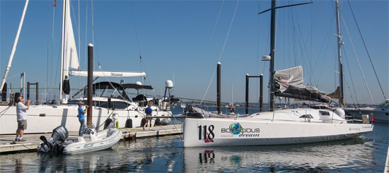
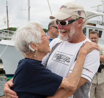 We celebrated the completion of the circumnavigation right there on the dock and then after a toast (or two) and more hugs than I can count, we wandered up the road for a bite to eat at the Ganny, more officially known as the
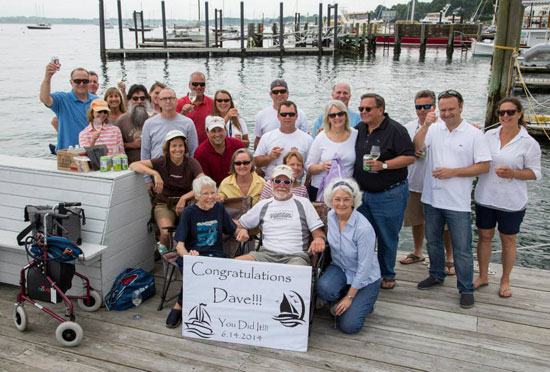
 By the time you read this, I will be docked in

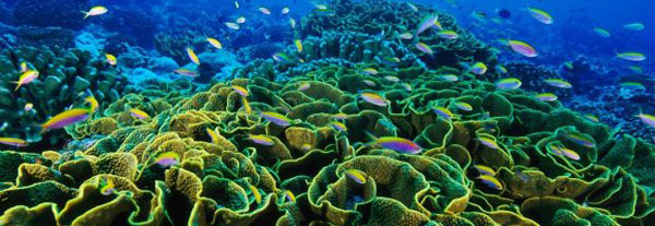
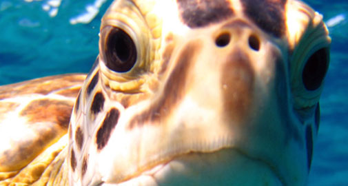
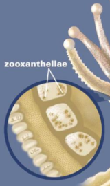 A coral reef is made up of many colonies of coral polyps which build the reef structure out of calcium carbonate. Tropical corals contain zooxanthellae, which is tiny algae that lives inside the coral where it photosynthesizes, creating food from sunlight. These algae are also what gives coral its brilliant and diverse colors. This means that coral can only occur in the “photic” zone, where sunlight penetrates the water. Corals polyps feed by extending stinging tentacles outwards to capture small prey and particles in the water column. Corals are related to other stinging animals including sea anemones and jellyfish.
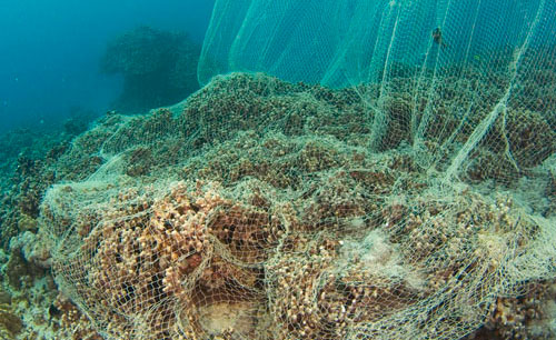
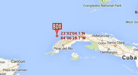
 It’s early morning on Thursday and I’m heading down to the marina to put final provisions and water onto the boat and hopefully, by the time you read this, I will have departed. Our course will take us north towards the Yucatan passage that runs between